The Towpath Photos


You might also consider


More like The Towpath
Recommended Reviews - The Towpath
Start your review...


Reviews With Photos


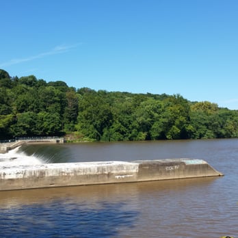
The Manayunk Towpath is a short part of the extensive Schuylkill River Trail: http://schuylkillrivertrail.com/ Portions of the trail remind me of NJ's D&R Canal, PA's Wissahickon Trails, and TX's San Antonio Riverwalk (the quiet parts). The Towpath is an idyllic aside from Manayunk's trendy Main Street, and the weekend walk/run/bike crowds are very manageable compared to the CC hordes at the South Street to Falls Bridge span. It's a great rest spot for an outgoing/return leg ride, and convenient Trail-Main street paths connect to the heart of Manayunk - with brunch and shopping options galore (I'm looking at your tots, Lucky's Last Chance)! Risk: * Some sections are a bit isolated, and parts of trail not maintained during winter. * Surface: mix of fine gravel, pavement, wood boards - be careful of the transitions! * Ba-whoosh! Narrow path with occasional bottlenecks. Don't fall in the canal! * Blowout beware: wood boards are splintered in a few areas, occasional rough surface transitions (watch that hill in Roxborough - gravel meets jagged blacktop edge, transitions to cobblestone wheel-benders, across train tracks, then a vicious uphill towards Conshohocken). Reward: * Awesome trail so close to the city, yet so tranquil you forget you're near a city. * Surface: mix of fine gravel, pavement, wood boards - keeps the ride interesting! * Center City to Valley Forge (and beyond?) trail for the bold! * Good trail community (so far): walkers/runners/bikers are aware of each other and follow trail and passing etiquette. (Not jinxing it, not jinxing it, not jinxing it). Respect the environment: * Greenery restoration in progress around the path - marked with "No-Mow Zone"signs. Please do not ride or walk on these areas! Respect the leash laws: * I love dogs. I have one, and it's so very tempting to let him off-leash to run and explore to his heart's content. However, pets can be unpredictable. I don't want to accidentally run over one, get bit by one, or ever see one in trouble by the dam/canal.
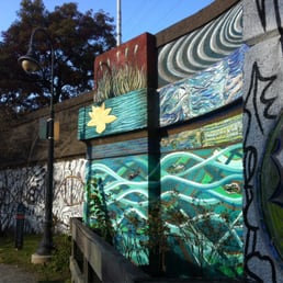

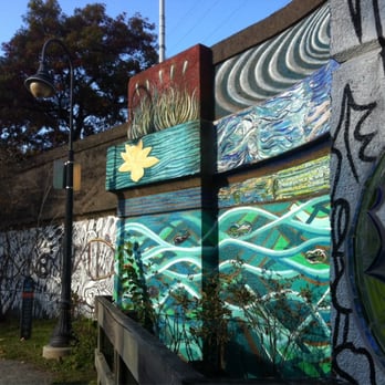
I found this in a quest to find a running spot, where I do not become an urban deer darting from oncoming cars. It is great place for a post work run; this transports you from the busy main st manayunk and into a realm where you can watch couples take a stroll to locals whom use this as a place to practice fishing. Bring your sneakers and bikes, take a load off and begin to feel like you are one with nature again. Take in the murals along this path.


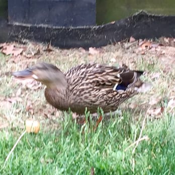
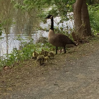
Love this place just beware of the Geese when w their babies almost got attacked a few times, also witnessed a few others get attacked . My advice if on foot bring bread w you to give to them for a safe passing . Also this path is pretty narrow & u hv to share w bikers .
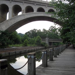

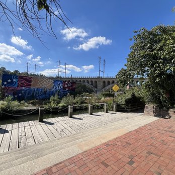


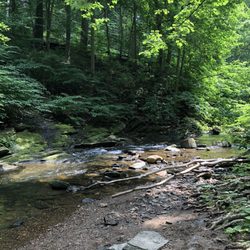
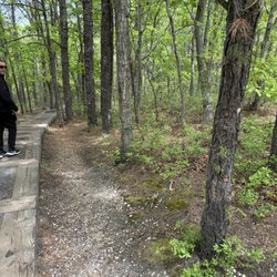
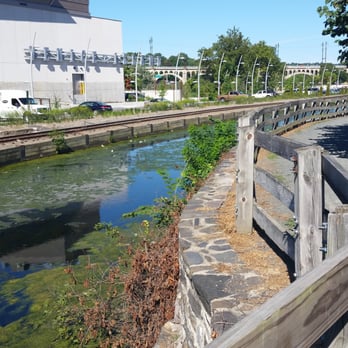
I was recently looking for a nice, easy hike somewhere in the vicinity of my home in Center City and came across The Towpath. By hiking standards, I'd rate this as very easy, as the trail is flat and wide, with a combination of dirt and gravel for walking. The Towpath runs along the Manayunk Canal and Schulykill River beyond and makes for a nice, peaceful stroll along the water. Along the way you see plenty of artwork and murals, as well as eerie remnants of a time when this place was a booming center for industry. Fascinating! Being it was late fall, there wasn't a lot of wildlife out and about, but I'm sure it's even more beautiful and alive in the warmer months. PS. Main Street in Manayunk runs parallel to the Towpath and is a great place to explore in and of itself! Plenty of unique shops and eateries to be found. read more
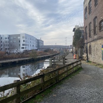
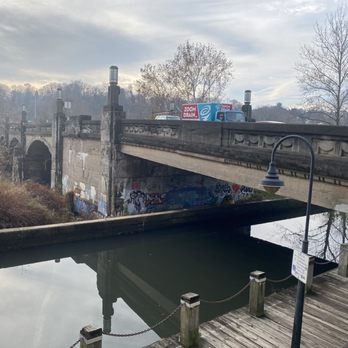

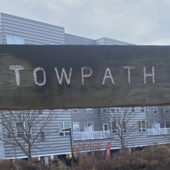


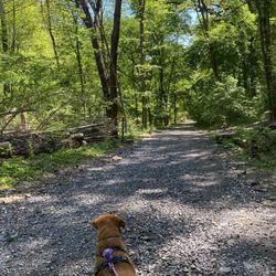
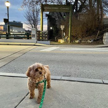
MANAYUNK/PHILADELPHIA: a former rail line downtown, the Manayunk Canal Towpath is part of an extended network of Schuylkill River Greenways NHA from Philadelphia through Valley Forge. It is an all-purpose path that welcomes walkers, hikers, cyclists, and is a great place to walk the pup. The Manayunk portion is near all the restaurants and shopping of town and is so convenient to access by Chloe's Corner! read more

The Manayunk Towpath is a short part of the extensive Schuylkill River Trail: http://schuylkillrivertrail.com/ Portions of the trail remind me of NJ's D&R Canal, PA's Wissahickon Trails, and TX's San Antonio Riverwalk (the quiet parts). The Towpath is an idyllic aside from Manayunk's trendy Main Street, and the weekend walk/run/bike crowds are very manageable compared to the CC hordes at the South Street to Falls Bridge span. It's a great rest spot for an outgoing/return leg ride, and convenient Trail-Main street paths connect to the heart of Manayunk - with brunch and shopping options galore (I'm looking at your tots, Lucky's Last Chance)! Risk: * Some sections are a bit isolated, and parts of trail not maintained during winter. * Surface: mix of fine gravel, pavement, wood boards - be careful of the transitions! * Ba-whoosh! Narrow path with occasional bottlenecks. Don't fall in the canal! * Blowout beware: wood boards are splintered in a few areas, occasional rough surface transitions (watch that hill in Roxborough - gravel meets jagged blacktop edge, transitions to cobblestone wheel-benders, across train tracks, then a vicious uphill towards Conshohocken). Reward: * Awesome trail so close to the city, yet so tranquil you forget you're near a city. * Surface: mix of fine gravel, pavement, wood boards - keeps the ride interesting! * Center City to Valley Forge (and beyond?) trail for the bold! * Good trail community (so far): walkers/runners/bikers are aware of each other and follow trail and passing etiquette. (Not jinxing it, not jinxing it, not jinxing it). Respect the environment: * Greenery restoration in progress around the path - marked with "No-Mow Zone"signs. Please do not ride or walk on these areas! Respect the leash laws: * I love dogs. I have one, and it's so very tempting to let him off-leash to run and explore to his heart's content. However, pets can be unpredictable. I don't want to accidentally run over one, get bit by one, or ever see one in trouble by the dam/canal. read more

13 years ago
I found this in a quest to find a running spot, where I do not become an urban deer darting from oncoming cars. It is great place for a post work run; this transports you from the busy main st manayunk and into a realm where you can watch couples take a stroll to locals whom use this as a place to practice fishing. Bring your sneakers and bikes, take a load off and begin to feel like you are one with nature again. Take in the murals along this path. read more

11 years ago
Love this place just beware of the Geese when w their babies almost got attacked a few times, also witnessed a few others get attacked . My advice if on foot bring bread w you to give to them for a safe passing . Also this path is pretty narrow & u hv to share w bikers . read more



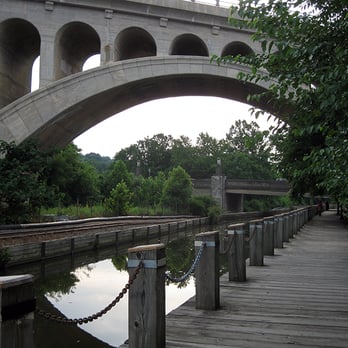
Accessible from Center City via Venice Island Playground in the East and extending up through Shawmont in the West, the Towpath is a straight shot through the city and connects directly to the Schuykill River Trail. Back in the day things were a little shady, but with the success of Main Street came a renewed interest in the Towpath. Since the formation of the Friends of the Manayunk Canal over 16 years ago, the Towpath and the Canal have been revitalized, cleaned and kept that way! With future plans to connect to the Cynwyd Heritage Trail and restore the Canal so that canoes and small boats may traverse it, the Towpath promises to remain a gem at the heart of Manayunk for years to come! The Towpath has multiple surfaces (from boardwalk along Main Street to gravel, hardpack and even pavement) and very little incline (surprising for Manayunk, I know, but remember it's following the river which is in the bottom of a valley-- pretty flat). As such, it is fantastic for biking, hiking, and jogging. Scattered all along the Towpath are great access points to wonderful fishing spots-- from childhood to my mid-20's I spent tons of summer days hanging out and playing catch & release at great places like Blackie Bridge (the old, black, railroad bridge down by V.I.) and Baby Rock (a lovely outcropping made for fishing, drinking, swimming, and lounging in the sun). It is also the fastest, easiest way to get yourself from Manayunk to Conshohocken without a mechanized vehicle (15-20 minutes by bike, 45 or so if you're walking). Perhaps the best thing about that commute, if you have the time to explore, is the fact that all along the Towpath are many of the original mills for which it was created; several still have giant tonnage scales and working fixtures, most have ever-changing examples of stellar Philly graf work. In addition, the old rail lines, the original sluice house and the canal locks are still there to explore-- just be careful, they are in baaad shape. (Neat fact: blasting for the Canal started in 1761, but it didn't actually open until 1818. And then flooding in 1850 required the complete rebuilding of it.) Regardless of your feelings about the crowds-- which are, of course, heaviest on weekends-- the Towpath is integral to Philly life for many reasons: as part of the Schuylkill Watershed, it is vital to the ecosystem; as a recreation area it provides much needed release for those living on the wrong side of the mountain; and as a thoroughfare it provides direct and easy access via foot or wheel from Center City Philadelphia all the way to Pottsville, PA, almost 100 miles away! Say what you want about Philadelphia -- we do parks right! P.S. The Towpath is considered a section of the Schuylkill River Trail these days. For people interested in making the whole journey (via canoe/kayak, bike or foot) here are maps: *Center City to Miquon/River Road trail map: http://www.schuylkillrivertrail.com/pdfs/Phila_section.pdf *Miquon/River Road to Valley Forge trail map: http://www.schuylkillrivertrail.com/pdfs/Montgomery%20County%20Trail_1.pdf *Map of trail from Center City Philadelphia all the way to Pottsville: http://www.schuylkillrivertrail.com/index.php? *Trail-Link Map From Center City Philadelphia to Valley Forge: http://www.traillink.com/trail/schuylkill-river-trail---valley-forge-to-philadelphia.aspx *Schulkill River Water Trail Guide: http://www.schuylkillriver.org/Water_Trail.aspx read more

14 years ago

8 years ago

13 years ago

11 years ago