
The Sewall Home, Dock, and Pineapple Fields Photos
More like The Sewall Home, Dock, and Pineapple Fields
Recommended Reviews - The Sewall Home, Dock, and Pineapple Fields
Start your review...



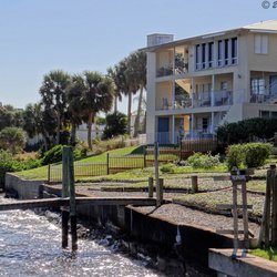
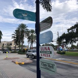
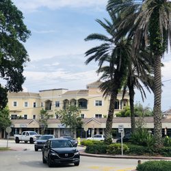
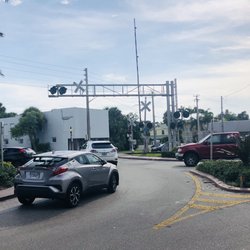
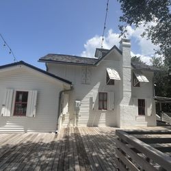
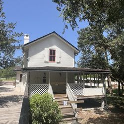
This historical marker in Sewall Point marks where the Sewall home, dock, and pineapple fields once stood. The marker was placed by the town of Sewall's Point which is located on Sewall's Peninsula, named for Henry Sewall who once owned it. Sewall came to the area with his wife Abbie in 1889 after they were awarded land including this peninsula in a land grant from the King of Spain in 1823. Sewall built a home and post office that operated until 1918. He built a dock that everyone who was traveling the Indian River north or south stopped at. He cleared the land and used it to grow pineapples. During the turn of the century settlers came to the area and built homes out of salvaged lumber from shipwrecks. Henry Sewall served as a Dade County commissioner in 1893 and as a state representative from 1894 to 1895. In the 1940's trailer parks started popping up in the area. In response to the development, the Sewall's Point Association was created in the 1950's to control the zoning on the peninsula and keep it a residential community. Efforts were led by Dr. Elvin Killheffer who became the towns first mayor when the town of Sewall Point received it's charter on June 12, 1957. Today the land that was once Sewall's home, dock, and pineapple fields is a luxury housing development. read more
More info about The Sewall Home, Dock, and Pineapple Fields












The Sewall Home, Dock, and Pineapple Fields - landmarks - Updated October 2026
Best of Sewall's Point
People found The Sewall Home, Dock, and Pineapple Fields by searching for…
Things to Do in Sewall's Point, FL
Post Offices in Sewall's Point, FL
Places to Take Pictures in Sewall's Point, FL
Public Services & Government in Sewall's Point, FL
Boardwalk in Sewall's Point, FL
Tourist Attractions in Sewall's Point, FL
Field Trips in Sewall's Point, FL
Night View in Sewall's Point, FL
Scenic View in Sewall's Point, FL
Historical Sites in Sewall's Point, FL
Lighthouses in Sewall's Point, FL
Usps Drop Off in Sewall's Point, FL
River Walk in Sewall's Point, FL
Places to Visit in Sewall's Point, FL
Photo Spots in Sewall's Point, FL
Things to See in Sewall's Point, FL
Usps Locations in Sewall's Point, FL
Scenic Drive in Sewall's Point, FL
Attractions in Sewall's Point, FL
Sunset View in Sewall's Point, FL
Waterfall in Sewall's Point, FL
Trending Searches in Sewall's Point, FL
Apple Orchards near The Sewall Home, Dock, and Pineapple Fields
Apple Picking near The Sewall Home, Dock, and Pineapple Fields
Attraction Farms near The Sewall Home, Dock, and Pineapple Fields
Corn Maze near The Sewall Home, Dock, and Pineapple Fields
Costume Store near The Sewall Home, Dock, and Pineapple Fields
Craft Fairs near The Sewall Home, Dock, and Pineapple Fields
Dog Parks near The Sewall Home, Dock, and Pineapple Fields
Hair Stylists near The Sewall Home, Dock, and Pineapple Fields
Halloween Events near The Sewall Home, Dock, and Pineapple Fields
Haunted Houses near The Sewall Home, Dock, and Pineapple Fields
Hidden Gems near The Sewall Home, Dock, and Pineapple Fields
Hiking near The Sewall Home, Dock, and Pineapple Fields
Historic Restaurants near The Sewall Home, Dock, and Pineapple Fields
Lookout Points near The Sewall Home, Dock, and Pineapple Fields
Men's Clothing near The Sewall Home, Dock, and Pineapple Fields
Photo Spots near The Sewall Home, Dock, and Pineapple Fields
Places To Take Pictures near The Sewall Home, Dock, and Pineapple Fields
Places To Visit near The Sewall Home, Dock, and Pineapple Fields
Public Art near The Sewall Home, Dock, and Pineapple Fields
Pumpkin Patches near The Sewall Home, Dock, and Pineapple Fields
Scenic Night View near The Sewall Home, Dock, and Pineapple Fields
Shoe Stores near The Sewall Home, Dock, and Pineapple Fields
Venues & Event Spaces near The Sewall Home, Dock, and Pineapple Fields
Browse Articles
Browse Nearby
BEST of Sewall's Point, Florida Restaurants near The Sewall Home, Dock, and Pineapple Fields
BEST of Sewall's Point, Florida Coffee near The Sewall Home, Dock, and Pineapple Fields
BEST of Sewall's Point, Florida Things to Do near The Sewall Home, Dock, and Pineapple Fields
BEST of Sewall's Point, Florida Breakfast near The Sewall Home, Dock, and Pineapple Fields
BEST of Sewall's Point, Florida Photo Spots near The Sewall Home, Dock, and Pineapple Fields
BEST of Sewall's Point, Florida Scenic Drive near The Sewall Home, Dock, and Pineapple Fields
BEST of Sewall's Point, Florida Hotels near The Sewall Home, Dock, and Pineapple Fields
BEST of Sewall's Point, Florida Star Gazing near The Sewall Home, Dock, and Pineapple Fields
BEST of Sewall's Point, Florida Visitor Centers near The Sewall Home, Dock, and Pineapple Fields
Browse Brands
Related Searches in Sewall's Point, FL
Best Lookout Points to Visit in Sewall's Point, Florida
Best Nature Trails for Hiking in Sewall's Point, Florida
Book Engaging Historical Tours in Sewall's Point, Florida
Discover Charming Historic Homes in Sewall's Point, Florida
Discover Famous Monuments in Sewall's Point, Florida
Discover Historic Sites and Places in Sewall's Point, Florida
Discover Popular Landmarks in Sewall's Point, Florida
Discover Popular Photo Spots in Sewall's Point, Florida
Discover a Library Near You in Sewall's Point, Florida
Discover the Best Interactive Museum in Sewall's Point, Florida
Discover the Best Military Museum in Sewall's Point, Florida
Dog-Friendly Hikes With Dogs in Sewall's Point, Florida
Enjoy the Best Family Activities in Sewall's Point, Florida
Enjoy the Best Walking Trails in Sewall's Point, Florida
Experience Stunning Sunset Views in Sewall's Point, Florida
Explore Beautiful Botanical Gardens in Sewall's Point, Florida
Explore Beautiful Castles and Landmarks in Sewall's Point, Florida
Explore Beautiful Parks and Green Spaces in Sewall's Point, Florida
Explore Children's Museums Near Sewall's Point, Florida
Explore Free Things to Do Around Sewall's Point, Florida
Explore Fun Activities to Do in Sewall's Point, Florida
Explore Fun Field Trips in Sewall's Point, Florida
Explore Popular Scenic Views Near Sewall's Point, Florida
Explore Secret Spots Worth Visiting in Sewall's Point, Florida
Explore Top Art Galleries Located in Sewall's Point, Florida
Explore Venues & Event Spaces in Sewall's Point, Florida
Explore the Top Car Museum in Sewall's Point, Florida
Find Beautiful Views in Sewall's Point, Florida
Find Parks and Recreation Activities in Sewall's Point, Florida
Find Top Art Museums in Sewall's Point, Florida
Find the Best Bridge Spots in Sewall's Point, Florida
Find the Best Parks for Picnics in Sewall's Point, Florida
Find the Best Playgrounds to Visit in Sewall's Point, Florida
Must-See Tourist Attractions Around Sewall's Point, Florida
Plan a Scenic Drive Route Near Sewall's Point, Florida
Popular Indoor Attractions to Visit in Sewall's Point, Florida
Popular Picnic Spots to Visit in Sewall's Point, Florida
Popular Places to Take Pictures in Sewall's Point, Florida
Popular Places to Walk Around in Sewall's Point, Florida
Popular Things to Do in Sewall's Point, Florida
Popular Things to See in Sewall's Point, Florida
Top Hiking Trails to Explore in Sewall's Point, Florida
Top Museums for Kids to Visit in Sewall's Point, Florida
Top Places to Visit in Sewall's Point, Florida for Sightseeing
Tour Famous Lighthouses Located in Sewall's Point, Florida
Tour Popular Historical Sites in Sewall's Point, Florida
Visit Popular Museums in Sewall's Point, Florida Now


