Tahquitz Canyon Photos


You might also consider


More like Tahquitz Canyon
Recommended Reviews - Tahquitz Canyon
Start your review...


Reviews With Photos


I highly recommend the Tahquitz Canyon hike back to the waterfall. It's a box canyon so there's no worry about getting lost. At a slow pace it'll take you about 90 minutes round-trip. It's so worth it as the canyon is beautiful and you're treated with an amazing waterfall at the back of the canyon. To avoid crowds, I do recommend going early during the week (as soon as they open). At that time of day, parking is easier and the temperature cooler. You are required to take water with you. Unfortunately, the trail is not suitable for people with mobility issues as there are quite a few uneven surfaces, while climbing over some of the rocks.
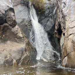


Fantastic place to hike! One of my favorites ever! We visited in May and were able to see the waterfall that only runs during certain months of the year. The hike is not aggressive, but if you have knee issues, I'd avoid because there are some higher step-ups or down spots along the way. You can also buy an annual pass if you plan to visit, as it costs $15 each time. You also need to bring an ID and 32oz of water or the ranger will not allow you to hike.


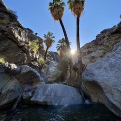
This hike is a must see! It is a fairly easy hike, approximately 2 miles round trip with a beautiful waterfall at the top. Parking was good, we paid 15$ each to enter. They require each person to have 32 ounces (1 liter) of water before doing hike. If you did not bring it with you, you can purchase a bottle for $2.50. The hike is somewhat Rocky, but we saw many kids and older persons completing it. Some used walking sticks. The heat is more of an obstacle, so wear hats, put on sunscreen and plan for early hikes in hotter days. There are a few small running water spots and a large waterfall at the top. The more is a fabulous pool to dip your hot feet in! The water was very cold, but felt refreshing! Lots of people on the trail, but I would not call it crowded and everyone was so pleasant!


Taquitz Canyon is an easy hike around 2 miles or more if you explore around we ended up doing 3.2 miles. The visitor centre is staffed with knowledgeable people, and once you've paid US$15.00 per person for entering the park, you can begin your hike to the Tahquitz falls. The hike is not difficult at all: A slow gradual climb till you reach the waterfall. And a round trip to the falls only takes about 1.5 hours or so. They don't charge for parking lot so that's great. Not happy about the entrance charge for such a small hike. Recommended it for one time and that's it.
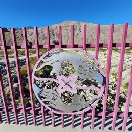

Returned after 5 years to hike this trail, and appreciated it more this time. The trail is so close to town, but a world away, the trail length is perfect at 1.4 miles, although a bit rugged with lots of rocks and steps, while the scenery is spectacular from start to the finish at a waterfall used in the movie "Lost Horizons" to represent shangri-la. The stewards are keeping the area pristine, with zero trash seen thanks to the $15 fee per person collected at the visitor's center, which has restrooms. Water is required, so bring 16 oz of water per person, or buy some at the ticket counter. The trail gets crowded and hot later, so go early when they open at 8 for the best experience


Tried out this hiking trail since Indian Canyon was closed for construction. This was def a good pick for us only 1.8 miles of a hike, which is good for beginners and intermediate hikers. It's a very clean hiking canyon when you enter to pay for tickets and buy souvenirs or use the restroom. It's a $15 fee for adults but if your law enforcement it's for free. You need at least a liter of water in order to walk. If not you can purchase a liter from them for only $2. So make sure to have your water on deck. It's really hot so have sunscreen on don't get BURNT! It's a nice view of a waterfall at the end and you can get inside the water if you want. The mini water areas is not recommended to get in because of the snakes. It's a nice little workout but still wear hiking boots to support your ankles it's many rocks and steeps you have to walk on. Overall, this is a very nice experience if you are in the Palm desert area for vacation. This hiking trail will not disappoint you! They gave good customer service and they have a trail ranger if you want one to walk with your group. I will def come back here when I come back!


Came here on a Monday around 11am. Parking lot was full so we had to park on the street and walk up the hill. Went into the building to pay the fees. It was $15 per adult and $7 for child. Got wristbands to show we paid. Staff wanted to check my water but my husband had the water in his bag and was in the restroom. She sold me tickets and then saw the water and was friendly about it. It was about 1.9 miles total and is on very rocky, uneven terrain with lots of steps. While walking up the trail there is not much to see. There is a creek running next to the trail that you can hear and then see. Many people on the trail. The waterfall was very underwhelming. There were many people there in swimsuits swimming. We went back a different way than the one we came in and it seemed easier (probably because were were going downhill) Overall it was something to do and we did it but not something I would do again or recommend.


Beautiful easy hike in the desert. I had some time to kill so I decided to get outdoors and see the waterfall. Entry is $15 per person and everyone is required to have water, for good reason. In mid March the requirement was 16 ounces per hiker. They sell water at the entrance if you need it. There are also restrooms at the start of the hike. It's crowded as it's definitely a tourist destination. If there's water in it you'll walk along a nice stream for a part of the hike. Took about an hour and there was limited shade. Well worth it though as you'll be rewarded with a pretty waterfall at the end. You're allowed to go in the waterfall but that water is COLD! There's a parking lot near the entrance. I didn't know this so I parked down the street and walked up to the welcome center. Get here early to avoid the crowds and the heat.


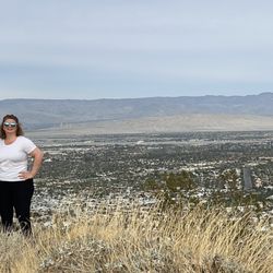
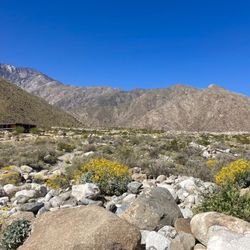
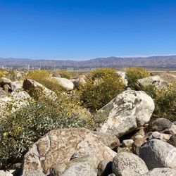
I was really happy we chose to hike this trail. The waterfall was definitely a draw. However even outside of that the views were beautiful. There were streams with mini waterfalls and aerial views that makes this hike worthwhile. We came at the end of February so it was the perfect weather - sunny and warm but not blistering hot. There was enough shade behind large rocks every so often to take a break. The trail itself had rock stairs that were steep and uneven. In addition there were a couple of bridges over the creeks. By the waterfall you had to walk on spaced out large rocks - no bridge. There were rocks all along the trail and at times the trail thinned by the edge. I would say the trail was moderately strenuous and doable, especially if you're careful and took it slow.


This is an update to my earlier report. My most recent visit was May 2022. Admission fees have been adjusted: $15.00 for adults and $7.00 for children (6-12 years). Entry is free for U.S. Military and First Responders with ID. Because of the warm weather, the docents really emphasized each adult should have at least one liter of water before setting out. (There is a water fountain to fill canteens. Bottled water is also sold at the station.) Mask requirements have been suspended. The waterfall wasn't flowing with any particular force; but the basin/pool was full. A lot of people were playing in the water. This is a "personal opinion": Having hiked the trail a number of times, I think the "return route" down from the falls to the trailhead is an easier hike than the prescribed route "up" from the trailhead to the falls. If you use the "down" route to go up to the falls, you'll find that the incline is not as steep (overall); the trail is more sand than rock; and there are fewer stone "step ups". I mention this because I noticed that a lot of people were returning from the falls to the trailhead using the "route up". Retracing your steps and returning via your original path makes sense, especially if you didn't take the free map offered at the ranger station. But a lot of people I encountered apparently never made it to the falls, finding the path too strenuous. Just a consideration.


They want to charge $12.50 for adults and $6.00 for kids EACH for a two mile hike. There are literally hundreds of other places in the immediate area that are far superior that don't ask you to waste money to hike. In other words, free. If you have a small group it'll cost more than $100 to hike here, what a joke! Give me yourself a favor and don't waste your time.


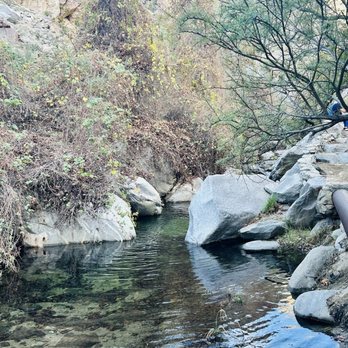
My husband and I are in the practice of decolonizing thanksgiving. We call it ThanksLiving. We thought it would be a good day to hike in Tahquitz Canyon. We learned about the indigenous Cahuilla people that inhabited this beautiful desert land. We thought of them as we did this moderately challenging, beautiful hike. The creek was flowing and the waterfall was gorgeous. The canyon is so peaceful. There are plenty of rock steps, so good hiking shoes with traction are essential. The park rangers in the visitor center make sure you have enough water with you, as there's no shade and the sun can be brutal. On this day, temps were cool and we hiked early so the sun was still shining on the other side of the mountain, but we still brought along our reusable water bottles, and sunscreen of course. This is truly a special place. There wasn't any trash along the trail, which was good to see that people are respecting the space, and/or staff is cleaning up after any littering occurs. This really was a great way for us to spend this day, my heart is full and my body is happy for the movement and exercise. read more




2 months ago
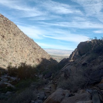
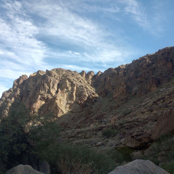
This is a really family-friendly hiking trail with well-marked, interconnecting trails throughout the park. The falls are the highlight, but I found fun views throughout! read more




2 months ago
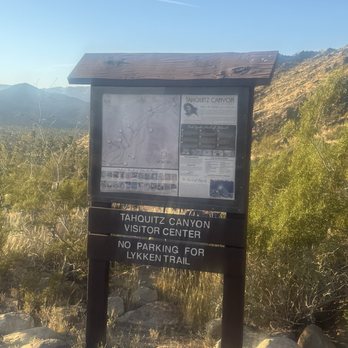
Easy hike and friendly staff, but the price tag of $15.00 was steep. I couldn't believe that they charged so much for hiking a 2-mile hike. At the end, when you make it to the water fall it is so worth it. Putting my bare feet in the water was amazing. read more


3 months ago
I highly recommend the Tahquitz Canyon hike back to the waterfall. It's a box canyon so there's no worry about getting lost. At a slow pace it'll take you about 90 minutes round-trip. It's so worth it as the canyon is beautiful and you're treated with an amazing waterfall at the back of the canyon. To avoid crowds, I do recommend going early during the week (as soon as they open). At that time of day, parking is easier and the temperature cooler. You are required to take water with you. Unfortunately, the trail is not suitable for people with mobility issues as there are quite a few uneven surfaces, while climbing over some of the rocks. read more


5 months ago
Great time hiking up to see the waterfalls yesterday. A good 2 miles on a well maintained trail. Definitely worth it after rainy days. read more
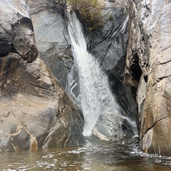


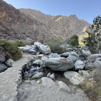
Fantastic place to hike! One of my favorites ever! We visited in May and were able to see the waterfall that only runs during certain months of the year. The hike is not aggressive, but if you have knee issues, I'd avoid because there are some higher step-ups or down spots along the way. You can also buy an annual pass if you plan to visit, as it costs $15 each time. You also need to bring an ID and 32oz of water or the ranger will not allow you to hike. read more




3 months ago

1 year ago
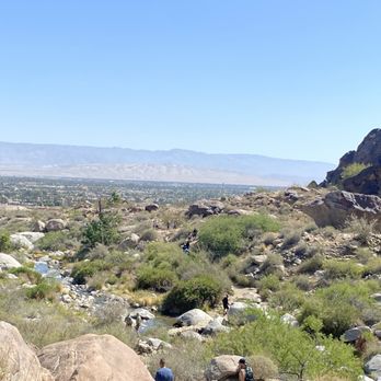
This hike is a must see! It is a fairly easy hike, approximately 2 miles round trip with a beautiful waterfall at the top. Parking was good, we paid 15$ each to enter. They require each person to have 32 ounces (1 liter) of water before doing hike. If you did not bring it with you, you can purchase a bottle for $2.50. The hike is somewhat Rocky, but we saw many kids and older persons completing it. Some used walking sticks. The heat is more of an obstacle, so wear hats, put on sunscreen and plan for early hikes in hotter days. There are a few small running water spots and a large waterfall at the top. The more is a fabulous pool to dip your hot feet in! The water was very cold, but felt refreshing! Lots of people on the trail, but I would not call it crowded and everyone was so pleasant! read more


4 months ago

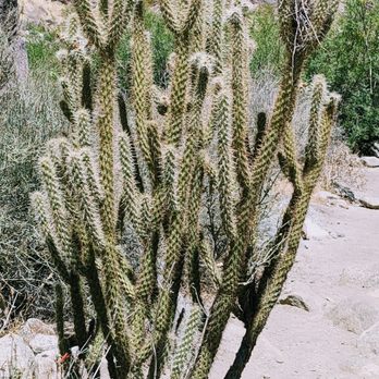
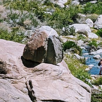
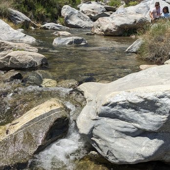
Taquitz Canyon is an easy hike around 2 miles or more if you explore around we ended up doing 3.2 miles. The visitor centre is staffed with knowledgeable people, and once you've paid US$15.00 per person for entering the park, you can begin your hike to the Tahquitz falls. The hike is not difficult at all: A slow gradual climb till you reach the waterfall. And a round trip to the falls only takes about 1.5 hours or so. They don't charge for parking lot so that's great. Not happy about the entrance charge for such a small hike. Recommended it for one time and that's it. read more





4 months ago

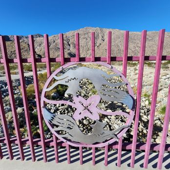
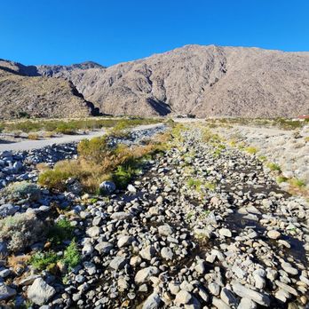
Returned after 5 years to hike this trail, and appreciated it more this time. The trail is so close to town, but a world away, the trail length is perfect at 1.4 miles, although a bit rugged with lots of rocks and steps, while the scenery is spectacular from start to the finish at a waterfall used in the movie "Lost Horizons" to represent shangri-la. The stewards are keeping the area pristine, with zero trash seen thanks to the $15 fee per person collected at the visitor's center, which has restrooms. Water is required, so bring 16 oz of water per person, or buy some at the ticket counter. The trail gets crowded and hot later, so go early when they open at 8 for the best experience read more


3 years ago
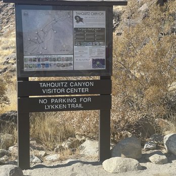
Tried out this hiking trail since Indian Canyon was closed for construction. This was def a good pick for us only 1.8 miles of a hike, which is good for beginners and intermediate hikers. It's a very clean hiking canyon when you enter to pay for tickets and buy souvenirs or use the restroom. It's a $15 fee for adults but if your law enforcement it's for free. You need at least a liter of water in order to walk. If not you can purchase a liter from them for only $2. So make sure to have your water on deck. It's really hot so have sunscreen on don't get BURNT! It's a nice view of a waterfall at the end and you can get inside the water if you want. The mini water areas is not recommended to get in because of the snakes. It's a nice little workout but still wear hiking boots to support your ankles it's many rocks and steeps you have to walk on. Overall, this is a very nice experience if you are in the Palm desert area for vacation. This hiking trail will not disappoint you! They gave good customer service and they have a trail ranger if you want one to walk with your group. I will def come back here when I come back! read more




3 years ago
Came here on a Monday around 11am. Parking lot was full so we had to park on the street and walk up the hill. Went into the building to pay the fees. It was $15 per adult and $7 for child. Got wristbands to show we paid. Staff wanted to check my water but my husband had the water in his bag and was in the restroom. She sold me tickets and then saw the water and was friendly about it. It was about 1.9 miles total and is on very rocky, uneven terrain with lots of steps. While walking up the trail there is not much to see. There is a creek running next to the trail that you can hear and then see. Many people on the trail. The waterfall was very underwhelming. There were many people there in swimsuits swimming. We went back a different way than the one we came in and it seemed easier (probably because were were going downhill) Overall it was something to do and we did it but not something I would do again or recommend. read more


Beautiful easy hike in the desert. I had some time to kill so I decided to get outdoors and see the waterfall. Entry is $15 per person and everyone is required to have water, for good reason. In mid March the requirement was 16 ounces per hiker. They sell water at the entrance if you need it. There are also restrooms at the start of the hike. It's crowded as it's definitely a tourist destination. If there's water in it you'll walk along a nice stream for a part of the hike. Took about an hour and there was limited shade. Well worth it though as you'll be rewarded with a pretty waterfall at the end. You're allowed to go in the waterfall but that water is COLD! There's a parking lot near the entrance. I didn't know this so I parked down the street and walked up to the welcome center. Get here early to avoid the crowds and the heat. read more


4 months ago

2 years ago
I was really happy we chose to hike this trail. The waterfall was definitely a draw. However even outside of that the views were beautiful. There were streams with mini waterfalls and aerial views that makes this hike worthwhile. We came at the end of February so it was the perfect weather - sunny and warm but not blistering hot. There was enough shade behind large rocks every so often to take a break. The trail itself had rock stairs that were steep and uneven. In addition there were a couple of bridges over the creeks. By the waterfall you had to walk on spaced out large rocks - no bridge. There were rocks all along the trail and at times the trail thinned by the edge. I would say the trail was moderately strenuous and doable, especially if you're careful and took it slow. read more


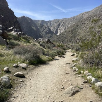


4 years ago
This is an update to my earlier report. My most recent visit was May 2022. Admission fees have been adjusted: $15.00 for adults and $7.00 for children (6-12 years). Entry is free for U.S. Military and First Responders with ID. Because of the warm weather, the docents really emphasized each adult should have at least one liter of water before setting out. (There is a water fountain to fill canteens. Bottled water is also sold at the station.) Mask requirements have been suspended. The waterfall wasn't flowing with any particular force; but the basin/pool was full. A lot of people were playing in the water. This is a "personal opinion": Having hiked the trail a number of times, I think the "return route" down from the falls to the trailhead is an easier hike than the prescribed route "up" from the trailhead to the falls. If you use the "down" route to go up to the falls, you'll find that the incline is not as steep (overall); the trail is more sand than rock; and there are fewer stone "step ups". I mention this because I noticed that a lot of people were returning from the falls to the trailhead using the "route up". Retracing your steps and returning via your original path makes sense, especially if you didn't take the free map offered at the ranger station. But a lot of people I encountered apparently never made it to the falls, finding the path too strenuous. Just a consideration. read more

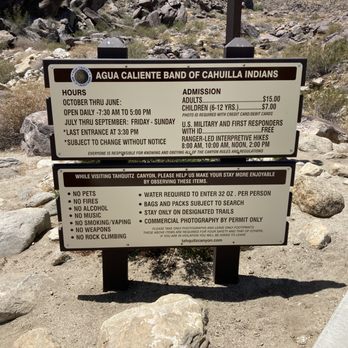

5 years ago
They want to charge $12.50 for adults and $6.00 for kids EACH for a two mile hike. There are literally hundreds of other places in the immediate area that are far superior that don't ask you to waste money to hike. In other words, free. If you have a small group it'll cost more than $100 to hike here, what a joke! Give me yourself a favor and don't waste your time. read more


2 years ago
Amazing hike! Gorgeous water fall with many little swimming pools for you and your kids! A little bit on the harder side. If you need a walking stick it might not be best because there are many steep steps on this hike up the canyon. However if you feel empowered enough, do it! (Might waste $15) Was a gorgeous 1.8- 2 mile round trip there and back. Make sure to bring 32 oz of water or else you will need to purchase a bottle for $1.50. The women inside at the front desk, Paula and Amaret I believe? were super helpful and gave us answers to any questions we had. I definitely recommend this if it is season and you are in town! read more


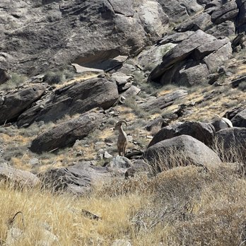


2 years ago
Meh. Way too overcrowded for what it is. It's a very short hike, and the price to enter is robbery. $15 per adult! What a joke. It wouldn't be so bad if it wasn't super crowded with children everywhere. The rangers suck also. I thought it was just one that was nasty, but they all have a stick up their ***. Not worth it. I would recommend looking into other trails in the area, or even visiting the tramway for a MUCH better hiking experience. read more


We visited at the end of January on a sunny afternoon. Good parking lot. They ask you to carry 32 oz of water per person. Hike level is easy to moderate. It was warm in the sun, cool in the shade. After about 3 pm, there was some shade on the left (north-facing) side of the canyon. The trail splits apart and joins together again. There are no signposts, and the printed guide vaguely corresponds to the trail. Just respect rocks arranged to indicate that there is no trail. Head up one side and down the other to form a loop. Including time to take photos and videos, it took me about an hour and twenty minutes. Perhaps longer if you have kids or need more time. The falls are great! Some fall colors lingered on the tree at the top of the waterfall. I also liked the view at the lip of the canyon and the remains of a channel built to carry water. We appreciated a hummingbird in her nest in a brittlebush near the trail! We had AT&T cellphone signal on most of the trail, but do not rely on signal. If you are not out by the specified time (5 pm on this visit), the ranger will lock the gate and may tow your car. I think the experience was worth the admission fee. read more


Go early before it gets hot! There's a $12 cover per person and you get a wristband. Are we at Coachella? Jk. The entrance and exit to the hike are all via the visitor center. They require you to have water so you don't dehydrate. The hike itself is rather easy and the waterfall is nice, however, wasn't as massive as I thought it would be. You can get great views of the city during the hike. We noticed that as we finished we saw a bunch of people on the trail so if you want to avoid crowds, go when they first open! read more


This is a pretty awesome hike. At first I wasn't too keen on having to pay $12 for a hike when there are a bunch of them you can go to for free. However it was worth it for the following reasons: 1) The trail, stream and waterfall areas were all in great condition. 2) There were a bunch of great spots to take some really nice photos 3) Nice parking lot 4) The stream was really clean, we spent a lot of time just hanging out at the stream and soaking our feet 5) They limit the number of people on the trail so everyone can be socially distant Definitely check out this trail if you are in the Palm Springs area. Get there early, otherwise you can get turned away if it gets too crowded. read more


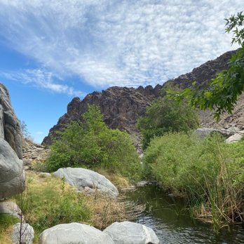

2 years ago
Great hike !! Bring water the rangers check !! Waterfall scenery sunshine makes for a great morning go before the heat ! read more


Really beautiful hike to the waterfall, fun for all ages. The trail is well maintained with gorgeous scenery. The waterfall is so pretty. I think the fee is too high and the parking lot is too far from the visitor center. read more


2 years ago
Great Hike, one of the places in the desert. The views are amazing. Make sure you bring water with you. The water is beautiful read more

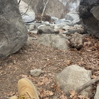


Fairly easy hike that takes about an hour and costs $15 per person. You must have water on you, but can buy onsite if needed. Parking lot was full by 9:30 am, but you can park below the park on the street and walk up. The trail is quite busy with lots of families, so expect it to take longer than advertised due to pedestrian traffic jams. The terrain isn't bad at all, but not suitable for those who aren't comfortable on rocky and uneven surfaces. Earlier the better for parking, cooler temps and avoiding the hordes. Waterfall is neat and cooling, you can even take a dip and get up close... makes sense why this trail is so popular! read more
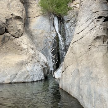
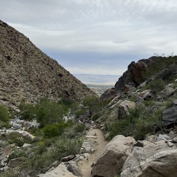


1 year ago

A great little oasis in the Desert! The hike takes about an hour from the visitors center to the waterfall. Bring cash... it costs about $12 per person. Well worth it! The views are spectacular and it's an easy hike with easy gradients and a couple of steep steps here and there. If you go in the summer, make sure you take a couple of bottles of water as the sun will take it out of you. Best time to go is in the spring when the snow is melting and the waterfalls and I'm full force. We went in the fall and it was still beautiful. Enjoy! read more


3 years ago

3 years ago
Make sure you take lots of water (it's required) Fun for the entire family! Make sure you catch the movie at the visitor's center before you go. read more


2 years ago
Great hike to a small waterfall! Highly recommend using poles for the steeper stepped parts. Always bring plenty of water in the desert. For regular hikers it's easy. For out-of-town visitors used to flatter groomed trails, sections may be outside your comfort zone. read more


5 years ago
This was the only hike that required us to pay $12.50 a person and that is because this is a sacred canyon that has a seasonal 60 foot waterfall. Before you actually do this hike ask if there is water in the waterfall. This hike would not be impressive without the waterfall. The waterfall was beautiful. While it was hot and getting to the waterfall without any shade seemed longer then it was, the waterfall was so cold. We did take our shoes off to cool off but you won't be able to keep your feet in the water for too long. When we came the water was freezing cold. No one attempted to swim here. Some people came in and walked back the same path but I recommend you do a loop and not go back the same way you came in. The view of the city on the way back was beautiful. read more


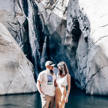


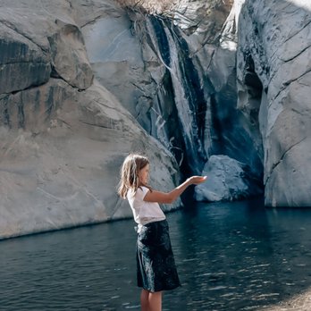
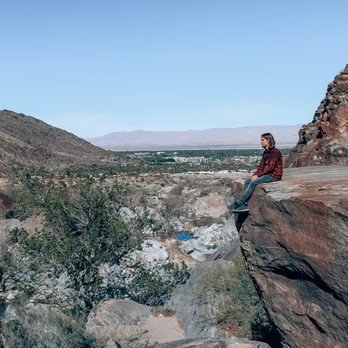


This is nice short hike, we came in the morning around 930am so we actually got bit of shade. Admission is $15 per person and you enter/exit through the visitor center. They also confirm to make sure you have water with you. There are bathrooms at the visitor center as well. The hike itself is pretty easy, you can get some cool pictures with some big rocks plus a nice view of the city. At the moment October 2021, there is no waterfall. If that is important to you be sure call and check first or come back in spring time. The price maybe a bit steep for some for such a short hike, however this is to help the cost of upkeeping of the trail and also to keep the crowds away I'm sure. We only saw few other people the morning that went. read more


3 years ago
Great family time and wonderful service at center!! Hike was easy to medium for all ages. Be prepared to get wet in ice cold waterfall!!! Great memory made!!! Definitely recommend!! read more


Page 1 of 7
More info about Tahquitz Canyon
500 W Mesquite Ave
Palm Springs, CA 92264
Directions
(760) 416-7044
Call Now
Visit Website
http://tahquitzcanyon.com
Hours
Indoor Amenities
Outdoor Amenities
Ask the Community - Tahquitz Canyon
Is there shade? Will it be too hot to do at the end of June?
There is some shade but I still wouldn't go in June unless you are very athletic.
Is the waterfall dry or there's still water right now?
Not sure when this question was asked but there should normally be water year round. There may be extraordinary rare periods where it may run nearly dry but this should be a very rare exception as even in summer months there is rain and moisture in… Read more
Are dogs allowed?
Review Highlights - Tahquitz Canyon
You might also consider



















Why does Yelp recommend reviews?


Tahquitz Canyon - hiking - Updated May 2026
Best of Palm Springs
People found Tahquitz Canyon by searching for…
Swimming Holes in Palm Springs, California
Hiking Trails With Waterfalls in Palm Springs, California
Beaches in Palm Springs, California
Natural Hot Springs in Palm Springs, California
Things to Do in Palm Springs, California
Parks in Palm Springs, California
Scenic Drive in Palm Springs, California
Walking Trails in Palm Springs, California
Scenic View in Palm Springs, California
Dog Friendly Hiking Trails in Palm Springs, California
Places to Take Pictures in Palm Springs, California
Watch Sunset in Palm Springs, California
Parks for Kids in Palm Springs, California
Off Road Trails in Palm Springs, California
River Swimming in Palm Springs, California
Cruising Spots in Palm Springs, California
Running Trails in Palm Springs, California
Picnic Areas in Palm Springs, California
Fishing Spots in Palm Springs, California
Dog Swimming in Palm Springs, California
Stroller Friendly Hikes in Palm Springs, California
Trail in Palm Springs, California
Trending Searches in Palm Springs, CA
Boat Rental near Tahquitz Canyon
Botanical Gardens near Tahquitz Canyon
Bounce House Rentals near Tahquitz Canyon
Campgrounds near Tahquitz Canyon
Cliff Jumping near Tahquitz Canyon
Dog Friendly Things To Do near Tahquitz Canyon
Flower Fields near Tahquitz Canyon
Flower Shop near Tahquitz Canyon
Lakes & Ponds near Tahquitz Canyon
Movie Theatre near Tahquitz Canyon
Nurseries & Gardening near Tahquitz Canyon
Outdoor Activities near Tahquitz Canyon
Outdoor Furniture Stores near Tahquitz Canyon
Party Equipment Rentals near Tahquitz Canyon
Pick Your Own Farms near Tahquitz Canyon
Picnic Areas near Tahquitz Canyon
Places To Walk Around near Tahquitz Canyon
Rainy Day Activities near Tahquitz Canyon
Rock Quarry near Tahquitz Canyon
Running Trails near Tahquitz Canyon
Scenic Drive near Tahquitz Canyon
Secret Spots near Tahquitz Canyon
Strawberry Picking near Tahquitz Canyon
Sunrise View near Tahquitz Canyon
Swimming Holes near Tahquitz Canyon
Things To Do On A Rainy Day near Tahquitz Canyon
Browse Articles
Browse Nearby
BEST of Palm Springs, California Restaurants near Tahquitz Canyon
BEST of Palm Springs, California Coffee near Tahquitz Canyon
BEST of Palm Springs, California Things to Do near Tahquitz Canyon
BEST of Palm Springs, California Walking Trails near Tahquitz Canyon
BEST of Palm Springs, California Parks near Tahquitz Canyon
BEST of Palm Springs, California Breakfast near Tahquitz Canyon
BEST of Palm Springs, California Campgrounds near Tahquitz Canyon
BEST of Palm Springs, California Caves near Tahquitz Canyon
BEST of Palm Springs, California Sightseeing near Tahquitz Canyon
Browse Brands
Related Searches in Palm Springs, CA
Best Fishing Locations and Guides in Palm Springs, California
Best Nature Trails for Hiking in Palm Springs, California
Best Places for Horseback Riding in Palm Springs, California
Best Sledding Spots and Fun in Palm Springs, California
Best Waterfalls and Swimming Holes in Palm Springs, California
Check Out Off Road Trails in Palm Springs, California
Discover Dog Friendly Trails to Explore in Palm Springs, California
Discover Kid Friendly Hiking Trails in Palm Springs, California
Discover Scenic Mountain Bike Trails Near Palm Springs, California
Discover Scenic Waterfall Spots in Palm Springs, California
Discover a Hiking Trail in Palm Springs, California
Discover the Best Night Hike Trails in Palm Springs, California
Discover the Best Running Track in Palm Springs, California
Dog-Friendly Hikes With Dogs in Palm Springs, California
Enjoy Camping Adventures Around Palm Springs, California
Enjoy Exciting Mountain Biking Adventures in Palm Springs, California
Enjoy Kayaking Adventures in Palm Springs, California
Enjoy Tent Camping Spots Around Palm Springs, California
Enjoy a Beautiful Waterfall Hike in Palm Springs, California
Enjoy the Best Walking Path in Palm Springs, California
Enjoy the Best Walking Trails in Palm Springs, California
Exciting Cliff Jumping Spots in Palm Springs, California
Explore Beautiful Parks and Green Spaces in Palm Springs, California
Explore Easy Hikes Perfect for All in Palm Springs, California
Explore Fun Activities to Do in Palm Springs, California
Explore Popular Campgrounds Near Palm Springs, California
Explore Top Dog Parks in Palm Springs, California Near You
Explore the Best Boating Spots in Palm Springs, California
Explore the Best Swimming Holes Around Palm Springs, California
Explore the Best Trail Options in Palm Springs, California
Family Friendly Hiking With Kids in Palm Springs, California
Find Beautiful Views in Palm Springs, California
Find the Best Scenic View Locations in Palm Springs, California
Great Places to Walk in Palm Springs, California
Hike the Popular Waterfall Trail in Palm Springs, California
Hiking Trails With Waterfalls in Palm Springs, California
Off Leash Dog Hiking Trails in Palm Springs, California
Plan Nature Center Visits in Palm Springs, California
Plan a Scenic Drive Route Near Palm Springs, California
Popular Fishing Spots to Explore in Palm Springs, California
Popular Outdoor Activities to Try in Palm Springs, California
Popular Picnic Spots to Visit in Palm Springs, California
Popular Things to See in Palm Springs, California
Safe River Swimming Areas in Palm Springs, California
Safe and Fun Parks for Kids in Palm Springs, California
Top Climbing Spots and Gyms in Palm Springs, California
Top Running Trails to Explore in Palm Springs, California
Top Swimming Lakes to Enjoy in Palm Springs, California
People who viewed Tahquitz Canyon also viewed

Indian Canyons
314 reviews

Lykken Trail
46 reviews

Wilderness Loop Trail
6 reviews

Whitewater Riverbed
7 reviews

Santa Rosa and San Jacinto Mtns Nat'l Monument Visitors Center
21 reviews

Araby Trail
13 reviews

The Wildlands Conservancy - Mission Creek Preserve
8 reviews

Bighorn Overlook Trail
9 reviews

Indio Hills Badlands Trailhead
8 reviews

Prescott Preserve
3 reviews