Cancel

Open app

Search

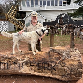
South Fork Hunting Preserve

4.4 (7 reviews)
Closed • 8:00 am - 6:00 pm

South Fork Hunting Preserve Photos

More like South Fork Hunting Preserve

Recommended Reviews - South Fork Hunting Preserve

Your trust is our priority, so businesses can't pay to alter or remove their reviews. Learn more about reviews.
Yelp app icon
Browse more easily on the app
Review Feed Illustration
Photo of Rm E.
0
60
40

1 year ago

Helpful 0
Thanks 0
Love this 0
Oh no 0

4 years ago

Helpful 0
Thanks 0
Love this 0
Oh no 0

10 years ago

Helpful 1
Thanks 0
Love this 0
Oh no 0

3 years ago

You will have a great time and they have a beautiful facility. Experienced guides and orderly hunts.

Helpful 0
Thanks 0
Love this 0
Oh no 0
Photo of Rod L.
0
18
0

5 years ago

Helpful 0
Thanks 0
Love this 0
Oh no 0

7 years ago

Helpful 0
Thanks 0
Love this 0
Oh no 0

8 years ago

Helpful 0
Thanks 0
Love this 0
Oh no 0

Ask the Community - South Fork Hunting Preserve

Verify this business for free

Get access to customer & competitor insights.

Verify this business

Rich Mountain Wildlife Management Area

Rich Mountain Wildlife Management Area

5.0(1 review)
73.1 mi

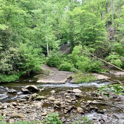
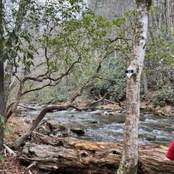
December 13, 2020…read more Approximately 8 miles north of Elijah, GA on highway 76 shortly before entering the town of Cherry Log, you'll turn right onto Rock Creek Connector which takes you to a regular looking two lane road called Rock Creek Rd. Almost immediately upon making the right hand turn on Rock Creek road is the sign "Rich Mountain Wildlife Management Area" and my cell reception (meteo PCS) dropped again. Following Rock Creek Road eventually turns into a crushed gravel road with a stream running next to it and past several farms including a small horse farm. This was my third time to this area in the past month, and thankfully my final time. My goal was to summit Tickanately Bald, a peak that was nearly 4000 ft tall and nestled 0.7 miles south of Rich Mountain. This time I went up FS295 to the end and hiked the rest of the way. The 4000 ft challenge led by the Appalachian Trail Club has less than 10 members who have ever climbed all 32 peaks. And there is a good reason why. You might think...hey, these peaks aren't Mt Everest. What's the big deal? You wouldn't be wrong, however, plan accordingly, if you want to attempt it. Be warned: this activity is not without risk. Climbing walls of vegetation only to encounter brambles that want to cut you, is definitely not everyone's cup of tea. In many cases, there is no good footing. Especially after a rain. Stream crossings or hopping is a skill and balancing yourself across rocks to ford a small spring also is an art form, especially if your heart is pounding out of your chest from climbing 1000 ft. And finally, it's very easy to get yourself turned around. If your phone dies, runs out of battery, or you simply smash it while slipping on a patch of leaves covering a slick rock, well you are SOL, especially without cell phone service to call for help. And better have a back up plan. Don't go out there without a secondary GPS device. Pack water, pack a snack. Put something on your windshield in writing notifying people you are out for a walk and expect to be back. Give someone a clue where you are going too. Weather can change quickly, and the terrain difficult to navigate. While these mountains aren't huge, they are still fairly remote compared to the usual urban park you may have encountered. Plan ahead an be safe! Suffice it to say, I had fantastic weather. (Winter is the best season to get out and conquer your Georgia 4K peaks! And Limited Vegetation). I brought my phone and my GPS watch and a bottle of water and although the distance to the peak was 2.5 miles I gave myself 6-7 miles and plenty of daylight to climb this peak by leaving at noon. FS295 is approximately 4 miles from the beginning of Rock Creek Road and begins steadily up for 2 miles right at the Hunter Checkin Station. It's fairly navigable and I managed it in my Prius at 4-6 mph! There are a couple of nice choice camping spots along the way. At the top, I parked and ran 1.2 miles down to Little Rock Creek. From there I picked a line and started hiking up, and pretty much kept this up for 1300 ft or 1.5 miles till I reached the top of Rich Mt where there is an old chimney from an old house that once was. There is no benchmark (the geodesic marker often installed by the US Forest Service to denote the high point) to be found anywhere on Rich Mountain, unfortunately. There is an old unmaintained trail to the West (facing south) which leads you directly to Tickanately. Unfortunately, I went down the wrong side of Rich Mountain and had to adjust. Translation...climb back up to the top of Tickanately, then stumbled upon the path which I took back to Rich, before descending the same 1300 ft I had climbed----this time it was weeeeehaww and nimbly bounding down hill till I got back to Little Rock Creek. The total elevation gain was 2400 ft in 2.5 hours and my glutes got worked big time. The feeling of accomplishment was overwhelming. Seven 4K peaks done and 25 to go!

Photos
Rich Mountain Wildlife Management Area

See all

Etowah Valley Game Preserve - 5 Pheasants in less than 2 hours

Etowah Valley Game Preserve

4.0(9 reviews)
53.3 mi

I hunted at Etowah on Valentines Day (in the morning & yes my wife said ok)…read moreEmory, my guide and his dogs did a great job. The Habitat is vey good and the guides & dogs know their business. Alex & Emory were very friendly and made me feel welcome. I belong to a Pheasant Hunt Club in Colorado but living in Georgia makes that a very long drive. Since I live in Suwanee, this was only a short 1 hour drive. I hunted alone and was well pleased with Etowah Valley. I got 5 Pheasants in less than 2 hours. I plan to make this trip again and hope to have a couple of my hunting buddies to join on my next adventure there.

Our Company has hunted with Alex & Etowah Valley, Annually, for many years in taking our Managers…read moreout for a full day of shooting, food and fellowship enjoyment. It now takes 3 days as we have to "keep the stores open!" Alex and his team do a terrific job with maximizing our outing. We typically do 3 foursomes with guides/dogs for the morning with 48-50 quail per group plus 12 chukkar to add value! Following a catered BBQ lunch, we do the British Pheasant Shoot in the afternoon, making for a great "combo" kind of day! The guides are personable, fun, and have good dogs. (not perfect, whose are?) Alex's crew and staff make the day better as we've got to know them over the years. Great for us as we can sleep in our own beds but "get away for the day" within driving distance! Not fancy but that's what makes it great! John Howard/Howard Brothers Outdoor Power & Hardware

Photos
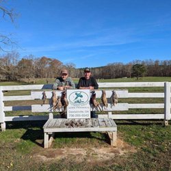
Etowah Valley Game Preserve - Pheasant, chukar quail

Pheasant, chukar quail

Etowah Valley Game Preserve
Etowah Valley Game Preserve - Pheasants, chukar and quail

See all

Pheasants, chukar and quail

South Fork Hunting Preserve - wildlifehunting - Updated May 2026
Loading...
Loading...
Loading...