1. Slot Canyon

0

Las Cruces, NM

Cancel

Open app

Search

Slot Canyon

4.8 (11 reviews)

Slot Canyon Photos

Recommended Reviews - Slot Canyon

Your trust is our priority, so businesses can't pay to alter or remove their reviews. Learn more about reviews.
Yelp app icon
Browse more easily on the app
Review Feed Illustration

Reviews With Photos

Danielle G.

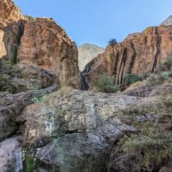
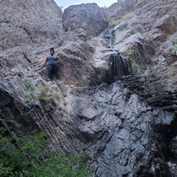
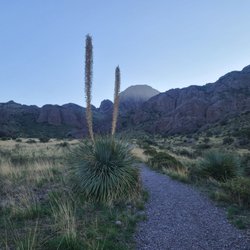
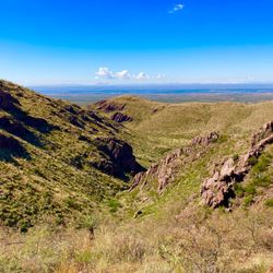
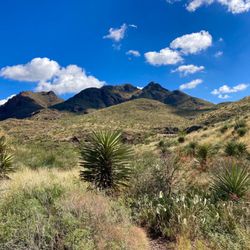
I've been wanting to go hiking since we moved here. We arrived around 8:00am and were the first ones there. We jumped the green gate then followed the path on the left. You walk towards where the mountains split. It was super beautiful! There were small spaces in the canyon itself. And big rocks to climb over. We would do it again for sure!

This is the gate to hop over, on Apple Maps the location is a bit off.

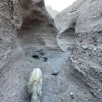
Super awesome hike dog friendly, not too stroller friendly unfortunately. every easy hike not much of an incline! Stays cool inside the canyon. Apple Maps location is not accurate!! 18659-19521 N Valley Dr Las Cruces, NM 88007 United States GOOD FOR CUTE PICS ;)

Sierra L.

super neat to see. would not recommend going during the day, as it's very hot. the gate you have to climb over gets hot. I would say morning or later in the evening. trail is easy to follow

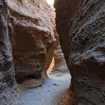
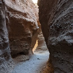
The slot portion!
Sherri H.

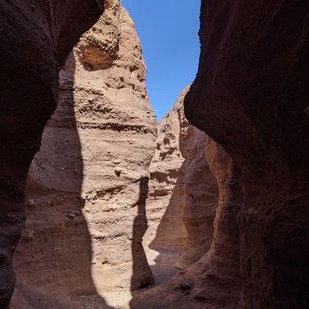
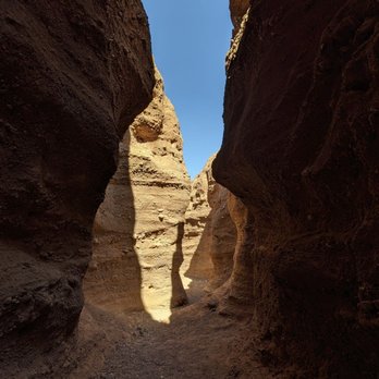
One of the easier pretty hikes in Las Cruces! To get to the Slot you have to go over a gate of a chained fence (according to everyone I talked to this trail is open). Then you go towards the mountain until you hit an opening. Then you go through the opening to get to the slot! It's definitely a different view compared to anything else in Las Cruces! However, I wouldn't go during raining season since it will bring out all the insects!
See all

3 years ago

Helpful 1
Thanks 0
Love this 3
Oh no 0

11 months ago

All it was an amazing sight of Gods handiwork I would recommend it to anyone who loves the rock formations !

Helpful 0
Thanks 0
Love this 1
Oh no 0

11 months ago

Absolutely beautiful views and a great experience! We would say an easy to moderate hike.

Helpful 0
Thanks 0
Love this 1
Oh no 0

2 years ago

Helpful 0
Thanks 0
Love this 0
Oh no 0

2 years ago

Helpful 0
Thanks 0
Love this 0
Oh no 0

1 year ago

Helpful 0
Thanks 0
Love this 0
Oh no 1

5 years ago

Helpful 0
Thanks 0
Love this 0
Oh no 0

6 years ago

Helpful 2
Thanks 0
Love this 1
Oh no 0

8 years ago

Helpful 3
Thanks 0
Love this 2
Oh no 0

5 years ago

Helpful 1
Thanks 0
Love this 0
Oh no 0
Photo of Jake A.
2
21
15

4 years ago

Very fun hike for the average hiker! Not to difficult but still rewarding! Highly Recommended!

Helpful 1
Thanks 0
Love this 0
Oh no 0

Ask the Community - Slot Canyon

Review Highlights - Slot Canyon

“Follow your way to the left of the split until you come to a clearing.”

Mentioned in 2 reviews

Read more highlights

Verify this business for free

Get access to customer & competitor insights.

Verify this business

Aguirre Springs

Aguirre Springs

4.8(6 reviews)
27.0 mi

This place is so great! We hiked here today for the first time (August 2017) and it took us about 2…read morehours to do the Pine Tree Trail. Super easy to get to, ample parking, and a restroom in the parking area! Always a plus... The trail is a pretty decent hike, however, and I would only recommend it if you are a moderate to experienced hiker. The trail is narrow and not clearly marked. There were a handful of orange ribbons tied to the trees, and only 2 or 3 actual signs that just said "Trail", with no arrows or mileage shown. The path was pretty overgrown, mostly due to the rains of the past month. Maybe in the winter it's not as overgrown? There were a few times where we really had to discern the proper trail from offshoots. When we were about 3 miles in, we heard someone across the ravine wondering if they were lost, so we shouted back to "Keep Going!" If you're not an experienced hiker, this could easily take 3 or 4 hours, or just be undoable. I honestly don't think children or small dogs would be able to make it either. If you do want to try, don't forget water and a snack, sunscreen and bug spray! The views and wildlife are definitely worth it though!

The 4 mile moderate Pine Tree trail from the campground is a must do with a huge variety of plant…read morelife, butterflies and birds. You will travel through high dessert to ponderosa pine climates and the wildflowers were spectacular in October after a wet fall. Views of Sugarloaf mountain and the Needles are spectacular.

Photos
Aguirre Springs
Aguirre Springs
Aguirre Springs

See all

Organ Mountains Desert Peaks National Monument - Dripping Springs Trail | Instagram: @telephonesmoothie

Organ Mountains Desert Peaks National Monument

5.0(6 reviews)
28.5 mi

This review is for Pine Tree Trail which was a ~4.2 miles round trip that took ~2.5 hours to…read morecomplete. Pine Tree Trail was located 45 minutes away from White Sands National Park. This was on the way back to Las Cruces which was a good stop for a second hike. This hike was done counterclockwise; trail was a narrow path of dirt and rock with plenty of inclines! Stunning views of the surrounding mountains and desert terrain! Short video of the hike for those interested! https://youtu.be/9wHTPd_FhNo

I came here on a whim to explore the mountains close up. This is a fee area of $5 per car, but if…read moreyou have an annual National Parks and Federal Recreational Lands Pass it's a participating site. You can either show the person in the visitor center to get a receipt or display it in your car on the dash or hangtag. The person in the visitor center was helpful. The park closes at sunset (with the chance of fees if you don't leave by then) and so there's a whiteboard with the exact time you need to leave. There are a bunch of trail maps and the maps that prohibit dogs are also clearly marked. The worker recommended the La Cueva trail as there wasn't enough time for us to do the trail originally planned and gave us the back story behind it. He seemed very knowledgeable! There are gorgeous views and the trails seemed well maintained with gravel/dirt.

Photos
Organ Mountains Desert Peaks National Monument - Dripping Springs Trail | Instagram: @telephonesmoothie

Dripping Springs Trail | Instagram: @telephonesmoothie

Organ Mountains Desert Peaks National Monument - Dripping Springs Trail | Instagram: @telephonesmoothie

Dripping Springs Trail | Instagram: @telephonesmoothie

Organ Mountains Desert Peaks National Monument - Dripping Springs Trail | Instagram: @telephonesmoothie

See all

Dripping Springs Trail | Instagram: @telephonesmoothie

Achenbach Canyon - After ~1.5 miles an open grassy area

Achenbach Canyon

5.0(2 reviews)
27.7 mi

This is definitely one of the best hikes in the Las Cruces area, which has no shortage of great…read morehiking trails that are scenic, especially in the Organ Mountains. This canyon hike is more remote than the other hikes in the area. To get to the parking area from Ladera Canyon Road it is helpful having a high-clearance vehicle. If you don't have one, there are places to park along the road back to the trailhead (with a short walk to the trail) but parking is strictly forbidden on Ladera Canyon Road. The hike itself was filled with amazing scenery and beautiful rock formations. There was nobody else on the trail, and the canyon is very quiet. We saw numerous deer droppings and tracks all along the route. There was a 1,200 foot elevation gain going into the canyon, and the return route is almost all downhill. Footing can be difficult in some spots as the trail had loose rocks that slip in spots, so I recommend taking hiking poles. It took us 3:45 minutes to complete the hike, which measured out at 5.2 miles. Strongly recommend this hike if you want a nice, quiet day and amazing views!

The scenery is spectacular on the Achenback trail. To get here, drive to near the end of Soledad…read moreCanyon road and go south on Ladera Canyon, then turn left on the primitive road marked with a trail sign and proceed to the parking area. A high clearance vehicle is helpful. The route is a steady uphill for about a mile through some interesting rock formations including dendritic rocks, then you will come to the top of a dry waterfall. There are great views all along the way. After this point it starts to flatten out a bit to a nice grassy area with 360 degree views. You can continue hiking along unofficial trails and stream beds or turn back.

Photos
Achenbach Canyon - West facing view near top of dry waterfall

West facing view near top of dry waterfall

Achenbach Canyon - Manganese and iron dendritic rocks near the beginning of the hike

Manganese and iron dendritic rocks near the beginning of the hike

Achenbach Canyon - Upper canyon

See all

Upper canyon

Slot Canyon - hiking - Updated November 2026

Loading...
Loading...
Loading...