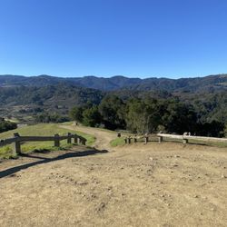
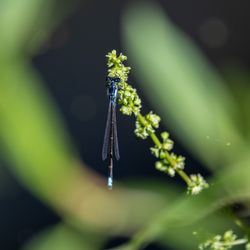
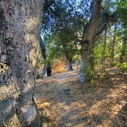
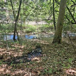
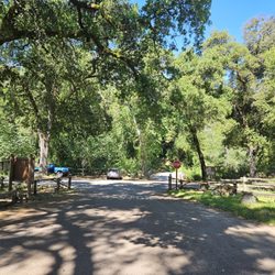
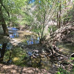
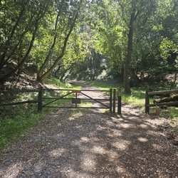
Skyline Trail Photos


You might also consider
More like Skyline Trail
Recommended Reviews - Skyline Trail
Start your review...

5 years ago
My pics don't do justice. It was my first time last weekend and made it to my fave trail list. Such stunning views and great trails! We parked on the side street. read more


6 years ago
18 years ago
More info about Skyline Trail
Skyline Blvd
Highway 9 & 35
Saratoga, CA 95070
Directions
Hours
Outdoor Amenities
Ask the Community - Skyline Trail
You might also consider


Skyline Trail - hiking - Updated July 2026
Best of Saratoga
People found Skyline Trail by searching for…
Hiking Trails With Waterfalls in Saratoga, CA
Waterfalls and Swimming Holes in Saratoga, CA
Walking Groups in Saratoga, CA
Stroller Friendly Hikes in Saratoga, CA
Fun Things to Do in Saratoga, CA
Beautiful Views in Saratoga, CA
Great View Points in Saratoga, CA
Walking Trails in Saratoga, CA
Hiking With Kids in Saratoga, CA
Redwood Forest in Saratoga, CA
Free Things to Do in Saratoga, CA
Parks for Kids in Saratoga, CA
Things to Do at Night in Saratoga, CA
Trending Searches in Saratoga, CA
Black Owned Nail Salons in Saratoga, CA
Jet Ski Rental in Saratoga, CA
Off Road Trails in Saratoga, CA
Outdoor Activities in Saratoga, CA
Places To Swim in Saratoga, CA
Places To Walk Around in Saratoga, CA
River Swimming in Saratoga, CA
Running Trails in Saratoga, CA
Scenic Night View in Saratoga, CA
Scenic Overlook in Saratoga, CA
Swimming Holes in Saratoga, CA
Browse Articles
Browse Nearby
BEST of Saratoga, California Restaurants near Skyline Trail
BEST of Saratoga, California Coffee near Skyline Trail
BEST of Saratoga, California Things to Do near Skyline Trail
BEST of Saratoga, California Breakfast near Skyline Trail
BEST of Saratoga, California Lakes near Skyline Trail
Browse Brands
Related Searches in Saratoga, CA
Affordable Kayak Rental Services in Saratoga, California
Best Fishing Locations and Guides in Saratoga, California
Best Nature Trails for Hiking in Saratoga, California
Best Places for Horseback Riding in Saratoga, California
Check Out Off Road Trails in Saratoga, California
Discover Dog Friendly Trails to Explore in Saratoga, California
Discover Kid Friendly Hiking Trails in Saratoga, California
Discover Scenic Hiking Trails in Saratoga, California
Discover Scenic Mountain Bike Trails Near Saratoga, California
Discover Scenic Waterfall Spots in Saratoga, California
Discover Walking Parks in Saratoga, California Near You
Discover a Hiking Trail in Saratoga, California
Discover the Best Night Hike Trails in Saratoga, California
Dog-Friendly Hikes With Dogs in Saratoga, California
Enjoy Camping Adventures Around Saratoga, California
Enjoy Exciting Mountain Biking Adventures in Saratoga, California
Enjoy Kayaking Adventures in Saratoga, California
Enjoy Tent Camping Spots Around Saratoga, California
Enjoy a Beautiful Waterfall Hike in Saratoga, California
Enjoy a Peaceful Nature Walk in Saratoga, California
Enjoy the Best Walking Path in Saratoga, California
Enjoy the Best Walking Trails in Saratoga, California
Exciting Cliff Jumping Spots in Saratoga, California
Experience Thrilling White Water Rafting in Saratoga, California
Explore Beautiful Parks and Green Spaces in Saratoga, California
Explore Easy Hikes Perfect for All in Saratoga, California
Explore Fun Activities to Do in Saratoga, California
Explore Popular Campgrounds Near Saratoga, California
Explore the Best Beach Spots in Saratoga, California
Explore the Best Boating Spots in Saratoga, California
Explore the Best Trail Options in Saratoga, California
Family Friendly Hiking With Kids in Saratoga, California
Find Popular Ziplining Spots Around Saratoga, California
Find the Best Parks for Picnics in Saratoga, California
Find the Best Scenic View Locations in Saratoga, California
Great Places to Walk in Saratoga, California
Hike the Popular Waterfall Trail in Saratoga, California
Hiking Trails With Waterfalls in Saratoga, California
Off Leash Dog Hiking Trails in Saratoga, California
Plan a Scenic Drive Route Near Saratoga, California
Popular Outdoor Activities to Try in Saratoga, California
Popular Picnic Spots to Visit in Saratoga, California
Safe River Swimming Areas in Saratoga, California
Safe and Fun Parks for Kids in Saratoga, California
Top Climbing Spots and Gyms in Saratoga, California
Top Paddleboarding Activities in Saratoga, California
Top Running Trails to Explore in Saratoga, California
Top Swimming Spots and Pools in Saratoga, California
People who viewed Skyline Trail also viewed
Hunter's Point
36 reviews
Monte Bello Open Space Preserve
56 reviews
Black Mountain Trail
42 reviews
Long Ridge Open Space Preserve
25 reviews
Pearson Arastradero Preserve
117 reviews
Windy Hill Open Space Preserve
168 reviews
Upper Stevens Creek County Park
13 reviews
Villa Montalvo
47 reviews
Half Moon Bay Coastal Trail
62 reviews
El Sereno Open Space Preserve
5 reviews