Cancel

    Open app

    Search

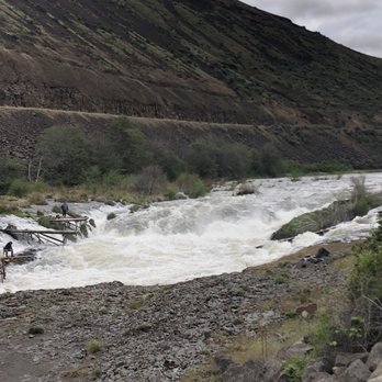
    Sherars Falls

    3.0 (1 review)

    Sherars Falls Photos
    Recommended Reviews - Sherars Falls

    Your trust is our priority, so businesses can't pay to alter or remove their reviews. Learn more about reviews.
    Yelp app icon
    Browse more easily on the app
    Review Feed Illustration
    Photo of Kim R.
    183
    1158
    3209

    4 years ago

    Helpful 2
    Thanks 0
    Love this 0
    Oh no 0

    Verify this business for free

    Get access to customer & competitor insights.

    Verify this business

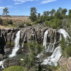
    White River Falls State Park

    White River Falls State Park

    4.8(8 reviews)
    3.3 mi

    Bring your binoculars! This is a hidden treasure well kept by the locals I'm sure! There are…read morestunning views everywhere you turn, so many picnic tables, and plenty of trees for shade at the top, there are restrooms, and the trail has different experience levels. It's a pretty beginner friendly hike going down to the first part and then from there, you can decide if you want to continue. You definitely need to be more experienced when you reach the sharper edges. There was a Ranger on site and I can honestly say I've never seen anyone do their job with such enthusiasm or efficiency in my entire life. I didn't even interact with them, but you could tell from every task they truly cared.

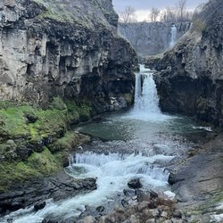
    Love this State Park!…read more This place is a little gem amongst state parks. It's kind of in the middle of nowhere...wouldn't have come upon it most likely had the hubby not seen note of it on a waterfall blog. First impression, the grounds are pristine. Perfectly manicured grasses scattered with picnic tables. Restrooms...extremely clean. There's a decent amount of parking near the restrooms/upper falls, as well as some right off the highway. A genius idea really, they made a now ghostly, obsolete hydroelectric power plant into a park. You can hear the upper falls as soon as you pull up, running hard and fast right now! You get great views from the overlook at the end of the lot, which is very accessible to most anyone. From there you can take the trail down to peek into the rusty, old ruins of the plant, as well as further down to another smaller, but still impressive falls. Heads up though, the trail down is NOT accessible to everyone. The footing is loose and fairly steep. BUT, if you can at least get down to the overlook above the old building do it...the view of the upper falls from that point is extraordinary. Really a gorgeous falls, much more than I expected. Just a great park, I highly recommend a visit to this one!

    Photos
    White River Falls State Park
    White River Falls State Park
    White River Falls State Park

    See all

    Mirror Lake Trail - This bridge on the way to the viewpoint is actually quite sturdy and stable

    Mirror Lake Trail

    4.3(39 reviews)
    37.1 mi

    This review is for Mirror Lake Loop which was a ~4.3 miles round trip that took ~2 hours to…read morecomplete. Located 22 minutes away from Tamanawas Falls, Mirror Lake Loop was a dense forest trail that was ~90% shaded in Mt Hood, Oregon. The first ~5 minutes of the trail was paved and becomes a dirt trail filled with rocks and roots. The last stretch towards the lake was an incline alongside the mountain. There were only a few openings around the lake to view the water and the surroundings. The best view would be the Mirror Lake with Mt Hood in the distance! Limited parking area at the trailhead. Restroom available at the parking lot. Short video of the hike for those interested! https://youtu.be/8WsTe72wDP4

    8.1 miles, 1509 ft elevation gain, 2 hrs 33 minutes…read more The hike all the way to Tom, Dick, and Harry Mountain is definitely longer than the stated 8 miles on AllTrails. We did not have enough water and had to turn around a bit early at mile 4 (for a grand total of 8). Tom, Dick, and Harry Mountain was visible but I didn't want to risk my poor pup overheating on such a warm day. Not many other folks go past mirror lake or the initial mountain viewpoint so you might find you'll have this to yourself. The trail is very well maintained to mirror lake, and even has a few cute little bridges and stream crossings. After that, it can be quite narrow and bouldery though there are many beautiful wildflowers lining the trail. There were also a few mosquitos just after the lake so come prepared with bug spray. All I can speak for is the mountain viewpoint (since that's as far as we got) but it was worth the trek up there to see Mt. Hood, Mirror Lake, and Government Camp from that point of view.
    Photos
    Mirror Lake Trail - The trail

    The trail

    Mirror Lake Trail
    Mirror Lake Trail - Mt. Hood and Mirror Lake

    See all

    Mt. Hood and Mirror Lake

    Mosier Creek Falls - Wildflower time

    Mosier Creek Falls

    4.3(8 reviews)
    33.7 mi

    Best time for this hike is end of April and May when the wildflowers are in bloom and cover the…read morehillsides with purple widow's grass, yellow balsam root, blue lupine and lavendar bachelor buttons. It's my favorite time to be in this area! Best place to park is right before the Mosier Creek Bridge as you leave the tiny two block downtown area. As you begin the hike you come to the cemetery of the founding father's of this charming town. Continue for another 10 minutes to the falls and the swimming hole below. The falls are small, not like the 7 popular falls you see along the Old Historic Highway by Multnomah Falls, but still lovely. Continue on and up where views of the Columbia River from this vantage point are breathtaking. The river widens In this area and slight turns as it makes it's way through Mosier and onto Rowena making for a beautiful vista to take in and photo ops. Unlike at Rowena Plateau and Tom McCall Preserve, dogs are allowed on these trails.

    Pretty fun trail with a variety of sites!…read more There's a small parking area right in town just on the other side of the bridge from where the trail begins. You can make a very short hike of it and just go to the falls. Or you can continue on from there and complete the approximately 3 mile out and back with a small loop at the top...I recommend the latter. There's nice signage at the start explaining some trail details. You'll pass by a cool, tiny cemetery and venture on to the falls. Mosier Falls was a bit more substantial than I'd expected, set in a pretty canyon with an overlook for your viewing pleasure. Should you wish to continue on the trail...and you really should...you'll start up the side of the hill on switchbacks and stairs to the top. Tiny flowers popping up were blanketing the entire hillside, and I'm guessing it'll be quite a show in couple of weeks. After zigging and zagging multiple times you'll reach the top and come to an overview with spectacular views of the gorge. There's a bench there should you need a little rest or just wish to sit and take in the view for a bit. From the viewpoint you'll see the dirt trail continue on. It meanders further down to the end of the line...a short loop that offers even more gorge views. The trail is quite narrow and fairly unshaded most of the way and there are regular signs warning hikers of private property lines. We enjoyed it on a Saturday morning, along with quite a few other hikers. It's a decent workout, a pretty waterfall, and some beautiful gorge views...not too shabby!
    Photos
    Mosier Creek Falls
    Mosier Creek Falls
    Mosier Creek Falls - Mosier Creek Falls - Feb 2024

    See all

    Mosier Creek Falls - Feb 2024

    Sherars Falls - parks - Updated August 2026

    Loading...
    Loading...
    Loading...