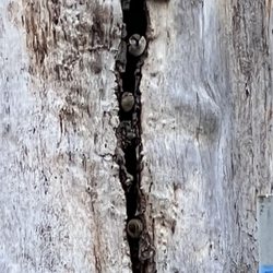
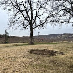
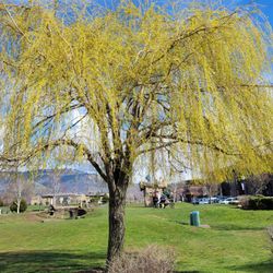
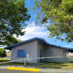
Mayer State Park Photos


More like Mayer State Park
Recommended Reviews - Mayer State Park
Start your review...

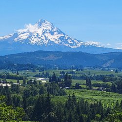
A lush, beautiful state park located off I-84 near Rowena. After passing by more times than I can count, I decided to venture off the highway to check it out. Was so surprised and delighted by the incredible views of the basalt cliffs across the way, and of course, close up views of the magnificent Columbia River. There is an area under the trees with picnic tables, a perfect spot to gather for a meal after a nice walk or hike. Plenty of parking, great views, peaceful and serene - a gem. read more


We pulled off recently to check out Mayer. In our camper van, it was a lovely, quiet spot to enjoy a stretch and a meal. It seemed to be more like a county park in feel, with plenty of parking, some picnic tables, and toilets. They had a recycle bin alongside the trash cans...loved to see that. Albeit a cold December day, we only saw a couple of cars come and go while we were there. From signage it appears to be a good windsurfing area at other times of the year, so I'm sure it gets much busier. Nice little stop-off along the gorge for a view, a stretch, or a picnic. read more


6 years ago
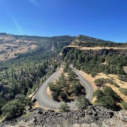
Beautiful scenery I drove through on my way to east Portland to deliver a load. It's always nice coming through this area. A breath of fresh air compared to Some of the places I have to pick up & deliver. read more

13 years ago
This is a Great Place for Windsurfing and Kiteboarding... When the Winds are Blowing! But me Personally, I come here to Swim but MOSTLY for the Quietness... I really Love this place!! Great place to Swim without the "Crowd"... And if your an Introvert like me, it's the Perfect place!! Quiet, Secluded & Serene!! I kind of didn't really want to Yelp it because of that Main Reason! But here it is... . I come here so much I've self proclaimed it... "Taylor's Private Beach" !! read more


More info about Mayer State Park


Why does Yelp recommend reviews?
1 review that is not currently recommended
The reviews below are not factored into the business's overall star rating.
1 month ago
Mayer State Park - parks - Updated June 2026
Best of Rowena
People found Mayer State Park by searching for…
Swimming Holes in Rowena, Oregon
Things to Do With Kids in Rowena, Oregon
Places to Swim in Rowena, Oregon
River Swimming in Rowena, Oregon
Parks for Kids in Rowena, Oregon
Scenic Overlook in Rowena, Oregon
Free Things to Do in Rowena, Oregon
Secret Spots in Rowena, Oregon
Things to Do at Night in Rowena, Oregon
Hiking Trails in Rowena, Oregon
Kid Friendly Beaches in Rowena, Oregon
Beautiful Views in Rowena, Oregon
Picnic Spots in Rowena, Oregon
Swimming Lakes in Rowena, Oregon
Trending Searches in Rowena, OR
Browse Articles
Browse Nearby
BEST of Rowena, Oregon Hiking near Mayer State Park
BEST of Rowena, Oregon Things to Do near Mayer State Park
BEST of Rowena, Oregon Restaurants near Mayer State Park
BEST of Rowena, Oregon Lakes near Mayer State Park
BEST of Rowena, Oregon Coffee near Mayer State Park
Browse Brands
Related Searches in Rowena, OR
Best Fishing Locations and Guides in Rowena, Oregon
Best Nature Trails for Hiking in Rowena, Oregon
Best Off Leash Dog Parks in Rowena, Oregon
Best Parks for Parties and Events in Rowena, Oregon
Best Places for Stunning Views in Rowena, Oregon
Best Water Parks for Kids in Rowena, Oregon
Best Waterfalls and Swimming Holes in Rowena, Oregon
Check Out Great Playgrounds in Rowena, Oregon
Check Out Off Road Trails in Rowena, Oregon
Discover Baseball Fields Around Rowena, Oregon
Discover Lakes & Ponds to Explore in Rowena, Oregon
Discover Popular Bike Trails in Rowena, Oregon
Discover Popular Photo Spots in Rowena, Oregon
Discover Top Nature Parks to Visit in Rowena, Oregon
Discover the Best Fishing Lake in Rowena, Oregon
Discover the Best Night Hike Trails in Rowena, Oregon
Enjoy Scenic Night View Experiences in Rowena, Oregon
Enjoy Water Activities and Fun in Rowena, Oregon
Enjoy the Best Walking Trails in Rowena, Oregon
Exciting Cliff Jumping Spots in Rowena, Oregon
Explore Beautiful Parks and Green Spaces in Rowena, Oregon
Explore Bike Rentals Throughout Rowena, Oregon
Explore Easy Hikes Perfect for All in Rowena, Oregon
Explore Family-Friendly Zoos and Wildlife in Rowena, Oregon
Explore Free Picnic Areas Around Rowena, Oregon
Explore Parks With Lakes to Visit in Rowena, Oregon
Explore Popular Campgrounds Near Rowena, Oregon
Explore Popular Picnic Areas Around Rowena, Oregon
Explore Popular RV Parks Around Rowena, Oregon
Explore Popular Scenic Overlook Points in Rowena, Oregon
Explore Popular Scenic Views Near Rowena, Oregon
Explore Popular View Points Around Rowena, Oregon
Explore Scenic Lakes to Visit in Rowena, Oregon
Explore Secret Spots Worth Visiting in Rowena, Oregon
Explore Top Gyms in Rowena, Oregon Now
Explore the Best Swimming Holes Around Rowena, Oregon
Find Beautiful Views in Rowena, Oregon
Find Parks and Recreation Activities in Rowena, Oregon
Find Top Dog Friendly Parks to Visit in Rowena, Oregon
Find Top-Rated Waterfalls in Rowena, Oregon Now
Find a Park With BBQ Pits in Rowena, Oregon
Find the Best Parks BBQ Grills in Rowena, Oregon
Find the Best Parks for Picnics in Rowena, Oregon
Find the Best Playgrounds to Visit in Rowena, Oregon
Find the Best Swimming Pools in Rowena, Oregon Today
Fun Indoor Activities to Try in Rowena, Oregon
Fun Things for Kids in Rowena, Oregon
Great Places to Swim in Rowena, Oregon
People who viewed Mayer State Park also viewed
Horsethief Lake State Park
12 reviews
Columbia Hills Historic State Park
6 reviews
Tom McCall Preserve at Rowena
4 reviews
Columbia River Gorge National Scenic Area
99 reviews
Klickitat Trail Conservancy
4 reviews
Wet Planet Rafting and Kayaking
195 reviews
Spear Fish Lake
2 reviews
Lepage Park
1 review
Ruthton County Park
2 reviews
Deschutes River State Recreation Area
15 reviews