Seconee Town Historical Marker Photos


More like Seconee Town Historical Marker
Recommended Reviews - Seconee Town Historical Marker
Start your review...

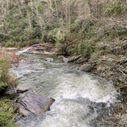
Just outside of Pickens, the roadside hosts this marker standing in a quiet stretch before the foothills start to rise and you're reminded right away that the settlers who came here in the 1700s were stepping into a world that already had deep roots. The Cherokee Lower Towns once filled this landscape and Seconee was one of them, a community that existed long before the idea of South Carolina or the United States, and the marker does a good job of grounding you in that older story. The front of the two-sided marker reads, "Seconee was the easternmost of the documented Cherokee Lower Towns in Upcountry S.C. Situated 1 mi. W in the broad floodplain at the confluence of Twelve Mile River and Town Creek, Seconee's location offered fertile ground and access to several trails. It is one of the only Lower Town sites in Pickens Co. that was not later submerged under Lakes Hartwell, Jocassee, and Keowee." The back reads, "During the American Revolution, the Cherokees allied with the British. Patriot forces burned Seconee and several other nearby Lower Towns in 1776 during Col. Andrew Williamson's campaign. Seconee had the ability to field 26 warriors, comparable to many other Cherokee towns. Nearby Secona Baptist Church and Town Creek were both named for their association with Seconee Town." It is marker number 29-25 and it was sponsored in 2020 by the Pickens County Historical Society. [Review 496 of 2026 - 1421 in South Carolina - 25678 overall] read more
More info about Seconee Town Historical Marker


Seconee Town Historical Marker - landmarks - Updated July 2026
Best of Pickens
People found Seconee Town Historical Marker by searching for…
Trending Searches in Pickens, SC
Black Owned Nail Salons near Seconee Town Historical Marker
Boardwalk near Seconee Town Historical Marker
Boat Rental near Seconee Town Historical Marker
Caves near Seconee Town Historical Marker
Cliff Jumping near Seconee Town Historical Marker
Day Trips near Seconee Town Historical Marker
Free Picnic Areas near Seconee Town Historical Marker
Jet Ski Rental near Seconee Town Historical Marker
Kayak Rental near Seconee Town Historical Marker
Landmarks & Historical Buildings near Seconee Town Historical Marker
Lookout Points near Seconee Town Historical Marker
Places To Swim near Seconee Town Historical Marker
Places To Visit near Seconee Town Historical Marker
Pool Day Pass near Seconee Town Historical Marker
Public Art near Seconee Town Historical Marker
Public Pools near Seconee Town Historical Marker
River Swimming near Seconee Town Historical Marker
River Tubing near Seconee Town Historical Marker
Scenic Restaurants near Seconee Town Historical Marker
Secluded Spots near Seconee Town Historical Marker
Sightseeing near Seconee Town Historical Marker
Skyline View near Seconee Town Historical Marker
Soccer Store near Seconee Town Historical Marker
Splash Pad near Seconee Town Historical Marker
Swimming Holes near Seconee Town Historical Marker
Swimming Lakes near Seconee Town Historical Marker
Things To Do This Weekend near Seconee Town Historical Marker
Things To See near Seconee Town Historical Marker
Browse Articles
Browse Nearby
BEST of Pickens, South Carolina Things to Do near Seconee Town Historical Marker
BEST of Pickens, South Carolina Photo Spots near Seconee Town Historical Marker
BEST of Pickens, South Carolina Restaurants near Seconee Town Historical Marker
BEST of Pickens, South Carolina Coffee near Seconee Town Historical Marker
BEST of Pickens, South Carolina Campgrounds near Seconee Town Historical Marker
BEST of Pickens, South Carolina Scenic Drive near Seconee Town Historical Marker
BEST of Pickens, South Carolina Breakfast near Seconee Town Historical Marker
BEST of Pickens, South Carolina Hotels near Seconee Town Historical Marker
BEST of Pickens, South Carolina Ski Resorts near Seconee Town Historical Marker
Browse Brands
Related Searches in Pickens, SC
Best Fun Things to Do in Pickens, South Carolina
Best Waterfalls and Swimming Holes in Pickens, South Carolina
Book Engaging Historical Tours in Pickens, South Carolina
Discover Charming Historic Homes in Pickens, South Carolina
Discover Famous Monuments in Pickens, South Carolina
Discover Free Parking Options in Pickens, South Carolina
Discover Historic Sites and Places in Pickens, South Carolina
Discover Popular Landmarks in Pickens, South Carolina
Discover Popular Photo Spots in Pickens, South Carolina
Discover Top Points of Interest in Pickens, South Carolina
Discover Top State Parks to Visit in Pickens, South Carolina
Discover the Best Beaches in Pickens, South Carolina
Discover the Best Night Hike Trails in Pickens, South Carolina
Enjoy Arts & Entertainment in Pickens, South Carolina
Enjoy Hiking Adventures in Pickens, South Carolina
Enjoy Scenic Night View Experiences in Pickens, South Carolina
Enjoy the Best Walking Trails in Pickens, South Carolina
Experience Stunning Sunset Views in Pickens, South Carolina
Explore Beautiful Botanical Gardens in Pickens, South Carolina
Explore Beautiful Castles and Landmarks in Pickens, South Carolina
Explore Beautiful Parks and Green Spaces in Pickens, South Carolina
Explore Free Kids Activities Near Pickens, South Carolina
Explore Free Things to Do Around Pickens, South Carolina
Explore Fun Field Trips in Pickens, South Carolina
Explore Popular Scenic Views Near Pickens, South Carolina
Explore Popular View Points Around Pickens, South Carolina
Explore Top Art Galleries Located in Pickens, South Carolina
Explore Venues & Event Spaces in Pickens, South Carolina
Find Beautiful Views in Pickens, South Carolina
Find Fun Things to Do With Kids in Pickens, South Carolina
Find Top Art Museums in Pickens, South Carolina
Find the Best Bridge Spots in Pickens, South Carolina
Find the Best Playgrounds to Visit in Pickens, South Carolina
Fun Rainy Day Activities to Try in Pickens, South Carolina
Hiking Trails With Waterfalls in Pickens, South Carolina
Must-See Tourist Attractions Around Pickens, South Carolina
Perfect Spots to Watch Sunset in Pickens, South Carolina
Popular Kids Activities in Pickens, South Carolina
Popular Places to Take Pictures in Pickens, South Carolina
Popular Things to Do in Pickens, South Carolina
Popular Things to See in Pickens, South Carolina
Top Entertainment Options in Pickens, South Carolina
Top Hiking Trails to Explore in Pickens, South Carolina
Top Historic Restaurants to Try in Pickens, South Carolina
Top Places to Visit in Pickens, South Carolina for Sightseeing
Top Things to Do With Kids in Pickens, South Carolina
Tour Famous Lighthouses Located in Pickens, South Carolina
Tour Popular Historical Sites in Pickens, South Carolina
People who viewed Seconee Town Historical Marker also viewed
Poe Mill Historical Marker
1 review
Berea School Historical Marker
1 review
Pickens County Courthouse
1 review
General John A Wagener Memorial
1 review
Mauldin Gateway Bridge
1 review
Wilkins House Historical Marker
1 review
Cashiers Area Chamber of Commerce
1 review
Southern Bleachery Mill Village
1 review
White Plains School
1 review
Joshua Daniel White Display
1 review