Cancel

    Open app

    Search

    Scenic Overlook

    4.0 (1 review)

    Scenic Overlook Photos

    Recommended Reviews - Scenic Overlook

    Your trust is our priority, so businesses can't pay to alter or remove their reviews. Learn more about reviews.
    Yelp app icon
    Browse more easily on the app
    Review Feed Illustration
    Photo of Ward D.
    8
    1239
    3207

    5 months ago

    Helpful 0
    Thanks 0
    Love this 0
    Oh no 0

    Verify this business for free

    People searched for Hiking 141 times last month within 15 miles of this business.

    Verify this business

    Purchase Knob - Trail signs

    Purchase Knob

    5.0(2 reviews)
    74.3 km

    This has been our favourite walk forever. Do not let the couple of bad characters hinder you from…read morethis beautiful hike, because getting to the top is its own reward with sheer beauty. This property was donated to the state park and open to all. Very clean and well-kept trails, dog friendly, and a nice place to rest and relax, including restrooms at the science centre.

    I discovered this place through my daughter. She has gone here twice- once through her middle…read moreschool, and once through a local camp. She raved about it, and we finally got a chance to check it out. So happy we did! 
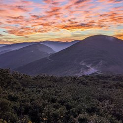
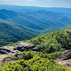
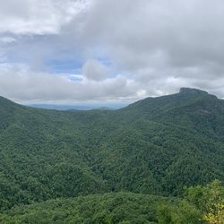
Purchase Knob was generously donated by the McNeil-Gilmore family to Great Smoky Mountains National Park. It is 535 acres of land that rises ultimately to 5,086 feet at the knob. In the meadow below the knob, at 4,850 feet, there are two buildings housing offices, a lab, a classroom for fifty students, and housing for up to eight scientists. Views are 180 degrees. You can hit the Cataloochee Divide Trail here, too. A refurbished cabin originally from the 1870s is nearby, which I will get to in a bit. When you get to the park, you will be blocked by a gate with a sign to the left identifying the park. It is open once in a while for scheduled visits/field trip students. It is easy to get your vehicle locked within the park. (People cannot get locked in.) Park your car on the sides of the road. Just walk around the gate if it is locked. Bring water, and a jacket in the spring or fall. The 2.5 mile round trip trail is basically a wide, dirt road that will eventually lead up to the main buildings. It is well maintained. When you get a glimpse of the building at the top, you will also see a grass trail leading upwards. I would take that trail. It is a shortcut. If you like to walk, just keep going, and the road will eventually lead to the building as well. 
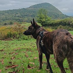
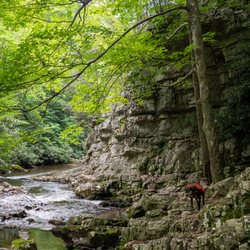
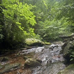
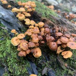
On the way up, you will see many types of wildflowers. We heard (up) and spotted a hawk (down). I got a photo of nightshade, all the while with my body centimeters from a hidden cliff edge. Be careful on grassy edges! The open areas and tree-filled areas were of equal beauty. In early September I saw purples, greens, grays, and yellows, all framed by a clear blue sky graced by fluffy clouds. Your soul will take this in, and it will hold on to it. When we got to the top, we relaxed. We did not go to the knob proper. We used the very clean bathrooms, and laid down in the field right in front of the buildings. There is a water fountain. You are allowed on the deck, but not in the buildings unless you are with a scheduled group. There are picnic tables grouped close together, and bear-proof trashcans and recycling bins. You can check out the outside of the weather station that is a bit away. I would not traipse around the adjacent fields. I saw tagged plants and left that area so that we would not screw up any data. If you decide to go to the actual knob, you have to blaze your own trail. 
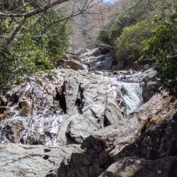
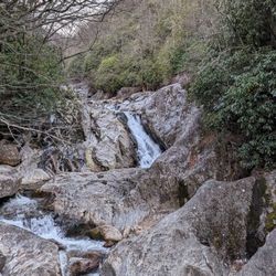
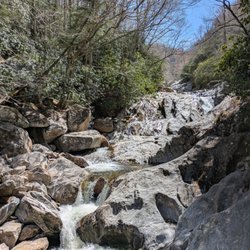
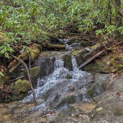
As of two days ago, the footbridge leading to Cataloochee was out. There is a sign warning of that; be careful crossing creeks. Anyway, that trail is easy to find; just look for signs. Check out the bulletin board for lists of the types of birds and butterflies that you can see there. I saw (possibly) a Cloudless skipper. It was fluorescent yellow! My first. To get down to the restored Ferguson cabin, just leave via the "grass carpet" trail. Make an obvious right and hitch your horse, or kids. This right will lead you to the cabin. The Fergusons were the first farmers to have an elevated farm. Their apples are still there. Do not pick anything. Do not get in the boar trap. Do not get near bears. Do not bother the cow spirits. Call to make sure horses are indeed still allowed. Bears and boars can hurt you. We leave all snacks in the car. You never know. Call the general number to see if bear activity is intense before going to this park. Middle school and up teachers, call this number to schedule a visit: 828-926-6251. This park welcomes wimpy and tough hikers mid-March through November. Call if you have a desire to hike in the deep winter. Remember to check out the Purchase Knob WebCam online for weather and views. To get to this park, take Exit 20, stay on 276 South for five miles. Get on Hemphill Road and stay on Hemphill Road for four miles. This review is dedicated to my daughter Sophie, a quick, beautiful trailblazer.

    Photos
    Purchase Knob
    Purchase Knob - Furbaby friendly

    Furbaby friendly

    Purchase Knob - Coral mushroom. Fall 2017.

    See all

    Coral mushroom. Fall 2017.

    Douglas Falls

    Douglas Falls

    4.3(3 reviews)
    33.8 km

    This hike is NOT for the inexperienced. The hike itself deserves the highest rating- ONLY FOR those…read morewho are into high intensity, steep, rocky terrains. I'd suggest this for someone who enjoys camping between the return hike or is very experienced in outdoor endeavors. The falls are beautiful, although not in my opinion worth the 7.6 miles of uphill battle. There is a separate way to get here (0.5 hike from it's own parking lot) The trail connects to a beautiful "Greyson's Overlook" for an additional 2.2 miles. Overall- I made it and I'm still alive.

    We had so many options to choose from when hiking yesterday that we just decided to pick one. How…read moredid we miss that this was rated hard?! I'm going to give you my most honest review possible because I think we did not have a clear vision of what to expect. Based off of other people's shoe choices at the top, I decided to wear my tennis shoes. Big mistake. My husband wore his hiking boots. Definitely ate crow on my choice of footwear. Wear hiking boots! The trail was overgrown much of the way. There were a few little rocky river areas to cross over. I managed those with the help of my husband. But my shoes were not appropriate for all of the rocky, muddy, slick areas. And there were many! There were a few trees to go over that had fallen into the pathway. I am a short girl, 5'1", and getting over them on the steep, slick trail was a feat! Also needed my husbands help for that. The trail was very overgrown in some areas, to the point that we weren't sure if we should continue, but we pressed on. There was some uphill in the beginning that had us begging for a little downhill relief. We got that... for awhile. Then, we paid the price for it on the way back. A whole lot of uphill on the way back! My knees, legs, and back were killing me on the way back and I definitely thought about bringing a child back pack to ride on my husbands back for our next hike. We aren't out of shape or inactive people. We enjoy hiking and try to do it often. We have a peloton at home that we do actually use. But this trail was 100% hard and more than we bargained for. I guess we figured that we made it on an accidental 9.5 mile hike the last time we were in town and would be fine. Wrong! Yeah, I'm old. 38. And my husband is 35. We aren't old old but we aren't 18 anymore either. (Thank goodness--that would make him 15! And no thanks to that.) At one point on the hike, we asked a couple that passed us if we were almost at the falls. They said about 15 minutes. I would guess it took us probably another hour to hour and a half to get there. We had to be very careful with my tennis shoes and the slippery rocky trail. Plus, climbing over the downed trees. I'm hoping maybe they were just high and time was confusing for them. I don't see any way they could've gone the mile and a quarter in 15 minutes. Regardless... we made it. The fall was beautiful. The hike kicked our asses. I would not do this hike again. Ever. But if you're down for a difficult, rocky, overgrown, steep hike.... Have at it! I will 100% stay out of your way. The waterfall was a nice treat. Be prepared to pray for the existence of an Uber Air to get back up. (Except those of you who are clearly far more trail savvy than us. I'm sure you will find it much easier than we did. And also... kudos to you!) Apx 7.8 miles of pure torture. Done and done!

    Photos
    Douglas Falls
    Douglas Falls - Douglas falls

    Douglas falls

    Douglas Falls

    See all

    Blue Ridge Parkway

    Blue Ridge Parkway

    4.9(185 reviews)
    53.1 km

    Blue Ridge Parkway is such an incredibly beautiful drive and well worth taking a few minutes out of…read morethe way to enjoy this lovely detour. It should be a crime that the government wants to privatize all national parks and it's a shame that we may not be able to enjoy this stunning area of the United States much longer. Take the long way during your roadtrip and drive through the Blue Ridge Parkway with the windows down, you will not be disappointed! The fresh air and calming scenery is healing to the soul! There are plenty of overlooks, as well. Take your time, enjoy the ride!

    The Blue Ridge Parkway spans several hundred miles long and a good chunk of it was unfortunately…read moreclosed when we came through due to hurricane damage but we were able to do a few hours on the road from the edge of the Smoky Mountains NP all the way to Asheville and it was GORGEOUS. The open stretch was in higher elevations (hence not impacted by the hurricane) which meant we had some really spectacular views of the mountains and terrain. It really was wonderful. There are a ton of scenic overlooks and a few maintained spots where you can pull over and enjoy a picnic or use the facilities (they're barebones restrooms but they have them) but aside from that amenities are few and far between so be sure to pack some food, drinks, and make sure your tank is full of gas so you can enjoy the views and explore stress free! The only trouble was there wasn't a lot of information available on what we'd find on the parkway (meaning what stretch was closed, what was open, must see overlooks, hiking trails, etc) as the visitors centers were closed and the Smoky Mountain NP visitor center we stopped into didn't have any brochures or maps or anything. Luckily once we got onto the parkway we were able to find a scenic overview with some signage that had a map so we took a picture of that and was helpful. The good news is is that I believe right after our trip they reopened another large stretch of the Parkway northeast for Asheville (which I believe has has all the amazing waterfalls) so we'll have to come back another time to enjoy all those views!

    Photos
    Blue Ridge Parkway - Boone Fork Trail | Instagram: @telephonesmoothie

    Boone Fork Trail | Instagram: @telephonesmoothie

    Blue Ridge Parkway - Boone Fork Trail | Instagram: @telephonesmoothie

    Boone Fork Trail | Instagram: @telephonesmoothie

    Blue Ridge Parkway

    See all

    Scenic Overlook - hiking - Updated May 2026

    Loading...
    Loading...
    Loading...