Russ Park Photos


You might also consider
More like Russ Park
Recommended Reviews - Russ Park
Start your review...

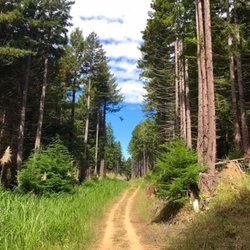
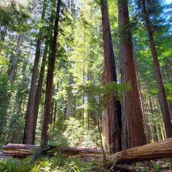
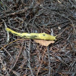
Somewhere in these 105 Acres resides my ballerina necklace. Somewhere... I loved this park when I was a kid and on my last trip still found it just as beautiful and serene as I remember. Just watch out for banana slugs! read more


5 years ago
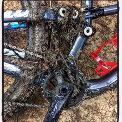
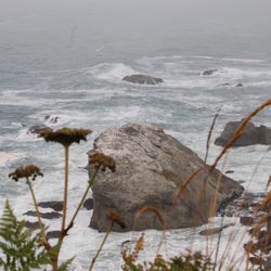
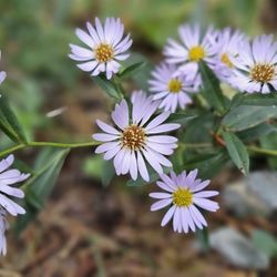
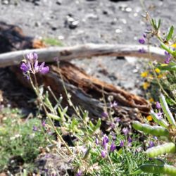
Seriously, how could I not review this park, lol When we were in Ferndale all of the locals we spoke with told me I had to go there, after all it's named after me ( well actually after someone called Mr Russ ). So we drive up to the park, there was only one other car in the parking lot. It is 105 acres of lush green natural beauty. Being drizzly that day the banana slugs were out in force. Banana slugs always remind me of Santa Cruz. The trails were in good shape and the plant life was pretty diverse and yep, lots of trees. Coming from the very dry Bay Area it was nice to see the lush foliage. Since the park is right on the edge of town it's a great spot to hike and enjoy the beauty of the area. Sorry we didn't find your ballerina necklace. read more

More info about Russ Park
100 Berding St
Ferndale, CA 95536
Directions
Hours
Outdoor Amenities


Russ Park - hiking - Updated July 2026
Best of Ferndale
People found Russ Park by searching for…
Things to Do in Ferndale, California
Hiking Trails in Ferndale, California
Waterfalls in Ferndale, California
Dog Friendly Trails in Ferndale, California
Places to Visit in Ferndale, California
Parks for Kids in Ferndale, California
View Points in Ferndale, California
Running Trails in Ferndale, California
Playground in Ferndale, California
Open Early in Ferndale, California
Off Road Trails in Ferndale, California
What to Do in Ferndale, California
Swimming Holes in Ferndale, California
Family Fun Center in Ferndale, California
Stuff to Do in Ferndale, California
Restaurants With a View in Ferndale, California
Walking Trails in Ferndale, California
Yoga Classes in Ferndale, California
Natural Hot Springs in Ferndale, California
Trending Searches in Ferndale, CA
Browse Articles
Browse Nearby
BEST of Ferndale, California Things to Do near Russ Park
BEST of Ferndale, California Parks near Russ Park
BEST of Ferndale, California Coffee near Russ Park
BEST of Ferndale, California Restaurants near Russ Park
BEST of Ferndale, California Waterfalls near Russ Park
BEST of Ferndale, California Breakfast near Russ Park
BEST of Ferndale, California Hot Springs near Russ Park
Browse Brands
Related Searches in Ferndale, CA
Best Fishing Locations and Guides in Ferndale, California
Best Fun Things to Do in Ferndale, California
Check Out Off Road Trails in Ferndale, California
Discover Dog Friendly Beaches Near Ferndale, California
Discover Popular Photo Spots in Ferndale, California
Discover Scenic Waterfall Spots in Ferndale, California
Discover a Hiking Trail in Ferndale, California
Discover the Best Night Hike Trails in Ferndale, California
Dog-Friendly Hikes With Dogs in Ferndale, California
Enjoy Exciting Mountain Biking Adventures in Ferndale, California
Enjoy Kayaking Adventures in Ferndale, California
Enjoy Tent Camping Spots Around Ferndale, California
Enjoy Water Activities and Fun in Ferndale, California
Enjoy a Beautiful Waterfall Hike in Ferndale, California
Enjoy the Best Family Activities in Ferndale, California
Enjoy the Best Walking Trails in Ferndale, California
Exciting Cliff Jumping Spots in Ferndale, California
Experience Stunning Sunset Views in Ferndale, California
Experience Thrilling White Water Rafting in Ferndale, California
Explore Beautiful Parks and Green Spaces in Ferndale, California
Explore Easy Hikes Perfect for All in Ferndale, California
Explore Fun Activities to Do in Ferndale, California
Explore Popular Campgrounds Near Ferndale, California
Explore Popular RV Parks Around Ferndale, California
Explore Popular View Points Around Ferndale, California
Explore Scenic Lakes to Visit in Ferndale, California
Explore Top Water Parks in Ferndale, California Today
Explore the Best Beach Spots in Ferndale, California
Explore the Best Boating Spots in Ferndale, California
Explore the Best Swimming Holes Around Ferndale, California
Family Friendly Hiking With Kids in Ferndale, California
Find Cozy Camping Cabins in Ferndale, California
Find the Best Playgrounds to Visit in Ferndale, California
Fun Toddler Activities to Try in Ferndale, California
Must-See Tourist Attractions Around Ferndale, California
Off Leash Dog Hiking Trails in Ferndale, California
Perfect Spots to Watch Sunset in Ferndale, California
Popular Fishing Spots to Explore in Ferndale, California
Popular Outdoor Activities to Try in Ferndale, California
Popular Picnic Spots to Visit in Ferndale, California
Popular Things to Do in Ferndale, California
Relax at Natural Hot Springs Near Ferndale, California
Safe River Swimming Areas in Ferndale, California
Safe and Fun Parks for Kids in Ferndale, California
Top Fishing Charter Experiences in Ferndale, California
Top Running Trails to Explore in Ferndale, California
Top Swimming Spots and Pools in Ferndale, California
Top Things to Do With Kids in Ferndale, California
People who viewed Russ Park also viewed
Sequoia Park & Garden
17 reviews
Humboldt Bay National Wildlife Refuge
14 reviews
Headwaters Forest Reserve
4 reviews
Founders Grove
22 reviews
King Salmon Beach
10 reviews
Grizzly Creek Redwoods State Park
11 reviews
Avenue Of The Giants
1 review
Centerville Beach
6 reviews
Elk River/Truesdale Access Trail
3 reviews
Shenipsit State Forest
1 review