Cancel

    Open app

    Search

    Rockport State Park

    5.0 (8 reviews)

    Rockport State Park Photos

    You might also consider

    Recommended Reviews - Rockport State Park

    Your trust is our priority, so businesses can't pay to alter or remove their reviews. Learn more about reviews.
    Yelp app icon
    Browse more easily on the app
    Review Feed Illustration
    Photo of Kim R.
    180
    1123
    3146

    4 years ago

    Helpful 3
    Thanks 0
    Love this 3
    Oh no 0

    4 years ago

    Helpful 4
    Thanks 0
    Love this 1
    Oh no 0
    Photo of Tanis L.
    283
    1056
    6360

    6 years ago

    Helpful 1
    Thanks 0
    Love this 0
    Oh no 0
    Photo of John S.
    9
    396
    75

    4 years ago

    Helpful 1
    Thanks 0
    Love this 1
    Oh no 0

    11 years ago

    Helpful 0
    Thanks 0
    Love this 1
    Oh no 0

    6 years ago

    Helpful 1
    Thanks 0
    Love this 1
    Oh no 0
    Photo of Mary M.
    108
    69
    11

    7 years ago

    Helpful 0
    Thanks 0
    Love this 0
    Oh no 0
    Photo of Karen K.
    0
    352
    311

    7 years ago

    Helpful 0
    Thanks 0
    Love this 0
    Oh no 0

    Ask the Community - Rockport State Park

    Verify this business for free

    Get access to customer & competitor insights.

    Verify this business

    Lake Tyee

    Lake Tyee

    3.7(3 reviews)
    9.7 mi

    The board, manager and employees ( most of whom are non-owners) have installed cameras EVERYWHERE…read morewithout the approval or vote of the owners and without informing people. They have them outside of every bathroom ( which shows the inside of the bathroom when the door is opened), as well as ALL AROUND the outdoor pools and hot tubs. The club house and pools are already secured with gate key access only, which already shows management WHICH LOT OWNERS have accessed the buildings and pools and the dates/ times associated with that access. The cameras are not needed. These web cameras have audio, zoom and sharability options. The user is notified in an app when someone gets into the hot tub or pool, so the hot tub goer can be watched in real time ( with sound available!). All content is sharable to other users of the app. The app itself can also be easily shared to non-employee devices at will. However, the owners whom foot the bill for these cameras are NOT allowed to have access to the app and cameras, only the board, management and all employees. Owners are not allowed to know how many people are employed by Lake Tyee either, depsite the owners paying their salaries. Owners are not allowed to know the number of people accessing these cameras. There are apparently NO background checks for those accessing cameras, as Lake Tyee does not require that for employment. The company they use for these cameras, utilizes AI when storing ALL content to the cloud. The employees of that camera company also has access to those cameras at will in real time, and all content previously created from those cameras. The camera company employees can share that content without ever needing to inform Lake Tyee. Lake Tyee is making potentially profitbale online content for a camera company at the detriment of owners. Lake Tyee has also installed hidden trail cams outside of comfort stations, green belts and trails. These cameras had no signage. These cameras ALSO pick up adio, recording your private conversations. Lake tyee has no real security camera policy, and put up all these cameras PRIOR to ever attempting to create one. They did however, put a single piece of paper in the owners handbook in May 2024, claiming to have a policy, and back dated it several months to March 2024, as a form of CYA after owners started asking questions. When the office employees were asked for a hard copy of the supposed policy they claimed to have had, they were unable to produce one. They were caught red handed falsifying records. Lake tyee did not put up camera notice signage until AFTER owners complained about the hidden cameras. Many cameras still have no signage. They put cameras up around the dumpster, and WILL go through your trash, in order to fine you. They have recently started to drive around with Dash cams on Lake Tyee vehicles and body cams on the security personnel, which affords them the abity to record your private property as they walk and drive around throughout the park. They have brought a Surveillance State to every owners front door. Important to note, security is so low level, you can not even call them directly. Only a message line. Because of these new body cam and dash cam footage they are getting, They now host monthly "public hearings" where they share the video footage of an owner doing something they can hopefully fine them for. Public embarrassment. Surveillance Abuse. When asked, the board and management claims that the shared spaces within the park are not considered private, so therefore, they are allowed to record us. FYI, Skagit County has those lands listed as private. Lake Tyee also markets the park as "private", yet films you everywhere throughout the park, in hopes of fining you. An example of a fine.... $1500 usd for a first time offense, no written or verbal warning, for having evidence of a fire during a burn ban ( even one that is already put out). Another example, $500 first time offense for putting ANYTHING into the dumpsters that management does not consider a kitchen scrap ( despite the owners being the ones who pay for those dumpsters to begin with). They will put a lean on your property and seize it, if you do not pay their ridiculous fines. At the annual owners meeting June 2024, they bragged about the number of lots they got "quit deeded" to them, because they overwhelmed the owners with assessments. The board president is buying up property within the park, with his personal LLC company, Alpine Lakes. His position on the boar awards him employment opportunities for his LLC, that other owners do not have. When asked about this obvious conflict of interest, the entire board was complicant. The presidents wife use to work in the realistate company LandsWest, who is the exclusive realtor for Lake Tyee, and would benefit from leans placed on properties by the board. Another conflict of interest. Would NOT recommend this park.

    I've been here a couple of times as a guest and love this place! It is more like glamping than…read morecamping, but you're still enjoying the outdoors :) My husband and I live in Kirkland, so it's far enough away that we feel like we're on vacation, but close enough we don't have to spend much time and money to get here. The first time we came was about 4 years ago in late September and there wasn't anyone there. It was kinda cold and drizzly (surprise! WA!) and we mostly stayed inside. However, we came for Labor Day weekend this year and it was so much fun! There were a lot of activities (my favorite was the pig they roasted on the spit), music, drinks, great food, crafts, etc. etc. and the weather was pretty decent, minus a few sprinkles here and there. TONS OF PEOPLE were out and about and I hear this is the big weekend and kind of the last bang of the year before things go quiet again. I'm so happy we were here for this and had a great time. Everyone was so nice! The grounds are well maintained. I like that there are public restrooms/showers scattered around the grounds in case you are on a walk and need to go ;) Everything is clean. Loved using the hot tub and pool (nice and heated) during the weekend and took most of my showers there even though we could have done that at the trailer we were at. Seems more convenient since you're wet from swimming. Apparently there are hikes around Lake Tyee, but I was usually recovering from the nights festivities and ended up in the hot tub instead ;) People were out riding bikes and running in the morning. Just an overall great place to enjoy the outdoors with the comforts of home. I'd definitely look into getting a place here if we had some extra $ :)

    Photos
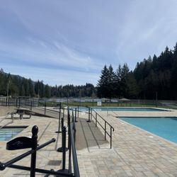
    Lake Tyee - Lake Tyee, looking towards the clubhouse

    Lake Tyee, looking towards the clubhouse

    Lake Tyee - Lake Tyee

    Lake Tyee

    Lake Tyee

    See all

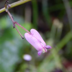
    Rasar State Park - A tiny bleeding heart.

    Rasar State Park

    4.7(29 reviews)
    13.2 mi

    My mom and I stopped here and at the nearby Rockport State Park recently on Wednesday 1 July 2020…read more We arrived in the morning just before 11 a.m., it had been a rainy morning and we managed to get here in a brief window where the rain stopped. It was still overcast, but no rain can be a plus when out hiking. The entrance to the park is well marked and there is a parking lot for those who are at the park for day use like we were. After parking our car we set out to explore the trails down to the river and back. Informational signs spot the trail and provide background and helpful tidbits if you are on the look-out for wildlife or their tracks. The mosquitos were fiercest at the parking lot and a number of them bit me through my clothing. Coming back I'd wear more layers or insect repellent if trying not to get bit. The trail we walked ran along the Skagit River for a short bit then twisted through the woods and back to the parking lot. On the way out to the Skagit River we passed a clearing. The grass was tall in the clearing center, but around the edges the grass had been cut to provide a walking path if one so yearned. We encountered mostly birds on our visit in terms of wildlife. The park itself wasn't too busy when we arrived, but we started to see more people by the time we departed. Restrooms were clean and we maintained our social distance.

    Great park, we drove with my family, nice place to walk, relaxing and dream, nice forest and quietread more

    Photos
    Rasar State Park
    Rasar State Park - Off to the Skagit River my mom and I go.

    Off to the Skagit River my mom and I go.

    Rasar State Park - Me sir happy to see some clover!

    See all

    Me sir happy to see some clover!

    Thunder Knob Trail - Instagram: @telephonesmoothie

    Thunder Knob Trail

    4.4(7 reviews)
    8.3 mi

    Spontaneous Saturday trip to Diablo Lake in Northern Washington but we parked and stayed in Thunder…read moreKnob Trailhead. We drove for almost 3 hours, but when we were looking for a place to park, I lost my signal sevice! Diablo Lake is big and long! We found a spot to relax and swim, but the water was 10°C (so cold, hahaha!). It's still a gorgeous place to visit! Remember, it's better with chairs, snacks, kayaks, paddleboards, and drinks! It's so nice to set aside city and technology life! Just for sure, we are looking to rest and swim and not to hike! But still it is a beautiful nature to see

    A vibrant trail with some sensational views! The Thunder Knob trail is a short but moderate 3.5…read moremile out and back trail that's located within North Cascades National Park. The trail begins just behind Diablo Lake and crosses over the beautiful rushing waters of Colonial Creek. It then begins to gently switchback through a lush forest that's filled with beautiful Douglas Fir and Western Hemlock trees. The trail is mostly shaded but features a few breaks within the trees that will reveal some amazing glimpses of the snowcapped mountaintops. As you ascend up the trail, you're rewarded with gorgeous views of the forest and mountains. The forest vegetation is super versatile. I was able to spot daisies, ferns, Western Hemlocks, Douglas Firs, an array of different wildflowers, and so on. The views are the best at the top, of course. There's this stunning vista point that features an aerial view of Diablo Lake with the striking North Cascades Mountain Range in the background. If there was ever a time to get a photo while on this hike, THIS is where you need to do it. It's simply breathtaking to witness. This is also a great spot to bring a picnic and/or take a lunch or snack break for heading back down to finish the second half of the hike. What I genuinely loved about this trail (aside from the views) was how incredibly green it is. The vibrancy is out of this world. Also, to see how clear Diablo Lake is from the top is just insane. It doesn't even look real, but it definitely is! The best part about hiking this trail is being able to literally walk right down to lake to relax after you've finished your hike. It's the perfect reward, and hiking this trail was truly a wonderful experience.

    Photos
    Thunder Knob Trail - Instagram: @telephonesmoothie

    Instagram: @telephonesmoothie

    Thunder Knob Trail
    Thunder Knob Trail - Instagram: @telephonesmoothie

    See all

    Instagram: @telephonesmoothie

    Skagit River Roadside Park - Gorgeous riverside park. Lots of soccer fields.

    Skagit River Roadside Park

    4.0(2 reviews)
    3.6 mi

    Lovely riverside park with lots of space. It's nice for a relaxing walk or some frisbee and…read morecertainly soccer.

    I've been here several times, in most cases just to get out of the car, stretch my legs, and look…read moreat the scenic view of the Skagit River, and on one occasion at night, to enjoy a fantastic view of the night sky. One down-side is the absence of toilets. When I was here for astronomy a few years ago, there were portable toilets, but apparently those aren't in the budget during the pandemic. Maybe they'll be back some day. If you're a bird watcher, you may have been here to see the summer birds -- American black swift, Vaux's swift, osprey, spotted sandpiper, Bullock's oriole, and lazuli bunting. Or maybe you've been here for the winter birds -- the bald eagles that are this place's namesake, common goldeneye, Barrow's goldeneye, merganser, and American dipper. (I confess that I'm not much of a birder, but since this place is noted for bird watching, it seems appropriate to give some bird details.) The GPS coordinates point to an interpretive sign about the birds and the Skagit Wild & Scenic River System. If you're a hobby astronomer (as I am), this place is a pretty sweet spot. There are no lights around, except headlights from vehicles on the highway, and it's possible to find spots where one can hide from the headlights. The sky is nice and dark, because there are no nearby population centers, and mountains block most of the light pollution from more distant cities. Astronomical "seeing" (atmospheric stability) can be very good. The mountains don't obscure the horizon much; the southern horizon is particularly clear. It's easy to find spots to see the sky without trees in the way. Access is very easy, as a highway rest area. On the other hand, it's not perfect for astronomy. For viewing in some directions, the headlights can be more of a challenge. The altitude is low, and being next to the river can mean fog. The same remoteness that mean dark skies also mean it's quite a trip from where most people live. And the toilets are gone, for now at least. My most recent visit was late August, in the year of the pandemic. It was a daytime stop, to get up and stretch our legs. My boy and I walked along the riverfront to the west end of the area. Just west of the area there's a short road from the highway almost to the river, along the dry creekbed of Sutter Creek. It looks like it was once a boat launch, but as of 2020 it was washed out. The washed out road still makes a good way to get to the edge of the river, where there's a gravel shore that looks like salmon heaven. Years ago, my wife and I stopped here for astronomy, and it was great. We enjoyed the very dark sky, and wished we had room to pack the telescope. That's a fond memory. It's not clear what this little park's official name is, or whether it even has one. - According to text on the Mount Baker Snoqualmie National Forest information sign, it's the "Skagit River Bald Eagle Natural Area". - According to the Skagit Audubon Society, it's the "Skagit River Bald Eagle Area". - According to the road sign, it's "Roadside Park - Mile 100". - According to Google Maps, it's "Rest Area, at Sutter Creek". - According to Google Plus Code, it's "FFV5+Q8 Rockport, Washington". - The GPS coordinates are 48.49438° N 121.541625° W. I'm not sure whether any of those are official, but "Skagit River Roadside Park" describes it accurately, and combines the names on the forest service sign and the highway department sign. Although the address listed is in Concrete, it's closer to Rockport. It has two entrances, one directly across the highway from Conrad Road, the other about 250 yards east of there. Note where the pin on the map is located.

    Photos
    Skagit River Roadside Park - The North Cascades are visible east of the park. This view, looking up the Skagit River, is from the washed-out boat launch.

    The North Cascades are visible east of the park. This view, looking up the Skagit River, is from the washed-out boat launch.

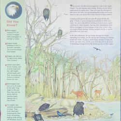
    Skagit River Roadside Park - "Eagle for a Day"  (Most US government publications, including this poster, are in the public domain.)

    "Eagle for a Day" (Most US government publications, including this poster, are in the public domain.)

    Skagit River Roadside Park - "Roadside Park: Mile 100" If you miss this little sign, marking the west entrance, there's another entrance about 250 yards farther east.

    See all

    "Roadside Park: Mile 100" If you miss this little sign, marking the west entrance, there's another entrance about 250 yards farther east.

    Gorge Creek Falls - Gorge Creek trail - paved section

    Gorge Creek Falls

    4.5(2 reviews)
    24.0 mi

    Nice little waterfall in North Cascades with great views of the water…read more The water here is unlike anything I've ever seen. Super green and beautiful. We walked to the overlook, and it had a decent view of the waterfall. Much better views if you walk over to the bridge and look from the walkway there. If you want, there's also a trail that walks along the water. We didn't take it, so can't vouch for it. Overall, it's worth a quick stop to take in the surrounding beauty.

    One more great spot to admire the fabulous beauty as you travel through North Cascades National…read morePark. There's plenty of parking at the trailhead, and another lot on the other side of the bridge. They have great pedestrian walks on either side of the bridge from which to admire the falls and the gorge. Once you've finished there head to the trail from the parking lot. There are fabulous viewpoints along the paved section of the trail from which to take in the crazy blue waters of the Gorge Lake below. The paved section is short (.3 mile) but very pretty and ends at the dam viewpoint. You can continue on, however, onto the unpaved path for 1/2 a mile through the trees and loop back to the lot. The unpaved section is still very easy and quite lovely...so why not loop! I found this short trail, coupled with the falls, to be a great stop. Don't miss it as you pass through!

    Photos
    Gorge Creek Falls - Instagram: @telephonesmoothie

    Instagram: @telephonesmoothie

    Gorge Creek Falls - Instagram: @telephonesmoothie

    Instagram: @telephonesmoothie

    Gorge Creek Falls - The overview to Gorge Lake

    See all

    The overview to Gorge Lake

    Rockport State Park - hiking - Updated May 2026
    Loading...
    Loading...
    Loading...