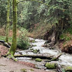
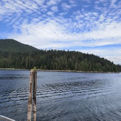
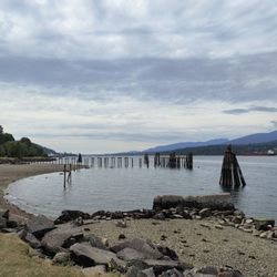
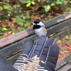
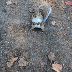
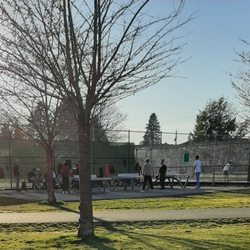
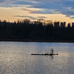
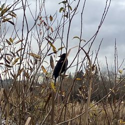
Robert Burnaby Park Photos


You might also consider
More like Robert Burnaby Park
Recommended Reviews - Robert Burnaby Park
Start your review...

3 years ago
A GREAT place to walk your dogs or just go by yourself. Beautiful park with many STEEP hills so be prepared. Even though .... It's worth read more


18 years ago
10 years ago
17 years ago
13 years ago
11 years ago
11 years ago
More info about Robert Burnaby Park
8155 Wedgewood Street
Burnaby, BC V3N 3S5
Canada
Directions
Hours
Outdoor Amenities
You might also consider


Why does Yelp recommend reviews?
2 reviews that are not currently recommended
The reviews below are not factored into the business's overall star rating.
12 years ago
16 years ago
Robert Burnaby Park - parks - Updated July 2026
People found Robert Burnaby Park by searching for…
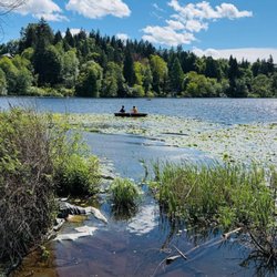
Lakes in Burnaby, British Columbia
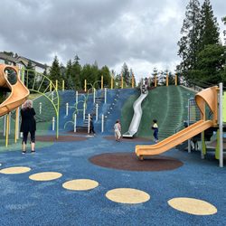
Playgrounds in Burnaby, British Columbia
BBQ Park in Burnaby, British Columbia
Dog Swimming in Burnaby, British Columbia
Picnic Areas in Burnaby, British Columbia
Disc Golf in Burnaby, British Columbia
Off Leash Dog Hikes in Burnaby, British Columbia
Views in Burnaby, British Columbia
Hidden Picnic Spots in Burnaby, British Columbia
Secret Spots in Burnaby, British Columbia
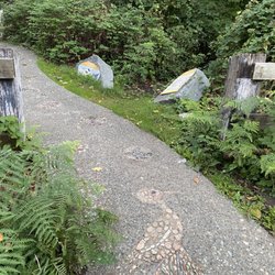
Hiking Trails in Burnaby, British Columbia
Tennis in Burnaby, British Columbia
Blackberry Picking in Burnaby, British Columbia
Tennis Courts in Burnaby, British Columbia
Secluded Spots in Burnaby, British Columbia
Picnic Parks in Burnaby, British Columbia
Walking Trails in Burnaby, British Columbia
Picnic Areas BBQ Pits in Burnaby, British Columbia
Places to Take Pictures in Burnaby, British Columbia
View Points in Burnaby, British Columbia
Night View in Burnaby, British Columbia
Running Trails in Burnaby, British Columbia
Browse Articles
Browse Brands
Related Searches in Burnaby, BC
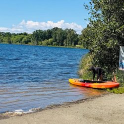
Affordable Kayak Rental Services in Burnaby, British Columbia
Best Fishing Locations and Guides in Burnaby, British Columbia
Best Off Leash Dog Parks in Burnaby, British Columbia
Best Places for Horseback Riding in Burnaby, British Columbia
Best Water Parks for Kids in Burnaby, British Columbia
Check Out Great Playgrounds in Burnaby, British Columbia
Check Out Off Road Trails in Burnaby, British Columbia
Discover Baseball Fields Around Burnaby, British Columbia
Discover Beautiful Garden Spots in Burnaby, British Columbia
Discover Free Parking Options in Burnaby, British Columbia
Discover Fun Toddler Parks in Burnaby, British Columbia for Your Little One
Discover Lakes & Ponds to Explore in Burnaby, British Columbia
Discover Popular Photo Spots in Burnaby, British Columbia
Discover Scenic Mountain Bike Trails Near Burnaby, British Columbia
Discover Scenic Waterfall Spots in Burnaby, British Columbia
Discover Soccer Fields in Burnaby, British Columbia Near You
Discover the Best Beaches in Burnaby, British Columbia
Discover the Best Kids Park Spots in Burnaby, British Columbia
Discover the Best Night Hike Trails in Burnaby, British Columbia
Discover the Best Running Track in Burnaby, British Columbia
Enjoy Camping Adventures Around Burnaby, British Columbia
Enjoy Exciting Mountain Biking Adventures in Burnaby, British Columbia
Enjoy Kayaking Adventures in Burnaby, British Columbia
Enjoy Tent Camping Spots Around Burnaby, British Columbia
Enjoy Water Activities and Fun in Burnaby, British Columbia
Enjoy the Best Family Activities in Burnaby, British Columbia
Enjoy the Best Picnic Spots and Ideas in Burnaby, British Columbia
Enjoy the Best Walking Trails in Burnaby, British Columbia
Exciting Cliff Jumping Spots in Burnaby, British Columbia
Experience Thrilling White Water Rafting in Burnaby, British Columbia
Explore Beautiful Botanical Gardens in Burnaby, British Columbia
Explore Beautiful Parks and Green Spaces in Burnaby, British Columbia
Explore Family-Friendly Zoos and Wildlife in Burnaby, British Columbia
Explore Free Picnic Areas Around Burnaby, British Columbia
Explore Free Things to Do Around Burnaby, British Columbia
Explore Fun Activities to Do in Burnaby, British Columbia
Explore Nature Spots Around Burnaby, British Columbia
Explore Parks With Pull Up Bars in Burnaby, British Columbia
Explore Popular Campgrounds Near Burnaby, British Columbia
Explore Popular Picnic Areas Around Burnaby, British Columbia
Explore Popular RV Parks Around Burnaby, British Columbia
Explore Popular Recreation Centers Around Burnaby, British Columbia
Explore Scenic Lakes to Visit in Burnaby, British Columbia
Explore Top Dog Parks in Burnaby, British Columbia Near You
Explore Top Water Parks in Burnaby, British Columbia Today
Explore the Best Beach Spots in Burnaby, British Columbia
Explore the Best Boating Spots in Burnaby, British Columbia
Explore the Best Trail Options in Burnaby, British Columbia
Find Beautiful Views in Burnaby, British Columbia
Find Parks and Recreation Activities in Burnaby, British Columbia
People who viewed Robert Burnaby Park also viewed
Fraser Foreshore Park
16 reviews
Jonathan Rogers Park
13 reviews
Mount Pleasant
Confederation Park
17 reviews
Burnaby Heights
Mosquito Creek Park
7 reviews
George Wainborn Park
9 reviews
Yaletown, Downtown
Taylor Park
10 reviews
Riley Park
6 reviews
Riley Park
Derby Reach Regional Park
9 reviews
Quilchena Park
5 reviews
Shaughnessy
John Lawson Park
12 reviews
Ambleside