Cancel

    Open app

    Search

    Roaring Brook Nature Center

    4.8 (6 reviews)
    Closed 1:00 pm - 4:00 PM

    Services - Roaring Brook Nature Center

    Community Service/Non-Profit

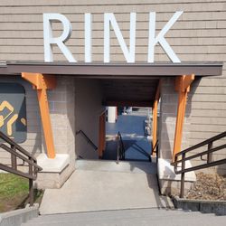
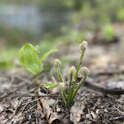
    Roaring Brook Nature Center Photos

    You might also consider

    More like Roaring Brook Nature Center

    Recommended Reviews - Roaring Brook Nature Center

    Your trust is our priority, so businesses can't pay to alter or remove their reviews. Learn more about reviews.
    Yelp app icon
    Browse more easily on the app
    Review Feed Illustration

    2 years ago

    Helpful 6
    Thanks 1
    Love this 6
    Oh no 0

    2 years ago

    Helpful 0
    Thanks 1
    Love this 0
    Oh no 0

    8 years ago

    Helpful 0
    Thanks 0
    Love this 0
    Oh no 0

    7 years ago

    Helpful 1
    Thanks 0
    Love this 0
    Oh no 0
    Photo of Sarah C.
    117
    110
    51

    11 years ago

    Helpful 2
    Thanks 0
    Love this 0
    Oh no 0
    Photo of R E.
    0
    10
    0

    8 years ago

    Visited after the renovations and was very impressed! Fantastic animal enclosures and new building and very dedicated staff and volunteers!

    Helpful 0
    Thanks 0
    Love this 0
    Oh no 0

    Ask the Community - Roaring Brook Nature Center

    You might also consider

    Verify this business for free

    People searched for Parks 1,461 times last month within 15 miles of this business.

    Verify this business

    Nepaug Reservoir Trail - View of the other side of the reservoir

    Nepaug Reservoir Trail

    (2 reviews)

    If you're looking for an easy paved trail, this is the one. The trail is wide and goes around the…read morereservoir. Many joggers, walkers, dog walkers, and people pushing strollers. Dogs on a leash are allowed, it's wheelchair accessible, and kid friendly. If you bring your dog, signs says to pick up after them. The Nepaug dam has a beautiful waterfall with serene sounds. It was built between 1914 to 1916 and created the 951 acre reservoir about 35 feet deep. There is a parking lot; on nice weekend days, it does get full. Overall, it's one of my favorite trails because I can take a stroller/wagon to lug my babies. Also, the view is amazing!

    One of the good things that happened to us from the Pandemic was it got us out of the house on…read moreweekends to visit so many of the parks and hiking trails in our area we had never visited before. We must have hit 30 different venues in 2020, and we started 2021 by visiting another new place that turned out to be a terrific find. The Nepaug Reservoir Trail is a mile long and is wide, paved, flat and about as easy to walk on as any trail we have visited. We parked at the main parking lot on Route 202, walked through a chain link gate, and found the start of the trail to begin our scenic walk around the reservoir and across the historic 100-year old Nepaug Dam. The 600-foot long dam has a concrete spillway in its center. The spillway is over 100 feet tall and is quite spectacular. The trail around the dam has a few cutouts that serve as observation platforms to take you out over the top of the dam. You will love the view ! We saw quite a variety of folks out there today -young families with strollers, couples of every age, joggers, lots of leashed dogs, and even a few hoverboard operators. What a great way to kick off the New Year.

    60 Westledge Trails - Flat trail

    60 Westledge Trails

    (2 reviews)

    This is a .5 mile trail and if you make it a loop, it will total to 1 mile; it's on yellow and red…read moreblazed trails. This short trail connects to the longer West Mountain Trails. The parking lot was spacious and it could fit a few vehicles. There was a kiosk and right next to that, a trail that forks; one is yellow and goes down the stairs and the other is red. We took the yellow trail which brings us down some rock stairs, and it was flat and easy after that. The trail was blazed nicely and it had some roots but it wasn't too bad. We got to the wooden bridge that goes over Hop Brook; there was an old stone wall and remnants of a dam. There is another other set of stairs and a picnic area if you do the loop back to the parking lot. Overall, it is definitely one of my favorite short trails. I look forward to going back and hiking this short trail again; as well as the West Mountain Trails, which is connected to this.

    This was one of the best hiking experiences we've had…read more The scenery is absolutely beautiful, you are deep in the woods and the quiet solitude and gorgeous views are quite a combination to behold. The trail is a one-mile loop so its not very challenging at all. There is a moderate incline on the way back to the parking lot, regardless of how you start the loop, and you do have to be pretty careful on the stone staircases, and you have to be quite vigilant and look out for stones and roots on the path. But the path is very well marked and for the most part level and easy to navigate. There's a stream, a picnic table or two, a one-person-at-a-time wooden bridge, an old and very cool stone wall, but mostly there is beautiful forestry and serenity all around. This was one of my favorite hikes to date.

    Bog Walk - What kind of scat? Dog?

    Bog Walk

    (3 reviews)

    This Bog trail is part of the Simsbury Land Trust. It's located on North Saddle Ridge Road in…read moreSimsbury, CT and parking can be found on street. There are two stone pillars and a sign, it can be easily missed if you drive too fast. The trail is 1 mile out and back; one of the shortest and easiest hikes I've done in a while. At first, the walk is in between two houses, continue to walk on the flat and wide esker (glacial stone), you will notice the bog on both sides, which is down the hill. At the end of the trail, on the right side, there is a steep hill going down towards the 150 ft boardwalk made of wood. We went in November, so the leaves were plentiful and slippery. There are educational signs on the boardwalk. The bog is 40 acres and is usually found in England and Canada. The bog water is acidic so there are only certain species of plants and animals that can live there; from the sphagnum moss to Gartner snakes, to name a couple, those species are highly adaptable in that environment. Other animals just passes through for food and shelter. It was a peaceful and relaxing walk, and there were views of West Mountain. I saw some dragonflies, which is a natural habitat for them. If you're looking for a short and easy hike, I recommend it!

    "Under the boardwalk, down by the sea" (The Drifters)…read more Mix equal parts of a hike in the forest, a bog, and a boardwalk, and you have one very cool trail to explore. The entrance to the trail was kind of hard to find. We knew from the Simsbury Land Trail book to be on the lookout for two stone pillars on North Saddle Ridge Drive, but even though we were looking for them, we missed them. Turns out the pillars are very small and set back from the road a bit. But we did find the entrance, and soon we found ourselves walking on a beautiful forest trail, under a canopy of tall green trees. The trail was wide, pretty flat for a while, and relatively free of obstacles except for some tree roots that you have to be careful to avoid. About 1,500 feet into the trail there's a right hand turn that leads to a very steep descent. Some well placed railroad ties acted as stairs to make the downhill trek easier to manage. Soon you will pop out of the forest and see a very cool sight- a long elevated boardwalk that will take you out into a 39-acre bog. You'll be thisclose to all sorts of vegetation on both sides and you'll also see a series of informational signs describing the plants and animals all around you. At the end of the boardwalk, there are three benches where you can relax and take in the beautiful views of the trees, the bog, and a pretty view of West Mountain. You enter this trail from a typical suburban residential street, and it just blows my mind that these gorgeous trails are all over Simsbury, pretty much hiding in plain sight.

    Farmington River Trail - Fiddleheads

    Farmington River Trail

    (3 reviews)

    This trail used to be a rail trail back in the day. The trail is paved and easy to walk, bike, and…read moreskate on. It has gorgeous views of the Farmington River. I've walked the trail in the Collinsville area in the Autumn and it was amazing seeing the foliage. Before crossing the street, there is a crosswalk and button to alert traffic to stop; beware though, some people will just go through the yellow light while you're waiting to cross. There is a little free library and bench once you get across. Once you walk up further, there is a flower bridge; when in season, the flowers are beautiful. Overall, a great trail that connects to the larger Farmington Canal Heritage Trail that goes through multiple towns.

    The Canton to Collinsville portion of the Farmington River Trail accounts for about 4 of its 18…read moremiles. The paved trail is level and flat and very easy to walk on. It was clean and free of debris and dog poop. There were quite a few bicyclists out today, so keep your ears open for "on your left" when they come up behind you. The trail hugs the Farmington River and winds through a park with picnic tables, benches, a gazebo, a flower bridge, and gives you some very pretty views of the river. We didn't see any geese or wild birds today, but we did see something odd. I noticed some kind of splashing or commotion in the water, and when I looked carefully, I saw it was a guy swimming in the river! I wonder if he was training for an Ironman or something?

    Onion Mountain Park

    Onion Mountain Park

    (2 reviews)

    Onion Mountain Park is such a funny name. I don't know how it got its name; I didn't see or smell…read moreany onions lol. There are 190 acres of woods and hills and a small sized parking lot. On the north side behind the gates, there's a short path to an opening and a pond; a small waterfall can be seen from the street is located here. There is a yellow and blue trail marker near the parking lot; multiple trails can be found throughout the park; orange, red, and white. Some of the trails are flat while others can be steep on the hillside. I read an article that there was a fatal plane crash on the peak of this mountain; it's a sad story. When I went, it was after rain (May 2024) the trails were muddy and overgrown. I did see some beautiful butterflies fluttering around. I will definitely come back to check out the trails again, when there is no rain recently. Just be vigilant about ticks and bears!

    Oh, to live on Sugar Mountain With the barkers and the…read morecolored balloons (Neil Young) Sorry, Neil, Simsbury doesn't have a Sugar Mountain, but would you settle for an Onion Mountain? Simsbury's Onion Mountain Park covers 190 acres with trails for hiking or walking. We saw a yellow and blue trail at the park entrance, and we chose the yellow trail on the left side. It was fairly flat and level with a clearly defined path and spray-painted yellow dots on tree trunks on either side of the trail. It's impossible to get lost here. It was a pretty easy walk with almost no uphill grade except for a few very small segments. We did have to climb over some tree trunks that had fallen and blocked the path once in a while. We also encountered some other hazards like rocks and tree roots on the path, so you really have to watch where you're going. The park's entrance is on West Mountain Road and there is a small parking lot at the entrance. While reading up on Onion Mountain, I learned that there was a fatal plane crash up there in November 2012. It's a perfect place for a very non-challenging hike, in other words, it was perfect for us.

    Roaring Brook Nature Center - parks - Updated May 2026

    Loading...
    Loading...
    Loading...