Cancel

    Open app

    Search

    Riverfront Park

    4.0 (1 review)

    Riverfront Park Photos

    Recommended Reviews - Riverfront Park

    Your trust is our priority, so businesses can't pay to alter or remove their reviews. Learn more about reviews.
    Yelp app icon
    Browse more easily on the app
    Review Feed Illustration
    Photo of Bruce K.
    2433
    26410
    78729

    2 years ago

    Helpful 2
    Thanks 0
    Love this 3
    Oh no 0

    Verify this business for free

    Get access to customer & competitor insights.

    Verify this business

    Fort Defiance State Park - Confluence Point

    Fort Defiance State Park

    3.4(7 reviews)
    3.0 mi

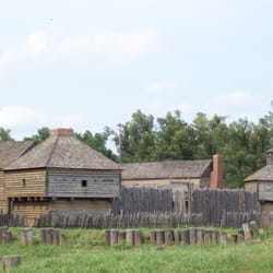
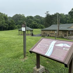
    The most important thing about this place is the confluence of the Ohio and Mississippi Rivers. The…read morepoint where the two great rivers meet and truly form the Mighty Mississippi from here on south. Historically, this was a very significant place. There has been an actual fort in place here during the Civil War. And the exploration of the Mississippi Purchase by Lewis and Clark famously stopped here for a week. Apparently, though, the confluence used to be quite a bit farther north and the rivers have just deposited so much sediment over the years that the point gradually drifts further and further south. The whole area feels a bit forgotten, much like the relics of old Route 66 in the American west. In this case, first the advent of automobiles, then air travel and interstates seem to have done it in over time. While it's a historically significant area, it's as if the constant flux of flooding and drought that wipes clean the surrounding area and perpetually re-maps the path of these rivers also keeps any more solid form of established tourism structures from sticking it out. There are no bathrooms here - just a porta-potty. The parking lot and roads are rough. The grass is overgrown and I was the only person visiting. The three-story old observation tower can be scaled, but I can't imagine it's long for this world in its current condition. The nearest permanent structure is a welcome center about a quarter mile back up the only road to the point. And that is completely shut down with a single worn-out info board in the parking lot. From the perspective of an individual seeking out even the finer points of American history, it's probably worth a stop assuming you're taking a tour of the Mississippi mounds or visiting the nearby New Madrid Fault. I wouldn't exactly suggest going out of your way to stop by here, however. It's been relegated to a blink in time.

    I really liked the atmosphere and solitude of this location. I wished there was more information,…read moreat the sight, about Fort Defiance, it's purpose and it's demise. I had to go on line and read about it, rather than the usual "brown signs". I was there both late in the evening and the next morning, early and didn't see a living sole either time. This place has a neat vibe and if I lived closer I would be out on "the point" a lot.

    Photos
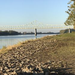
    Fort Defiance State Park - Looking at the bridge to Kentucky, over the barges

    Looking at the bridge to Kentucky, over the barges

    Fort Defiance State Park - To Kentucky

    To Kentucky

    Fort Defiance State Park - To Missouri

    See all

    To Missouri

    Reelfoot Lake State Park

    Reelfoot Lake State Park

    4.5(17 reviews)
    40.4 mi

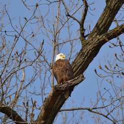
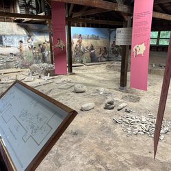
    I have always lived near ReelFoot lake and I grew up going there on special occasions. I had never…read morebeen on the boat tours until recently however. I had the opportunity on my day off from work to come visit this park in all of its beauty. My first boat outing was with their seasonal ranger Jewell West, she was very knowledgeable and personable! She was definitely passionate about the eagles, the park, our beautiful state, and the preservation of our state's natural wonders. On our outing we saw nearly 16 eagles, plenty of osprey, and many other native species. It was a very enjoyable way to spend the morning, and a very beautiful and relaxing ride! That afternoon I came back for the history of the lake boat ride, it was shorter than the eagle spotting venture, but was also with seasonal ranger West. She painted a unique picture about the geological origins of the lake and its troubled past. It was very interesting, and I really enjoyed hearing about it while actively seeing it in person. The facilities at the state park are brand new and they are amazing. They have very enriching and hands on ways to experience this park's history and biological elements. Many of their facilities are brand new due to increased funding and repairs after a tornado a few years ago. The flora and fauna of the lake are immensely beautiful. This place is most definitely a hidden gem for west Tennessee! I look forward to coming back this July for the 250th anniversary of the USA celebration.

    As the biggest lake in Tennessee (covering 15,000 acres of water.,, but very shallow with most…read moreplaces not going over 5 feet), Reelfoot Lake was acquired by the state in the early 20th century and been maintained for public use since then. My wife and I stopped into their visitor center for a visit, being one of the few visitors on a Tuesday afternoon. It consists of two buildings: one is a museum/souvenir shop and the other had small acquariums, filled with snakes and fish. Outside, there were two sets of avian cages where a pair of bald eagles were kept in one, and the other had hawks.

    Photos
    Reelfoot Lake State Park
    Reelfoot Lake State Park
    Reelfoot Lake State Park

    See all

    Dixon Springs State Park - Gak

    Dixon Springs State Park

    4.8(5 reviews)
    37.1 mi

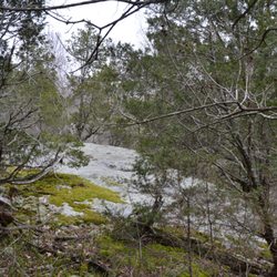
    A nice state park in the area with a pretty nice trail in the Ghost Dance Canyon. Some interesting…read morestuff to see when it's raining, but the rain also makes the rocks very slick. All in all, I have no complaints it, but this shouldn't be your first or second or even third stop if you have time to roam around in the area.

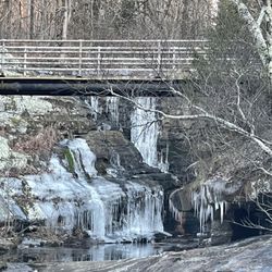
    Tony and I went hiking at Dixon Springs State Park and we had a nice time. The rock formations are…read moreawesome and there is a bridge across the top of the Waterfall. I was able to get some great photos from the base of the rocks and the waterfall. The park was a little dead today but it was early about 10am. There was only one other couple there. There was picnic tables and some grills..and even some grills where I guess there was some picnic tables that are now gone...hummmmm...they also have a pool for the public use but it is still pre-season so it was not open..but I was there for the stunning rock formations and the beauty of God's backyard. This park is FREE to enjoy..which is always nice and very easily located on the intersection of Rt. 146 and Rt . 145. Here is some important information from the website: Dixon Springs State Park is one of several state parks in the Illinois Shawnee Hills. The park is on a giant block of rock which was dropped 200 feet along a fault line that extends northwesterly across Pope County. The 801 acre park is about 10 miles west of Golconda on Illinois Route 146 near its junction with Illinois Route 145. The first land acquisition was in 1946. Facilities at the park include a modern swimming pool, bathhouse, and 45-foot water slide provided for swimmers' enjoyment. Lifeguard is on duty at all times. Towering oaks, elms, and birch trees shade the pool. A concession stand near the pool provides a variety of refreshments. Picnic tables and outdoor stoves are available at three shaded picnic areas. Two picnic shelters, playgrounds, parking areas, and drinking water are also available. There is a Class B trailer camping area with a sanitary dumping station and electricity available. Also available are ten sites for primitive camping, two hiking trails, two basketball courts, three horseshoe pits, two volleyball courts and an archery range Also some HISTORY OF THE AREA which I found very interesting information I wanted to share: The area around the park was occupied by various tribes of Algonquins who, after the Shawnee had been driven from Tennessee, had settled near the mouth of the Wabash River. Dixon Springs was one of their favorite camping grounds and was called "Kitchemuske-nee-be" for the Great Medicine Waters. One of the better known Indian Trails, which the early French called the "Grand Trace," passed to the west of the park and south to Fort Massac, then branched out into lesser trails. Much of the "Grand Trace" is Illinois Route 145, one of the most scenic highways in the state, running nearly all of its length south from Harrisburg through the Shawnee National Forest. This section of the state was part of an Indian Reservation occupied for a time by about 6,000 Native Americans. Like the buffalo, most of the Indians were gone by the early 1830's. Dixon Springs takes its name from William Dixon, one of the first white settlers to build a home in this section, who obtained a school land warrant in 1848 from Governor Augustus C. French. His cabin was a landmark for many years as was an old log church on the adjoining knoll. A small community grew up at Dixon Springs with a general store, post office, blacksmith shop, grist mill, and several churches.Dixon Springs Dixon Springs became a 19th century health spa which attracted hundreds to the seven springs of mineral-enriched water. A bathhouse provided mineral or soft water baths, hot or cold, available at any time. The natural beauty of the area and its interesting stone formations helped to give the park valley a more equable temperature in the summer than most of southern Illinois. This made the resort so popular that people came by steamboat excursions from as far away as Paducah, KY, Evansville, IN, and Cairo to Golconda. They then traveled by train to within a couple miles of the park. The entire county is hilly and during rainy weather rivulets cascade down the hills in the park forming waterfalls of varying sizes and heights. Bold cliffs and crags overhang a bubbling brook while large boulders, overgrown with ferns, ivy, lichens, and moss, fringe the hillside. Giant century-old trees interlock above the small creek as cliffs rise on either side and huge boulders are scattered through the valley. Equally intriguing are the names given numerous points of interest, including Album Rock, Red Man's Retreat, Wolf Pen, Lover's Leap, Ghost Dance, Pluto's Cave. Alligator Rock, the Chain of Rocks, Devil's Workshop, and Honeycomb Rock. The principle canyon has walls nearly 60 feet high with a long, narrow passageway. I found this park very nice and I would definitely go here again..so if you are in the area...enjoy some hiking and gorgeous scenery...God gives us so much to ENJOY for FREE !!! A great Park

    Photos
    Dixon Springs State Park - Colors

    Colors

    Dixon Springs State Park - The water fall

    The water fall

    Dixon Springs State Park

    See all

    Riverfront Park - parks - Updated October 2026
    Loading...
    Loading...
    Loading...