Cancel

    Open app

    Search

    Rhododendron State Park

    4.7 (3 reviews)

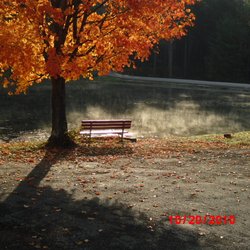
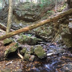
    Rhododendron State Park Photos
    More like Rhododendron State Park

    Recommended Reviews - Rhododendron State Park

    Your trust is our priority, so businesses can't pay to alter or remove their reviews. Learn more about reviews.
    Yelp app icon
    Browse more easily on the app
    Review Feed Illustration
    Photo of Lexy M.
    1181
    984
    9229

    3 years ago

    Helpful 48
    Thanks 5
    Love this 52
    Oh no 0
    Photo of L F.
    0
    439
    1595

    5 years ago

    Helpful 0
    Thanks 0
    Love this 0
    Oh no 0

    4 years ago

    Helpful 0
    Thanks 0
    Love this 0
    Oh no 0

    Verify this business for free

    People searched for Parks 247 times last month within 15 miles of this business.

    Verify this business

    Monadnock State Park - White Dot trail

    Monadnock State Park

    4.7(43 reviews)
    7.1 mi

    I have hiked A LOT of mountains in New England but I had never hiked the mountain it seemed like…read moreeveryone I knew had hiked. Fortunately, I had the opportunity to change that and now I can see what all the hubbub is about. What a great mountain with fantastic views. After doing a bit of homework, I realized it was in my best interest to make a park reservation so that I could secure a parking space for the day at the start of the trailheads I was eyeing for the next day. As one of the most hiked mountains (in the world?), this park reports hosting a massive number of visitors each year and from first hand experience, I can attest that it is a busy one. The $15 was worth the peace of mind and my ability to pull right in and hop onto the trail. I had a hard time locating their "opening hours" but I arrived shortly after 8am with about 20 cars there ahead of me. I really appreciated the park ranger that checked me in for my reservation at the Poole Road entrance. Incredibly welcoming, inquisitive about plans, quick to offer advice for the best experience, and even shared a weather update (30 mph+ winds at the summit that day) before I was on my way. Supplied with a paper map and an idea which trails would be least busy and most scenic, I felt well-prepared for an enjoyable morning on the mountain. I opted to start out on the White Dot Trail. For less crowds, I branched off to the Cascade Link, then hooked a left onto the Red Spot Trail which delivered me to the summit. Gaining elevation at a slow and steady pace, I found the whole climb quite enjoyable. I rejoined the crowd at the summit but still with plenty of room for photos of the scenery and some quiet time to enjoy a snack. Wide open, bald summit with views for days. I would have stayed longer if not for the strong winds. After nestling in between the rocks away from the air currents to enjoy a brief snack, I was on my way down the mountain via the White Cross Trail. There were even glimpses of Boston in the distance! Each trail was clearly marked by it namesake (literally white dots, red dots, and white crosses) which made wayfinding a breeze. That said, I still came across a party or two that had gotten turned around. Do your homework, connect to a trail app if you have the means, practice your map reading skills, and heed the recommendations of the rangers and you should have the basic tools you need to keep you on track and still smiling. So many trails and options that can keep you coming back for more. The visitor center at this entrance was a welcome amenity, restrooms, and all. I cannot comment on the park store because it was closed for lunch when I was finishing up. All in all I got in just under 5 miles using the route that I did. Beautiful peak, beautiful day. Highly recommend.

    Great day hike and not for those with weak ankles! Took the white dot trail up and used the white…read morecross trail to come down. Forgot the bug spray which would have kept the critters at bay with much of the trail having slow or puddled water. Parking wasn't too crowded, $15 for access to park. Snack and gift shop in the lot and the headquarters building just up the trail. Great restroom facility to use prior to starting the hike as well. Very rocky terrain all the way up, clearly marked with white dots (crosses as well for the return). Enjoyed the fact there were multiple volunteer guides hiking or positioned at locations (one steady at fork for dot/cross) if needed. Had low reception all through the hike for emergencies as well. Beautiful views towards the top and of course 360 once on the summit. Definitely worth the time spent. Pack in pack out, bring water and snacks along with the spray (both bug and sun)! Enjoyed a quick snack on the top with the views and a quick tsp of the marker before heading back down. Time to get up to the peak, what are you waiting for?!

    Photos
    Monadnock State Park - Trail head

    Trail head

    Monadnock State Park
    Monadnock State Park - Along or near the White Dot Trail

    See all

    Along or near the White Dot Trail

    Living Memorial Park

    Living Memorial Park

    4.0(2 reviews)
    20.6 mi

    Driving by and I saw this wooden covered bridge so we had to pull over and check it out! So glad…read morewe did, The bridge is located right with this cute,well cared for small park. Well maintained trees, bushes and plants. Love to see how well they take care of the landscape here, also lots of garbage cans around. The park even has a few benches to sit and relax on. The wooden covered bridge was very cool to see and walk through. No cars allowed.... so this allows you to walk right inside the bridge ( love that there is a picnic bench inside too)The bridge goes over a small stream loaded with rocks and wildlife. On the outside of the bridge there are also another pathway to get a closer look at the stream. Very cute area perfect for a quick lunch break and rest before getting back on the road.

    Living Memorial Park is a local gem. Just past the quaint Creamery Covered Bridge off Rt 9, you'll…read morefind this park, central to the Brattleboro community. On one side of the entrance around the corner from the public pool there are play areas, basketball hoops, a gazebo and benches. Residents and non-residents alike may use the pool and small children's water park for a small fee. There are public bathrooms, but they are what you would expect from an old, public park bathroom...built with concrete blocks and minimally cleaned (ie: kinda gross), but at least they're available. On the other side of the entrance is a baseball field. In the winter, the hill is a popular spot for sledding and skiing. There is a T-bar and the capacity to make snow. Many local children get their start skiing here because it is incredibly inexpensive to buy a day pass and free for children under 5. If you venture further up the hill you'll find other fields, an ice skating rink, a small outdoor stage, and a picnic pavilion. The views from the top of the hill are beautiful, and from the top there are hiking trails through the woods around the park.

    Photos
    Living Memorial Park
    Living Memorial Park
    Living Memorial Park

    See all

    Table Rock Trail

    Table Rock Trail

    5.0(2 reviews)
    28.1 mi

    Anytime of the year is perfect for the rewarding view. Maybe a little tough during snow and mud…read moreseason, but still doable. Table Rock faces the Bellows Falls are from New Hampshire, just across the Connecticut River. We're in our 60s and needed to stop a few times on the way up, but it was never too steep or treacherous, just a long steady hike. You want bring good hiking shoes with serious treads. No fees. Dogs allowed.

    Phenomenal trail!! Definitely in my top 5 fave hikes - especially for the fall colors (my visit was…read morein early October)!! And it's a killer workout too! The view from the top is breathtaking- but not for the faint of heart - I have a fear of heights and it took me a while to work up the nerve to go sit on the edge lol! AllTrails has this trail labeled as "moderate" - but it was insanely muddy and very wet when I hiked it - took me ages and totally wore me out - so in those conditions I'd call it moderate-hard. And also with the rock scrambling at the top - it can be quite difficult. Very steep and especially narrow at the top - can be dangerous if you're not careful. I did a total of 2 miles round trip - it's an out and back trail. In those 2 miles, my tracker showed an 800 foot elevation gain so it's definitely a butt burner. And along the trail there are numerous areas of rock scrambling (some are very steep) and stream crossings during the wet season - get ready to be covered in mud lol! You will definitely need decent hiking shoes - and poles would've been so helpful I think! There were quite a few other hikers around. The trails are very well marked with colorful tree badges - but in some spots between the markers, I needed my trail map bc the ground was covered in leaves and mud and it wasn't as obvious. Once you get to the top of Table Rock, the stunning view will absolutely take your breath away! It's a sweeping vista of the entire forest area with the lake and resort below to the left and the long stretch of road through the park to the right - perfect for taking in all the colorful autumn splendor!! The top is a long, very narrow and flat tableau. It seems pretty stable - but has extremely steep (and deadly!) drop offs either side and no safety rails or fencing or anything so be aware. Drones aren't allowed in the park (according to the State Park website) but someone was flying one and buzzing us closely at the top which made it very distracting and scary unfortunately. Dogs are allowed - there were many on the trail and at the top. Parking is a small dirt lot pull out on the side of the road at the trailhead - Google maps took me right to it (just put in Table Rock Trailhead). It's located in Dixville Notch State Park (you can see my review of that for more detailed info). The park doesn't have bathrooms that I could find. And I think it's free. I didn't see any fee areas and their website doesn't list it as a fee area.

    Photos
    Table Rock Trail
    Table Rock Trail - Another stream crossings along the trail

    Another stream crossings along the trail

    Table Rock Trail - Gorgeous fall colors all along the trail (early October)!

    See all

    Gorgeous fall colors all along the trail (early October)!

    Rhododendron State Park - parks - Updated July 2026

    Loading...
    Loading...
    Loading...