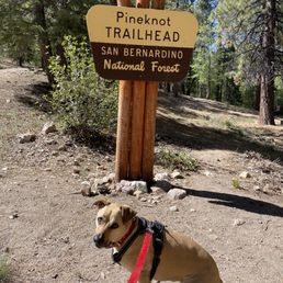
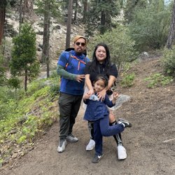
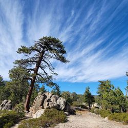
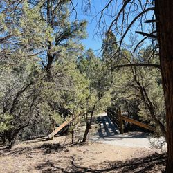
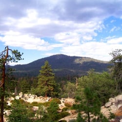
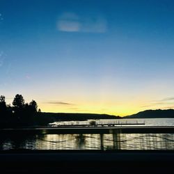
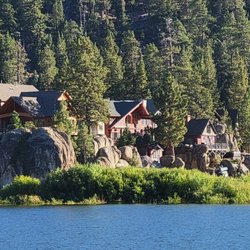
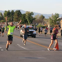
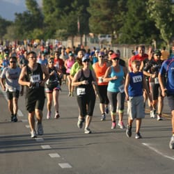
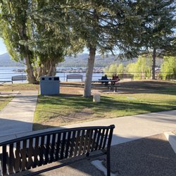
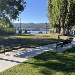
Pine Knot Trail Photos


You might also consider
More like Pine Knot Trail
Recommended Reviews - Pine Knot Trail
Start your review...

Reviews With Photos

You need an Adventure Pass for the lot, but you may there are some limited street parking. Thee as some picnic tables at the beginning of the hike. I hiked 2 miles of this with a toddler so it took a while, but the partial shade was nice. I also hiked most of the 6+ miles but wasn't quite sure if we ended up at the Grandview point. There are some split trails so it was good to have a navigation app running to check if we were on the right trail. Would return for future hikes.

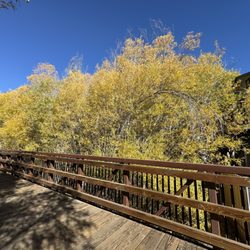
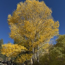
One of my favorite hikes in the area. We parked in the picnic area parking lot. There are plenty of spaces to park and restrooms to use. We were here in mid October and many of the leaves were changing to a beautiful yellow gold. It's my favorite time of year... still warm enough during the day and the air is so crisp. The pine cones have started to fall off many of the trees. This hike if you do the full trail, will take about 3 to 3.5 hours round trip. The trail is well manicured and easy to walk on. However, there are a few steep parts. (huff and puff) Be sure to take water with you and I hope you enjoy it as much as I did! Happy trails!

Park in the aspen glen picnic area but make sure to have a parking permit in your car! When we were leaving a bunch of cars had tickets, so make sure to prevent that by getting the adventure parking pass. It's only $5.50 and you can get it at a handful of stores around town. The trail is marked well with signage and blue indicators on trees as you go. You get beautiful views of the lake as you go higher through the trail. I wore regular athletic shoes and felt fine on the hike. Would definitely recommend for a quick hike in big bear!

A trail that highlights NOT Big Bear Lake but the San Bernardino National Forest. Step 1: Purchase a $5 Adventure Pass or other pass like the National Park Service annual pass. Step 2: Park in the Aspen Glen Picnic Area lot on Mill Creek Road. Step 3: Use one of multiple trailheads in the picnic area. Keep wandering uphill as the trails eventually converge into one - the Pine Knot Trail as marked by signs with maps. A dirt road also goes to the top, but a trail is more interesting, safer, and less dusty. Sporadic views of Big Bear Lake appear between the trees. Step 4: At 2.2 miles is a junction with the road and when things get good. Look up for a tree top growing at a 90-degree angle (see pic). Perhaps the knot in this pine is what gives the trail its name? Look down for red ant hills made with pine needles that are knee high (see pic). Pass through the Deer Group Campground with meadow which was dried out on our drought visit but likely gorgeous when green. Step 5: Cross Grand View Junction where seven pathways intersect including the Skyline Trail. The first view of the valley south of Big Bear appears. Step 6: At 3.3 miles and 900' elevation change, arrive at Grand View Point with view of the valley, the peak of San Gorgonio, and a small chunk of the Inland Empire. Not entirely "grand", the views are partially obscured by trees.

Really enjoyed this trail. It was a moderate hike that was doable for our kids and dogs. The trail offers plenty of shade and is dog friendly. We didn't make it all the way to the top (because kids), but did make it up to an area that had big rocks and a great view of the lake. Can't wait to come back and do the entire trail with the dogs!

Beautiful moderate trail with breathtaking views and plenty of lush greenery! Total of 7-8 miles round trip (depending on if you get lost or not) for a 3-4 hr hike. Despite plenty of shade along the trail, be prepared for bright/sunny patches and some steep inclines. Bring lots of water and good shoes! - Limited parking in the Aspen Glen Picnic Area Lot, but there's additional parking along the street a little bit down the road. Make sure to purchase an Adventure Pass beforehand! (You can purchase a day pass for $5 at any store along the way- bought mine at 7/11) - Very clean trail with little to no trash. - Trail markings throughout. We got a bit lost at the fork and near the end because we didn't realize the blue markings on trees were directional! To get to Grand View, carry on straight through "Adopt a Trail" and you'll pass Deer Campground. Keep following the trail straight until you see signs that veer off to Grand View. Note that Knickerbocker Rd will also loop you to View Point, but this is mostly a bike trail. - Views at the top were great and there was a shaded rocky area perfect for a picnic. I would highly recommend this hike to anyone willing to get a bit sweaty and dehydrated!

Loved this trail. You're in the middle of the forest but the trail is perfectly clear. Lots of great views and shade for resting. It is a tough hike, but a great workout. And it's dog friendly! We went without a parking pass and so we didn't use the picnic area parking. Instead we parked along the road...and no ticket. Other vehicles did the same. Will be returning, but next time we'll make the most of the nice picnic area as well.

Yay! Excellent! We followed the trail directions from this site: http://nobodyhikesinla.com/2010/08/16/grandview-pointpine-knot-trail/ The trip up to the point is beautiful - pine trees, fairly well-shaded, gorgeous boulders. It was not at all crowded and my husband and I made it to the point without feeling very winded at all, even though it is a gentle incline for the most part. There are a few parts that will make you work a little more, but they are interspersed throughout. The trail, while still beautiful (and very well-maintained; directions from the aforementioned website really weren't that needed), started to get slightly monotonous a few hours in, which was also the point at which we saw signs saying that Grandview Point was near... Oh my gosh - it was an incredible view. A solid 180 degree view of San Gorgonio and the surrounding mountains and river valley; we were totally surprised and blown away by how picturesque it was. Although it's the middle of April, and CA is still in a dought - there was tons of snow on the mountains (the ones we saw from Grandview Point, not on the actual hike). Just gorgeous and totally worth any slight bit of monotony you might feel along the way. Cons: a few reckless mountain bikers, one of which was speeding around a blind corner and almost hit my husband. Parking requires a $5 adventure pass; you can get it at Bear Valley Bikes, which is at the intersection of Mill Valley Road and Hwy 18.

Hands down, my favorite hike I've done since I moved to San Diego 7 years ago. Big Bear always seemed like a little to far for a day trip from downtown San Diego, but during COVID when I'm not driving the rest of the week, and I have no big weekend plans, the 2 1/2 hour drive each way really wasn't a big deal. And the last 50 minutes of that drive is BEAUTIFUL. Mountain views, lake views, wildflowers etc! Purchased an annual adventure pass at a liquor store on the way up (I have no idea if it's required these days or not, but figured I'd grab one so I don't have to worry about the parking). There's a small lot at the trailhead, we arrived around 10:30am on a Sunday and grabbed the second the last spot. I'd imagine the lot can fill up quickly at peak times. The trail is also SUPER well marked. At any turn or split off, there was a sign of which way to go. I also had service for the majority of the hike, and checked our route on All Trails a few times. 3.5 miles to the peak, there's a place where a bunch of trails converge at about 3.3 miles where a lot of people stopped, but continue following the signs to Grand View Point another quarter of a mile, it's worth it!! The view was stunning. Sat on a rock and enjoyed my lunch, and then we hiked back, making it a little bit of a loop, which extends the trail to 8 miles instead of 6.6. I like the idea of not doing an out and back, and we got to see some different sites, but it also made the last 2 miles of the hike along a road where there were some cars driving. It definitely was a moderate to difficult hike, and it's at altitude, I was pretty much thirsty the entire time, so bring a lot of water!

The trail is about 3 miles to the top and it's a great hike if you're a beginner hiker. Not too mountainous and there's plenty of places to rest. If you're not use to elevation change I'd bring plenty of water. I'm from San Diego and I did notice it was a little harder to breathe and I got dehydrated faster. The trail is also dog friendly as long as your dog is on a leash.


We walked this trail today and while the views were beautiful I guess I should have taken a map with me. We parked at aspen park, got an adventure pass from the little green building by the road. I took my daughters with me ( age 4 and 11) and it was hard for them but it was beautiful. It's mid July and it was not hot at all. Lots of up hills and you caught views of big bear lake as you walk. But BEWARE of the mountain bikers, they come barreling down towards you and just randomly yell how many more bikes are coming. Kinda disappointing because the visitors center said there were waterfalls and there wasn't. But, it was a nice hike. The trail got thin on some spots kinda scary for my kids with the huge hills they could fall down but it was beautiful.

3 months ago
This was a great trail to hike. Parking was easily accessible. No pass was required to park. The weather was nice and there was a breeze when we went a couple weeks ago. We did nearly nine miles. The trail connects to different trails which is how we covered that distance. The views were great and my puppy enjoyed running parts of the trail with me. It's a definitely a place where you can bring a light lunch to picnic with. I would come again and do different parts of the trail. read more


18 days ago
This is Pine Knot 1E01. We loved everything about it. Super easy to find. Parking lot at base of trail. QR code to pay a $5 parking fee. You'll feel a slight climb occasionally but the trail expertly has switchbacks that alleviate a steep ascent. Before reaching Camp 89 (on map) there is a gorgeous vista of Big Bear Lake and the pine covered mountains. Another plus, very shaded throughout the whole hike. You'll meet bikers and dogs along the trail and everyone is enjoying the path. Highly recommend! read more
2 years ago
You need an Adventure Pass for the lot, but you may there are some limited street parking. Thee as some picnic tables at the beginning of the hike. I hiked 2 miles of this with a toddler so it took a while, but the partial shade was nice. I also hiked most of the 6+ miles but wasn't quite sure if we ended up at the Grandview point. There are some split trails so it was good to have a navigation app running to check if we were on the right trail. Would return for future hikes. read more


8 years ago
One of my favorite hikes in the area. We parked in the picnic area parking lot. There are plenty of spaces to park and restrooms to use. We were here in mid October and many of the leaves were changing to a beautiful yellow gold. It's my favorite time of year... still warm enough during the day and the air is so crisp. The pine cones have started to fall off many of the trees. This hike if you do the full trail, will take about 3 to 3.5 hours round trip. The trail is well manicured and easy to walk on. However, there are a few steep parts. (huff and puff) Be sure to take water with you and I hope you enjoy it as much as I did! Happy trails! read more


Park in the aspen glen picnic area but make sure to have a parking permit in your car! When we were leaving a bunch of cars had tickets, so make sure to prevent that by getting the adventure parking pass. It's only $5.50 and you can get it at a handful of stores around town. The trail is marked well with signage and blue indicators on trees as you go. You get beautiful views of the lake as you go higher through the trail. I wore regular athletic shoes and felt fine on the hike. Would definitely recommend for a quick hike in big bear! read more


5 years ago
A trail that highlights NOT Big Bear Lake but the San Bernardino National Forest. Step 1: Purchase a $5 Adventure Pass or other pass like the National Park Service annual pass. Step 2: Park in the Aspen Glen Picnic Area lot on Mill Creek Road. Step 3: Use one of multiple trailheads in the picnic area. Keep wandering uphill as the trails eventually converge into one - the Pine Knot Trail as marked by signs with maps. A dirt road also goes to the top, but a trail is more interesting, safer, and less dusty. Sporadic views of Big Bear Lake appear between the trees. Step 4: At 2.2 miles is a junction with the road and when things get good. Look up for a tree top growing at a 90-degree angle (see pic). Perhaps the knot in this pine is what gives the trail its name? Look down for red ant hills made with pine needles that are knee high (see pic). Pass through the Deer Group Campground with meadow which was dried out on our drought visit but likely gorgeous when green. Step 5: Cross Grand View Junction where seven pathways intersect including the Skyline Trail. The first view of the valley south of Big Bear appears. Step 6: At 3.3 miles and 900' elevation change, arrive at Grand View Point with view of the valley, the peak of San Gorgonio, and a small chunk of the Inland Empire. Not entirely "grand", the views are partially obscured by trees. read more


6 years ago
Really enjoyed this trail. It was a moderate hike that was doable for our kids and dogs. The trail offers plenty of shade and is dog friendly. We didn't make it all the way to the top (because kids), but did make it up to an area that had big rocks and a great view of the lake. Can't wait to come back and do the entire trail with the dogs! read more

5 years ago
Beautiful moderate trail with breathtaking views and plenty of lush greenery! Total of 7-8 miles round trip (depending on if you get lost or not) for a 3-4 hr hike. Despite plenty of shade along the trail, be prepared for bright/sunny patches and some steep inclines. Bring lots of water and good shoes! - Limited parking in the Aspen Glen Picnic Area Lot, but there's additional parking along the street a little bit down the road. Make sure to purchase an Adventure Pass beforehand! (You can purchase a day pass for $5 at any store along the way- bought mine at 7/11) - Very clean trail with little to no trash. - Trail markings throughout. We got a bit lost at the fork and near the end because we didn't realize the blue markings on trees were directional! To get to Grand View, carry on straight through "Adopt a Trail" and you'll pass Deer Campground. Keep following the trail straight until you see signs that veer off to Grand View. Note that Knickerbocker Rd will also loop you to View Point, but this is mostly a bike trail. - Views at the top were great and there was a shaded rocky area perfect for a picnic. I would highly recommend this hike to anyone willing to get a bit sweaty and dehydrated! read more


4 years ago
Just love this hike in BB. Go early to miss the crowds and bring lots of water and snacks. Jodie views of the lake Nd surrounding areas. Highly recommend read more

7 years ago
Loved this trail. You're in the middle of the forest but the trail is perfectly clear. Lots of great views and shade for resting. It is a tough hike, but a great workout. And it's dog friendly! We went without a parking pass and so we didn't use the picnic area parking. Instead we parked along the road...and no ticket. Other vehicles did the same. Will be returning, but next time we'll make the most of the nice picnic area as well. read more

6 years ago
Yay! Excellent! We followed the trail directions from this site: http://nobodyhikesinla.com/2010/08/16/grandview-pointpine-knot-trail/ The trip up to the point is beautiful - pine trees, fairly well-shaded, gorgeous boulders. It was not at all crowded and my husband and I made it to the point without feeling very winded at all, even though it is a gentle incline for the most part. There are a few parts that will make you work a little more, but they are interspersed throughout. The trail, while still beautiful (and very well-maintained; directions from the aforementioned website really weren't that needed), started to get slightly monotonous a few hours in, which was also the point at which we saw signs saying that Grandview Point was near... Oh my gosh - it was an incredible view. A solid 180 degree view of San Gorgonio and the surrounding mountains and river valley; we were totally surprised and blown away by how picturesque it was. Although it's the middle of April, and CA is still in a dought - there was tons of snow on the mountains (the ones we saw from Grandview Point, not on the actual hike). Just gorgeous and totally worth any slight bit of monotony you might feel along the way. Cons: a few reckless mountain bikers, one of which was speeding around a blind corner and almost hit my husband. Parking requires a $5 adventure pass; you can get it at Bear Valley Bikes, which is at the intersection of Mill Valley Road and Hwy 18. read more

Hands down, my favorite hike I've done since I moved to San Diego 7 years ago. Big Bear always seemed like a little to far for a day trip from downtown San Diego, but during COVID when I'm not driving the rest of the week, and I have no big weekend plans, the 2 1/2 hour drive each way really wasn't a big deal. And the last 50 minutes of that drive is BEAUTIFUL. Mountain views, lake views, wildflowers etc! Purchased an annual adventure pass at a liquor store on the way up (I have no idea if it's required these days or not, but figured I'd grab one so I don't have to worry about the parking). There's a small lot at the trailhead, we arrived around 10:30am on a Sunday and grabbed the second the last spot. I'd imagine the lot can fill up quickly at peak times. The trail is also SUPER well marked. At any turn or split off, there was a sign of which way to go. I also had service for the majority of the hike, and checked our route on All Trails a few times. 3.5 miles to the peak, there's a place where a bunch of trails converge at about 3.3 miles where a lot of people stopped, but continue following the signs to Grand View Point another quarter of a mile, it's worth it!! The view was stunning. Sat on a rock and enjoyed my lunch, and then we hiked back, making it a little bit of a loop, which extends the trail to 8 miles instead of 6.6. I like the idea of not doing an out and back, and we got to see some different sites, but it also made the last 2 miles of the hike along a road where there were some cars driving. It definitely was a moderate to difficult hike, and it's at altitude, I was pretty much thirsty the entire time, so bring a lot of water! read more


6 years ago
The trail is about 3 miles to the top and it's a great hike if you're a beginner hiker. Not too mountainous and there's plenty of places to rest. If you're not use to elevation change I'd bring plenty of water. I'm from San Diego and I did notice it was a little harder to breathe and I got dehydrated faster. The trail is also dog friendly as long as your dog is on a leash. read more

6 years ago
This trail was moderate... but filled with tons of shade. Dogs are allowed on the trail and even allowed off leash... the picnic area is still closed... but it's all good ...the view and scenery was just breathtaking read more


11 years ago
We walked this trail today and while the views were beautiful I guess I should have taken a map with me. We parked at aspen park, got an adventure pass from the little green building by the road. I took my daughters with me ( age 4 and 11) and it was hard for them but it was beautiful. It's mid July and it was not hot at all. Lots of up hills and you caught views of big bear lake as you walk. But BEWARE of the mountain bikers, they come barreling down towards you and just randomly yell how many more bikes are coming. Kinda disappointing because the visitors center said there were waterfalls and there wasn't. But, it was a nice hike. The trail got thin on some spots kinda scary for my kids with the huge hills they could fall down but it was beautiful. read more

10 years ago
For parking, go down Mill Creek Road, directly across from a bike shop and next to Hillcrest Lodge. There is a lot at Aspen Glen camp ground. I picked up an adventure pass for five bucks at 7-11 on big bear Blvd about two miles from the trail. It's good for a day. Head through there ground and the trail starts on your right. You need to walk about five minutes to get to the trailhead. There are many switchbacks on mostly sandy trail. The colors in October is mostly green with some yellow and orange. If you want to stay on Pineknot and head to the grand view point, once you see the first map sign of the whole trail system, head through the trail that has a sign for adopt a trail. It will pass deer group campground and you will see the posts for Pineknot. You can still hit it through knickerbocker road but I only saw bike tracks. It took about 80 minutes to reach grandview point at a brisk walk. But the best view was of Big Bear Lake. A pine cone fell down and many of the petals spiraled down to the trail. They are littered everywhere. Saw a huge falcon like bird, many squirrels, and lizards. The trail is very clean without a single piece of trash anywhere. And there are blue, white and pink ribbons to guide the trail. There are also blue spray paint around tree trunks. You do need to bring an extra layer as the shaded parts can get chilly in the morning when I hiked it. read more


I prefer longer distance, moderate hikes over short, intense hikes with lots of steep inclines... [especially at this altitude where I can barely breathe as it is] which is why we opted for the Pine Knot Trail on this last visit to Big Bear over the more popular Castle Rock Trail and I already can't wait to come back. The hike starts our VERY rocky and treacherous! The ground is uneven and blanketed with rocks the size of baseballs, almost deterring me from continuing on. The rocks disappear about 1/4 of a mile into the hike and the ground becomes like any regular packed dirt trail, nice and smooth, soft like sand in some areas, with little to no danger of rolling an ankle besides some sparse trail irregularities. Not a big deal. As you climb up the very gradual incline you are surrounded by all that beautiful Big Bear forest, giant xmas trees and other pines, tons of sequoia looking trees, lots of interesting plant and animal life, and even a couple of really awesome lake and mountain vistas at certain points. There are tons of picturesque scenes for snapping pics, which is one of my favorite things to do while hiking. From start to finish the hike is a little over 6 miles, and like I said, moderate in difficulty [there were lots of young children, and people of all ages really, flying up this mountain with much greater ease than me] Mountain bikers also use this trail, but for the most part are courteous and use bells, whistle, or alert you well in advance so you have time to step to the side. There is plenty of shade and some nice cool breezes, making this is a great way to spend a few hours on a hot summers day in Big Bear and burn a few hundred extra calories. To park and access this trail you need to grab a five dollar Adventure pass beforehand, and we did so at a nearby 7-11. For a full list of businesses selling these passes check bigbearcountry.com. A year's pass will run you $30. Scenic, well maintained, moderate, mountain hike! read more


8 years ago
I enjoyed a gorgeous hike on the Pine Knot Trail to Grand View point today. I began at 9am and it was a perfect sunny day. I had my husky Sassafrass with me, of course. The trail is about 7 miles round trip if you start counting at the parking lot and go to the Grand View Vista. It took me just a little bit over 3 hours. I did enjoy a rest at the vista, and stopped to take a lot of photos along the trail. There were squirrels chipmunks, lizards, and lots of beautiful birds around. Also a few wildflowers. You park at the Aspen Glen picnic area on Mill Creek Road. I purchased my Adventure Pass at the Big Bear Visitor's Center for $5. Make certain that you display your pass when you park here! The terrain varies throughout the hike. Ups and downs and a few switchbacks. The trail is very well marked with little blue diamond markers along the way. I wore hiking sandals and the trail was fine for that type of footwear. I consider it it a easy to moderate level hike. There is the option to continue on Skyline Trail and Seven Oaks Trail. I saw very few others hiking today (Wednesday), and a few mountain bikers. I really enjoy being out there by myself! I imagine that the weekends are busier. I definitely recommend the Pine Knot Trail. read more


11 years ago
First, a few important points (some of which I gleaned from fellow yelpers): - Buy an Adventure Pass for $5. You can get it at the visitor center (cash only), discovery center, or the 7-11 (which is just minutes from the village. -Park at the Aspen Park Picnic Area. We went around 9am on a Saturday and there were plenty of spots. -The trailhead is past the restrooms. The hike begins to the right of the Pine Knot Trail sign. I was dumb enough to start at the left of it, which made for some cool steep climbs. But, still... Hikers! This is app 7 miles of hiking if you choose to enjoy the view from Grand View Point. I highly recommend it, btw. Some shade from the trees at certain points, some winding sections, clear markers along the way, and definitely a thin trail for most of the hike. With that said, beware of mountain bikers! I'm pretty sure you're not looking to get hit. All in all, a decent hike. I liked it because I just love hiking. But, I give it 3 stars because I have a weakness for steep inclines, and this trail didn't really offer much in that department. Oh, and the trail may get tricky at some points, because it intersects with other trails somewhere in the middle. This is where the detailed guidelines from the Modern Hiker came in handy. Here's the link: http://www.modernhiker.com/2009/03/31/snowshoeing-pine-knot-trail/ Enjoy!! read more


11 years ago
We loved this trail! We went on a Thursday in the late morning and there were very few people on the trail. We did not see any mountain bikers until we were almost back to the parking lot. There are restrooms located at the parking lot, and a small outdoor restroom at the group camp site about ¾ of the way up. Another reviewer said it was about 7 miles round trip. The hike is somewhat shaded but you will need to bring a lot of water (I drank two 32oz Nalgene water bottles and it was not very hot) as there is no water on this trail. The hike is not too steep, I would rate it moderate. Another reviewer said that there is a picnic area about half way, but it's not a picnic area, it's a group camp site, and I think it's actually a lot more than halfway because it only took about 20 minutes past that point to reach the Grandview Point. Also, the view is incredible. I could have hiked twice as far for the view and been content. This is an excellent hike, and I highly recommend it if you are looking for a somewhat lengthy hike that is not a full day hike. DON'T FORGET YOUR ADVENTURE PASS! read more

7 years ago
This hike is wonderful! We were siked to find such a beautiful dog friendly trail to roam through the forest in. Growing up in Seattle I grew to love the forest and although I wouldn't trade my SoCal life, I definitely miss the forest once in a while. Coming here was so healing, rejuvenating and peaceful! The dogs also enjoyed it and were exhausted after! The whole trail was 8 miles long and it took most of the day. So worth it though and great exercise. The pictures don't even do it justice. read more


10 years ago
It was a fun hike and 7 miles round trip from the trailhead to grand view point. - Park at Aspen Glen Picnic area - Get an Adventure Pass - After about 2 miles has passed, you will see cross roads but you keep going straight and follow " adopt a trail". When you see camp ground area, you are on the right track - The trail is well-marked and shady read more


8 years ago
A friend told me about the trail and that it went to the village. I was told it was about 3 miles! Took my two small dogs and headed out over prepared. Thank goodness I brought my lunch and plenty of water. The trail to the village is about 10 miles. It was beautiful and mentally cleaning. I did okay but did not wear the right hiking shoes. My 3 legged dog was resilient and a trooper. The views were spectacular. I'll do it again and brink the dogs but just better shoes. Oh and my hiking stick really helped me. read more

6 years ago
This trail is a pretty decent workout with a gradual incline, although it's much less shaded than I anticipated based on other reviews. Bring more water than you think you need. I ended up not making it to grand view point because after getting to the Deer Group Campground I realized that my camel back was nearly empty and I only had a 20 oz bottle of water left to get me the next mile to the view point, and then back the other 3+ so I turned around. A few additional tips in addition to the water one: - bring sunblock - anticipate mountain bikers (they won't stop usually, and probably can't really because they're going so fast) - I'd allot about 45 min/mile on the way up factoring in a few stops to appreciate the views (you'll be able to see the lake even if you don't make it to grand view point) - get an adventure pass: you need one to park near the picnic area at the head of the trail - I'd also bring bug spray (I didn't and was bitten up) This is a nice hike, and next time I'm in Big Bear I aim to make it all the way! read more


7 years ago
The hike was great, it wasn't too hot, there was a good amount of shade, and the views were great. Also, my dog definitely loved the hike! read more

9 years ago
One of my favorite hikes I've ever done! Sooooo absolutely beautiful. Astounding views from every direction and the trail is extensive and connects with others so you can make it longer if you want. I loved this trail so much. We started around 1 and went all the way to the grand view and then made it back down to the picnic area by 6. I will cherish the experience hiking on this trail forever!!! An absolute must do if you are in the big bear area. read more


6 years ago
12 years ago
This review is for beginner level hikers. If you are pro or fit please disregard. This trail kicked my ass. It was snowy and uphill most of the way in the beginning. I almost lost a friend up there. Not literally but figuratively. That bitch would not wait for me. So I guess kind of literally. Don't take a date here unless you want him to see what you'll look like while giving birth. Admittedly the harshest part was post holing my way to the top since I didn't realize it would be so snowy and wore sneakers. I read the reviews and it sounded so breezy so just be prepared if you know you're a little vanilla when it comes to hiking。Surprise ending though because I did make it to the top and the view was beautiful and all the things everyone else said. read more

9 years ago
12 years ago
11 years ago
7 years ago
Overall not a bad hike. Trail markers say 3.25 miles one way from Aspen Glen Picnic area. Nicely shaded throughout the trail and dog friendly. I did this solo and made the round trip in just under 3 hrs with stops to take pictures here and there. Started early afternoon and temperatures were in the low 80s so having had as much shade as there was helped in making this a pleasant hike. read more

Page 1 of 2
More info about Pine Knot Trail
Mill Creek Rd
Big Bear Lake, CA 92315
Directions
(909) 382-2790
Call Now
Hours
Indoor Amenities
Outdoor Amenities
Ask the Community - Pine Knot Trail
Review Highlights - Pine Knot Trail
You might also consider


Pine Knot Trail - hiking - Updated June 2026
Best of Big Bear Lake
People found Pine Knot Trail by searching for…
Things to Do in Big Bear Lake, California
Hiking Trails With Waterfalls in Big Bear Lake, California
Parks in Big Bear Lake, California
Campgrounds in Big Bear Lake, California
Fishing in Big Bear Lake, California
Places to Take Pictures in Big Bear Lake, California
Scenic Views in Big Bear Lake, California
Dog Friendly in Big Bear Lake, California
Picnic Areas in Big Bear Lake, California
Things to Do at Night in Big Bear Lake, California
Walking Trails in Big Bear Lake, California
Off Road Trails in Big Bear Lake, California
Dog Friendly Hiking Trails in Big Bear Lake, California
Snow in Big Bear Lake, California
Night Hike in Big Bear Lake, California
Mountain Bike Trails in Big Bear Lake, California
Visitor Centers in Big Bear Lake, California
Scenic Drive in Big Bear Lake, California
Running Trails in Big Bear Lake, California
Easy Hikes in Big Bear Lake, California
Scenic Overlook in Big Bear Lake, California
Waterfalls and Swimming Holes in Big Bear Lake, California
Trending Searches in Big Bear Lake, CA
Black Owned Nail Salons near Pine Knot Trail
Boat Rental near Pine Knot Trail
Cliff Jumping near Pine Knot Trail
Day Trips near Pine Knot Trail
Dog Friendly Trails near Pine Knot Trail
Fireworks near Pine Knot Trail
Fishing Spots near Pine Knot Trail
Jet Ski Rental near Pine Knot Trail
Kayak Rental near Pine Knot Trail
Lakes & Ponds near Pine Knot Trail
Outdoor Activities near Pine Knot Trail
Places To Walk Around near Pine Knot Trail
Public Pools near Pine Knot Trail
Public Shower near Pine Knot Trail
River Swimming near Pine Knot Trail
Rock Quarry near Pine Knot Trail
Scenic Night View near Pine Knot Trail
Scenic Overlook near Pine Knot Trail
Secluded Spots near Pine Knot Trail
Soccer Store near Pine Knot Trail
Splash Pad near Pine Knot Trail
Strawberry Picking near Pine Knot Trail
Sunrise View near Pine Knot Trail
Swimming Holes near Pine Knot Trail
Swimming Lakes near Pine Knot Trail
Watch Sunset near Pine Knot Trail
Browse Articles
Browse Nearby
BEST of Big Bear Lake, California Things to Do near Pine Knot Trail
BEST of Big Bear Lake, California Coffee near Pine Knot Trail
BEST of Big Bear Lake, California Restaurants near Pine Knot Trail
BEST of Big Bear Lake, California Walking Trails near Pine Knot Trail
BEST of Big Bear Lake, California Parks near Pine Knot Trail
BEST of Big Bear Lake, California Breakfast near Pine Knot Trail
BEST of Big Bear Lake, California Caves near Pine Knot Trail
BEST of Big Bear Lake, California Hot Springs near Pine Knot Trail
BEST of Big Bear Lake, California Campgrounds near Pine Knot Trail
Browse Brands
Related Searches in Big Bear Lake, CA
Affordable Kayak Rental Services in Big Bear Lake, California
Best Fishing Locations and Guides in Big Bear Lake, California
Best Nature Trails for Hiking in Big Bear Lake, California
Best Places for Horseback Riding in Big Bear Lake, California
Best Sledding Spots and Fun in Big Bear Lake, California
Best Waterfalls and Swimming Holes in Big Bear Lake, California
Check Out Off Road Trails in Big Bear Lake, California
Discover Dog Friendly Trails to Explore in Big Bear Lake, California
Discover Kid Friendly Hiking Trails in Big Bear Lake, California
Discover Scenic Bike Paths in Big Bear Lake, California
Discover Scenic Waterfall Spots in Big Bear Lake, California
Discover Walking Parks in Big Bear Lake, California Near You
Discover a Hiking Trail in Big Bear Lake, California
Discover the Best Night Hike Trails in Big Bear Lake, California
Dog-Friendly Hikes With Dogs in Big Bear Lake, California
Enjoy Camping Adventures Around Big Bear Lake, California
Enjoy Exciting Mountain Biking Adventures in Big Bear Lake, California
Enjoy Kayaking Adventures in Big Bear Lake, California
Enjoy Tent Camping Spots Around Big Bear Lake, California
Enjoy a Beautiful Waterfall Hike in Big Bear Lake, California
Enjoy the Best Picnic Spots and Ideas in Big Bear Lake, California
Enjoy the Best Tubing Experiences in Big Bear Lake, California
Enjoy the Best Walking Path in Big Bear Lake, California
Enjoy the Best Walking Trails in Big Bear Lake, California
Exciting Cliff Jumping Spots in Big Bear Lake, California
Explore Beautiful Parks and Green Spaces in Big Bear Lake, California
Explore Easy Hikes Perfect for All in Big Bear Lake, California
Explore Fun Activities to Do in Big Bear Lake, California
Explore Nature Spots Around Big Bear Lake, California
Explore Popular Campgrounds Near Big Bear Lake, California
Explore Top Dog Parks in Big Bear Lake, California Near You
Explore the Best Beach Spots in Big Bear Lake, California
Explore the Best Boating Spots in Big Bear Lake, California
Explore the Best Swimming Holes Around Big Bear Lake, California
Explore the Best Trail Options in Big Bear Lake, California
Family Friendly Hiking With Kids in Big Bear Lake, California
Find Popular Ziplining Spots Around Big Bear Lake, California
Find the Best Parks for Picnics in Big Bear Lake, California
Great Places to Walk in Big Bear Lake, California
Hiking Trails With Waterfalls in Big Bear Lake, California
Plan Nature Center Visits in Big Bear Lake, California
Popular Outdoor Activities to Try in Big Bear Lake, California
Popular Picnic Spots to Visit in Big Bear Lake, California
Safe and Fun Parks for Kids in Big Bear Lake, California
Top Climbing Spots and Gyms in Big Bear Lake, California
Top Running Trails to Explore in Big Bear Lake, California
Top Swimming Lakes to Enjoy in Big Bear Lake, California
Top Swimming Spots and Pools in Big Bear Lake, California
Top Things to Do With Kids in Big Bear Lake, California
Walk Dog Friendly Hiking Trails in Big Bear Lake, California
People who viewed Pine Knot Trail also viewed
Pacific Crest Trail
4 reviews
Bertha Peak through Cougar Crest Trail
8 reviews
Happy Hills Trail
3 reviews
Alpine Pedal Path
56 reviews
Stanfield Marsh Boardwalk & Wildlife Preserve
50 reviews
Maple Lane Trails
3 reviews
Rose Hill Drive Trail Head
1 review
Big Bear Lake
61 reviews
Butler Peak Fire Tower
2 reviews
Aspen Glen Picnic Area
94 reviews