Pictured Rocks National Lakeshore Photos


You might also consider

More like Pictured Rocks National Lakeshore
Recommended Reviews - Pictured Rocks National Lakeshore
Start your review...


Reviews With Photos


Pictured Rocks has been on my bucket list for many years. I've been to the upper Peninsula a few times, but I've never made it to this area. This is most certainly a popular attraction for tourists and if you get the opportunity book a sunset cruise to view the rocks. The entire area is full of unique trails to hike with stunning views of Lake Superior. I'm looking forward to coming back next summer.


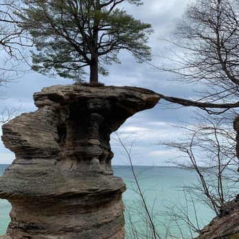
My husband and I visited Pictured Rocks National Lakeshore in September 2023 with our 2 dogs. We made sure that we respected the rules for pets within the area. We both wanted to see Chapel Rock, but it wasn't dog friendly - so each of us hiked it alone while the other sat in the car with the dogs in the parking lot. There were many people who did not respect the rules regarding pets in these areas. We definitely enjoyed our time in this lovely place. There is so much to see !


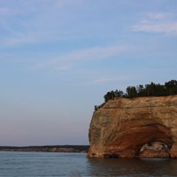

What words can I say here that will do this lakeshore justice? I genuinely don't know! Just do your heart, mind, and spirit a favor and visit Pictured Rocks National Lakeshore. It's gorgeous, in all seasons, and in all weather conditions. It's called Lake Superior for a reason. It's a NATIONAL lakeshore for a reason. This place is magnificent & truly deserves to be one of the crowning jewels of Michigan. There is so much to do all the outdoor activities here - backpack, camp, cruise, hike, do all the beach things, swim, dance, laugh, and soak up the sun and the stars. It's everything and more. The drive through Pictured Rocks on H-58 is also absolutely stunning. There is so much to do, I could spend an entire week here. I love coming back here each time I visit and each time I discover more and more beauty, activities, and fall even more head over heels for this place xoxo


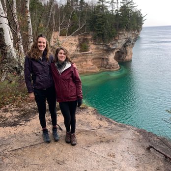
Doesn't really get much better than hiking the National Lakeshore. We've been in the U.P. several times over the years and Pictured Rocks always wows me. This year instead of taking the boat tour, we decide to get up close and personal and hike a stretch of it. To say the views are breathtaking is simply an understatement. Going during off-peak season is also a bonus as we were virtually the only ones on the trails, and we ran into less than a handful of fellow hikers and campers. We hiked the Mosquito Falls and Chapel Falls via the Channel Loop. It was 12 miles of stellar views, some muddy muck and so much inn general to look at. It was a tiring jaunt but so worth it when we made it back to where we started. This is a hike that is a must if your ever in this area. The pictures do only a smidgen of justice.


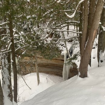
There's a calming sense of serenity when venturing the trail in the dead of winter. I saw virtually no one and you're able to view the Pictured Rocks from a different perspective than the usual photo dump of the greenery in full bloom. That being said, parts of the trail can be treacherous in the wintertime, so exercise caution, as some of the Sand Point and Cliffs camp trails will legitimately hug the edge of the rocks.


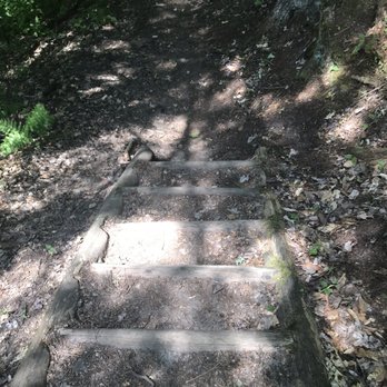
Before you begin this journey through paradise, I should warn you to be prepared. The sights along the path to the shore are jaw droppingly beautiful. I highly suggest wearing comfortable shoes for hiking, and ones you do not mind getting dirty. I suggest bringing a small backpack or shoulder bag that can fit necessary essentials. I felt terrible for the couple behind us because they were bitten by tons of mosquitos and we offered them some spray. Be sure to bring mosquito spray, sunscreen, water, and perhaps a beach towel. We used a nice shoulder tote that has a mini cooler at the bottom. It was not too heavy to carry, and it had all of our essentials. When you begin the journey down to the shores, it can be very confusing. They are signs along the way to help you navigate. The couple behind us ended up splitting off by going right instead as we were not sure which way to go. They ended up having to come back up to take the correct route. When we met them up at the shores, they informed us that the other route was not one you could navigate. The ground was a bit wet in some spots and muddy, so you have to walk carefully. Also, it can be narrow in quite a few spots. I must admit that I am very out of shape and the journey down was quite exhausting. However, I did enjoy the beautiful scenic route towards the water. I saw amazing and beautiful rocks. There were tons and tons of trees and plants everywhere. We got to walk along wooden paths created, with plants on both sides. It was an amazing experience. Once we reached the point of running down the sand towards the water, we felt a sense of accomplishment. You could feel the breeze from the water on the hill. The water was clear and beautiful. The sand was pretty much empty, aside from 4 teenagers to the right of us. It was like having your own secret paradise all to yourself. Going back up was tough, but manageable. It was well worth the trip down though. It was quiet and a beautiful experience. I would definitely do it again.


Pretty, pretty good Not five stars, but worth visit Prefer the Porkies For a place that is really in the middle of nowhere, they sure do pack them in here. The park was jam packed when I was there this past weekend. Long line to get to the viewing platform to see the falls. Hard to find parking at some of the stops. I only visited a small portion of the park - the westernmost part that is close to Munising. I visited the Porcupine Mountains Park a number of years ago and gave that a five. This was not as impressive as that so four stars here. One pro was there was no admission fee - not sure if that is all the time or just due to COVID. Cons - signage getting there is poor and no visitor center that I could find - likely would not have been open if there was one anyways with the pandemic and all.


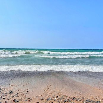
Wonderful Place Filled With Beauty! Michigan was the only state in the country I had not visited, and this area makes me feel like I wasted many years of not seeing this lovely area. Many park areas, beautiful beaches, tranquil waterfalls, serene hiking trails and terrific green landscapes make this a peaceful and relaxing place to spend some time. There is just so much to do and see here if you are like my family and love nature. I actually felt like living here in this area would be a nice idea even! What are you waiting for? Get out here and explore this wonderful place.


Wow!! We visited pictured rocks National lakeshore in early may and did the mosquito falls/chapel falls loop ending up somewhere around 11 miles total. Absolutely gorgeous! I think we were off season/very early in season and the weather was on and off threatening rain so the place was pretty empty which was great. We definitely encountered some fallen trees and muddy paths, but the views were definitely worth it. The fact there was no admission free was a great surprise bonus as well. Like much hiking in the Midwest there wasn't a whole bunch of elevation change- just a little hill to get down to the shore and back up but the lakeshore is so beautiful I didn't mind the flat terrain. The biggest surprise to me was the dirt road to get to the parking lot. I'm not sure if it's better maintained in the summer but it was a bumpy ride and on several occasions I was worried my tiny car wouldn't make it. Luckily we persevered and it was totally worth it. I would recommend it to anyone traveling in the UP.


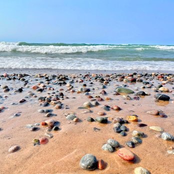
I went here for my first backpacking trip this past weekend! It was a perfect trip for a first time backpacker as the hike was mostly flat and you have the option to go as far / short as you'd like. We did ~25 miles total along the lakeshore and it was beautiful! There is many campsites along the way but they book up fast during the summer so I recommend booking early. We started at the visit center and ended by little beaver lake. We planned it out so we did 8 miles on the first day, 12 on the second day, and 4 miles the last. It was supposed to rain the weekend we went, however the weather held and it ended up being beautiful. The lake was still warm so we hopped in several times throughout our journey to cool off. The sunset was breath taking. I definitely recommend going to the lake at night to see the sunset and stars. It was absolutely amazing and so clear! There's also many options to do car camping or day hikes if you're more into that. The rocks along shore are some awesome! There's so many pretty colors and sizes. I would take a few home with you. :)


The trail if you are up for it, is good. It's lengthy and windy and many ups and down. Definitely good for sneakers or hiking boots, maybe even a hiking stick for some leverage on the inclines. Make sure as with any walks or hikes, bring water to keep yourself hydrated. As the walk will leave you parched as you go up and down small hills. It's good either way to get some fresh air, not the urban air either. Happy hiking and see cool stuff! You can drive close to by the Sand Point, Miners Castle other stops along the shore. read more
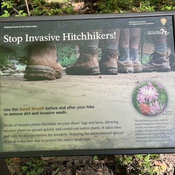


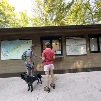


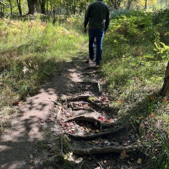


1 month ago

I've visited Pictured Rocks multiple times. The trails range in difficulty levels and length. I would say the easiest is Munising Falls, as it's 800 ft from the visitor center and the main trail is paved with asphalt with some wooden bridge areas and pretty flat. The other trails can be as long as you want them to be-you can string a bunch of them together to make a super long hike. Hiking along the cliffs is definitely worth it. The cliffs are beautiful with carved out sea cave areas and rock collapses, and the color of the cliffs are flat out gorgeous. Just be sure to bring mosquito repellent. The visitor center at Munising Falls is newly renovated and a bit bare, without a gift shop or exhibits. They're probably going to be adding that soon since the lobby is large and empty for now. The park ranger is friendly and helpful to make up for it. Next time I'll probably do a boat cruise so I can get another vantage point to admire the shores! read more
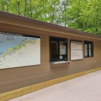
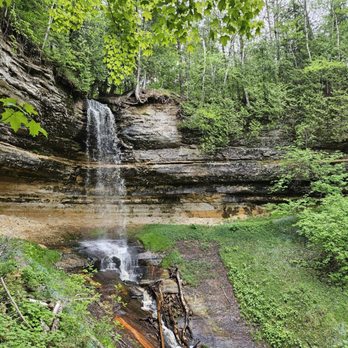


Pictured Rocks has been on my bucket list for many years. I've been to the upper Peninsula a few times, but I've never made it to this area. This is most certainly a popular attraction for tourists and if you get the opportunity book a sunset cruise to view the rocks. The entire area is full of unique trails to hike with stunning views of Lake Superior. I'm looking forward to coming back next summer. read more


2 years ago
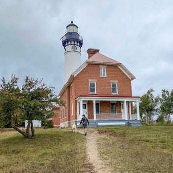
My husband and I visited Pictured Rocks National Lakeshore in September 2023 with our 2 dogs. We made sure that we respected the rules for pets within the area. We both wanted to see Chapel Rock, but it wasn't dog friendly - so each of us hiked it alone while the other sat in the car with the dogs in the parking lot. There were many people who did not respect the rules regarding pets in these areas. We definitely enjoyed our time in this lovely place. There is so much to see ! read more


11 months ago

2 years ago
Lots of nice trails, easy to follow. Good signage. Beautiful waterfalls and lake views. Trails and facilities in good condition. Entry fee of $25/car seemed well worth it for 7 day access. Be aware that cell service is spotty in this part of the state. read more


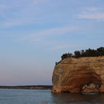
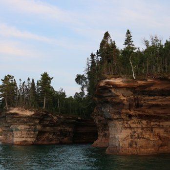
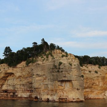
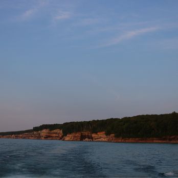
What words can I say here that will do this lakeshore justice? I genuinely don't know! Just do your heart, mind, and spirit a favor and visit Pictured Rocks National Lakeshore. It's gorgeous, in all seasons, and in all weather conditions. It's called Lake Superior for a reason. It's a NATIONAL lakeshore for a reason. This place is magnificent & truly deserves to be one of the crowning jewels of Michigan. There is so much to do all the outdoor activities here - backpack, camp, cruise, hike, do all the beach things, swim, dance, laugh, and soak up the sun and the stars. It's everything and more. The drive through Pictured Rocks on H-58 is also absolutely stunning. There is so much to do, I could spend an entire week here. I love coming back here each time I visit and each time I discover more and more beauty, activities, and fall even more head over heels for this place xoxo read more



10 months ago


6 years ago
Doesn't really get much better than hiking the National Lakeshore. We've been in the U.P. several times over the years and Pictured Rocks always wows me. This year instead of taking the boat tour, we decide to get up close and personal and hike a stretch of it. To say the views are breathtaking is simply an understatement. Going during off-peak season is also a bonus as we were virtually the only ones on the trails, and we ran into less than a handful of fellow hikers and campers. We hiked the Mosquito Falls and Chapel Falls via the Channel Loop. It was 12 miles of stellar views, some muddy muck and so much inn general to look at. It was a tiring jaunt but so worth it when we made it back to where we started. This is a hike that is a must if your ever in this area. The pictures do only a smidgen of justice. read more


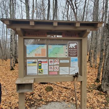


There's a calming sense of serenity when venturing the trail in the dead of winter. I saw virtually no one and you're able to view the Pictured Rocks from a different perspective than the usual photo dump of the greenery in full bloom. That being said, parts of the trail can be treacherous in the wintertime, so exercise caution, as some of the Sand Point and Cliffs camp trails will legitimately hug the edge of the rocks. read more



Before you begin this journey through paradise, I should warn you to be prepared. The sights along the path to the shore are jaw droppingly beautiful. I highly suggest wearing comfortable shoes for hiking, and ones you do not mind getting dirty. I suggest bringing a small backpack or shoulder bag that can fit necessary essentials. I felt terrible for the couple behind us because they were bitten by tons of mosquitos and we offered them some spray. Be sure to bring mosquito spray, sunscreen, water, and perhaps a beach towel. We used a nice shoulder tote that has a mini cooler at the bottom. It was not too heavy to carry, and it had all of our essentials. When you begin the journey down to the shores, it can be very confusing. They are signs along the way to help you navigate. The couple behind us ended up splitting off by going right instead as we were not sure which way to go. They ended up having to come back up to take the correct route. When we met them up at the shores, they informed us that the other route was not one you could navigate. The ground was a bit wet in some spots and muddy, so you have to walk carefully. Also, it can be narrow in quite a few spots. I must admit that I am very out of shape and the journey down was quite exhausting. However, I did enjoy the beautiful scenic route towards the water. I saw amazing and beautiful rocks. There were tons and tons of trees and plants everywhere. We got to walk along wooden paths created, with plants on both sides. It was an amazing experience. Once we reached the point of running down the sand towards the water, we felt a sense of accomplishment. You could feel the breeze from the water on the hill. The water was clear and beautiful. The sand was pretty much empty, aside from 4 teenagers to the right of us. It was like having your own secret paradise all to yourself. Going back up was tough, but manageable. It was well worth the trip down though. It was quiet and a beautiful experience. I would definitely do it again. read more




Pretty, pretty good Not five stars, but worth visit Prefer the Porkies For a place that is really in the middle of nowhere, they sure do pack them in here. The park was jam packed when I was there this past weekend. Long line to get to the viewing platform to see the falls. Hard to find parking at some of the stops. I only visited a small portion of the park - the westernmost part that is close to Munising. I visited the Porcupine Mountains Park a number of years ago and gave that a five. This was not as impressive as that so four stars here. One pro was there was no admission fee - not sure if that is all the time or just due to COVID. Cons - signage getting there is poor and no visitor center that I could find - likely would not have been open if there was one anyways with the pandemic and all. read more


5 years ago
Wonderful Place Filled With Beauty! Michigan was the only state in the country I had not visited, and this area makes me feel like I wasted many years of not seeing this lovely area. Many park areas, beautiful beaches, tranquil waterfalls, serene hiking trails and terrific green landscapes make this a peaceful and relaxing place to spend some time. There is just so much to do and see here if you are like my family and love nature. I actually felt like living here in this area would be a nice idea even! What are you waiting for? Get out here and explore this wonderful place. read more



5 years ago
Wow!! We visited pictured rocks National lakeshore in early may and did the mosquito falls/chapel falls loop ending up somewhere around 11 miles total. Absolutely gorgeous! I think we were off season/very early in season and the weather was on and off threatening rain so the place was pretty empty which was great. We definitely encountered some fallen trees and muddy paths, but the views were definitely worth it. The fact there was no admission free was a great surprise bonus as well. Like much hiking in the Midwest there wasn't a whole bunch of elevation change- just a little hill to get down to the shore and back up but the lakeshore is so beautiful I didn't mind the flat terrain. The biggest surprise to me was the dirt road to get to the parking lot. I'm not sure if it's better maintained in the summer but it was a bumpy ride and on several occasions I was worried my tiny car wouldn't make it. Luckily we persevered and it was totally worth it. I would recommend it to anyone traveling in the UP. read more


5 years ago

8 years ago
I went here for my first backpacking trip this past weekend! It was a perfect trip for a first time backpacker as the hike was mostly flat and you have the option to go as far / short as you'd like. We did ~25 miles total along the lakeshore and it was beautiful! There is many campsites along the way but they book up fast during the summer so I recommend booking early. We started at the visit center and ended by little beaver lake. We planned it out so we did 8 miles on the first day, 12 on the second day, and 4 miles the last. It was supposed to rain the weekend we went, however the weather held and it ended up being beautiful. The lake was still warm so we hopped in several times throughout our journey to cool off. The sunset was breath taking. I definitely recommend going to the lake at night to see the sunset and stars. It was absolutely amazing and so clear! There's also many options to do car camping or day hikes if you're more into that. The rocks along shore are some awesome! There's so many pretty colors and sizes. I would take a few home with you. :) read more


3 years ago

4 years ago
We took the boat trip. Abosuluely worth the $40/per person. Get seats next to window on right side. If you get car sick, ask for a bag especially for choppy waters. Make reservations in advance online. Get there early to get good seats. read more


3 years ago
3 years ago
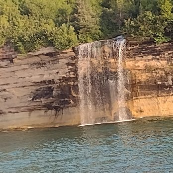
We did the falls cruise in the big boat. We sat inside in the middle behind the captain. We had a great time. My only complaint was others didn't control their children who were constantly moving & bumping into our seats. We moved & that helped. Captain knew his job. The ride was smooth and educational. I'm not sure why the rest of the crew huddled up around him. They seemed to be students? $58 is a bit of $$ but it was worth it for the 2 hours we were out. read more


3 years ago

5 years ago
So beautiful! We will have to come back because there's so much to see and do! We did Miners Castle and falls which was incredible. Our boat tour got cancelled because of the weather so that was a bummer but we will just have to come back! read more


This is a beautiful area. We only had a day to see the Shipwreck Museum, Tahquamenon Falls, and Pictured Rocks. If I had it to do over again, I would have skipped the Shipwreck museum and added the boat cruise along Pictured Rocks instead. We hiked from the trail head to the beach during the fall (September 23 was before peak color) which was cooler (temps in 50s), less crowded, and less buggy (we didn't need insect repellant). It was great to be on the beach alone. read more


8 years ago
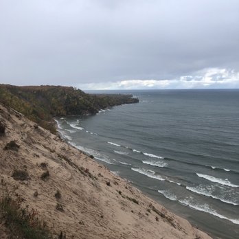
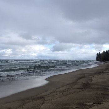
On of the best places on can see in the UP of Michigan. The park is especially beautiful in the middle-end of October. If you can't take a boat ride to see all the great places of the lakeshore start with the Log Slide up north and go all the way down to Chapel Rock, to Spray Falls, and then to Miners Castle. Incredible places to hike and to see in person. Amazing views of the Lake Superior. Beware of deer (especially in the evenings) as there a quite a lot of them crossing roads. And don't worry about bears, chances of meeting them are very low. All in all, if you're in the UP this is a must visit place! read more




3 years ago
3 years ago
3 years ago
7 years ago
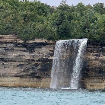
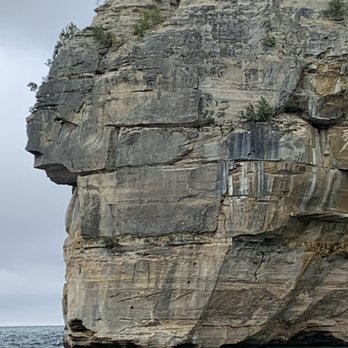
This cruise was beautiful! We took the one that went to the waterfall @ 3:00. Real chilly that afternoon and 5-6' waves so we sat inside on lower level. Perfect level for pictures. Made sure we sat ON THE RIGHT where we could open the window and take pictures (IMPORTANT IF SITTING INSIDE). Tour was nice. Captain and staff friendly and helpful for sickly. Waves slashed on window on and off the whole time. Beautiful lake, rock formations, and waterfalls along the way. Left side does get photo ops but right is better viewing. Line forms early even if chilly . Definitely worth the ride. read more



7 years ago
Breathtaking views. Fun hike that is beginner friendly! We didn't see much wildlife but the waterfalls, rock formations, and history were definitely worth the long hike. We spent about 8 hours hiking around, taking pictures, and spending some time to just take in the beauty. I highly recommend taking your time and doing the full loop. It isn't too difficult and the scenery is amazing! read more


10 years ago

12 years ago
If you live in the midwest, and you haven't been to Pictured Rocks National Lakeshore, you owe it to yourself and your family to make this trip a priority as soon as you can. SUMMARY: - Wish we had stayed in the area longer and done more hikes - DO A BOAT CRUISE - Miners Falls were the best falls - The walk out to Au Sable Light Station is TOTALLY worth it FIRST, make a hotel reservation. We didn't and almost couldn't find a room. We ended up at Super 8 Munising Wetmore Area (http://www.yelp.com/biz/super-8-munising-wetmore-area-wetmore-2?hrid=uB-kzl8Q8oir68xihwrpXQ) Note, the name is changing in September 2014. But there are other very cool, probably better places to stay for local flavor such as Sunset Motel on the Bay (http://www.yelp.com/biz/sunset-motel-on-the-bay-munising). We approached this national treasure from the south east, and went to Grand Marais first where we entered the park from the NE on 58, making our first stop The Grand able Visitors Center. The rangers were great, gave me an very accurate estimate of how long it would take to get to Musining for our 6pm cruise, and made some excellent suggestions of what we should do until we had to arrive for our boat cruise. Our first stop was the Log Slide overlook, and the view was most unexpected. The Grand Sable Dunes were impressive and beautiful from the overlook. From there were hustled to the Hurricane River parking area to walk out to the Au Sable Light Station for a 330pm tour. Its a 1.7 mile hike on the path to the lighthouse, but we did mange to arrive in time for the tour. It was worth every bit of the $3 admission per person, but BRING EXACT CHANGE, as they do not make change there. The keeper's house is slowly being rehabbed to bring it to its 1910 condition, but the work is slow, and the money is likely scant. Still, we were glad to explore the house with the ranger's excellent tour. Of course, the real treat is the 98 steps up to get to the top of the lighthouse and walk on the catwalk. The view to the Grand Sable Dunes was impressive. From that perspective, you can really see how fog rising from those dunes can create a navigational nightmare for shipping. Though pressed for time, we did take some time to walk the beach and see the ship wrecks on shore, which certainly fill the imagination. But the large amount of round rock on the beach was very colorful and captivating too, and if we had one place where I wish we had spent more time, that was where I would have spent an extra hour or two. The drive to Musining was swift, but the scenery along the road was gorgeous. We arrived in time to make our 6pm cruise with not much time to spare. IT WAS indeed the highlight of the trip. We took the 6pm cruise that went all the way to Spray Falls, and I would recommend it. Worth every penny. You can't experience all that is Pictured Rocks National Lakeshore without taking one of these cruises. It was AWESOME, in the classic definition of the word (not the urban punk usage). The next day we began with a fast stop at the Interagency Visitors Center in Musining. Worth a stop, but skip the movie they have available. It has no educational value whatsoever. It clearly needs an update. Very much liked learning about the Hiawatha National Forest at the center though, and will need to make another trip up here to explore it more. It is a real gem. From Musining we drove to the hike at Miners Falls, and that was the highlight of the second day. If you have just one waterfall to visit, make this one the one. Such a beautiful hike and such an amazing waterfall on the Musining Escarpment. We lingered and enjoyed the walk there and back from the parking lot, and because we are the family we are, we did the walking tour with the dozen or so stops and read and learned rather a bit about the forest and geology there while reading the trail guide at the posted and numbered locations. Next was Miners Castle. There is an information center there, and for NPS stamp collectors (of which I am one), there is a separate stamp you can only get there. Miners Castle was great to hike down to, and it was fun to see up close, but the best view of it was really from the boat during the cruise the night before. Very happy we stopped here because the perspective of seeing it up close and from the boat was very intriguing for the kids (11 yo daughter and 9 yo son). That was something they continued to comment on which I did not expect to be such a curiosity for them. Our visit of Pictured Rocks National Lakeshore ended with Musining Falls and Sand Point. The Musining USCG Station was an interesting stop, and Sand Point was a great view, but the gem here is the falls, which you can view from three different vantage points. There is an informative visitors center here too, and it was where my two cubs earned their Junior Ranger badges before we began our drive home. read more


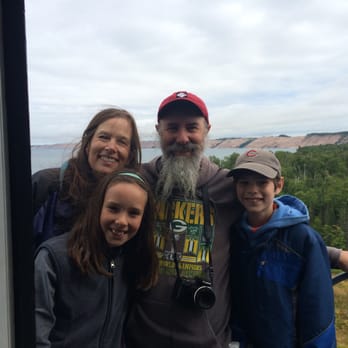


Incredible camping and hiking experience! Do your homework before you go. Know the animals and weather you can run into and how to avoid bears in your campsite. Also look up all the hikes and kayak/boat trips. There is so much to do here that you won't want to waste your time looking it up while camping. Also... You won't have phone service very often. So don't expect to be able to use your phone for a gps or to look up campgrounds. We took a car and camped at Twelvemile Campground and Bay Furnace. Both wonderful campgrounds. From there we did day hikes and a boat tour. If you love the outdoors, you will love this trip!! Give yourself several days to try to get it all in!! read more
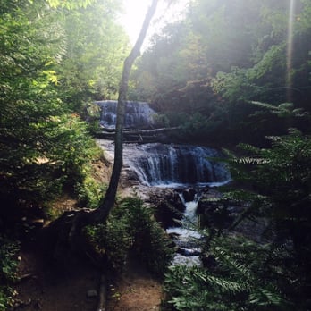


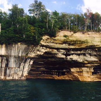


Page 1 of 2
More info about Pictured Rocks National Lakeshore
Ask the Community - Pictured Rocks National Lakeshore
We are thinking of going to visit PR the end of May/beginning of June. Is this a good time to visit? How is the weather then and water temperature?
Pictured Rocks is on lake Superior. Lake Superior water temps are ALWAYS cold even in the middle of summer... Summer is gorgeous up there but I personally love end of summer/fall
I saw a review that said "we took the one that went to the waterfall", which is that one??? We would love to see the waterfall!
It's the Spray Falls Cruise. If you go this year, you'll want to reserve a spot online in advance.
I'm going up to pictured Rock this weekend and hiking Chappel Rock, should I worry about seeing any bears?
I wouldn't worry too much about seeing bears. However, it is always important to exercise caution when hiking the backcountry. If you are worried, be sure to bring bear mace and always keep a respectful distance from any wildlife you may encounter.… Read more
Do you have to take your own boat/kayak, or do they provide one there as a rental?
There are plenty of places to rent kayaks/boats near Pictured Rocks. I highly recommend doing one of the kayaking tours as they guides are knowledgeable about the location and have great information on the history of the area.
Review Highlights - Pictured Rocks National Lakeshore




















Why does Yelp recommend reviews?
1 review that is not currently recommended
The reviews below are not factored into the business's overall star rating.

15 years ago
Pictured Rocks National Lakeshore - parks - Updated May 2026
Best of Munising
People found Pictured Rocks National Lakeshore by searching for…
Campgrounds in Munising, Michigan
Things to Do in Munising, Michigan
Off Road Trails in Munising, Michigan
Picnic Spots in Munising, Michigan
Running Trails in Munising, Michigan
Dog Friendly Trails in Munising, Michigan
Scenic Drives in Munising, Michigan
Star Gazing in Munising, Michigan
Must See in Munising, Michigan
Kids Friendly Beaches in Munising, Michigan
Hiking Trails Kid Friendly in Munising, Michigan
Sightseeing in Munising, Michigan
Parks for Picnics in Munising, Michigan
Scenic Overlook in Munising, Michigan
Boardwalk in Munising, Michigan
Landmarks in Munising, Michigan
Bathroom in Munising, Michigan
Night Hiking in Munising, Michigan
Fall Foliage in Munising, Michigan
Bird Sanctuary in Munising, Michigan
Places to Walk in Munising, Michigan
Trending Searches in Munising, MI
Boat Rental near Pictured Rocks National Lakeshore
Campgrounds near Pictured Rocks National Lakeshore
Hiking near Pictured Rocks National Lakeshore
Nurseries & Gardening near Pictured Rocks National Lakeshore
Parks near Pictured Rocks National Lakeshore
Party Equipment Rentals near Pictured Rocks National Lakeshore
Pedicure near Pictured Rocks National Lakeshore
Playgrounds near Pictured Rocks National Lakeshore
Things To Do On A Rainy Day near Pictured Rocks National Lakeshore
Things To Do With Kids near Pictured Rocks National Lakeshore
Browse Articles
Browse Nearby
BEST of Munising, Michigan Coffee near Pictured Rocks National Lakeshore
BEST of Munising, Michigan Restaurants near Pictured Rocks National Lakeshore
BEST of Munising, Michigan Things to Do near Pictured Rocks National Lakeshore
BEST of Munising, Michigan Playgrounds near Pictured Rocks National Lakeshore
BEST of Munising, Michigan Hiking near Pictured Rocks National Lakeshore
BEST of Munising, Michigan Breakfast near Pictured Rocks National Lakeshore
BEST of Munising, Michigan Campgrounds near Pictured Rocks National Lakeshore
BEST of Munising, Michigan Sledding near Pictured Rocks National Lakeshore
BEST of Munising, Michigan Motel near Pictured Rocks National Lakeshore
Browse Brands
Related Searches in Munising, MI
Affordable Kayak Rental Services in Munising, Michigan
Best Fishing Locations and Guides in Munising, Michigan
Best Nature Trails for Hiking in Munising, Michigan
Best Places for Stunning Views in Munising, Michigan
Best Things to Do on a Rainy Day in Munising, Michigan
Best Waterfalls and Swimming Holes in Munising, Michigan
Check Out Great Playgrounds in Munising, Michigan
Check Out Off Road Trails in Munising, Michigan
Discover Kid Friendly Beaches to Visit in Munising, Michigan
Discover Lakes & Ponds to Explore in Munising, Michigan
Discover Popular Photo Spots in Munising, Michigan
Discover Top Nature Parks to Visit in Munising, Michigan
Discover the Best Beaches in Munising, Michigan
Discover the Best Fishing Lake in Munising, Michigan
Discover the Best Night Hike Trails in Munising, Michigan
Dog-Friendly Hikes With Dogs in Munising, Michigan
Enjoy the Best Night View Spots in Munising, Michigan
Enjoy the Best Picnic Spots and Ideas in Munising, Michigan
Enjoy the Best Walking Trails in Munising, Michigan
Experience Stunning Sunset Views in Munising, Michigan
Explore Landmarks & Historical Buildings in Munising, Michigan
Explore Nature Spots Around Munising, Michigan
Explore Popular Campgrounds Near Munising, Michigan
Explore Popular Picnic Areas Around Munising, Michigan
Explore Popular RV Parks Around Munising, Michigan
Explore Popular Scenic Views Near Munising, Michigan
Explore Popular View Points Around Munising, Michigan
Explore Scenic Lakes to Visit in Munising, Michigan
Explore Top Gyms in Munising, Michigan Now
Family Friendly Hiking With Kids in Munising, Michigan
Find Beautiful Views in Munising, Michigan
Find Fun Kids Activities Outdoor in Munising, Michigan
Find Top-Rated Waterfalls in Munising, Michigan Now
Great Places to Swim in Munising, Michigan
Must-See Tourist Attractions Around Munising, Michigan
Popular Fishing Spots to Explore in Munising, Michigan
Popular Outdoor Activities to Try in Munising, Michigan
Popular Places to Take Pictures in Munising, Michigan
Popular Things to Do in Munising, Michigan
Popular Things to See in Munising, Michigan
Relax at Natural Hot Springs Near Munising, Michigan
Top Hiking Trails to Explore in Munising, Michigan
Top Must See Attractions and Spots in Munising, Michigan
Top Places to Visit in Munising, Michigan for Sightseeing
Top Running Trails to Explore in Munising, Michigan
Top Swimming Lakes to Enjoy in Munising, Michigan
Top Things to Do With Kids in Munising, Michigan
Top-Rated Boat Rental Services in Munising, Michigan


