1. Pictured Rocks National Lakeshore

0

Munising, MI

Cancel

Open app

Search

Pictured Rocks National Lakeshore

5.0 (1 review)

Pictured Rocks National Lakeshore Photos

More like Pictured Rocks National Lakeshore

Recommended Reviews - Pictured Rocks National Lakeshore

Your trust is our priority, so businesses can't pay to alter or remove their reviews. Learn more about reviews.
Yelp app icon
Browse more easily on the app
Review Feed Illustration
Photo of Richard F.
156
2689
12053

12 years ago

Helpful 0
Thanks 0
Love this 1
Oh no 0

Verify this business for free

Get access to customer & competitor insights.

Verify this business

Pictured Rocks National Lakeshore Miner's Castle/Beach - Miner's Beach

Pictured Rocks National Lakeshore Miner's Castle/Beach

4.8(34 reviews)
11.5 mi

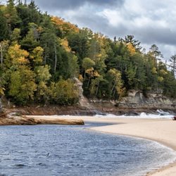
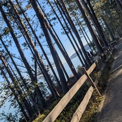
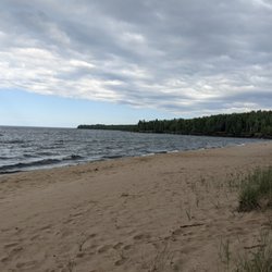
We visited Pictured Rocks in mid-May with our dog and had a great day! We hiked to Miners Castle (a…read morebit over a mile each way) from the Miners Beach parking lot and spent an hour or so at Miners Beach after our hike. The views on our hike were incredible, especially towards the top when you could start to see the Pictured Rocks. We took some time to enjoy the view from the viewing decks and our pup enjoyed getting lots of love from all the kids that were there (you can drive directly up to Miners Castle if hiking isn't your thing, there are also viewing windows for kiddos on the platforms so they can enjoy the view too). After spending some time at the top enjoying the view of Pictured Rocks/Miners Castle, we hiked down and went directly to Miners Beach. While it was a bit chilly, it was still comfortable to sit in the sand and play with our dog in shorts/tshirt! We enjoyed our day at Pictured Rocks during our trip up north and would highly recommend this hike/beach! Note - at the time of our visit, the main entrance to Miners Beach was blocked off due to emergency conditions by the National Park Service, but there was another access point a few hundred feet down the dirt path that was open/recommended for use! You do not need to hike to access Miners Beach from the Miners Beach parking lot, the main access point is directly in front of the lot and the one we used is only a few hundred feet down the dirt path.

Miner's Castle is a nice gentle hike for folks who aren't big hikers, with an upper viewing (in my…read moreopinion the better of the two), and a lower viewing point. Parking is limited, so we circled until someone left; bathrooms were more plentiful at the Miner's Castle than at National Lakeshore, but they did have some there as well. We loved the beach at the National Lakeshore; clean sand and the beautiful, Caribbean-like waters you expect from Lake Superior. Water is cold, but was so refreshing after a day of hiking and sun! Miner's Castle is a one and done spot for us, but we will definitely be back to the beach at the National Lakeshore!

Photos
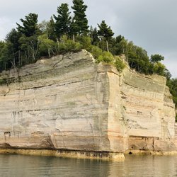
Pictured Rocks National Lakeshore Miner's Castle/Beach - View of Pictured Rocks from nearing the end of hike from Miners Beach to Miners Castle

View of Pictured Rocks from nearing the end of hike from Miners Beach to Miners Castle

Pictured Rocks National Lakeshore Miner's Castle/Beach - The trail down

The trail down

Pictured Rocks National Lakeshore Miner's Castle/Beach - Pictured Rocks view from viewing decks at Miners Castle

See all

Pictured Rocks view from viewing decks at Miners Castle

Miners Falls - This is Miners Falls.

Miners Falls

4.8(20 reviews)
19.4 mi

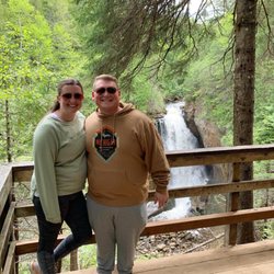
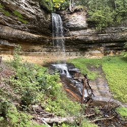
Miners Falls is a great hike for all ages and abilities in Painted Rocks National Seashore. The…read moretrail is well maintained and easy to follow. Along the way, you will be treated to beautiful forests and peaceful surroundings. When you get to the end of the trail the best viewpoint of the falls is down the set of stairs to your left. It is well worth the climb back up. The falls is 39 feet high and it has a pretty good water flow. The total distance on this hike is 1.2 miles. The parking is large and there are pit toilets at the trailhead. Signage is also good at the trailhead. We enjoyed our hike out to the falls, in all we took about 50 minutes on this hike, stopping along the way for pictures of cool trees and also taking a bunch of pictures of the falls.

Miners Falls is another great, relatively easy hike that can be done by all skill levels and I…read morewould highly recommend it as well during your Pictured Rocks trip, either before or after you make a stop at Miners Castle as well. Clocking it at 1.2 miles, it takes about half an hour to complete out and back. Miners Falls is way bigger and grander than Munising Falls, so it's definitely impressive and worth the hike out. You aren't able to get as close to it as you do to Munising Falls, you view it from 2 different viewing platforms across a wide river, but it's still impressive just the same. The hike is more intensive. It's mostly shallow, sometimes steeper in areas decline through forest on the way there, but that just means that you know the way back is going to be a constant uphill, which is a bit killer. Total elevation gain here is about 150 feet. Great part about this hike is that the trail is so WIDE, tons of space to walk and be distant from other people, not that this trail was even all that heavily trafficked by any means. When you get to the falls, the first viewpoint you get to really doesn't give you a good view. For both viewpoints, you are already looking down at the falls, and the first viewpoint, which is much higher up, is blocked by trees and at too high of an angle for you to appreciate much of anything. So it's imperative that you head to viewpoint #2, which is down one final series of steep stairs. From this viewing platform, you get a great, impressive view of the falls, get a moment to take pictures, catch your breath, before you embark on the not-so-long-but-sort-of-feels-long-because-it's-all-uphill journey back up to the parking lot. I was definitely breathing hard by the time I got to the parking lot, but it was a great, short hike to do! It really didn't hurt either that there was gorgeous fall foliage all along the road leading into the Miners Falls parking lot and spots of color along the entire hike as well. Can't be anything but happy when looking at fall rolling in! :)

Photos
Miners Falls
Miners Falls - Miners Fall

Miners Fall

Miners Falls

See all

Munising Falls - Creek between visitors center and Munising Falls

Munising Falls

4.4(20 reviews)
17.6 mi

From the parking lot to the falls, this trail is not even half a mile out and back. Definitely…read morefriendly to all skill-levels and a very easy stop at the beginning (or end) of the Pictured Rocks National Lakeshore, whichever way you look at it. Fun / sad story: My parents came here 30+ years ago, well before I was born, and it was one of their first trips after they had moved to Michigan. Back then, you were still able to walk the entire trail all the way up to the falls and then walk BEHIND the falls, so that you got to experience the water falling on one side of you and the rock wall on the other side. Over 30 years later, erosion has sadly caused it so that you can no longer walk behind the falls, there's simply not even enough pathway left to do so. So this past weekend, when I went to Munising Falls for the first time with my parents who were coming for the second time, we were all pretty disappointed to see that we could no longer walk behind the falls. Instead, now there are just three different viewpoints you can walk up to: 1) a middle, head on, from the ground up view, 2) a medium altitude, left-side vantage point view, and 3) a highest altitude, right-side vantage point, almost looking down at the falls kind of view. The highest altitude viewpoint involves quite a bit of climb and forks out early on in the path. Viewpoints 1 & 2 go hand in hand. You arrive at the first viewpoint, take some photos, then can take the staircase up a bit to the left of the viewing platform up to viewpoint #2. My group ultimately only did 1 & 2 because we were pressed for time, but I believe viewpoint #3 would have the best view of the falls out of the 3 if you're down to make the climb. If not, viewpoint #1 gets you a great view as well and I was more than satisfied with what I got to see! Onwards to the next destination!

The Munising Falls are about 800 feet from the visitor center. The main path is paved with some…read morewooden bridge areas, but overall it's a smooth trail, definitely family friendly. It follows the stream so you can hear and admire the pretty tannin-stained water. There's a trail to the lower falls which takes you to the level of the plunge pool (and then stairs from that point to a middle vantage point), but also branches to stairs to the upper falls if you want to get another viewpoint. The upper falls trail also winds close to the sandstone cliffs, some of which have been unfortunately defaced by graffiti. Overall this can be a quick stop if you're in a hurry, or you can spend longer if you take some time to absorb your surroundings. Make sure to bring bug repellent since there's plenty of mosquitoes around!

Photos
Munising Falls - Upper viewpoint path, which winds along the base of the sandstone cliffs.

Upper viewpoint path, which winds along the base of the sandstone cliffs.

Munising Falls - Twin Falls

Twin Falls

Munising Falls - Twin Falls

See all

Twin Falls

Grand Island - Ferry dock

Grand Island

4.6(8 reviews)
18.8 mi

Grand Island offers a bus tour! For those of us long past strenuous hiking or mountain biking but…read morestill wanting to explore Grand Island, there's a bus tour for day trippers! Experience and explore the highlights of Grand Island without worrying about mobility. The bus has a lift for mobility aides. Most walkways are plank board or firm gravel. Viewing area have plenty of room. The driver adjusts to the needs of the group. You get all the best of " pure Michigan " and then some. Yes, I'm talking about flies, mosquitoes, and no-see-in's. Dress accordingly and bring bug spray. Learn a bit of the fascinating history of Grand Island without over exerting yourself. Some of the nicest people you'll ever meet are in the main office. Surprise! They're also your ferry captain and 1st mate. Rich, the bus guide, is a lifelong local who loves the area and especially Grand Island. Ask him anything. He tells great stories. You'll see some fauna and a lot of flora. Overall, a most enjoyable excursion in Munising.

Based on other reviews we got lucky when it came to bugs...I do't recall even using our bug spray…read moreand we didn't have any issues. We visited the first week of September, so maybe we just got lucky. My husband talked me into biking the west rim, then cutting down the middle of the island back to the ferry. Around 20 miles. Our rental bikes were a bit tough to use with not much padding on the seat and gears that were difficult to use. My husband's chain came off at one point. The good news is that we made it in just over four hours - I was so worried about missing the last ferry at 6pm, but we actually caught the 5pm ferry. I would love to visit the island again and stay over night so we don't have to race a clock. The bike trails are tough! I'm a decent bike rider, but trail riding is tough for me. I actually was okay for the first 12 miles, but my legs and rear became sore, making the last eight miles tough. I'm super glad that I was able to complete the ride, and once again had we gotten an earlier start and didn't have to worry about catching the ferry back I think I could have relaxed and not been as worried about having to push my bike up and down some tough and washed out trails. The views on the west rim were amazing! I actually wish we would have just turned around and retraced our steps instead of going down the middle of the island to get back, which is mainly a dirt road for atvs. We will be back to explore some more and work on our bike skills!

Photos
Grand Island - The friendly crew of the Grand Island ferry service and bus tour

The friendly crew of the Grand Island ferry service and bus tour

Grand Island - Rich, Grand Island's newest and best bus guide

Rich, Grand Island's newest and best bus guide

Grand Island

See all

Scott Falls Park - Scott Falls in spring

Scott Falls Park

3.5(2 reviews)
26.0 mi

Located at Au Train Bay on Lake Superior and off Michigan Route 28, this woodsy rest stop was…read morewelcome as there really isn't much going on in this part of Michigan. With the onshore breeze, it was a nice spot for a rest and to look out over the lake. It is also pretty with the trees. There is plenty of parking, picnic tables, charcoal grills and a restroom. Take the walk to the actual Falls, though as Scott Z points out, there really isn't very much to it. A historical marker points out the history of Lake Superior and some of the earliest settlement and fur trading that passed through. [Review 17925 overall - 329 in Michigan - 1446 of 2022.]

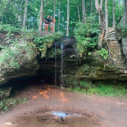
Possibly the UP's most accessible waterfall. If you know what you're looking for, you can see it…read morefrom your car as you drive past. Look for the "Scott Falls" road sign on the southern side of the road. The waterfall is teeny tiny. About 10 feet tall. It can be easily missed through the trees. But it's maybe 25 feet south of the curb. If you want to walk to the waterfall, it's safest to go in the summer. Park at the rest area on the north side of the road by the lake. This rest stop is seasonal. So it's not only a matter of the building being closed during the winter and early spring, the snow in its parking lot isn't plowed making it inaccessible. The waterfall freezes in the winter. It was a big popsickle as of late March 2018. And the path to it is covered in snow in winter. But in warmer months, you just climb down a ditch, hop across some rocks in a tiny creek, and you're there. The waterfall is cute, and you can walk under / behind it. A fun 5 minute break. And it's family friendly. Just be very careful on this 65 mph road as a pedestrian. Don't expect too much. The waterfall is quite small.

Photos
Scott Falls Park - Scott Falls Park, Au Train MI

Scott Falls Park, Au Train MI

Scott Falls Park
Scott Falls Park - Scott Falls Park, Au Train MI

See all

Scott Falls Park, Au Train MI

Fayette State Park - Nice reflection off the rocks at sunset

Fayette State Park

4.9(20 reviews)
61.1 mi

First visit to Fayette. What a history and a nice place to walk through. Unreal how much is still…read morestanding from the 1800's and amazing how much is lost.

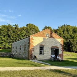
In a whim, we decided to stay one night here to tour the historical landmark town. So glad we did…read more We got a site, #18, in a Thursday night, by making a request on the website. We have had luck with all the parks finding openings within a week or two of our travel (thought we tend to travel during the weekdays in the summer) The historical iron smelting village is fascinating. The state has done a wonderful job preserving the various community buildings, the iron smelting factory and some of the homes in the community. It is truly a loving, outdoor museum. Great information on signs and plaques throughout. We visited about two-hours before sunset on a Thursday evening. We rode to the historical village and were able to ride our back to the campground , after sunset. The village is bikable which is a great if mobility is an issue. There's a lot to see and it's spread out. Excellent photo ops around sunset. The sun sets behind the community area and the buildings can be nice "props". The sun also reflects off the rocks of the Niagara Escarpment which makes for a pretty photo. We biked the handicap road back to the campground. It's an easy and direct route between the two areas. There are clearings among the trees to get a wonderful, private view of the sunset. The trip is worth it simply to check out the historical community. What a gem in the UP. The campground was fun, yet busy and crowded for our tastes. Site 18 is good for a tent with some fairly flat grassy areas around it. The bro G bird behind and to one side of had RV's and were flexible about letting us spread into their site to find a good place for our tent. Similarly, the neighbors to our right, #20, camped in the bed of their truck. They struggled to find a level space and were concerned about mid with possible space. They parked partially on our site. It all worked out; we had great neighbors, but it was a bit of juggling. The fire rings can also be closer to a tent than we prefer. The washroom was close by and was clean. Small number of shower stalls to share with lots of people. Other sites looked larger and might have offered more privacy. The star of the show is accessibility to Lake Michigan. Wonderful sandy beaches. Lots of good walking, hiking. We would return to have more time to check out the peninsula. We had dinner at a fun restaurant in the water, not far from the campground (10-minutes): The Dock Grill & Bar. Nice people. Beautiful patio view of the water and good "bar food" options. The Shell gas station also has a mini mart with good meat and deli items, some grocery selections and frozen food.
Photos
Fayette State Park - Good to explore on bike
Good to explore on bike
Fayette State Park - Kiddos in the water

Kiddos in the water

Fayette State Park

See all

Pictured Rocks National Lakeshore - parks - Updated October 2026

Loading...
Loading...
Loading...