Cancel

    Open app

    Search

    Mule Canyon Interpretive Site

    5.0 (1 review)

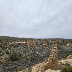
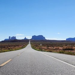
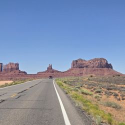
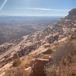
    Mule Canyon Interpretive Site Photos

    More like Mule Canyon Interpretive Site

    Recommended Reviews - Mule Canyon Interpretive Site
    Your trust is our priority, so businesses can't pay to alter or remove their reviews. Learn more about reviews.
    Yelp app icon
    Browse more easily on the app
    Review Feed Illustration

    8 months ago

    Helpful 1
    Thanks 0
    Love this 1
    Oh no 0

    Verify this business for free

    Get access to customer & competitor insights.

    Verify this business

    Newspaper Rock State Historic Monument - Newspaper Rock Trail

    Newspaper Rock State Historic Monument

    5.0(7 reviews)
    25.3 mi

    This is one of the West's most famous rock art sites, with a high density of petroglyphs. It was…read morebreath-taking as this is a massive expanse of rock all covered in etchings that are as old as 2,000 years ago. It had me contemplating our current existence and what things would look like 2,000 years from now. It was right off the road with a small parking lot with vault toilets. I came during the off season so the lot was empty, but it gets busy enough that there are traffic signs preventing people from parking on the road. Free to park and walk on the sidewalk to the cliff face.

    NOTE: This petroglyph wall is not located in Monticello, but outside of town about 30 minutes. It's…read moreon Highway 211, on your way from US-191 into the Needles District of Canyonlands. I fixed the pin drop marker here on Yelp, but these things can be finicky. It's marked and on the side of the road, but GPS crowds can set to: 37.9879209, -109.5188924. Man, I really love this spot. I mean, it's a nice little get-out-and-stretch and won't take you more than a few minutes, but it's a nice roadside pull-off when you're already off and rolling on adventure. I first visited in 2005 or so and was struck by just how prolific all the petroglyphs are. Sometimes you only see a few in one place, but here at Newspaper Rock, it's plastered with characters. Pull off the highway, park, and walk up the paved path. It'll take you less than two minutes, so almost anyone from grandma to the little ones can make it. There's a small fence at the base of the rock to keep you from touching the panel, but you get a front row seat to the artwork. This is very near a campground, but there is a small toilet facility here so you can hit that up before you get into the park, or out to Lockhart, or wherever your travels are taking you. Note that this is not the only panel in the area. If you keep driving, pay attention to the cliffs and the walls around you--you can spy a few characters. But they're sparse, and in comparison to this amazing display, they may barely register. That's what makes this mysterious spot (but why were ancient inhabitants all tagging it???) so wonderful.

    Photos
    Newspaper Rock State Historic Monument - Path the the rock

    Path the the rock

    Newspaper Rock State Historic Monument - Sign about the area

    Sign about the area

    Newspaper Rock State Historic Monument - The rock itself!

    See all

    The rock itself!

    Forrest Gump Point

    Forrest Gump Point

    4.8(26 reviews)
    45.7 mi

    I didn't even know this place was a thing until I was mapping out our Spring Break road trip! It…read morejust so happened we were going to be driving right by here, so we decided to make a stop. My oldest had just recently watched the movie, so she remembered the scene. They have signs to clearly mark where to stop based on the movie. And there is parking available along the road in several spots so you can stop and take your photos. There are also some vendors with booths selling items for the Navajo Nation. It was VERY windy when we were there. Also, be careful with all the cars driving through.

    This photo spot is quintessential for any road trip going towards (or even away from) Oljato…read moreMonument Valley. Cameras just don't do it justice -- it's really impressive to stop, get out of your car, and just take in the vastness of the valley and the land formations in the distance. It really embodies the spirit of America that I think makes this country special and beautiful. There are a handful of vendors around the area mostly selling native American creations and snacks. It makes sense, given that even though this is just a quick photo-op spot, the foot traffic is WILD. There were so many cars stopping for pics; it's kind of difficult to get a photo without anyone in it and it is HIGHLY discouraged to try to get a pic in the middle of the road because cars come FAST, and some of the hills can make it challenging to see when they're coming. But definitely at least get a pic on the side of the road!

    Photos
    Forrest Gump Point - Maggie

    Maggie

    Forrest Gump Point - Have fun

    Have fun

    Forrest Gump Point

    See all

    Moki Dugway

    Moki Dugway

    4.6(11 reviews)
    34.9 mi

    Reading blogs online made my scared to do this drive. But after telling my husband about it there…read morewas no turning back. It was so much FUN. And in decent weather, it was easy in our SUV. We saw an RV coming down the pass which looked ridiculous and scary but we had a blast!!!

    Moki Dugway for those who are possibly wondering exactly what is a Moki Dugway....it's…read moresimple....this is a very short, yet windy and steep uphill drive for 3 miles and 1200 feet reaching the top of Cedar Mesa. So what makes it so special??? Well, for me, it was just the drive. For the 3 miles, it's on dirt road. The speed limit and it's posted is 5 MPH. Yes...go slow and take your time. I have a fear of heights so driving up...on the right hand side is the view of the surrounding desert area of Southeastern, Utah. And the drive up wasn't anything difficult or dangerous, but from time to time I had to sort of move over towards the left of the road just in case, lol...to be safe. That's all. But...I came here to Moki Dugway in early afternoon right after I completed exploring Valley of the Gods. And I'd basically say Valley of the Gods is a miniature version (or even on the same level) as highly acclaimed Monument Valley! I exited Valley of the Gods on the west side along Highway 261 and literally the start to Moki Dugway was like 1 - 2 miles down the road. There really weren't any official signs saying this was Moki Dugway, but signs were posted that you'll be driving uphill on a much elevated degree along a dirt road for the next few miles. So...you'll know you're on Moki Dugway when you see it. I found there to be plenty of little roadside pullovers to stop, get out of my car and not only appreciate the fresh air, but the scenic and wide open views among the heart of the desert of secluded Mexican Hat, Utah. And...I drove Moki Dugway up to the top of Cedar Mesa and didn't stop from there. Combined with Moki Dugway was heading to Muley Point. To arrive at Muley Point I made a left onto the first road at the top of the Dugway. There wasn't a sign for Muley Point. You just have to trust that it'll be the immediate first left up at the top. Then...it's an easy 5 mile drive along a gravel road to the overlook. Once again...there weren't any signs for Muley Point when I arrived...but I knew what it was because there was no road left to drive. From there, I exited my car and headed to see what Muley point was all about. Just a few extra points...there were posted signs at the start of Moki Dugway that no RV's were allowed to drive up it. And I can understand that. They're just too big. Also, my basic mid-sized car had no issues traversing it. When I visited here in early afternoon back in September....the good news about witnessing Moki Dugway is that I had the sun facing my back so my photographs came out nice, clear and vibrant. I'd recommend coming here in the afternoon instead of possibly fighting the sun in morning time. Some may think that Moki Dugway and Muley Point are completely remote, yet that's not true. I actually started my day hanging out at Goosenecks State Park nearby...then drove 17 mile Valley of the Gods for a few hours and ultimately headed towards Bluff, Utah and Natural Bridges National Monument the following day. Also, when I did drive up...maybe I passed just a few cars headed in the opposite down the Dugway. Point is...it's not a crowded landmark. I had cell phone reception from time to time from what I remember. Lastly I'd say about 3/4's of the way to the top of Moki Dugway, I found the best opportunities to pull my car off to the side, step out and grab good pictures. So, as you'd expect the higher I went and definitely towards the top of Cedar Mesa...were the ideal views and opportunities for photos. Although Moki Dugway wasn't 5 stars for me...(I mean the views were good, not totally off the charts) it was still certainly worthwhile to come drive it while I was in the area. Combined with other attractions around Mexican Hat, I'm a fan of it.

    Photos
    Moki Dugway
    Moki Dugway - Viewpoint

    Viewpoint

    Moki Dugway - Road to the top entrance

    See all

    Road to the top entrance

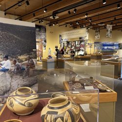
    Canyons of the Ancients National Monument - Museum lobby

    Canyons of the Ancients National Monument

    4.6(17 reviews)
    52.1 mi

    Simply amazing. I would stop by the visitor center and museum first before exploring the pueblos…read moreand other locations that make up this national monument. The visitor center and museum have a lot of artifacts and information about how scientists research the artifacts and structures of the Pueblo peoples. It helps put into context the other sites that are part of this national monument. It kind of made me feel like an archaeologist when I identified some potsherds later on my hikes and could identify which Pueblo Era they came from. Definitely worth a stop!

    Canyons of the Ancients National Monument and Visitor Center are a worthwhile destination or a…read moreshort diversion, if you are in SW Colorado. Inside, there are educational movies about the history of the Puebloan Indians who inhabited the plains 1200 years ago, and then suddenly left about 1300. There are numerous exhibits about these people, their tools, their cooking implements, their arrow heads, basketry, housing, etc. It is well laid out and then there are descriptions of several deserted Pueblos within an hour or two of the visitor center. Your national park pass will get you entrance, or a small fee if you don't have one. With the Federal workforce cuts, staffing is minimal, so be patient and respect the work these Rangers do for us every day. Wish I had visited this site before I went to Mesa Verde National Park last year as it added an additional perspective to the way some of our SW native Indians lived.

    Photos
    Canyons of the Ancients National Monument - Exhibits

    Exhibits

    Canyons of the Ancients National Monument - Exhibit- life sized

    Exhibit- life sized

    Canyons of the Ancients National Monument - Cooking Pottery exhibit

    See all

    Cooking Pottery exhibit

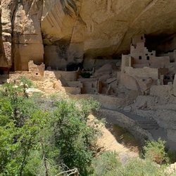
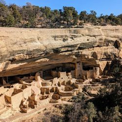
    Mesa Verde Cliff Palace - Rees's Roots - Cliff Palace Mesa Verde National Park Colorado

    Mesa Verde Cliff Palace

    4.9(11 reviews)
    62.0 mi

    Wow, Cliff Palace completely blew my mind. I was amazed at the dwellings we saw, how well preserved…read morethey were, and our guide gave us so much information throughout the tour. You need to book a tour in order to get close to the dwellings at Mesa Verde. Otherwise you can only see them from the overlooks. I would definitely recommend a tour as it's impossible to get a feel for the dwellings without actually being in them. We had a short walk down to Cliff Palace and there were a few ladders to climb, but overall the tour was not strenuous and my out of shape 50+ year old self didn't have any difficulty. I would recommend a morning tour to beat the heat. We also toured Balcony House, and if I had to choose just one, I'm not sure which one I would pick. Be sure to book early on the National Parks website and don't miss an up close tour of a dwelling when you visit Mesa Verde.

    I visited Cliff Palace on July 5, 2026. I was lucky that I was able to get tickets two days before…read morebecause I found a cancellation on the recreation.gov website. So if you are like me and did not know that you had to book them a couple of weeks ahead of time, then constantly check the website as there might be cancellations for some of the tours. I managed to also get tickets to the Long House tour. My tour of cliffs Palace was at 10:30 AM, and my tour of longhouse was at 1:45 PM. This was enough time to allow us to see the different overlooks near Cliff Palace and then drive over to the Weatherill Mesa. However, our stops were not long since the drive between Cliff Palace and Weatherill Mesa is long. Parking was very easy and there were also restrooms available, we met the Ranger at a shaded sitting area right at the entrance of the trail that takes you to the Cliff Palace overlook. The Ranger did mention that although she was sitting there and most people were gathering there, that the official meeting point is actually the overlook. So we headed over to the overlook a few minutes before the start of the tour to make sure that everybody else had found our group. The tour was informative and we also were able to watch another Ranger who played the flute at Cliff palace while we were standing at the overlook. It was a magical experience. The tour goes down some stairs, where there are some metal railings that can be a bit hot. The steps are carved onto the rock or made of rocks, so they are somewhat don't even and also high. Then we walked through a short trail and then up a ladder. All in all it was not as difficult as the signs made it to be, although you still need to be fully able to do all of those things in order to get in and out of the site. Also make sure that you have a backpack, hat and plenty of water as you need to have both hands-free and available for holding on to the ladders or rocks in order for you to be safe. The side itself was awe inspiring. And such a great way to learn about the ancient Pueblo inhabitants. After visiting Cliff Palace, we had to go through a different trail that went up more stairs that were carved into the rock, which can be narrow due to the Rocks around them, and although I am somewhat claustrophobic, I feel perfectly fine. Also, the Ranger told us to take our time and climb out safely. All in all it was a great tour and I highly recommend it.

    Photos
    Mesa Verde Cliff Palace - Instagram: @telephonesmoothie

    Instagram: @telephonesmoothie

    Mesa Verde Cliff Palace - Rees's Roots - Cliff Palace Mesa Verde National Park Colorado

    Rees's Roots - Cliff Palace Mesa Verde National Park Colorado

    Mesa Verde Cliff Palace - Rees's Roots - Cliff Palace Mesa Verde National Park Colorado

    See all

    Rees's Roots - Cliff Palace Mesa Verde National Park Colorado

    Mule Canyon Interpretive Site - landmarks - Updated July 2026

    Loading...
    Loading...
    Loading...