Monument Corridor Trail Photos


You might also consider
More like Monument Corridor Trail
Recommended Reviews - Monument Corridor Trail
Start your review...

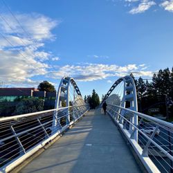
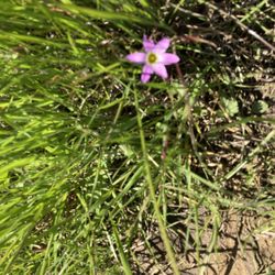
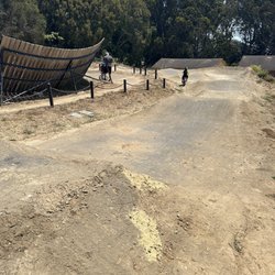
The Monument Corridor Trail is a short shared used trail located in the heart of Concord. It can be accessed across the street from the 7 Eleven off of Mohr lane and Monument Blvd or on Market street behind the self-storage building. I love discovering new trails and I've had my eye on this one for quite some time. Part of this trail is parallel to the infamous Iron Horse trail that runs alongside the 680 freeway. If you're looking for beautiful views and wildlife... unfortunately, this is won't be the trail for you. This trail is really short and runs about a mile and a half one way. You will find many locals taking a short brisk walk or run along this trail. There isn't really any parking. I walked from my house to the trail, which is about a mile and a half away. The tunnel underpass was pretty dirty but was to be expected since there are homeless and careless teenagers roaming around. What I do like about this trail is that it connects to the Iron Horse Trail at the Monument Blvd entrance. So if you are a local, you have an easy connector trail to the Iron Horse. Overall, this wouldn't be a trail that I would frequent. However, I would definitely use it when I feel like taking a quick run. read more


More info about Monument Corridor Trail
Concord, CA 94518
Directions
Hours
Outdoor Amenities
You might also consider


Monument Corridor Trail - hiking - Updated May 2026
Best of Concord
People found Monument Corridor Trail by searching for…
Hiking Trails in Concord, California
Walking Trails in Concord, California
Running Trails in Concord, California
Scenic View in Concord, California
Secret Spots in Concord, California
Kid Friendly Hiking Trails in Concord, California
Stroller Friendly Hikes in Concord, California
Walking Groups in Concord, California
Off Road Trails in Concord, California
Easy Hikes in Concord, California
Beautiful Views in Concord, California
Off Leash Dog Hikes in Concord, California
Pump Track in Concord, California
Hiking With Kids in Concord, California
Romantic Views in Concord, California
Things to Do on a Rainy Day in Concord, California
Secluded Spots in Concord, California
Shaded Hike in Concord, California
Things to Do With Teenagers in Concord, California
Things to Do With Kids in Concord, California
Cycling in Concord, California
Sunrise View in Concord, California
Trending Searches in Concord, CA
Boat Rental near Monument Corridor Trail
Botanical Gardens near Monument Corridor Trail
Bounce House Rentals near Monument Corridor Trail
Campgrounds near Monument Corridor Trail
Cherry Picking near Monument Corridor Trail
Cliff Jumping near Monument Corridor Trail
Dog Friendly Things To Do near Monument Corridor Trail
Dog Friendly Trails near Monument Corridor Trail
Flower Fields near Monument Corridor Trail
Flower Shop near Monument Corridor Trail
Free Picnic Areas near Monument Corridor Trail
Garage Sales near Monument Corridor Trail
Hair near Monument Corridor Trail
Hiking near Monument Corridor Trail
Lakes & Ponds near Monument Corridor Trail
Lookout Points near Monument Corridor Trail
Nurseries & Gardening near Monument Corridor Trail
Outdoor Activities near Monument Corridor Trail
Outdoor Furniture Stores near Monument Corridor Trail
Party Equipment Rentals near Monument Corridor Trail
Pedicure near Monument Corridor Trail
Pick Your Own Farms near Monument Corridor Trail
Picnic Areas near Monument Corridor Trail
Places To Take Pictures near Monument Corridor Trail
Plant Nursery near Monument Corridor Trail
Rock Quarry near Monument Corridor Trail
Running Trails near Monument Corridor Trail
Scenic Drive near Monument Corridor Trail
Scenic Night View near Monument Corridor Trail
Scenic Places To Walk near Monument Corridor Trail
Secluded Spots near Monument Corridor Trail
Secret Spots near Monument Corridor Trail
Star Gazing near Monument Corridor Trail
Strawberry Picking near Monument Corridor Trail
Sunrise View near Monument Corridor Trail
Swimming Holes near Monument Corridor Trail
Walking Trails near Monument Corridor Trail
Browse Nearby
BEST of Concord, California Restaurants near Monument Corridor Trail
BEST of Concord, California Coffee near Monument Corridor Trail
BEST of Concord, California Things to Do near Monument Corridor Trail
BEST of Concord, California Walking Trails near Monument Corridor Trail
BEST of Concord, California Parks near Monument Corridor Trail
BEST of Concord, California Breakfast near Monument Corridor Trail
BEST of Concord, California Campgrounds near Monument Corridor Trail
BEST of Concord, California Sightseeing near Monument Corridor Trail
BEST of Concord, California Hotels near Monument Corridor Trail
Browse Brands
Related Searches in Concord, CA
Affordable Bike Repair Services in Concord, California
Affordable Bike Tune Up Services in Concord, California
Affordable Kayak Rental Services in Concord, California
Affordable Road Bike Rental in Concord, California
Best Dog Hiking Trails Around Concord, California
Best Electric Bike Rental Services in Concord, California
Best Fishing Locations and Guides in Concord, California
Best Nature Trails for Hiking in Concord, California
Best Places for Horseback Riding in Concord, California
Best Sledding Spots and Fun in Concord, California
Best Used Bikes for Sale Near Concord, California
Check Out Off Road Trails in Concord, California
Discover Dog Friendly Trails to Explore in Concord, California
Discover Kid Friendly Hiking Trails in Concord, California
Discover Popular Bike Tours in Concord, California
Discover Scenic Bike Paths in Concord, California
Discover Scenic Hiking Trails in Concord, California
Discover Scenic Mountain Bike Trails Near Concord, California
Discover Scenic Waterfall Spots in Concord, California
Discover Walking Parks in Concord, California Near You
Discover a Hiking Trail in Concord, California
Discover the Best Night Hike Trails in Concord, California
Dog-Friendly Hikes With Dogs in Concord, California
Enjoy Biking Adventures Around Concord, California
Enjoy Camping Adventures Around Concord, California
Enjoy Exciting Mountain Biking Adventures in Concord, California
Enjoy Hiking Adventures in Concord, California
Enjoy Kayaking Adventures in Concord, California
Enjoy Tent Camping Spots Around Concord, California
Enjoy a Beautiful Waterfall Hike in Concord, California
Enjoy a Peaceful Nature Walk in Concord, California
Enjoy the Best Picnic Spots and Ideas in Concord, California
Enjoy the Best Tubing Experiences in Concord, California
Enjoy the Best Walking Path in Concord, California
Enjoy the Best Walking Trails in Concord, California
Explore BMX Bike Shops Near Concord, California
Explore Beautiful Mountains and Hiking Spots in Concord, California
Explore Beautiful Parks and Green Spaces in Concord, California
Explore Bike Rentals Throughout Concord, California
Explore Easy Hikes Perfect for All in Concord, California
Explore Electric Bikes Available in Concord, California
Explore Fun Activities to Do in Concord, California
Explore Popular Campgrounds Near Concord, California
Explore Popular Scenic Overlook Points in Concord, California
Explore Scenic Lakes to Visit in Concord, California
Explore Secret Spots Worth Visiting in Concord, California
Explore the Best Beach Spots in Concord, California
Explore the Best Swimming Holes Around Concord, California
Browse Articles
People who viewed Monument Corridor Trail also viewed
Blue Oak Shortcut Trail
2 reviews
Acalanes Ridge Recreation Area
16 reviews
Ygnacio Canal Trail
3 reviews
Lime Ridge Open Space - Concord
20 reviews
Lime Ridge Open Space
33 reviews
East Bay Casual Hiking Group
12 reviews
Howe Homestead Park
14 reviews
Sugarloaf Open Space
14 reviews
Callippe Preserve Trail
6 reviews
Pacheco Marsh
2 reviews