Mexican Hat Rock Photos


More like Mexican Hat Rock
Recommended Reviews - Mexican Hat Rock
Start your review...


Reviews With Photos


This rock formation is so cool that they named the nearby town after it. Mexican Hat Rock is a sombrero-shaped rock near the San Juan River in Utah. Mexican Hat town has a very small population of under a hundred. Mexican Hat Rock is easy to spot when driving down the 163. The rock formation balances a rock in the shape of a pancake atop of a 300-foot-high cone. There is a short road that leads up to the rock formation if you want to get a closer look at it. No fee required.


There's not a whole lot to say about Mexican Hat Rock. It's a cool natural rock formation that looks like it sounds like it looks... but it's definitely worth the stop and pictures! When driving, it's more difficult to see when heading north... but if you're traveling toward it heading south, then you're in for a treat! Cool roadside stop with no admittance fees and just a short drive off the expressway! Go check it out! *****FIVE STARS*****


Mexican Hat Rock is outside Monument Valley and nearby Goosenecks State Park, along US 163 that overlooks the San Juan River. In the tiny town of Mexican Hat is this unique, naturally occurring, rock formation that resembles a sombrero with a wide brim right above a narrow head (see my photos). You can hike to the Mexican Hat, however the trail is not well defined (you will walk down a dirt road). There are beautiful views and scenery of the land and you can also see Monument Valley from here. My husband, our little girl dog and I came by here on a Tuesday afternoon, around 3:30 pm and then again a little before 6 pm since we decided to get a photo of our girl wearing a hat with this rock formation in the background (our little girl is pretty easy going and will do things for treats, lol) after visiting Forrest Gump Point that isn't too far from this location. If you are already driving to Monument Valley (or from if you are coming from the other way), it wouldn't hurt to add this to your list of sight seeing.


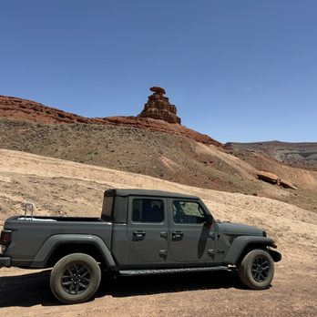
I loved coming to this because it was FREE and I just bought a Jeep so perfect to do some terrain 4x4 driving. It's very hot out there. People camp here it seems as there was barbecue spots. I did not climb up unlike others.


Perplexing and gorgeous . Go see it!! Be prepared to have no cell service. The people in the little town are nice. We stayed in a yurt in Mexican Hat, UT. We could see Mexican Hat Rock from our window when we woke up in the morning. Very cool!


On our way to Monument Valley, we made a photo stop at Mexican Hat Rock in Southeast Utah. It would be good idea to stop here if you are doing the same thing. It's located a few miles north of the small village of Mexican Hat (named after the sombrero-looking formation) and about 25 miles (40 km) north of the Utah/Arizona border. Mexican Hat's 60-foot (18.3 m) diameter cap rock is known to be the oldest being over 300 million years old! Make a stop here. It is very hot, no shade. Take water. There was no trail, I didn't see any. You can take the pic easily. There is no restroom or anything else, so just a roadside attraction with amazing history. This can be seen from quite far away but there is a dirt road that goes from the highway and runs around the formation. It is worth driving up to see it.


As we were on our way to Monument Valley, we drove right by this rock formation. It definitely looks like what it's title describes. It is on a census designated place on the San Juan River and borders the Navajo Nation within the San Juan River county. We pulled over and shot a quick picture and then we were on our way. The rock itself takes up about 8.5 miles. It is close to Valley of the Gods park as well as Gooseneck Park is nearby. Not too much more to say except the question remains as to how this structure was created. I suppose lots of wind and erosion over time. This is a fun spot to stop and have a bite, take a pic and move on. I suppose some chips and salsa would be delicious right here!


(sung to the tune of La Cucaracha) Mexican Hat Rock, Mexican Hat Rock This a review about a Boulder Yes a Boulder, a giant Boulder That was carved out of Bedrock! ¡Olé! This is either the highlight of my Yelp career, or my all-time low―you decide! But, yes, I'm actually reviewing a rock. Not just any rock, mind you, but a giant 60' wide × 12' thick sandstone outcropping that curiously resembles a giant Sombrero! Was it (A) Dropped and left there thousands of years ago by a drunken Rock Monster (B) Aliens trying to communicate with us, or (C) Just a bizarre anomaly of wind and erosion over thousands of years?? Science would have us believe it's (C), but you know how them fancy, know-it-all types are! You and I, we know the truth... We. Know. The. Truth!!! 0_o *Ahem* I digress from the truth ―for the moment― and give you some "facts." Mexican Hat Rock is so (*Trump Voice*) Huuuuuge that there is an 8.5 square mile town surrounding it, and named after it. Well, technically, it's not a town, per se, but a "census-designated place" that has a whole 31(!!) people living there; as of the 2010 census. There are also several hotels/lodges, a Mexican joint, a Steak House―and is noted on the list of "Unusual Place Names" (https://goo.gl/ERjYrI)! How many other rocks can claim that?! Huh?? Suck it, Gibraltar! Located 20 miles from Monument Valley; 13 miles south of Valley of the Gods; 9 miles from Goosenecks State Park and only 6 miles from Alhambra Rock! If any of those places are on your to-do list I highly recommend taking the short drive to Mexican Hat. It's neat, fun and you don't even have to get out of your car! Just beware that the Rock Monster might come back to look for his Sombrero. After all, it is a fine piece of haberdashery, if I do say so myself.
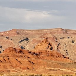

This is a fun-shaped rock that you can easily drive passed and miss if you're not looking for it! I wouldn't go here as the top destination, but if you're near Monument Valley and are looking to enjoy a scenic drive this rock is a fun, silly, almost UFO-like saucer shape that'll make you smile. When you're driving here, be sure to check out Goosenecks State Park right around the corner, a short drive a way.


A really cool tourist attraction to see while driving through Utah. This rock is shaped like a sombrero, hence the name Mexican Hat Rock. Just one of the many wonders in this great nation of ours...and yes, when we stopped, I took a cheesy selfie with the hat rock in the background. It was a good place to stop, stretch, and take a breather from driving while on the way to Colorado. It really is a neat sight to see.


I can't say it was visually impressive. Geologically speaking this is a marvel of nature and a billion to one chance of it happening any where else. I came here in the middle of a warm Spring day and it was not that exciting compared to Monument Valley or Zion. We had a fake 4 wheel drive which enabled us to take on the dirt road so we got closer to this rock without having to hike in the heat. But we almost got stuck not being able to turn around on the dirt road.


I've heard of Mexican Hat because it is an interesting name for a town. On our drive to Monument Valley, I saw what the town was named after. Mexican Hat is actually a 60 foot wide rock which sits on top of a smaller rock. Apparently, many folks thinks it resembles a Mexican Sombrero. Personally, I think it looks more like a mushroom. There is a dirt road off Hwy 163 which leads to the Mexican Hat Rock. Unfortunately, we did not have the time to get closer. Would have been nice to climb that rock (if allowed), and take some pics of the beautiful scenery all around. Oh well, maybe next time. For now, I will have to settle for some pics of the rock from the highway. If you find yourself in this part of the country, you may want to check it out.


This unique rock formation is located just north of the town of Mexican Hat, UT. You can pull off US-163 onto a dirt road. There is a sign saying this is private property, so we weren't sure how far we should go. We drove a little ways, stopped, and took a few pictures before turning around to leave. This is a 300 ft tall and 60-foot wide red sandstone formation. On one website it says it looks like an upside-down sombrero. Oh, now I "see" it!! I didn't really think it looked like a sombrero, but it makes sense that it is upside-down! If you find yourself driving by, it will be hard to miss. Take a few moments to take a look. It is pretty cool! read more


3 months ago
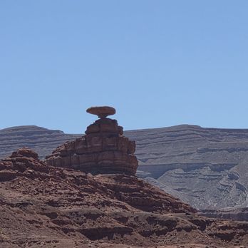
The Mexican Hat rock is cool, it's a quintessential thing to do if you're road tripping from Utah to Arizona and going towards the Oljato Monument valley for sure. You can even see the rock in the distance from the main freeway, but there is a turn off the highway that takes you maybe 10-15 minutes down a fairly smooth dirt/dust road that gets you closer. I think some people get out of the car and maybe even try to walk closer, but I didn't want to do that since I think some of the area is private property and there's not really any specific place to "park." The road does eventually end at a little turn around that takes you back the way you came to the freeway. Re: the rock itself, it's neat to see the little thing balancing/looking like it could fall any minute because of the narrow base. I tried taking some pics but from the road it's so small by the camera's eye that I think photos just don't do it justice. It's an easy pit stop and takes just a few minutes so I'd definitely say it's worth it to drop by! read more


4 months ago
Mexican Hat Rock was a neat stop on our road trip. Located just outside the tiny town of Mexican Hat, the famous rock formation really does look like a sombrero balanced on top of a narrow base. I didn't have my 4x4 vehicle for our trip, as a result, we weren't sure about taking the dirt roads to get closer, so we played it safe and admired it from afar. Even from a distance, it's a unique sight and worth a quick stop if you're passing through. Kind of reminded us of Radiator Springs lol! The surrounding scenery is beautiful, and it's conveniently located near Goosenecks State Park, Monument Valley, and Valley of the Gods. read more


This rock formation is so cool that they named the nearby town after it. Mexican Hat Rock is a sombrero-shaped rock near the San Juan River in Utah. Mexican Hat town has a very small population of under a hundred. Mexican Hat Rock is easy to spot when driving down the 163. The rock formation balances a rock in the shape of a pancake atop of a 300-foot-high cone. There is a short road that leads up to the rock formation if you want to get a closer look at it. No fee required. read more


There's not a whole lot to say about Mexican Hat Rock. It's a cool natural rock formation that looks like it sounds like it looks... but it's definitely worth the stop and pictures! When driving, it's more difficult to see when heading north... but if you're traveling toward it heading south, then you're in for a treat! Cool roadside stop with no admittance fees and just a short drive off the expressway! Go check it out! *****FIVE STARS***** read more


Mexican Hat Rock is outside Monument Valley and nearby Goosenecks State Park, along US 163 that overlooks the San Juan River. In the tiny town of Mexican Hat is this unique, naturally occurring, rock formation that resembles a sombrero with a wide brim right above a narrow head (see my photos). You can hike to the Mexican Hat, however the trail is not well defined (you will walk down a dirt road). There are beautiful views and scenery of the land and you can also see Monument Valley from here. My husband, our little girl dog and I came by here on a Tuesday afternoon, around 3:30 pm and then again a little before 6 pm since we decided to get a photo of our girl wearing a hat with this rock formation in the background (our little girl is pretty easy going and will do things for treats, lol) after visiting Forrest Gump Point that isn't too far from this location. If you are already driving to Monument Valley (or from if you are coming from the other way), it wouldn't hurt to add this to your list of sight seeing. read more


I loved coming to this because it was FREE and I just bought a Jeep so perfect to do some terrain 4x4 driving. It's very hot out there. People camp here it seems as there was barbecue spots. I did not climb up unlike others. read more



4 years ago
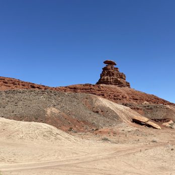
Perplexing and gorgeous . Go see it!! Be prepared to have no cell service. The people in the little town are nice. We stayed in a yurt in Mexican Hat, UT. We could see Mexican Hat Rock from our window when we woke up in the morning. Very cool! read more


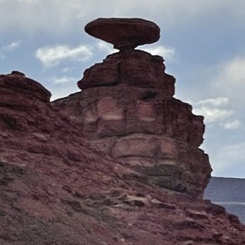


On our way to Monument Valley, we made a photo stop at Mexican Hat Rock in Southeast Utah. It would be good idea to stop here if you are doing the same thing. It's located a few miles north of the small village of Mexican Hat (named after the sombrero-looking formation) and about 25 miles (40 km) north of the Utah/Arizona border. Mexican Hat's 60-foot (18.3 m) diameter cap rock is known to be the oldest being over 300 million years old! Make a stop here. It is very hot, no shade. Take water. There was no trail, I didn't see any. You can take the pic easily. There is no restroom or anything else, so just a roadside attraction with amazing history. This can be seen from quite far away but there is a dirt road that goes from the highway and runs around the formation. It is worth driving up to see it. read more


As we were on our way to Monument Valley, we drove right by this rock formation. It definitely looks like what it's title describes. It is on a census designated place on the San Juan River and borders the Navajo Nation within the San Juan River county. We pulled over and shot a quick picture and then we were on our way. The rock itself takes up about 8.5 miles. It is close to Valley of the Gods park as well as Gooseneck Park is nearby. Not too much more to say except the question remains as to how this structure was created. I suppose lots of wind and erosion over time. This is a fun spot to stop and have a bite, take a pic and move on. I suppose some chips and salsa would be delicious right here! read more


(sung to the tune of La Cucaracha) Mexican Hat Rock, Mexican Hat Rock This a review about a Boulder Yes a Boulder, a giant Boulder That was carved out of Bedrock! ¡Olé! This is either the highlight of my Yelp career, or my all-time low―you decide! But, yes, I'm actually reviewing a rock. Not just any rock, mind you, but a giant 60' wide × 12' thick sandstone outcropping that curiously resembles a giant Sombrero! Was it (A) Dropped and left there thousands of years ago by a drunken Rock Monster (B) Aliens trying to communicate with us, or (C) Just a bizarre anomaly of wind and erosion over thousands of years?? Science would have us believe it's (C), but you know how them fancy, know-it-all types are! You and I, we know the truth... We. Know. The. Truth!!! 0_o *Ahem* I digress from the truth ―for the moment― and give you some "facts." Mexican Hat Rock is so (*Trump Voice*) Huuuuuge that there is an 8.5 square mile town surrounding it, and named after it. Well, technically, it's not a town, per se, but a "census-designated place" that has a whole 31(!!) people living there; as of the 2010 census. There are also several hotels/lodges, a Mexican joint, a Steak House―and is noted on the list of "Unusual Place Names" (https://goo.gl/ERjYrI)! How many other rocks can claim that?! Huh?? Suck it, Gibraltar! Located 20 miles from Monument Valley; 13 miles south of Valley of the Gods; 9 miles from Goosenecks State Park and only 6 miles from Alhambra Rock! If any of those places are on your to-do list I highly recommend taking the short drive to Mexican Hat. It's neat, fun and you don't even have to get out of your car! Just beware that the Rock Monster might come back to look for his Sombrero. After all, it is a fine piece of haberdashery, if I do say so myself. read more


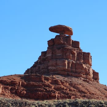


This is a fun-shaped rock that you can easily drive passed and miss if you're not looking for it! I wouldn't go here as the top destination, but if you're near Monument Valley and are looking to enjoy a scenic drive this rock is a fun, silly, almost UFO-like saucer shape that'll make you smile. When you're driving here, be sure to check out Goosenecks State Park right around the corner, a short drive a way. read more
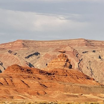
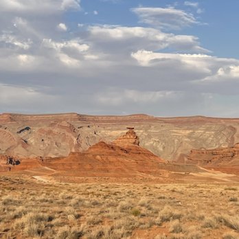


A really cool tourist attraction to see while driving through Utah. This rock is shaped like a sombrero, hence the name Mexican Hat Rock. Just one of the many wonders in this great nation of ours...and yes, when we stopped, I took a cheesy selfie with the hat rock in the background. It was a good place to stop, stretch, and take a breather from driving while on the way to Colorado. It really is a neat sight to see. read more


I can't say it was visually impressive. Geologically speaking this is a marvel of nature and a billion to one chance of it happening any where else. I came here in the middle of a warm Spring day and it was not that exciting compared to Monument Valley or Zion. We had a fake 4 wheel drive which enabled us to take on the dirt road so we got closer to this rock without having to hike in the heat. But we almost got stuck not being able to turn around on the dirt road. read more


10 years ago
I've heard of Mexican Hat because it is an interesting name for a town. On our drive to Monument Valley, I saw what the town was named after. Mexican Hat is actually a 60 foot wide rock which sits on top of a smaller rock. Apparently, many folks thinks it resembles a Mexican Sombrero. Personally, I think it looks more like a mushroom. There is a dirt road off Hwy 163 which leads to the Mexican Hat Rock. Unfortunately, we did not have the time to get closer. Would have been nice to climb that rock (if allowed), and take some pics of the beautiful scenery all around. Oh well, maybe next time. For now, I will have to settle for some pics of the rock from the highway. If you find yourself in this part of the country, you may want to check it out. read more


Not much to it, it's just a rock that looks a little like a hat. There's no official lookout spot, just pull in, drive closer to it and take some pictures! If you're in the area, stop for a pic, but dont come here just to see it. read more


More info about Mexican Hat Rock
Hwy 261
Mexican Hat, UT 84531
Directions
Hours
Outdoor Amenities
Mexican Hat Rock Reviews in Other Languages
Ask the Community - Mexican Hat Rock
Review Highlights - Mexican Hat Rock





















Mexican Hat Rock - landmarks - Updated October 2026
Best of Mexican Hat
People found Mexican Hat Rock by searching for…
Things to Do in Mexican Hat, UT
Attractions in Mexican Hat, UT
Sunset View in Mexican Hat, UT
Watch Sunset in Mexican Hat, UT
Off Road Trails in Mexican Hat, UT
Navajo Food in Mexican Hat, UT
Natural Hot Springs in Mexican Hat, UT
Tourist Attractions in Mexican Hat, UT
Photo Spots in Mexican Hat, UT
Places to Take Pictures in Mexican Hat, UT
Scenic Overlook in Mexican Hat, UT
Public Services & Government in Mexican Hat, UT
Hiking Trails in Mexican Hat, UT
Beautiful Views in Mexican Hat, UT
Tent Camping in Mexican Hat, UT
Scenic View in Mexican Hat, UT
View Points in Mexican Hat, UT
Points of Interest in Mexican Hat, UT
Browse Articles
Browse Nearby
Browse Brands
Related Searches in Mexican Hat, UT
Best Fishing Locations and Guides in Mexican Hat, Utah
Best Lookout Points to Visit in Mexican Hat, Utah
Best Nature Trails for Hiking in Mexican Hat, Utah
Best Places for Horseback Riding in Mexican Hat, Utah
Best Places for Stunning Views in Mexican Hat, Utah
Best Sightseeing Experiences Available in Mexican Hat, Utah
Best Spots for Star Gazing in Mexican Hat, Utah
Check Out Off Road Trails in Mexican Hat, Utah
Discover Charming Historic Homes in Mexican Hat, Utah
Discover Historic Sites and Places in Mexican Hat, Utah
Discover Lakes & Ponds to Explore in Mexican Hat, Utah
Discover Popular Bike Trails in Mexican Hat, Utah
Discover Popular Landmarks in Mexican Hat, Utah
Discover Popular Photo Spots in Mexican Hat, Utah
Discover Romantic Activities to Enjoy in Mexican Hat, Utah
Discover Romantic Views in Mexican Hat, Utah
Discover Top Nature Parks to Visit in Mexican Hat, Utah
Discover a Hiking Trail in Mexican Hat, Utah
Discover the Best Caves to Explore in Mexican Hat, Utah
Discover the Best Dinosaur Park Experiences in Mexican Hat, Utah
Discover the Best Night Hike Trails in Mexican Hat, Utah
Dog-Friendly Hikes With Dogs in Mexican Hat, Utah
Enjoy Hiking Adventures in Mexican Hat, Utah
Enjoy Scenic Night View Experiences in Mexican Hat, Utah
Enjoy the Best Night View Spots in Mexican Hat, Utah
Enjoy the Best Picnic Spots and Ideas in Mexican Hat, Utah
Enjoy the Best Walking Trails in Mexican Hat, Utah
Experience Stunning Sunset Views in Mexican Hat, Utah
Explore Beautiful Castles and Landmarks in Mexican Hat, Utah
Explore Beautiful Parks and Green Spaces in Mexican Hat, Utah
Explore Easy Hikes Perfect for All in Mexican Hat, Utah
Explore Landmarks & Historical Buildings in Mexican Hat, Utah
Explore Picnic Parks Near Mexican Hat, Utah
Explore Popular Campgrounds Near Mexican Hat, Utah
Explore Popular RV Parks Around Mexican Hat, Utah
Explore Popular Scenic Overlook Points in Mexican Hat, Utah
Explore Popular Scenic Views Near Mexican Hat, Utah
Explore Popular State Park Destinations in Mexican Hat, Utah
Explore Popular View Points Around Mexican Hat, Utah
Explore Scenic National Park Locations in Mexican Hat, Utah
Explore Secret Spots Worth Visiting in Mexican Hat, Utah
Explore the Rich History in Mexican Hat, Utah
Family Friendly Hiking With Kids in Mexican Hat, Utah
Find Beautiful Views in Mexican Hat, Utah
Find Exciting Tours to Take in Mexican Hat, Utah
Find Picnic Tables for Outdoor Fun in Mexican Hat, Utah
Find the Best Bridge Spots in Mexican Hat, Utah


