Lu Young Park Photos


More like Lu Young Park
Recommended Reviews - Lu Young Park
Start your review...

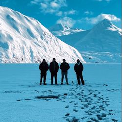
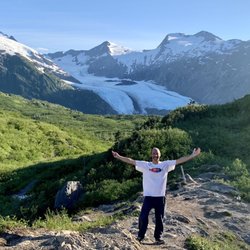
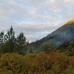
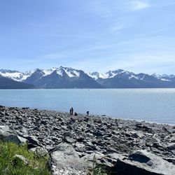
I love, love, love this picnic park. It's well hidden and unknown by most people unfamiliar with Whittier (well, I've gone and ruined that now haven't I?) The park is tucked away in Shotgun Cove at the confluence of a glacial stream and Prince William Sound. The protected cove offers a lovely vista of mountains, water and trees (ok and a parking lot.) It's got several grills, tables and a picnic pavilion that is perfect for small gatherings. Midweek, the park is an ideal place for contemplation. The only issue here is the mosquitoes, which are significant. But if I could plunk a house down anywhere in the world, it would be right here, a little piece of paradise. read more


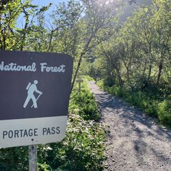
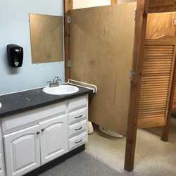
One of my absolute favorite places to spend time in Southcentral Alaska. I didn't actually discover Lu Young Park in Whittier until June of 2016. I happened to have a day off and decided to drive down to Portage area for some photography and enjoy a beautiful summer sunny day. Even though I have lived in Alaska for over 45 years, I didn't visit Whittier or go through the tunnel all that often. Maybe only a handful of times since I was young. A few times included taking the train while another was driving down there with a friend where I was riding shotgun. But something that day made me decide to pay the money to go through the tunnel and do a bit of exploring. And given I'm one with an insatiable quest for exploring, I found myself on the road to Shotgun Cove. And that is where I found Lu Young Park. To access Lu Young park drive up Blackstone Road and then turn right on Salmon Run Road just past the abandoned Bucker Building (hard to miss, one of the tallest buildings in Whittier). Continue on the dirt road for about a 1/2 mile and you will see a pull out with a covered picnic area. The area has a couple of picnic tables, bathrooms and an overlook. It is a great place to explore both at high and low tide. Additionally the area is teaming with thousands of pink salmon during their run in August. It is not uncommon to find kayakers and SUPs in the cove. There is always something different to see and experience here. During the evenings after work during the summer I like to grab a bit of food from somewhere and drive down and catch the tunnel opening and then have a picnic. It is always serenity to me. read more


More info about Lu Young Park
Shotgun Cove Trl
Whittier, AK 99693
Directions
Hours
Outdoor Amenities


Lu Young Park - parks - Updated July 2026
Best of Whittier
People found Lu Young Park by searching for…
Things to Do in Whittier, Alaska
Picnic Areas in Whittier, Alaska
Parks for Picnics in Whittier, Alaska
Photo Spots in Whittier, Alaska
Fishing Spots in Whittier, Alaska
Scenic Restaurants in Whittier, Alaska
Cool Places to Hang Out in Whittier, Alaska
Fishing With Kids in Whittier, Alaska
Attractions in Whittier, Alaska
Running Trails in Whittier, Alaska
Places to Take Pictures in Whittier, Alaska
Waterfalls in Whittier, Alaska
Scenic Views in Whittier, Alaska
View Points in Whittier, Alaska
Stuff to Do in Whittier, Alaska
State Park in Whittier, Alaska
Public Bathroom in Whittier, Alaska
Browse Nearby
BEST of Whittier, Alaska Coffee near Lu Young Park
BEST of Whittier, Alaska Restaurants near Lu Young Park
BEST of Whittier, Alaska Fishing near Lu Young Park
BEST of Whittier, Alaska Things to Do near Lu Young Park
BEST of Whittier, Alaska Breakfast near Lu Young Park
BEST of Whittier, Alaska Hiking near Lu Young Park
BEST of Whittier, Alaska Campgrounds near Lu Young Park
BEST of Whittier, Alaska Natural Hot Springs near Lu Young Park