Hoosier Hill Photos


More like Hoosier Hill
Recommended Reviews - Hoosier Hill
Start your review...

1 year ago
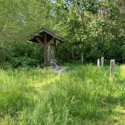
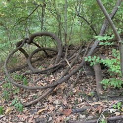
Yes, I climbed to the highest point of Indiana today with an elevation of 1257 feet above sea level. The site is called Hoosier Hill and is promoted by Wayne County. (There really is no hike as you can easily drive up to the site). We drove pass miles of beautiful Amish farmland in Wayne County to find the marker. There is a small gravel drive into a wooded area that is marked by a second rock as the highest point. A picnic table and bench are available for those who want to enjoy the beauty of the site. A mailbox invites visitors to sign the guest book. I must confess that the site did not feel that much higher than other points in the otherwise flat state, but I trust the geological survey that conducted the survey. Parking is limited. There are no restroom facilities or amenities other than the bench. read more


The highest natural point in the entire State of Indiana, Hoosier Hill has an elevation of 1257 feet above sea level. It is on private property but amazingly open to the public thanks to the local land owner. A small forested area next to farmland but a small picnic area is at the end of the short trail from the small parking area. I've been to Britton Hill (Florida) and Ebright Azimith (Delaware) and Clingmans Dome (Tennessee) among others, so now I'm adding Hoosier Hill to my list of highest points. Indiana's highest point is the 44th highest point of the state highest points. Way down the ladder but IT STILL COUNTS. [Review 1316 of 2024 - 192 in Indiana - 22339 overall] read more


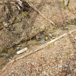
Five stars for being a point in the middle of a field that still has great access to the public. (points like this can sometimes be on private land) At 1,257, Hoosier Hill is over 3.5X as tall as the highest point in Florida. (Britton Hill) It looks like it might be on private land but, luckily, it still affords great access to the public! Please be respectful and don't litter/deface or otherwise be obnoxious! There's a mailbox "on top" with a summit register that you can fill out. There are also fun little micro pamphlets that you can give to other people with directions to the high point. Despite not rising up much above the surrounding land, there is a babbling brook nearby which adds nice ambience. There's also something about the seren farmland views. Definitely worth a short detour! read more
More info about Hoosier Hill
11951 Elliott Rd
Lynn, IN 47355
Directions
Hours
Outdoor Amenities


Hoosier Hill - parks - Updated July 2026
Best of Lynn
People found Hoosier Hill by searching for…
Fun Date Night Ideas in Lynn, Indiana
Places to Take Pictures in Lynn, Indiana
Hiking Trails in Lynn, Indiana
Beautiful Views in Lynn, Indiana
Running Tracks Open to the Public in Lynn, Indiana
Walking Trails in Lynn, Indiana
Swimming Holes in Lynn, Indiana
Off Road Trails in Lynn, Indiana
Natural Hot Springs in Lynn, Indiana
Parks and Recreation in Lynn, Indiana
Things to Do on a Rainy Day in Lynn, Indiana
Swimming Lakes in Lynn, Indiana