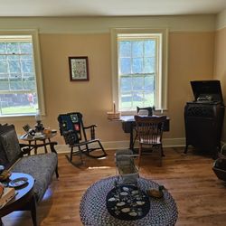
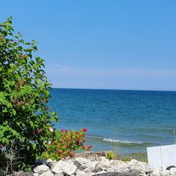
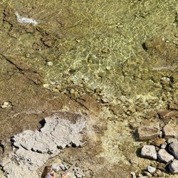
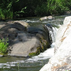
Half Way North Photos


More like Half Way North
Recommended Reviews - Half Way North
Start your review...

Best half-way marker ever: not just in degrees north we're measuring in miles and decimal fractions thereof. some may quibble about the accuracy of measurements and continental drift and other such foolishments but those types will never be satisfied by any except their own scales so I suggest they get out their transits and commence the measuring forthwith. was here about thirty years ago on a circuit of the lake before Yelp was even a thing and it is just as enchanting as ever... read more


10 years ago
8 years ago
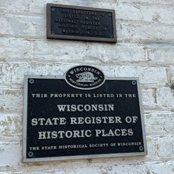
Driving around discovering new things in the area we drove past this and decided to stop ! It's a historical marker and is said to be the half way point from the North Pole and the equator. Pretty cool to stand there and think about the distance. read more
More info about Half Way North


Half Way North - landmarks - Updated July 2026
Best of Crivitz
People found Half Way North by searching for…
Things to Do in Crivitz, Wisconsin
Attractions in Crivitz, Wisconsin
Places to Take Pictures in Crivitz, Wisconsin
Lighthouses in Crivitz, Wisconsin
Public Services & Government in Crivitz, Wisconsin
Tourist Attractions in Crivitz, Wisconsin
Scenic Overlook in Crivitz, Wisconsin
Things to See in Crivitz, Wisconsin
Night View in Crivitz, Wisconsin
Historical Sites in Crivitz, Wisconsin
Scenic View in Crivitz, Wisconsin
View Points in Crivitz, Wisconsin
Old Town in Crivitz, Wisconsin
Field Trips in Crivitz, Wisconsin
Photo Spots in Crivitz, Wisconsin
Hidden Gems in Crivitz, Wisconsin
Landmarks in Crivitz, Wisconsin
Points of Interest in Crivitz, Wisconsin
Trending Searches in Crivitz, WI
Boat Rental near Half Way North
Free Things To Do near Half Way North
Kayak Rental near Half Way North
Landmarks & Historical Buildings near Half Way North
Public Pools near Half Way North
Strawberry Picking near Half Way North
Sunset View near Half Way North
Swimming Holes near Half Way North
Browse Articles
Browse Nearby
Browse Brands
Related Searches in Crivitz, WI
Best Fishing Locations and Guides in Crivitz, Wisconsin
Best Spots for Star Gazing in Crivitz, Wisconsin
Best Things to Do on a Rainy Day in Crivitz, Wisconsin
Best Waterfalls and Swimming Holes in Crivitz, Wisconsin
Check Out Off Road Trails in Crivitz, Wisconsin
Discover Charming Historic Homes in Crivitz, Wisconsin
Discover the Best Beaches in Crivitz, Wisconsin
Discover the Best Dinosaur Park Experiences in Crivitz, Wisconsin
Enjoy Hiking Adventures in Crivitz, Wisconsin
Explore Beautiful Castles and Landmarks in Crivitz, Wisconsin
Explore Beautiful Parks and Green Spaces in Crivitz, Wisconsin
Explore Family-Friendly Zoos and Wildlife in Crivitz, Wisconsin
Explore Free Things to Do Around Crivitz, Wisconsin
Explore Scenic Lakes to Visit in Crivitz, Wisconsin
Explore Sunday Fun Things to Do in Crivitz, Wisconsin
Explore Top Art Galleries Located in Crivitz, Wisconsin
Explore Venues & Event Spaces in Crivitz, Wisconsin
Explore Vibrant Public Art Displays in Crivitz, Wisconsin
Explore the Rich History in Crivitz, Wisconsin
Find Fun Things to Do at Night With Kids in Crivitz, Wisconsin
Find Top Libraries to Visit in Crivitz, Wisconsin
Find the Best Playgrounds to Visit in Crivitz, Wisconsin
Fun Indoor Activities to Try in Crivitz, Wisconsin
Get Your City Pass for Attractions in Crivitz, Wisconsin
Must-See Tourist Attractions Around Crivitz, Wisconsin
Popular Things to Do in Crivitz, Wisconsin
Public Services & Government Offices in Crivitz, Wisconsin
Relax at Natural Hot Springs Near Crivitz, Wisconsin
See Top Fireworks Events in Crivitz, Wisconsin
Top Entertainment Options in Crivitz, Wisconsin
Top Museums for Kids to Visit in Crivitz, Wisconsin