Cancel

    Open app

    Search

    Guemes Channel Trail

    5.0 (1 review)

    Guemes Channel Trail Photos

    You might also consider

    Recommended Reviews - Guemes Channel Trail

    Your trust is our priority, so businesses can't pay to alter or remove their reviews. Learn more about reviews.
    Yelp app icon
    Browse more easily on the app
    Review Feed Illustration

    6 years ago

    Helpful 1
    Thanks 0
    Love this 1
    Oh no 0

    Verify this business for free

    People searched for Hiking 239 times last month within 15 miles of this business.

    Verify this business

    Deception Pass State Park

    Deception Pass State Park

    4.6
    (226 reviews)
    7.7 mi

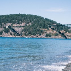
    Deception Pass State Park is a top tier gem of a state park. There's so much to see! This park…read morespans multiple islands, and of course is connected by a bunch of bridges that traverse sheer ocean cliffs with rocky beaches at the base. More inland, there are quiet old growth forests, lakes, and bluffs. I visited the tide pools at Rosario Head during one of the lowest tides of the year. From the parking lot, it's about a 10 minute walk to the tide pools, crossing a conveniently located washroom as well. Since it's so heavily trafficked, there are ropes strung about to keep visitors from trampling on recovering habitats, and also ropes that guide the way to see some tide pool critters. Some staff members were also there to answer any questions and give more information. I did a hike around Rosario Head after my tidepool visit-you get to stand on top of the bluffs and admire the bluest water and the most fluffy clouds for miles. Of course, it's among one of the most trafficked state parks in Washington, so come early if you want to easily snag a parking spot.

    First, don't let the name scare you. This was our first thought when planning to come here. It was…read moregiven since there are a ton of waterways which was deceiving to visitors. Those waterways are what make this place so amazing though. Beautiful state park. Lots of scenic trails. Hike down to the water or stay high and explore the views. You can go in through the whidbey island side or the fidalgo island side. We came in through the whidbey island side and it was pretty easy. Recommend checking out the bays too. It's a nice relaxing beach day with actual sand! We camped at bowman bay. During low tide, explore the rocks and you'll find a ton of crabs. Kids loved it! Pet friendly as well. We brought our huge bernedoodle and she loved it too. Dogs must be on leash but the trails were doable with her. Mostly dirt trails without many rocks or obstacles. Weather is always hit or miss in the PNW. It did rain on us the first night but it was actually very relaxing. Remember, no such thing as bad weather, only bad gear. So gear up, come prepared, and get ready to enjoy some beautiful exploration.

    Photos
    Fishing on the shore with everyone else
    Fishing on the shore with everyone else
    IG: @thephotographerfoodie
    IG: @thephotographerfoodie
    Instagram: @telephonesmoothie

    See all

    Instagram: @telephonesmoothie
    Oyster Dome Trail

    Oyster Dome Trail

    4.5
    (31 reviews)
    13.0 mi

    It's a hike that you must do in the Bellingham area, hell, in the state. It's one of those gems…read morethat everyone talks about - and I know in Washington, everyone talks about hiking trails, but this is one of those that you have to do...if you like hiking and are in the area. We spent a weekend in Bellingham and not gonna lie, Oyster Dome was one of the primary reasons for spending time up north. Located along the Chuckanut Drive on Blanchard Mountain, it's a hike with a rewarding view at the end. So yes, it's worth it. This hike is about a five-mile, round-trip trail with an elevation gain of just over 1000. It's a good climb, but not difficult or challenging. The parking area can get filled up quickly, and you'll likely see many people along the trail and definitely up at summit. It's dog-friendly; we saw a lot of dogs on the trail and brought our little hiker, too. You'll need a Discover Pass to park here and in the lot is where there are restrooms. The hike goes through a forested area, providing tree canopy and cooler temperatures. But some parts can be rocky, especially towards the summit. Descending was worse as it can be sore on your knees, so it felt longer going down than up in my opinion. The views are incredible. You can see the mountains, the valley and even Canada. Pretty amazing.

    Yet another great hiking trail we softly explored, to help our toddlers calm down before we headed…read moreback home. Oyster Dome Trail has multiple markers for guidance throughout it. Now that we've all thawed out from the winter, exploring WAs beautiful trails, parks, and landmarks come naturally; investing in a Discovery pass could be helpful. We will definitely return, and recommend!

    Photos
    Saturdays solo adventure
    Saturdays solo adventure
    Cool mushrooms
    Cool mushrooms
    Almost done

    See all

    Almost done
    Sharpe Park

    Sharpe Park

    5.0
    (3 reviews)
    5.1 mi

    We were exploring Deception Pass State Park and stumbled onto this county park and hopped out to…read morecheck it out. We didn't hike too far, but enjoyed a nice walk down the path and back. I left me phone charging in the car after too many pictures earlier- so no pictures from this run- just memories of brisk, forest air & lush, dense fauna. The meadow at the entrance of the park would be fun for a picnic!

    A hidden gem in Anacortes! This hike is right near Deception Pass State Park, but still part of the…read moreSkagit county park system. The parking lot is not huge but good sized and has a pit toilet. Day use only and dogs are permitted on a leash. This trail has a lot of different trails on it. You can get a map at the kiosk but I recommend downloading the Avenza Maps app and getting the map for this trail. It has markers on the trails but I still would have got lost without the app. It works offline and shows exactly where you are on the map. If you just want to see some spectacular views, then take the easy route down the Sares head trail to the Sares head overlook. The views are just breathtaking. I did some other trails in the park but some were really tough and climbing over rocks and branches and going up some hills. And at one point it was a very sketchy spot that dropped off right by the water. Next time I will make sure I look up the difficulty of the trail before attempting all of it. But it is definitely worth it just for that main viewpoint. Be sure to check it out if you are in the area.

    Photos
    Witch's butter
    Witch's butter
    Easy hike and beautiful sunset views!
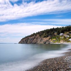
    Easy hike and beautiful sunset views!
    Lichen everywhere

    See all

    Lichen everywhere

    Guemes Channel Trail - hiking - Updated August 2026

    Loading...
    Loading...
    Loading...