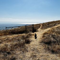
MY PHOTOGRAPHS. (1) View to the south, of a deep canyon. At the top of my photo, you can see the…read moreBay-O-Vista neighborhood in San Leandro.
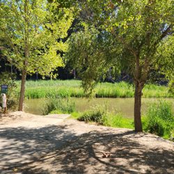
(2) Later on, you pass a little peninsula of land, where people sometimes go fishing. Here and there by the water's edge there are thick patches of tall reeds.
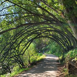
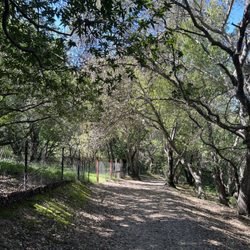
(3) Further along on Bass Cove Trail, there is a transition in the trail, where long branches from thousands of trees cover the entire trail, like a tunnel.
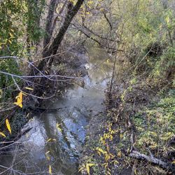
(4) Gulch that is covered with arching trees, where the tree are covered with bright green moss.
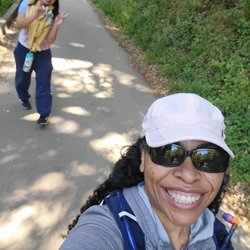
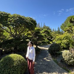
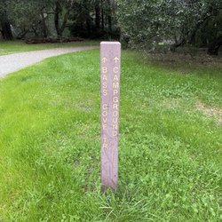
(5) Further along on Bass Cove Trail, you will encounter a second trail sign at a fork in the trail. The sign indicates the direction to Bass Cove, and the direction of Goldenrod Trail. I am posing in this photo.
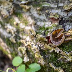
(6) Close up photo of one of the thousands of trees covered with bright green moss.
(7) View of a beautiful little bay, located at the western edge of Lake Chabot. As you can see from this photograph, Bass Cove Trail is now about 200 feet above the Lake Chabot.
(8) Photograph of several ducks. The ducks are swimming at the northern-most part of Bass Cove.
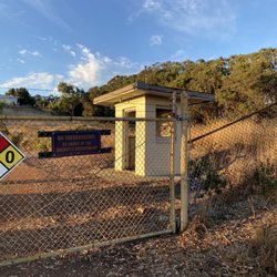
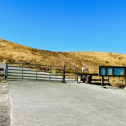
BASS COVE TRAIL. The most direct access to Bass Cove Trail is by starting at the parking lot at the end of Estudillo Ave. The initial part of the hike is uphill and, once beyond the dam, it remains mostly level, where you are taking a clockwise route around Lake Chabot. Early in your hike, you will encounter a chain linked fence at the right side of the trail. Just beyond this fence is a very steep hill (almost a cliff) where a canyon resides at the bottom of the cliff. The view of the trees growing near the bottom of this canyon is beautiful. Dramatic photographs can be taken from the top of the very steep hill. Further along Bass Cove Trail, hikers will encounter a beach that has thick clusters of reeds. On occasion, one or two fishermen practice their fishing hobby near these reeds. A tiny restroom is at the edge of Bass Cove Trail, next to this beach.
DISTINCTIVE STYLE OF BASS COVE TRAIL. From the beach with reeds, all the way to the northern-most area of Bass Cove, the trail consists of about 20 loops that loop inland and away from the lake, and about 20 loops that loop towards the lake. The trail loops inland where there is a gulch (the gulch is like a notch in the mountain, and the trail takes you through this notch). The trail loops towards the lake, wherever a narrow hill extends from the mountain to the west. This extending hill is sort of like an arm reaching out from the mountain to the west (here, the trail allows you to skirt this arm, and to walk around the extending arm). When hiking northwards, the gulches to your left provide opportunities for taking photographs of moss-covered trees and bushy clusters of ferns. To the right side of the trail, which is filled with gnarly-looking trees, some of them covered with electric-green moss. Because the brightly-lit waters of Lake Chabot are in back of the gnarly trees, the outlines of the gnarly trees are easier to see.
DUCKS. My 300 millimeter telephoto lens enabled me to take several photographs of the ducks that make their home at the northern-most area of Bass Cove. This northern-most area had another cluster of reeds. Once at this northern-most area, hikers have the choice of continuing their clockwise hike around Lake Chabot, or continuing in the northwards direction on a straight trail (not a loop trail) that follows along Grass Valley Creek.
HUMOR WHILE HIKING. Near the end of my return hike, I noticed two women walking uphill towards me, and one of them was wearing a long coat with an unusual color. I paused in my walk and said, "Can you tell me the color of your coat? I know that it is not pink or scarlet." Then, the woman with the brightly colored coat answered, "It is fuchsia ! ! !" Within a blink of an eye, I replied, "Oh, I was so CONFUCHED ! ! !" The two ladies responded with a cascade of merry laughs. Then, I continued my walk, and I was glad that their response had made my day.