Glen Canyon Dam Photos


More like Glen Canyon Dam
Recommended Reviews - Glen Canyon Dam
Start your review...


Reviews With Photos


In Page, AZ, this is a nice little visitor center to stop in to check out the dam, use restrooms and check out their small gift shop. You'll learn about the history of the site and you can also take a closer look. The AC was on blast in September so I had to go outside to warm up! If you have questions, staff are helpful to provide recommendations about trails and other things to see. Just a 15-minute drive to Antelope Canyon.


I visited this dam last year on my trip to Sedona. The visit to this dam was part of the Pink Jeep tour. This dam is amazing to see in person and inside the visitor center, there is an education center where visitors can learn about the dam and its history. When there, I read about the controversy regarding the dam. Who knew a dam could have drama???? Glen Canyon Damn located just outside of Page is one of the largest and most important dams in the United States. The 710-foot high dam was built by the U.S. Bureau of Reclamation from 1956 to 1966 and forms Lake Powell, one of the largest man-made reservoirs in the U.S. with a capacity of 27 million acre-feet. The dam is named for Glen Canyon, a series of deep sandstone gorges now flooded by the reservoir. The dam helps ensure an equitable distribution of water between the states of the Upper Colorado River Basin (Colorado, Wyoming, and most of New Mexico and Utah) and the Lower Basin (California, Nevada, and most of Arizona). During years of drought, Glen Canyon guarantees water delivery to the Lower Basin states, without the need for rationing in the Upper Basin. What I learned: Long after the Glen Canyon Dam was built and continuing to the present day, controversy remains between supporters of dam removal and those who believe it should be left in place. One of the earliest debates regarding the dam was its impact on Rainbow Bridge National Monument, whose 290-foot high natural arch is the highest in North America, and is a sacred site to the Navajo people.The environmental lobby wanted the Bureau of Reclamation to keep Lake Powell at or below a level of 3,600 feet (1,100 m), to prevent it from intruding into the monument. The Bureau of Reclamation proposed to build a barrier dam and pump system in order to keep water out of the monument. The proposal was fought over and litigated for years until it was permanently shelved in 1973. If taking the Pink Jeep Tour or visiting on your own accord, the dam is worth a stop and offers stunning views and it is truly a hidden gem with a lot of hands-on exhibits and an informative movie/documentary for visitors.


We were in Page to see Antelope Canyon and Horseshoe Bend, and happened to stumble upon Glen Canyon Dam. Neither of us had heard of the dam previously, but it turns out it's larger than the Hoover Dam with a really interesting history. We parked next to the bridge and took the footpath that had little cutouts in the barbed wire for picture taking. The views were incredible, and the dam itself was striking. It's definitely worth a stop!


bigger than hoover dam. Cool dam and bridge. Easy to see. no fee for this area. Can walk across the bridge. Stop at visitor center for nice bathrooms and different view point. National Park pass will get you into other part. We went to a Mars event they had in the evening that is everything you want to know about Mars and much much much more. We also stopped at the overlook which ain't going to lie was hard for me . The steps were uneven and scary. The railing was painfully hot to try to hold but had no choice. But the view was worth the effort. I'm scared of heights and the overlook was out of my comfort zone. Glad I did it.


We stumbled upon this attraction while driving from Page, AZ. The dam is very impressive and a great sight to see! They have a visitor center with a lot of very cool information about the dam and the Colorado River. They also have a learning and activity center for kids. There were lots of people walking on the bridge to see the dam. It was a great place to take some pictures. There is also a gift shop, water and restrooms inside.


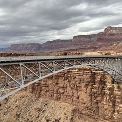
We drove over this dam while passing through Page. I have only driven over it a handful of times in the past. Glen Canyon Dam was built after Hoover Dam and opened in 1966. It took ten years to built it and it is the 4th highest dam in the U.S. The dam is located on the Colorado River and forms Lake Powell (a popular vacation destination). Right next to the dam is Glen Canyon Bridge which allows cars on U.S. Route 89 to cross over the Colorado River. We stopped for a few minutes to admire the dam from the lookout spot next to the visitor center. Despite how beautiful Glen Canyon Dam and the Bridge are, this dam has had some controversy over the years. Many environmentalists feel the reservoir is unnecessary and destroys the canyon's ecosystem. There is sediment buildup behind the dam and the reservoir is currently half empty. The dam was also damaged due to flooding in 1983.
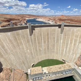

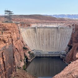
Such a neat landmark to check out while in Page! Although the Glen Canyon Dam isn't as popular as Horseshoe bend or Antelope Canyon, it's still pretty mesmerizing in its' own right. It's one of the tallest dams in the US at 710 feet tall and impounds Lake Powell, the second largest reservoir in the US with a capacity of 27 million acre-feet. There's a visitor center right next to the dam (Carl Hayden Visitor Center) and a bridge that crosses over Lake Powell that you can walk across whilst admiring the views of both the dam and the lake. Who would have thought that a dam could be so pretty to look at?! The visitor center has all all kinds of interesting facts and history tidbits about the dam. I learned that the Glen Canyon Dam delivers water to Colorado, Wyoming, New Mexico, Nevada, and even California during drought years. There are several different viewing points of the dam which all provide excellent places for picture taking. The best pictures in my opinion are from the bridge. The gate makes it hard to get the best pictures, but there are a few pictures holes in the center of the bridge gate that allow for an unobstructed view. Another great place to see the dam up close in from the back patio of the visitor center. From here, you can even see Lake Powell and the canyon up above. This is also a free activity, making it worth your while to make a stop here while you're exploring the great city of Page. Make sure to stop at the visitor center and to make that walk across the bridge to maximize your visit.


Absolutely love how impressive the Glen Canyon Dam is. 710ft tall! 2nd largest Dam in USA, located in Page Arizona near the Navajo Reservation. There is a nice museum, gift store, restrooms and lots of great view points. It truly is outstanding! The weather was really nice and breezy, so made for a great day to visit.


This dam was real damn impressive! I'd actually never seen one this huge before (I've never been to the Hoover dam and all the ones I've been to otherwise were a bit puny) so the sheer vastness of the structure and the canyon below was really impressive. I spent a lot of time just sitting and staring at the view. I never thought a concrete structure could be so mesmerizing but it was! The visitor's center adjacent has some great history and background on the dam so if you're a nerd like I am I highly recommend going and checking that out. They also offer tours so you can get real into the nitty gritty if you want! Or you can just wander around the grounds and enjoy everything on your own. That's what I did and I found it very enjoyable.


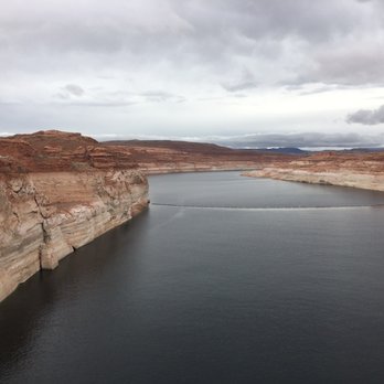
Glen Canyon Dam is definitely worth a visit, especially if you're traveling with family. The natural surroundings are beautiful--the earthy tones of the canyon and the reflections on the water create a really picturesque scene. While the dam itself is fairly average compared to others we've seen across different states, it's still an impressive structure and adds to the overall experience. A nice stop if you're in the area!


Nice video playing at the visitors center telling why the dam was built, vegetation and ecosystem efforts. It is bittersweet, knowing that man built this ingenious water-stopper, but yet this dam has created problems in and of itself for the natural flow of earth's creations; however, still interesting to hear about many of the positives this dam has done for American civilization. It would be awesome to see the dam opened, but that doesn't happen too often at all (it's been for major flooding and high-flow experiments, only).
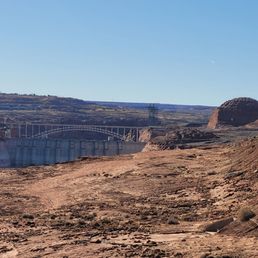

Stopped at the Glen Canyon Dam on the way to check out Lake Powell. There's a visitor center with viewing areas, a nice exhibit about the history of dam and surrounding area, cute gift shop, and bathrooms. Fun fact: this dam is bigger than the Hoover Dam! It's free, so why not visit? The extremely low water levels are alarming!


I've never been to the Hoover Dam, so I can safely say that this is the biggest dam I've ever seen. Definitely very impressed and as an engineer, I fully respect this magnificent feat of engineering! It's so big, coming to the dam's visitor center is what I would consider as TOO CLOSE to really take in the whole view of it. But if you want to see it up close and personal, definitely come here! Also, I came here in December, and I think it's definitely a bit less impressive in the winter when the water levels are extremely extremely low. But all in all, that's a HUGE dam!


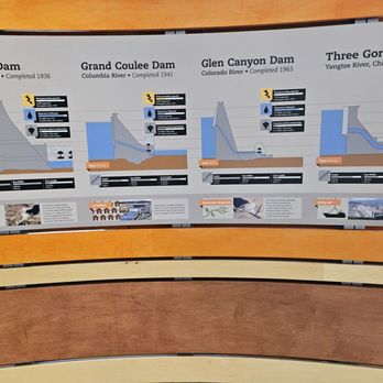
First off, I love how large the parking lot is. It's rare that I comment on the parking situation, but given how many visitors this place sees (with a bunch of tour busses too!) I like how they split up the lots with overflow parking. The visitor center is pretty big. As you enter you can see a big area of exhibits that talk about the geology of the dam as well as how Glen Canyon Dam compares to other dams in the world. Quite ominously, there was a exhibit about the water levels and it hadn't been updated in years...the overall trend was that there isn't a lot of water now. You can also watch a movie in back, shop at the gift shop, and get more information about the dam and surrounding areas at the information desk. Don't forget to walk on the bridge nearby, although it can be a bit unnerving to have traffic whizz by with not a lot of distance between you and them. It's unfortunate you can't actually enter the dam, but it makes sense due to the visitor volume and security concerns. read more
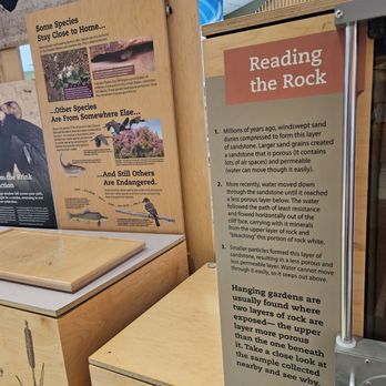

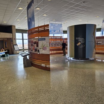




Perfect picnic lunch spot!! Breathtaking views, wonderful museum and if you want some panoramic shots, this is a good place to get them. There is shady trees along the left side where there's a wall where you can overlook the canyon. A great gift shop and museum to look through as well. read more


1 year ago
Great stop to get info about the City of Page and activities to do. The Glen Canyon Dam was worth seeing. The Dam construction has the Lake Powell backdraft. Beautiful views to take photos. read more




In Page, AZ, this is a nice little visitor center to stop in to check out the dam, use restrooms and check out their small gift shop. You'll learn about the history of the site and you can also take a closer look. The AC was on blast in September so I had to go outside to warm up! If you have questions, staff are helpful to provide recommendations about trails and other things to see. Just a 15-minute drive to Antelope Canyon. read more


2 years ago
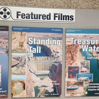
I visited this dam last year on my trip to Sedona. The visit to this dam was part of the Pink Jeep tour. This dam is amazing to see in person and inside the visitor center, there is an education center where visitors can learn about the dam and its history. When there, I read about the controversy regarding the dam. Who knew a dam could have drama???? Glen Canyon Damn located just outside of Page is one of the largest and most important dams in the United States. The 710-foot high dam was built by the U.S. Bureau of Reclamation from 1956 to 1966 and forms Lake Powell, one of the largest man-made reservoirs in the U.S. with a capacity of 27 million acre-feet. The dam is named for Glen Canyon, a series of deep sandstone gorges now flooded by the reservoir. The dam helps ensure an equitable distribution of water between the states of the Upper Colorado River Basin (Colorado, Wyoming, and most of New Mexico and Utah) and the Lower Basin (California, Nevada, and most of Arizona). During years of drought, Glen Canyon guarantees water delivery to the Lower Basin states, without the need for rationing in the Upper Basin. What I learned: Long after the Glen Canyon Dam was built and continuing to the present day, controversy remains between supporters of dam removal and those who believe it should be left in place. One of the earliest debates regarding the dam was its impact on Rainbow Bridge National Monument, whose 290-foot high natural arch is the highest in North America, and is a sacred site to the Navajo people.The environmental lobby wanted the Bureau of Reclamation to keep Lake Powell at or below a level of 3,600 feet (1,100 m), to prevent it from intruding into the monument. The Bureau of Reclamation proposed to build a barrier dam and pump system in order to keep water out of the monument. The proposal was fought over and litigated for years until it was permanently shelved in 1973. If taking the Pink Jeep Tour or visiting on your own accord, the dam is worth a stop and offers stunning views and it is truly a hidden gem with a lot of hands-on exhibits and an informative movie/documentary for visitors. read more


1 year ago
We were in Page to see Antelope Canyon and Horseshoe Bend, and happened to stumble upon Glen Canyon Dam. Neither of us had heard of the dam previously, but it turns out it's larger than the Hoover Dam with a really interesting history. We parked next to the bridge and took the footpath that had little cutouts in the barbed wire for picture taking. The views were incredible, and the dam itself was striking. It's definitely worth a stop! read more


bigger than hoover dam. Cool dam and bridge. Easy to see. no fee for this area. Can walk across the bridge. Stop at visitor center for nice bathrooms and different view point. National Park pass will get you into other part. We went to a Mars event they had in the evening that is everything you want to know about Mars and much much much more. We also stopped at the overlook which ain't going to lie was hard for me . The steps were uneven and scary. The railing was painfully hot to try to hold but had no choice. But the view was worth the effort. I'm scared of heights and the overlook was out of my comfort zone. Glad I did it. read more


We stumbled upon this attraction while driving from Page, AZ. The dam is very impressive and a great sight to see! They have a visitor center with a lot of very cool information about the dam and the Colorado River. They also have a learning and activity center for kids. There were lots of people walking on the bridge to see the dam. It was a great place to take some pictures. There is also a gift shop, water and restrooms inside. read more


We drove over this dam while passing through Page. I have only driven over it a handful of times in the past. Glen Canyon Dam was built after Hoover Dam and opened in 1966. It took ten years to built it and it is the 4th highest dam in the U.S. The dam is located on the Colorado River and forms Lake Powell (a popular vacation destination). Right next to the dam is Glen Canyon Bridge which allows cars on U.S. Route 89 to cross over the Colorado River. We stopped for a few minutes to admire the dam from the lookout spot next to the visitor center. Despite how beautiful Glen Canyon Dam and the Bridge are, this dam has had some controversy over the years. Many environmentalists feel the reservoir is unnecessary and destroys the canyon's ecosystem. There is sediment buildup behind the dam and the reservoir is currently half empty. The dam was also damaged due to flooding in 1983. read more


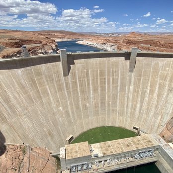
Such a neat landmark to check out while in Page! Although the Glen Canyon Dam isn't as popular as Horseshoe bend or Antelope Canyon, it's still pretty mesmerizing in its' own right. It's one of the tallest dams in the US at 710 feet tall and impounds Lake Powell, the second largest reservoir in the US with a capacity of 27 million acre-feet. There's a visitor center right next to the dam (Carl Hayden Visitor Center) and a bridge that crosses over Lake Powell that you can walk across whilst admiring the views of both the dam and the lake. Who would have thought that a dam could be so pretty to look at?! The visitor center has all all kinds of interesting facts and history tidbits about the dam. I learned that the Glen Canyon Dam delivers water to Colorado, Wyoming, New Mexico, Nevada, and even California during drought years. There are several different viewing points of the dam which all provide excellent places for picture taking. The best pictures in my opinion are from the bridge. The gate makes it hard to get the best pictures, but there are a few pictures holes in the center of the bridge gate that allow for an unobstructed view. Another great place to see the dam up close in from the back patio of the visitor center. From here, you can even see Lake Powell and the canyon up above. This is also a free activity, making it worth your while to make a stop here while you're exploring the great city of Page. Make sure to stop at the visitor center and to make that walk across the bridge to maximize your visit. read more


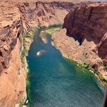


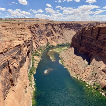


2 years ago
Absolutely love how impressive the Glen Canyon Dam is. 710ft tall! 2nd largest Dam in USA, located in Page Arizona near the Navajo Reservation. There is a nice museum, gift store, restrooms and lots of great view points. It truly is outstanding! The weather was really nice and breezy, so made for a great day to visit. read more


3 years ago
This dam was real damn impressive! I'd actually never seen one this huge before (I've never been to the Hoover dam and all the ones I've been to otherwise were a bit puny) so the sheer vastness of the structure and the canyon below was really impressive. I spent a lot of time just sitting and staring at the view. I never thought a concrete structure could be so mesmerizing but it was! The visitor's center adjacent has some great history and background on the dam so if you're a nerd like I am I highly recommend going and checking that out. They also offer tours so you can get real into the nitty gritty if you want! Or you can just wander around the grounds and enjoy everything on your own. That's what I did and I found it very enjoyable. read more


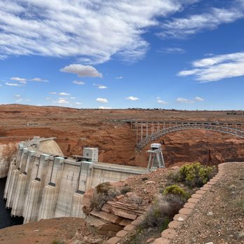


1 year ago
Glen Canyon Dam is definitely worth a visit, especially if you're traveling with family. The natural surroundings are beautiful--the earthy tones of the canyon and the reflections on the water create a really picturesque scene. While the dam itself is fairly average compared to others we've seen across different states, it's still an impressive structure and adds to the overall experience. A nice stop if you're in the area! read more


Nice video playing at the visitors center telling why the dam was built, vegetation and ecosystem efforts. It is bittersweet, knowing that man built this ingenious water-stopper, but yet this dam has created problems in and of itself for the natural flow of earth's creations; however, still interesting to hear about many of the positives this dam has done for American civilization. It would be awesome to see the dam opened, but that doesn't happen too often at all (it's been for major flooding and high-flow experiments, only). read more


3 years ago
Stopped at the Glen Canyon Dam on the way to check out Lake Powell. There's a visitor center with viewing areas, a nice exhibit about the history of dam and surrounding area, cute gift shop, and bathrooms. Fun fact: this dam is bigger than the Hoover Dam! It's free, so why not visit? The extremely low water levels are alarming! read more
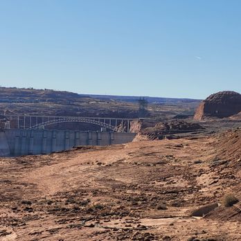


I've never been to the Hoover Dam, so I can safely say that this is the biggest dam I've ever seen. Definitely very impressed and as an engineer, I fully respect this magnificent feat of engineering! It's so big, coming to the dam's visitor center is what I would consider as TOO CLOSE to really take in the whole view of it. But if you want to see it up close and personal, definitely come here! Also, I came here in December, and I think it's definitely a bit less impressive in the winter when the water levels are extremely extremely low. But all in all, that's a HUGE dam! read more


4 years ago
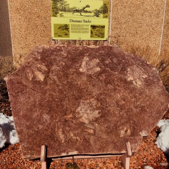
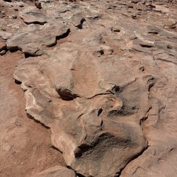
Great place to stop and check out the history surrounding the dam as well as take a walk out to the bridge. I was saddens to see how much the water level has dropped since I was here last three years ago. Plenty of parking . Don't forget to check out the dinosaur tracks and more. read more


3 years ago
This was a beautiful quick stop between horseshoe bend and antelope canyon. There are some great views and a little visitor's center with more information about the dam. read more
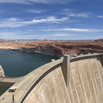
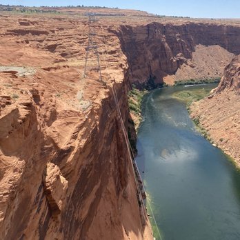


Glad we stopped by here on our way to Vegas from Page I was not even aware of this. While going to Vegas from Page, AZ I crossed this bridge and saw Glen Canyon Visitor center. I stopped by and glad I did. It is a less famous version of Hoover Dam. See, its all about publicity. The Glen Canyon Dam was built in a similar manner to the more famous Hoover Dam. As such, it's quite similar in appearance. Glen Canyon Dam is upstream of Hoover Dam and impounds water for states in the Upper Colorado River Basin (Western Colorado, Utah, and New Mexico). The dam and the Carl Hayden Visitor Center, located just north of Page, serve both as the beginning and the end for this loop drive. The visitor center provides an excellent introduction to the rich history and prehistory of the area. Inside the visitor center, a small museum having pictures of famous Dam give you knowledge about Dams. This dam is the second highest in the United States. Glen Canyon surrounds Lake Powell, giving it a thousand miles of coastline, and making it a huge boating attraction. There is a lot more to see in this canyon though. read more
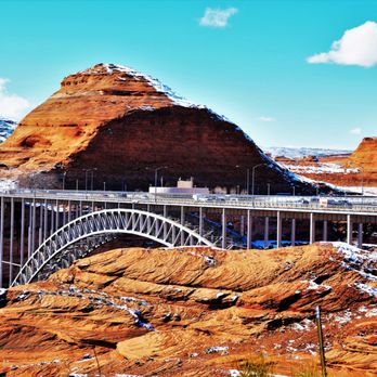




I love dams and this one is breathtaking with the red rock and Colorado river....omg! There are many ways to view this beautiful work of art in combination with nature. You can park at the visitors center and take the $5 tour and get information about the dam. You can park at the top by the crossover and take pics from the road like I did. Which were not bad. Or go a little further down the road (couple miles) and there is a turn out to view the dam and take pics of the dam and surrounding valley. read more


4 years ago
Wonderful place along Lake Powell. Certainly a sight to see. So much history and technical ingenuity here. Breathtakingly beautiful at night. The dam is along a beautiful drive towards Lake Powell, the marina and many camp sights. Perfect place to eat lunch and take in the sights. read more


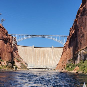


Damn, it's a heckuva dam! Nestled near the sleepy north-central town of Page, the concrete arch-gravity dam gets its water from the Colorado River. It ensures equitable distribution of water between the states of the Upper Colorado River Basin (Colorado, Wyoming, NM, and Utah) and the Lower Basin (California, Nevada, and Arizona). As well, it allowed for the flooding of Glen Canyon ... better known to vacationers as Lake Powell. If you're not a water engineering nerd, likely this isn't of much importance to you. I'll make it really clear: It's a totally amazing sight to see. Think of it like a movie trailer: "From the Makers of The Hoover Dam .... it's ... THE GLEN CANYON DAM!" I recommend parking on the bridge opposite the Visitor's Center. Crossing the Glen Canyon Bridge, as it has great visuals below and dam and of the Colorado River. I love how "user friendly" the GC Bridge is. First, there are the rectangular holes in the fencing, perfect for unfettered photos. Second, there are crosswalks and frequent crossers seem to be aware of the foot traffic. You'll want to cross as one side gives a beautiful view of the Colorado River entering the dam, the other side shows the stunning depths and grandiosity of the dam. And then there's the Carl Hayden (named for the late 8-term Arizona Senator) Visitor's Center. The main area is circular, giving great panoramic angles to get the view from different vantage points. Both in the back and in the front are great viewing areas to take in the Dam. They've got detailed displays showing the ins and outs of the dam, have a theater showing movies about the dam, and offer tours for $5 (!!!) All I've got to say about Glen Canyon is .... "DAAAAAAAAAAAM!" read more


5 years ago
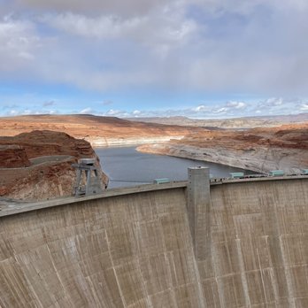
The dam itself is awe inspiring in it's immensity. In person, I'd say it's magnificent. But man is it impossible to get a decent picture with it. There are a few vantage points around the visitor center and there is a cool bridge you can walk on and take pictures but understandably this thing wasn't really setup for good photo-ops. When we went, the visitor center also wasn't open, which was a bummer. I see two differences between Glen Canyon and Hoover. While you have to pay to visit the Hoover Dam and the Glen Canyon Dam is free, the Hoover Dam offers you more to do to go along with the price tag. I'd say it's worth a stop to get whatever pictures you can and the bridge is pretty fun to walk over since it bounces when big trucks drive past... read more


2 years ago

Beautiful dam!!! Once you cross over, you're in Page, Az. The view of the dam against the sunset is magnificent. Make sure you stop on the side of the road to snap some shots of the canyon and dam. You won't be disappointed. read more


My review is for the Glen Canyon Dam Overlook. It's a hidden gem that not many tourists know about!! Unlike Horseshoe Bend where you get photo interrupted nonstop, this overlook area is quaint and provides plenty of fantastic views of Glen Canyon Dam and the area beyond. There are no specific signs pointing to the overlook or is there a specific address, but if you google "Glen Canyon Dam Overlook," there's a link with helpful directions on how to find it. When you're in the heart of Page, there is a physical bridge on top of the dam that tourists can walk over, but it's also a passenger vehicle bridge that's fenced in and prevents ideal photo opportunities. Actually, it may be perfect for people who have selfie sticks because you can't stand in the middle of the road on the bridge and take pictures. The bridge can't be missed and is located right next to the Carl Hayden Visitor's Center. But, for finding the overlook, drive roughly 5 minutes past this tourist bridge and right before you enter town, it's located on the right hand side of the road. Remember, there are NO signs pointing towards it. Once you find the small parking lot area, you hike an easy 10 minutes and you're right there! The views are grand and it's much better than being on the crowded bridge. There is one spot where you can climb on a rock and take awesome pictures of the Glen Canyon Dam. Myself and a few others were doing it. It made the search for the overlook all the worthwhile! So, if you have a brief 30 - 40 minutes, I recommend stopping at this Glen Canyon Dam Overlook and taking in a different perspective of the wonderful town of Page, AZ. read more


Beautiful rock and river views. I didn't not have time to tour but still was quite the view. Would love to return for a longer trip. Just love Page, Az. A park is located to the left side of the bridge, beyond the bridge and main bridge views too. I preferred the left side not wheelchair accessible or stroller friendly but the view of the river is amazing. Shade at base of trail. read more


9 years ago
There isn't much here. Its a dam for crying out loud. The spot is good to stretch and use the bathroom. The photography and landscape is limited. No services but Page, the small arizona town, is nearby with everything including good cell coverage. Safe travelings. read more


5 years ago
The Glen Canyon Dam and it's sightseeing overlook is well worth the sight! It's very beautiful and a easy, short walk. read more


10 years ago
Without Glen Canyon Dam, there would be no Lake Powell and no Page, Arizona. I find dams to be a man made marvel. Glen Canyon Dam in Northern Arizona is no exception. Must have been very cool back in the day to watch this wonder be constructed! Took 10 years to complete. You can get up close and personal if you stop at the Carl Hayden Visitor's Center. They even conduct tours of the Glen Canyon Dam for $5 per adult. Personally, I enjoyed viewing the Glen Canyon Dam from a distance. There is a nice viewing spot a couple miles away where you may view the entire dam. Stop by for a quick photo opp. This controversial and historic spot is pretty dam cool. read more


10 years ago
There's a visitor center, but the site itself is pretty damn impressive. I liked taking it in from afar, but if your daring you can walk across the bridge. Even crossing the bridge in a car is like an e ticket ride at Disneyland. Don't look down if you're afraid of heights!!! read more


9 years ago
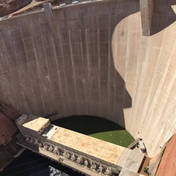
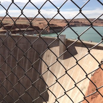
What a way of a brilliant idea of Electricity creating and industrial making. This was a piece of work. Now u ask why 5 stars, if u know your history or reason behind a dam well ur sure you'll appreciate it. Through the cables it creates electricity for the city of Page, Arizona. The amount of water they allow in during heavy rainfall the brilliance of it itself. I'm being geeky. This is a must! read more






7 years ago

If your in Page AZ, this is definitely worth a stop. This dam has a similar setup to the Hoover Dam but I guess is not as well known. What's awesome about this Dam is that they offer tours to everyone - even kids! We were unable to tour the Hoover Dam because our littles are under 8, but here is was no problem. Go to the Carl Hayden Visitor Center and make a reservation for a tour, information and times/pricing located on their website. If you have littles you can take a stroller, probably not something huge, but an umbrella stroller would be fine. Another family on our tour did have a stroller and it was no issue. I used a wrap to carry around my 1 year old, and my four year old walked no problem. You can take some personal items but there are other items they do not allow, but when you register for the tour they will discuss which items are allowed and not with you. You will need to go through a medal detector prior to the tour, so keep that in mind. You do walk the tour but it's easy and there was an older couple who did our tour who didn't appear to have any issues with the walk. No stairs involved. Our tour guide was wonderful, she was full of information and I really enjoyed listening to everything, she even responded well when my four year old made comments or had questions. She was very friendly and easy to talk too, even answered questions unrelated to the Dam. Inside the visitor center there is a bunch of information on the dam, a fun place center with interactive items for the littles - which included a building "block" area and a boat with vests and such. My son played and was occupied until our tour time. There is also a model dam that you can turn a crank on and it will show you how it makes electricity - easy enough for my son to use, and it lights up when you go fast enough! He had a wonderful time making the model "make electricity"! My family and I really enjoyed this place and its a great place to stop in and have some family fun while in Page! I highly recommend it. read more




9 years ago
I came to Page for the Lake Powell Half Marathon. I wanted to visit the dam and go on the tour. The dam had a presence and I wanted to know all about it. It was a wonderful tour. So worth the $5 read more


Just pull off on the side of the road and stop and stand in awe about how man and nature come together and work together. It's really quite impressive and breath-taking. There is a visitors center if you want the history and the functionality. Man's ingenuity is impressive. Nature's ability to adapt is impressive. read more


Page 1 of 2
More info about Glen Canyon Dam
Glen Canyon Dam Reviews in Other Languages
Ask the Community - Glen Canyon Dam
Review Highlights - Glen Canyon Dam














Why does Yelp recommend reviews?

Glen Canyon Dam - landmarks - Updated September 2026
Best of Page
People found Glen Canyon Dam by searching for…
Trending Searches in Page, AZ
Browse Articles
Browse Nearby
BEST of Page, Arizona Restaurants near Glen Canyon Dam
BEST of Page, Arizona Coffee near Glen Canyon Dam
BEST of Page, Arizona Scenic View near Glen Canyon Dam
BEST of Page, Arizona Things to Do near Glen Canyon Dam
BEST of Page, Arizona Museums near Glen Canyon Dam
BEST of Page, Arizona Breakfast near Glen Canyon Dam
BEST of Page, Arizona Visitor Centers near Glen Canyon Dam
Browse Brands
Related Searches in Page, AZ
Best Fun Things to Do in Page, Arizona
Best Lookout Points to Visit in Page, Arizona
Best Things to Do on a Rainy Day in Page, Arizona
Book Engaging Historical Tours in Page, Arizona
Check Out Off Road Trails in Page, Arizona
Discover Charming Historic Homes in Page, Arizona
Discover Fun Things to Do Alone in Page, Arizona
Discover Historic Sites and Places in Page, Arizona
Discover Popular Landmarks in Page, Arizona
Discover Popular Photo Spots in Page, Arizona
Discover the Best Beaches in Page, Arizona
Dog-Friendly Hikes With Dogs in Page, Arizona
Enjoy Arts & Entertainment in Page, Arizona
Enjoy Hiking Adventures in Page, Arizona
Enjoy the Best Night View Spots in Page, Arizona
Experience Stunning Sunset Views in Page, Arizona
Explore Beautiful Castles and Landmarks in Page, Arizona
Explore Beautiful Parks and Green Spaces in Page, Arizona
Explore Children's Museums Near Page, Arizona
Explore Easy Hikes Perfect for All in Page, Arizona
Explore Free Things to Do Around Page, Arizona
Explore Fun Activities to Do in Page, Arizona
Explore Popular View Points Around Page, Arizona
Explore Top Art Galleries Located in Page, Arizona
Explore Top Things to Do at Night in Page, Arizona
Explore Venues & Event Spaces in Page, Arizona
Find Exciting Tours to Take in Page, Arizona
Find Top Libraries to Visit in Page, Arizona
Find the Best Bridge Spots in Page, Arizona
Get Your City Pass for Attractions in Page, Arizona
Must-See Tourist Attractions Around Page, Arizona
Perfect Spots to Watch Sunset in Page, Arizona
Plan a Scenic Drive Route Near Page, Arizona
Popular Fishing Spots to Explore in Page, Arizona
Popular Picnic Spots to Visit in Page, Arizona
Popular Places to Take Pictures in Page, Arizona
Popular Things to Do in Page, Arizona
Popular Things to See in Page, Arizona
Top Entertainment Options in Page, Arizona
Top Hiking Trails to Explore in Page, Arizona
Top Places to Visit in Page, Arizona for Sightseeing
Top Running Trails to Explore in Page, Arizona
Top Things to Do With Kids in Page, Arizona
Top Things to Do With Teenagers in Page, Arizona
Tour Famous Lighthouses Located in Page, Arizona
Visit Cultural Centers in Page, Arizona


