Cancel

    Open app

    Search

    Fowler Park

    3.4 (5 reviews)

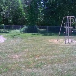
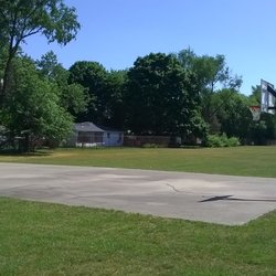
    Fowler Park Photos

    Recommended Reviews - Fowler Park

    Your trust is our priority, so businesses can't pay to alter or remove their reviews. Learn more about reviews.
    Yelp app icon
    Browse more easily on the app
    Review Feed Illustration

    1 year ago

    Helpful 0
    Thanks 0
    Love this 0
    Oh no 0

    5 years ago

    Helpful 1
    Thanks 0
    Love this 0
    Oh no 0
    Photo of Ken N.
    668
    3984
    21554

    7 years ago

    Helpful 2
    Thanks 0
    Love this 0
    Oh no 0
    Photo of Linda K.
    19
    31
    60

    5 years ago

    Helpful 0
    Thanks 0
    Love this 0
    Oh no 0
    Photo of Ken K.
    0
    36
    0

    8 years ago

    Helpful 0
    Thanks 0
    Love this 0
    Oh no 0

    Verify this business for free

    Get access to customer & competitor insights.

    Verify this business

    Cataract Falls State Recreation Area

    Cataract Falls State Recreation Area

    4.4(47 reviews)
    30.6 mi

    What a wonderful place to get out of the city and just slow down! My honey took me here 4/26/26…read moresince we've had some nice weather lately. Pleasantly surprised they have many picnic tables, the cover bridge to see and of course the Falls. Just be careful when walking to the lower fall as you are pretty close to the ledge of the falls. Plenty to enjoy here. Next time we shall have a nice picnic and enjoy the scenery. You can swim too.Parking is easy but i'm sure it gets crowded in the summer time!

    Cataract Falls is a geological wonder worth visiting and only an hour west of Indianapolis. These…read moremagnificent Falls were created over millions of years as ice and water carved into the ancient limestone resulting in Mill Creek and two sets of falls. The Upper Falls drops 20 feet and can be viewed near the entrance to the park at several overlooks. We visited this week on a bright summer day. The waters were loud and rapid after recent rains. This is one of Indiana's most beautiful sites. There is a large parking lot near the Upper Falls along with picnic tables, grill, pavilion and small playground. We brought a picnic lunch so we could enjoy the Falls. There are pit bathrooms near the playground in a second parking lot. The Lower Falls are a short drive through the park. A nearby lot provides plenty of parking. The short path to view the falls is not paved, but an easy walk. These falls drop 18 feet with incredible views of the layered limestone exposed west of the falls. I was envious of a lone kayaker below the falls. There are marked trails through dense woods descending near the creek. You'll want to wear good hiking shoes and bug spray if you are up for the adventure. The property was donated by Agnes Stuckey in memory of her mother, Agnes Steiner. The Park is maintained by the Indiana DNR. There was no admission during our midweek visit.

    Photos
    Cataract Falls State Recreation Area
    Cataract Falls State Recreation Area - Inside the bridge

    Inside the bridge

    Cataract Falls State Recreation Area - Info

    See all

    Info

    Dobbs Park & Nature Center - touch table items with matching identifying cards

    Dobbs Park & Nature Center

    4.3(3 reviews)
    9.3 mi

    This is a nice nature park. It has a couple of ample sized parking areas, three to be exact. There…read moreis a nice calm 3 acre lake in the park with picnic tables and picnic shelters with tables under them and grills just outside of them. Fishing is allowed in the lake, but with limits. You will definitely need a fishing license to fish here. With every nature park, there is some green space to play filed activities such as soccer, football, catch, kite flying or other activities. This park is no exception. There is a decent amount of green space by the playground area. Some of the shelters are in desperate need of repair though. A couple has sections of the roof collapsing in. There is a small playground at this park with older traditional equipment laid on a wood chip bed. Some of the playground equipment includes a some traditional and toddler swings, A tall spiral slide, a decent sized jungle gym with slides, a see-saw, and a large truck tire. It has benches and picnic tables on the perimeter of the area where parents can sit and watch their littles. There are a couple of small accessible piers on the lake that you can walk out on. They do not go too deep into the lake. I would say about 10 to 15 feet from shore. You will find a nature center and Native American Museum here at the park, along with some awesome wooded trails. It you are not feeling adventurous and are intimidated by the wood trail, you can just walk around the lake. I saw a bunch of people doing that while I was there. Additionally, there is a nice bike/running trail that goes past the front of the park. All in all, there are approximately 3 miles of trails which will take you past restored wetlands, through pine woods, old growth and second growth forest as well as a 25 acre State Nature Preserve. With visits to the Nature Center, native American Museum, Lake, playground and trails, you could easily spend a half a day or more here. I wish that the playground area was a little bit more robust, but it will do. This park has a peaceful vibe and is very relaxing. It is a destination park and hopefully you will get to visit it in the near future.

    We are retired. Nice place to bring your lunch, watch the Canadian geese, and dads trying to teach…read moretheir kids to fish!!

    Photos
    Dobbs Park & Nature Center - Entrance to the nature center

    Entrance to the nature center

    Dobbs Park & Nature Center
    Dobbs Park & Nature Center

    See all

    Wabashiki Trail

    Wabashiki Trail

    2.0(1 review)
    10.0 mi

    Although I am giving the Wabashiki Trail only a 2 at this point, I am hopeful that this trail is…read morestill a work in progress and therefore could get a few more Yelp stars in time. The 2600 aces that comprise this fish and wildlife area was born around 2010. The trail came a bit later. Regardless of my opinion on the trail in 2019, I think this area of Terre Haute along the Wabash River should be preserved and I am glad this trail is there. As a bird viewing area and also one of the unique aspects to Terre Haute and the history of the Wabash River, there is room for this place to be great, but the trail experience needs improvements. I would say the best part of the trail is the trail head and parking lot. When I pulled in to start my hike along the Wabashiki Trail, the nice covered picnic table area, the bird viewing telescopes, a bathroom and a sign talking about the Wabashiki Trail were welcome amenities to see. Unfortunately, that is where the support to the trail starts and also ends. The trail itself for the first 30 minutes hugs West Terre Haute on one side and the marshy land on the other. You are basically walking on top of the levy. The path is clearly marked, small graveled and a nice trail, although there is not much to see. The first thirty minutes is full exposure to the sun with no shade at all. I felt like I was basically walking through a residential area on a designated gravel footpath. There is then a turn into the wooded area and at first I was not sure if I was heading the right way. The entrance to this part of the trail has a lot of low lying limbs hanging over it and not clearly marked. After realizing I was headed down the correct path, the trail is now completely covered and there is little to no exposure to the sun because you are in the thick of trees. It is quiet (despite the trucks of I-70 being heard in the distance), it is peaceful and you can tell this place is special. As I continued along this route with the expectation of attempting to make the full loop, other than the small general Wabashiki Trail sign you see on the trail with a general little map, there is no additional signage along the trail highlighting the Wabash River history, pointing out birds that are unique to this area, explaining the reason why this protected area is important to Terre Haute. Nothing. At the very least, I would have thought to see one informational sign giving me some information. Some sign that you could teach an interested outdoors woman like me or a kid why this trail is special, why it was important to this area, why it is important to protect, but there is nothing. The trail itself is clean without a single piece of trash nor graffiti. This wooded section of the trail goes under I-70 and then actually loops back under another section of I-70 about 10 minutes later. It was at this point though where I had to stop and turn back. The trail was washed out completely and simply an entire soupy mess. I attempted to navigate through another portion in the woods that it appears might be designed to get around this section when this happens to only be stuck with nowhere to go just under I-70. I found myself climbing over questionable heavy highway wires and unsafe conditions simply to find a way to get back on the trail with no success. I was thinking this section of the trail that is closest to the Wabash River would be the most interesting, but I do not know because the trail was washed out. So from the trailhead back in the parking lot, to the section that is the second cross under 1-70 and I could go no further, it took about 50 minutes or so (one way). My athletic hiking self went out in hearty tennis shoes that I do not care if they get muddy, had a hat, a bottle of water and my cell phone. Hiking boots are not necessary and you can navigate in good tennis shoes, assuming the mud is minimal. A mountain bike would address the same issues as a person on foot. The terrain is basically flat with only maybe two short steeper grades along the trail. I hiked alone and felt safe, but if you are not a confident solo hiker, better to go with a friend, for the wooded area is isolated. When I was leaving, I drove over to section of West Terre Haute called Taylorsville specifically where S. Sampson Place & W. Lorey Drive come together to see if you can hike the Wabashiki Trail starting from that area. There is a small area specifically for Wabashiki Trail visitors to park and I could see where the trail starts right there. Maybe on a dryer day, I will head out on the trail from this parking lot and see how far I can go and what the trail looks like in that section. Ideally, they connect, but because of the washout, I could not. I'm hopeful with a little future planning and some money that there are improvements to be made to the Wabashiki Trail that can make this trail great.

    Photos
    Wabashiki Trail
    Wabashiki Trail
    Wabashiki Trail

    See all

    Turkey Run State Park

    Turkey Run State Park

    4.5(148 reviews)
    39.5 mi

    Beautiful, fun place to take the kids for summer!!! We had an absolute blast & can't wait to go…read moreback again. Perfect day!

    This is not wheelchair friendly! Me and my dear friend Agatha in a wheelchair were driving here one…read moreday to come here. we checked into our hotel room and it was pretty nice. we took a rest and the next day we set out in the morning to walk trail 3. Little did we know, Agatha was in trouble. as we set out, going down the stairs Agatha was bumping all around in her wheelchair and all of the sudden she tipped on her back! she was screaming and I was trying to help her but I couldn't, luckily some kind young man helped her up and said "why are you on this trail?". we kept trekking in and we made it to the bridge and one again there were more stairs! so another young man carried her up the stairs and onto the bridge. how nice! we continued walking and walking, it was getting very hot and then we saw a narrow passageway not suitable for a wheelchair, there was a foot of water beneath us and the wheelchair didnt fit! so we helped Agatha out and folded the wheelchair she made it across the passageway and we continued, trudging in feet of water. Then we made it to the ladder. I dont know how people in a wheelchair do this! Luckily I had a pulley with a rope so I climbed the ladder and it was a grueling experience but finally I made it to the first edge. There was still another ladder! so I hooked up the pulley system and Agatha's wheelchair was tied on the rope. With the strength of 2 young men, we successfully pulled Agatha up. But then Agatha fell over on the edge and fell to the ground! Oh no! So we hooked up the pulley again and lifted her up and made sure to secure her on the ledge. We made it to the top and pulled her up successfully. Finally we were almost done, we just had a mile long hike left. So, we completed the trail and Agatha emerged with inly minor injuries. What a non-wheelchair-friendly place!

    Photos
    Turkey Run State Park
    Turkey Run State Park
    Turkey Run State Park - Remi

    See all

    Remi

    Shakamak State Park - Patio view of one of the cabins.

    Shakamak State Park

    4.1(11 reviews)
    13.0 mi

    Shakamak State Park is considered one of Indiana's more rustic state parks with a strong focus on…read morecamping and fishing within the park. Shakamak includes three man-made lakes within its boundaries offering 400 acres of lakes along with an aquatic center for family activities. Shakamak was dedicated on Sept. 3, 1928 with land donated by the counties of Clay, Greene, and Sullivan. It's believed the name was chosen by the park's founders and is an Indigenous word meaning "river of the long fish" meant to describe the nearby Eel River. The word is believed to be either from the Delaware (Lenape) or Kickapoo Indians. The first lake was created by stopping up a 5-foot sewer. The other two lakes were added in following years including Lake Kickapoo (30 years later). Prior to these lakes being made, there were no lakes in the area. Richard Lieber stocked the lakes with bass and began what would really make this particular park noteworthy. The Civilian Conservation Corps also helped develop the park from 1933-42. Shakamak State Park was added to the National Register of Historic Places in 2000. In terms of camping, Shakamak has 8 sites with full hook-ups, 114 electric sites, 42 non-electric sites, and on Maple Loop there are 10 sites (2 are paved and accessible). There's group camping, a dumping station, and a camp store. There are also cabins - I generally find them not very accessible. Shakamak offers picnic areas w/shelters (must be reserved), a nature center, a boat launch ramp, fishing/ice fishing, hiking trails, paddleboat/rowboat/kayak rentals, a recreation building that can be rented, a tennis area, a basketball court, and a swimming pool/water slide area. Shakamak is about 3 miles southeast of Jasonville in Sullivan County. Shakamak has seven marked trails with five being labeled as moderate in difficulty. The other two, both under two miles, are considered easy, multi-use trails for hiking or biking - these two trails have no stairs and white-tailed deer have been known to be seen on them. The longest trail is just under four miles and will take you by Lake Shakamak. The multi-use trails are for the most part accessible, though you are out in nature and I generally recommend not going on trails alone. That said, I've been able to do just fine on both trails. This isn't a real touristy state park except for those who want to fish and hike. That's the real selling point here. For those needing accessibility, it's definitely possible but will involve pre-planning. As some have noted, upkeep here is somewhat hit-and-miss. It's a beautiful park, however, my experience has been it's fairly lightly staffed compared to some other parks. That said, my recent visit things were in good shape and I know DNR has been really working on our less popular parks. I tend to see Shakamak as a less appreciated park that is definitely worth a visit for nature lovers and for hikers who want a chance to see wildlife. I've never not seen wildlife on the trails here.

    Shakamak is much bigger than I anticipated. My husband, dogs, and I got a lovely 4-mile hike in…read morewith great views of Lake Kickapoo, one of the three lakes. With two more lakes and six more trails to explore, it appears we'll have to make another trip in the future. I look forward to it!

    Photos
    Shakamak State Park - Another lake view.

    Another lake view.

    Shakamak State Park - One of three Shakamak State Park lakes.

    One of three Shakamak State Park lakes.

    Shakamak State Park - External view of a cabin - entry not accessible, but for those with ability to hop small steps it's possible.

    See all

    External view of a cabin - entry not accessible, but for those with ability to hop small steps it's possible.

    Fowler Park - hiking - Updated August 2026

    Loading...
    Loading...
    Loading...