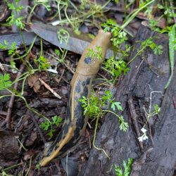
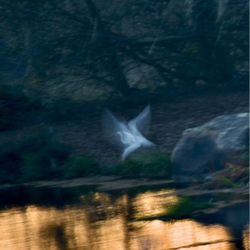
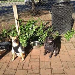
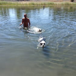
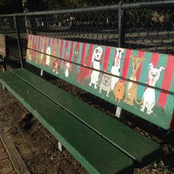
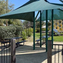
Fitch Mountain Open Space Photos


You might also consider
More like Fitch Mountain Open Space
Recommended Reviews - Fitch Mountain Open Space
Start your review...

2 years ago


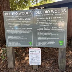
More info about Fitch Mountain Open Space
900 Chanticleer Way
Healdsburg, CA 95448
Directions
(707) 431-3317
Call Now
Visit Website
https://www.ci.healdsburg.ca.us/757/Fitch-Mountain-Map
Hours
Indoor Amenities
Outdoor Amenities


Fitch Mountain Open Space - hiking - Updated June 2026
Best of Healdsburg
People found Fitch Mountain Open Space by searching for…
Hiking Trails in Healdsburg, California
Dog Parks in Healdsburg, California
Fireworks in Healdsburg, California
Dog Friendly Hiking Trails in Healdsburg, California
Walking Trails in Healdsburg, California
Running Trails in Healdsburg, California
Picnic Areas in Healdsburg, California
Playgrounds in Healdsburg, California
Fishing Spots in Healdsburg, California
River Swimming in Healdsburg, California
Scenic Drive in Healdsburg, California
Pickleball Courts in Healdsburg, California
Photo Spots in Healdsburg, California
Fall Foliage in Healdsburg, California
Running Routes in Healdsburg, California
Track and Field in Healdsburg, California
Parks With Pull Up Bars in Healdsburg, California
Pokemon Go in Healdsburg, California
Night Hike in Healdsburg, California
Fun Places to Go in Healdsburg, California
Sculpture Park in Healdsburg, California
Running Stairs in Healdsburg, California
Trending Searches in Healdsburg, CA
Black Owned Nail Salons near Fitch Mountain Open Space
Boat Rental near Fitch Mountain Open Space
Cliff Jumping near Fitch Mountain Open Space
Day Trips near Fitch Mountain Open Space
Dog Friendly Beaches near Fitch Mountain Open Space
Fireworks near Fitch Mountain Open Space
Fishing Spots near Fitch Mountain Open Space
Free Picnic Areas near Fitch Mountain Open Space
Jet Ski Rental near Fitch Mountain Open Space
Kayak Rental near Fitch Mountain Open Space
Lakes near Fitch Mountain Open Space
Lakes & Ponds near Fitch Mountain Open Space
Outdoor Activities near Fitch Mountain Open Space
Outdoor Basketball Courts near Fitch Mountain Open Space
Paddle Boat Rentals near Fitch Mountain Open Space
Picnic Parks near Fitch Mountain Open Space
Public Pools near Fitch Mountain Open Space
Public Shower near Fitch Mountain Open Space
River Swimming near Fitch Mountain Open Space
Rock Quarry near Fitch Mountain Open Space
Scenic Night View near Fitch Mountain Open Space
Scenic Overlook near Fitch Mountain Open Space
Secluded Spots near Fitch Mountain Open Space
Soccer Store near Fitch Mountain Open Space
Splash Pad near Fitch Mountain Open Space
Strawberry Picking near Fitch Mountain Open Space
Sunrise View near Fitch Mountain Open Space
Swimming Holes near Fitch Mountain Open Space
Swimming Lakes near Fitch Mountain Open Space
Watch Sunset near Fitch Mountain Open Space
Browse Articles
Browse Nearby
BEST of Healdsburg, California Coffee near Fitch Mountain Open Space
BEST of Healdsburg, California Restaurants near Fitch Mountain Open Space
BEST of Healdsburg, California Things to Do near Fitch Mountain Open Space
BEST of Healdsburg, California Parks near Fitch Mountain Open Space
BEST of Healdsburg, California Walking Trails near Fitch Mountain Open Space
BEST of Healdsburg, California Breakfast near Fitch Mountain Open Space
BEST of Healdsburg, California Hot Springs near Fitch Mountain Open Space
BEST of Healdsburg, California Campgrounds near Fitch Mountain Open Space
BEST of Healdsburg, California Sightseeing near Fitch Mountain Open Space
Browse Brands
Related Searches in Healdsburg, CA
Affordable Kayak Rental Services in Healdsburg, California
Best Fishing Locations and Guides in Healdsburg, California
Best Off Leash Dog Parks in Healdsburg, California
Best Parks for Parties and Events in Healdsburg, California
Best Places for Horseback Riding in Healdsburg, California
Best Water Parks for Kids in Healdsburg, California
Check Out Great Playgrounds in Healdsburg, California
Check Out Off Road Trails in Healdsburg, California
Discover Baseball Fields Around Healdsburg, California
Discover Beautiful Garden Spots in Healdsburg, California
Discover Fun Toddler Parks in Healdsburg, California for Your Little One
Discover Lakes & Ponds to Explore in Healdsburg, California
Discover Popular Photo Spots in Healdsburg, California
Discover Soccer Fields in Healdsburg, California Near You
Discover Top State Parks to Visit in Healdsburg, California
Discover the Best Beaches in Healdsburg, California
Discover the Best Kids Park Spots in Healdsburg, California
Discover the Best Night Hike Trails in Healdsburg, California
Discover the Best Running Track in Healdsburg, California
Enjoy Camping Adventures Around Healdsburg, California
Enjoy Exciting Mountain Biking Adventures in Healdsburg, California
Enjoy Kayaking Adventures in Healdsburg, California
Enjoy Tent Camping Spots Around Healdsburg, California
Enjoy Water Activities and Fun in Healdsburg, California
Enjoy a Beautiful Waterfall Hike in Healdsburg, California
Enjoy the Best Picnic Spots and Ideas in Healdsburg, California
Enjoy the Best Tubing Experiences in Healdsburg, California
Enjoy the Best Walking Path in Healdsburg, California
Enjoy the Best Walking Trails in Healdsburg, California
Exciting Cliff Jumping Spots in Healdsburg, California
Experience Thrilling White Water Rafting in Healdsburg, California
Explore Beautiful Botanical Gardens in Healdsburg, California
Explore Beautiful Parks and Green Spaces in Healdsburg, California
Explore Easy Hikes Perfect for All in Healdsburg, California
Explore Family-Friendly Zoos and Wildlife in Healdsburg, California
Explore Free Picnic Areas Around Healdsburg, California
Explore Fun Activities to Do in Healdsburg, California
Explore Nature Spots Around Healdsburg, California
Explore Parks With Pull Up Bars in Healdsburg, California
Explore Popular Campgrounds Near Healdsburg, California
Explore Popular Picnic Areas Around Healdsburg, California
Explore Popular RV Parks Around Healdsburg, California
Explore Scenic Lakes to Visit in Healdsburg, California
Explore Top Dog Parks in Healdsburg, California Near You
Explore Top Gyms in Healdsburg, California Now
Explore Top Water Parks in Healdsburg, California Today
Explore the Best Beach Spots in Healdsburg, California
Explore the Best Boating Spots in Healdsburg, California
Explore the Best Swimming Holes Around Healdsburg, California
People who viewed Fitch Mountain Open Space also viewed
Foothill Regional Park
76 reviews
Riverfront Regional Park
52 reviews
Crane Creek Regional Park
48 reviews
Willow Creek Road Trail
3 reviews
Monte Rio Redwoods Trailhead
3 reviews
Islands In The Sky Trailhead
1 review
Monte Rio Recreation & Park District
51 reviews
West County Trail
2 reviews
The Petrified Forest
172 reviews
Sonoma Coast State Park
58 reviews