Cancel

    Open app

    Search

    Ellison Bluff State Natural Area

    5.0 (1 review)

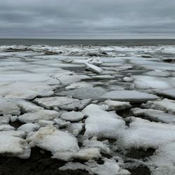
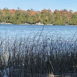
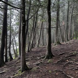
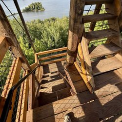
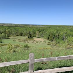
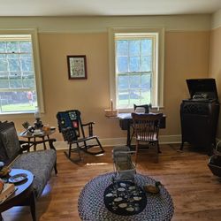
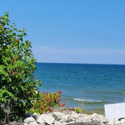
    Ellison Bluff State Natural Area Photos

    You might also consider

    More like Ellison Bluff State Natural Area

    Recommended Reviews - Ellison Bluff State Natural Area

    Your trust is our priority, so businesses can't pay to alter or remove their reviews. Learn more about reviews.
    Yelp app icon
    Browse more easily on the app
    Review Feed Illustration
    Photo of Bill S.
    1684
    860
    9415

    2 years ago

    Helpful 4
    Thanks 0
    Love this 1
    Oh no 0

    Verify this business for free

    Get access to customer & competitor insights.

    Verify this business

    Rock Island State Park - Inside the party room above boathouse. Look at the chandelier.

    Rock Island State Park

    4.8(20 reviews)
    17.6 mi

    This island is definitely worth the ferry rides to get there. You can tour the lighthouse and hike…read morethe entire island. The lighthouse attendants are so friendly and knowledgeable. Very beautiful place to see.

    Rock Island is, well, rocky. Make sure you have sturdy soled shoes or hiking boots because hiking…read morearound without them will sincerely tire out your feet. Unless you have your own boat access, you will take two boats to get there. The first is from the tip of the Door County peninsula to Washington Island, and the second is from Washington Island to Rock Island. Now, you may take your vehicle to Washington Island, but Rock Island is pedestrian traffic only. That is because there is nothing on it....it's uninhabited forest save for birds and some ground dwelling animals, like squirrels and chipmunks. You may hike around the island (it's large, but not huge, it doesn't take all day), and primitive camp. There are a few buildings you can visit and some you can even go in. Food and beverage is allowed, but you must bring it with you, and take all trash with you when you leave. Make sure to get back to the dock at one of the scheduled departure times, especially if you need to make the ferry back to the mainland. If you miss the last boat on either island, you're stuck until the following day. 6/2025

    Photos
    Rock Island State Park - Me doing yoga on a rock in the lake.

    Me doing yoga on a rock in the lake.

    Rock Island State Park - Fireplace in the upstairs party room.

    Fireplace in the upstairs party room.

    Rock Island State Park - Boathouse and upstairs party room, which is gorgeous.

    See all

    Boathouse and upstairs party room, which is gorgeous.

    Potawatomi State Park - It's as cool to climb as it looks

    Potawatomi State Park

    4.3(27 reviews)
    32.2 mi

    Five stars, and this is based on a one day visit, of approximately 3 hours!…read more We were heading home from our stay at Peninsula State Park, and stopped in to check it out, since I had never been here before. What a lovely park! We picnicked down by the boat launch, which looks out over Sturgeon Bay and Sawyer Harbor. Our view actually consisted of two islands and the homes thereon. There is a shelter, of sorts, very near the boat ramp, and we learned that it is actually a place to process your catch....there are metal tables there to do what you need to do. After eating, we drove through the park to take in the sights and get a feel for it. We headed up to the tower, and as of our visit, it is still closed. We continued to the Old Ski Hill Overlook and got out to take some photos. We drove through more forest and ended up at the Nature Center and Park Store. Here you can rent bikes, canoes, kayaks, and paddle boards. You can also pick up a souvenir or two, or some snacks. We made a pit stop at the toilets (flushable and with nice showers) before heading out and on our way home. This park is located within a decent distance of Sturgeon Bay, but is also remote enough that you won't get the sounds of the city disturbing you at night. It is an easy drive up the peninsula from this location, and day trips are definitely doable. The only downside, as others have mentioned, is that there is no beach at this park. If that is a deal breaker, there are 4 more state parks in Door County to choose from. I don't know if we will ever camp here, but I can definitely say that I am not opposed to another visit! 49/2022

    Pretty large state park. We got a $16 day pass and drove around. We attempted to do a hike through…read moreone of the forested trails but there were just so many mosquitoes that we had to abort. Even the mosquito repellent couldn't keep them away and I got bit through my clothes. We got a great view on top of the tower. And then ventured towards the dock where apparently sometimes you can catch the fisherman come back with their catches.

    Photos
    Potawatomi State Park
    Potawatomi State Park - Now for the trek downward

    Now for the trek downward

    Potawatomi State Park - View from the old ski hill

    See all

    View from the old ski hill

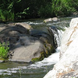
    Marinette County Waterfalls - This would not be a good place to slip into the water, so wear shoes that grip and watch your step!

    Marinette County Waterfalls

    4.0(1 review)
    46.0 mi

    Marinette Waterfalls - there's Good News and there''s Bad News. On top of that, we need to know The…read moreGood, The Bad and The Ugly. The Good News: Marinette County bills itself as the "Waterfall Capital of Wisconsin" and judging from the amount of fast water on the rivers in the county, there is plenty of evidence to back up that claim. The county tourism people would like you to come visit and tour the waterfalls. The Bad News: No one publishes a dedicated map to help you find the waterfalls and plan out a route to see them. There are too many to see in one day, possibly even two days. Without a map or a plan, you're liable to take three or four days to see them all and do a great deal of criss-crossing and back tracking to accomplish your goal. Incidentally, Marinette County does publish a map on their website that has waterfalls in the legend. It is one of six maps on the website and is not identified as a "waterfalls" map. It is the first of three maps listed as "Marinette County Waterfalls, Recreation & Snowmobile Maps" but once you print it, there's so much detail you can't see much of anything. It is next to useless as a PDF file, too. Now for the Good, the Bad, and the Ugly. The Good: Some of these waterfalls are breathtaking and well worth the effort to see them. The Bad: Others, not so much. The Good: Some are easy to reach without an real hiking experience. The Bad: Many are at the end of unimproved trails and will require some creative hiking to reach them. The Ugly: Some of the trails are a bit dangerous and downright scary to reach. A few caveats for potential waterfall hunters: 1) Most are off the beaten path, several miles from main highways. 2) Most of the access is on narrow, gravel roads, shared by enormous logging trucks. If you like your car to be kept in pristine condition, waterfall hunting in Marinette County is not for you. Drive with care! 3) Most of the waterfalls are in county parks. A nominal daily fee is required, however, once the fee is paid for the day, the permit is good in all the county parks. 4) Plan your day(s) before you head for Marinette County to go waterfall hunting. 5) Many of the waterfalls are actually whitewater rapids, very popular with rafters and kayakers but not so exciting for people looking for dramatic drops. I took a few hours and located the waterfalls on a map app and located the GPS coordinates. I was surprised how many of them are actually close together, but how far out some of them are. You actually have to go to Michigan to see waterfalls on boundary waters. My own favorites? Dave's Falls, Four Foot Falls, Horseshoe Falls, Twelve Foot Falls, Strong Falls and McClintock Falls. There are others that I need to go back to Marinette County to see.

    Photos
    Marinette County Waterfalls
    Marinette County Waterfalls
    Marinette County Waterfalls

    See all

    Fayette State Park - Nice reflection off the rocks at sunset

    Fayette State Park

    4.8(19 reviews)
    38.1 mi

    In a whim, we decided to stay one night here to tour the historical landmark town. So glad we did…read more We got a site, #18, in a Thursday night, by making a request on the website. We have had luck with all the parks finding openings within a week or two of our travel (thought we tend to travel during the weekdays in the summer) The historical iron smelting village is fascinating. The state has done a wonderful job preserving the various community buildings, the iron smelting factory and some of the homes in the community. It is truly a loving, outdoor museum. Great information on signs and plaques throughout. We visited about two-hours before sunset on a Thursday evening. We rode to the historical village and were able to ride our back to the campground , after sunset. The village is bikable which is a great if mobility is an issue. There's a lot to see and it's spread out. Excellent photo ops around sunset. The sun sets behind the community area and the buildings can be nice "props". The sun also reflects off the rocks of the Niagara Escarpment which makes for a pretty photo. We biked the handicap road back to the campground. It's an easy and direct route between the two areas. There are clearings among the trees to get a wonderful, private view of the sunset. The trip is worth it simply to check out the historical community. What a gem in the UP. The campground was fun, yet busy and crowded for our tastes. Site 18 is good for a tent with some fairly flat grassy areas around it. The bro G bird behind and to one side of had RV's and were flexible about letting us spread into their site to find a good place for our tent. Similarly, the neighbors to our right, #20, camped in the bed of their truck. They struggled to find a level space and were concerned about mid with possible space. They parked partially on our site. It all worked out; we had great neighbors, but it was a bit of juggling. The fire rings can also be closer to a tent than we prefer. The washroom was close by and was clean. Small number of shower stalls to share with lots of people. Other sites looked larger and might have offered more privacy. The star of the show is accessibility to Lake Michigan. Wonderful sandy beaches. Lots of good walking, hiking. We would return to have more time to check out the peninsula. We had dinner at a fun restaurant in the water, not far from the campground (10-minutes): The Dock Grill & Bar. Nice people. Beautiful patio view of the water and good "bar food" options. The Shell gas station also has a mini mart with good meat and deli items, some grocery selections and frozen food.

    Almost didn't go here as it was a little off our travel path. So glad we did tho. This place is…read moreamazing, old village with buildings intact and a great historical story. You can see the past while you're here. Great photo ops here as well. If you need to use a wheelchair, they have a wheelchair equipped for terrain that you can use, I thought this was amazing!

    Photos
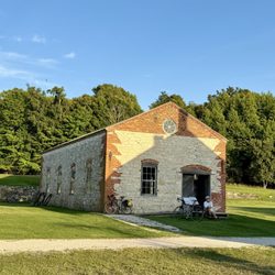
    Fayette State Park - Good to explore on bike

    Good to explore on bike

    Fayette State Park - Kiddos in the water

    Kiddos in the water

    Fayette State Park

    See all

    Ellison Bluff State Natural Area - parks - Updated May 2026

    Loading...
    Loading...
    Loading...