Ediz Hook Photos


You might also consider
More like Ediz Hook
Recommended Reviews - Ediz Hook
Start your review...


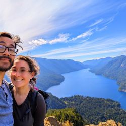
Ediz Hook is a 3-mile-long sand spit close to Port Angeles and extends north towards the Strait of Juan de Fuca. To get here, drive past a paper company in the industrial district down a narrow road. The U.S. Coast Guard sits at the end of the spit but there is plenty of space for you to park. It's known to be a place to watch the sunset which is what we did, and we saw other cars parked there doing the same. It was super windy outside so we took some pictures and then went back to the car. This spit allows both cars and pedestrians, whereas the longer sand spit east in Sequim (Dungeness Spit) doesn't allow cars. read more


This is a really ghetto park; it looks like it's the current homeless / drug hangout at the end of the peninsula. There is pretty much nothing there besides a few cars parked there for good on a dirt lot. We immediately left after we got to the end. The road to the way there was filled with crappy cars that raced way above the speed limit; it seems this is the local hooligan spot... There were some kite surfers on the way there to look at but in summary, Port Angeles seems like a fairly sad place to live. read more


A quick stop to see the sea and island Victoria of Canada. Drive passes some factories area and came to this nature created "hook" land, there's a coast guard station at the end of the hook. It's very windy and cold even in summer. read more


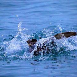
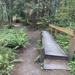
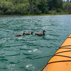
Ediz Hook is a place people go to fish and bird watch, canoe or kayak. This place was a bit confusing on how to get to, but my friend and I figured it out. You have to drive down the main street to the end, past a factory, then you're there. We were here in August 2020 and it was really cold with the wind off the ocean so bring a jacket. The sand flies, or whatever they are called, were in abundance out there so bring the bug spray too. Lots of seagulls and crows. Saw a food stand, but it was closed when we were there in late afternoon. Free parking. read more


8 months ago
More info about Ediz Hook
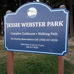
645 Ediz Hook Rd
Port Angeles, WA 98362
Directions
Hours
Outdoor Amenities
Ask the Community - Ediz Hook


Why does Yelp recommend reviews?
1 review that is not currently recommended
The reviews below are not factored into the business's overall star rating.
3 years ago
Ediz Hook - parks - Updated July 2026
Best of Port Angeles
People found Ediz Hook by searching for…
Things to Do in Port Angeles, WA
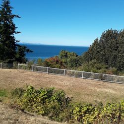
Watch Sunset in Port Angeles, WA
Free Parking in Port Angeles, WA
Fun Things to Do at Night in Port Angeles, WA
Fishing Spots in Port Angeles, WA
Picnic Areas in Port Angeles, WA
Places to Take Pictures in Port Angeles, WA
Sunset View in Port Angeles, WA
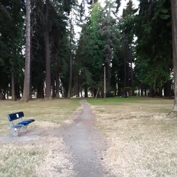
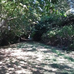
Walking Trails in Port Angeles, WA
Attractions in Port Angeles, WA
Dog Friendly Beaches in Port Angeles, WA
Photo Spots in Port Angeles, WA
View Points in Port Angeles, WA
What to Do in Port Angeles, WA
Tourist Attractions in Port Angeles, WA
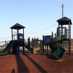
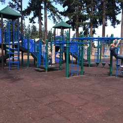
Playgrounds for Kids in Port Angeles, WA
Fun Things to Do on Your Birthday in Port Angeles, WA
Fishing Pier in Port Angeles, WA
Trending Searches in Port Angeles, WA
Browse Articles
Browse Nearby
Browse Brands
Related Searches in Port Angeles, WA
Best Off Leash Dog Parks in Port Angeles, Washington
Best Parks for Parties and Events in Port Angeles, Washington
Best Water Parks for Kids in Port Angeles, Washington
Check Out Great Playgrounds in Port Angeles, Washington
Discover Baseball Fields Around Port Angeles, Washington
Discover Beautiful Garden Spots in Port Angeles, Washington
Discover Popular Photo Spots in Port Angeles, Washington
Discover Top Nature Parks to Visit in Port Angeles, Washington
Discover the Best Beaches in Port Angeles, Washington
Enjoy Hiking Adventures in Port Angeles, Washington
Enjoy Scenic Places to Walk in Port Angeles, Washington
Enjoy the Best Picnic Spots and Ideas in Port Angeles, Washington
Enjoy the Best Walking Trails in Port Angeles, Washington
Explore Easy Hikes Perfect for All in Port Angeles, Washington
Explore Family-Friendly Zoos and Wildlife in Port Angeles, Washington
Explore Free Picnic Areas Around Port Angeles, Washington
Explore Fun Activities to Do in Port Angeles, Washington
Explore Parks With Pull Up Bars in Port Angeles, Washington
Explore Picnic Parks Near Port Angeles, Washington
Explore Popular Campgrounds Near Port Angeles, Washington
Explore Popular Picnic Areas Around Port Angeles, Washington
Explore Popular RV Parks Around Port Angeles, Washington
Explore Scenic Lakes to Visit in Port Angeles, Washington
Explore Top Dog Parks in Port Angeles, Washington Near You
Explore Top Trampoline Parks in Port Angeles, Washington
Explore Top Water Parks in Port Angeles, Washington Today
Find Beautiful Views in Port Angeles, Washington
Find Great Places to Feed Ducks in Port Angeles, Washington
Find Top Dog Friendly Parks to Visit in Port Angeles, Washington
Find Top Skate Parks in Port Angeles, Washington for All Skill Levels
Find a Park With BBQ Pits in Port Angeles, Washington
Find the Best Parks BBQ Grills in Port Angeles, Washington
Find the Best Parks for Picnics in Port Angeles, Washington
Find the Best Playgrounds to Visit in Port Angeles, Washington
Fun Things for Kids in Port Angeles, Washington
Have Fun at a Splash Pad in Port Angeles, Washington
Hiking Trails With Waterfalls in Port Angeles, Washington
Must-See Tourist Attractions Around Port Angeles, Washington
Picnic Areas With BBQ Pits Available in Port Angeles, Washington
Popular Outdoor Activities to Try in Port Angeles, Washington
Popular Picnic Spots to Visit in Port Angeles, Washington
Popular Things to Do in Port Angeles, Washington
Popular Things to See in Port Angeles, Washington
Safe and Fun Parks for Kids in Port Angeles, Washington
Top Amusement Parks to Visit in Port Angeles, Washington
Top Hiking Trails to Explore in Port Angeles, Washington
Top Playgrounds for Kids to Enjoy in Port Angeles, Washington
Top-Rated Basketball Courts to Play at in Port Angeles, Washington