Eagle Lake Trailhead Photos


More like Eagle Lake Trailhead
Recommended Reviews - Eagle Lake Trailhead
Start your review...

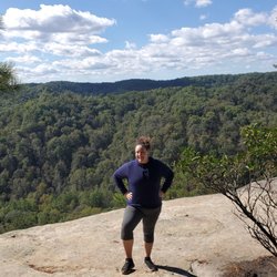
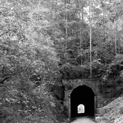
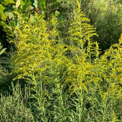
This is a nice trail that connects to the Sheltowee Trace National Recreation Trail and then loops on around Eagle Lake. Beautiful views of the lake and plenty of shade, as the trail is heavily wooded. This trail isn't especially difficult but there are some small up-and-down parts of the trail. I wouldn't call it moderately difficult but it isn't flat. The lake features fishing and kayaking. read more


More info about Eagle Lake Trailhead


Eagle Lake Trailhead - hiking - Updated June 2026
Best of Morehead
People found Eagle Lake Trailhead by searching for…
Things to Do in Morehead, Kentucky
Beautiful Views in Morehead, Kentucky
Hiking Trails in Morehead, Kentucky
Off Road Trails in Morehead, Kentucky
Waterfalls in Morehead, Kentucky
Scenic View in Morehead, Kentucky
Places to Take Pictures in Morehead, Kentucky
Fishing Lake in Morehead, Kentucky
Attractions in Morehead, Kentucky
Scenic Overlook in Morehead, Kentucky
Things to Do on a Rainy Day in Morehead, Kentucky
Walking Trails in Morehead, Kentucky
Running Trails in Morehead, Kentucky
Lakes & Ponds in Morehead, Kentucky
Fun Things to Do at Night in Morehead, Kentucky
Romantic Views in Morehead, Kentucky
Bicycles in Morehead, Kentucky
Lookout Points in Morehead, Kentucky
Electric Bikes in Morehead, Kentucky
Trending Searches in Morehead, KY
Day Trips near Eagle Lake Trailhead
Fireworks near Eagle Lake Trailhead
Fishing Spots near Eagle Lake Trailhead
Fruit Picking near Eagle Lake Trailhead
Hiking near Eagle Lake Trailhead
Parks near Eagle Lake Trailhead
Photo Spots near Eagle Lake Trailhead
Scenic Overlook near Eagle Lake Trailhead
Splash Pad near Eagle Lake Trailhead
Swimming Holes near Eagle Lake Trailhead
Browse Articles
Browse Nearby
BEST of Morehead, Kentucky Things to Do near Eagle Lake Trailhead
BEST of Morehead, Kentucky Parks near Eagle Lake Trailhead
BEST of Morehead, Kentucky Lakes near Eagle Lake Trailhead
BEST of Morehead, Kentucky Coffee near Eagle Lake Trailhead
BEST of Morehead, Kentucky Restaurants near Eagle Lake Trailhead
BEST of Morehead, Kentucky Taxis near Eagle Lake Trailhead
BEST of Morehead, Kentucky Breakfast near Eagle Lake Trailhead
BEST of Morehead, Kentucky Hot Springs near Eagle Lake Trailhead
Browse Brands
Related Searches in Morehead, KY
Affordable Bike Repair Services in Morehead, Kentucky
Affordable Bike Tune Up Services in Morehead, Kentucky
Affordable Cheap Bike Tune Up Services in Morehead, Kentucky
Best Dirt Bike Riding Spots in Morehead, Kentucky
Best Fishing Locations and Guides in Morehead, Kentucky
Best Fun Things to Do in Morehead, Kentucky
Best Lookout Points to Visit in Morehead, Kentucky
Best Nature Trails for Hiking in Morehead, Kentucky
Best Places for Horseback Riding in Morehead, Kentucky
Best Places for Stunning Views in Morehead, Kentucky
Best Waterfalls and Swimming Holes in Morehead, Kentucky
Check Out Off Road Trails in Morehead, Kentucky
Discover Popular Bike Trails in Morehead, Kentucky
Discover Scenic Creeks to Explore in Morehead, Kentucky
Discover Scenic Mountain Bike Trails Near Morehead, Kentucky
Discover Stunning Skyline View Spots in Morehead, Kentucky
Discover Top Nature Parks to Visit in Morehead, Kentucky
Discover the Best Night Hike Trails in Morehead, Kentucky
Enjoy Camping Adventures Around Morehead, Kentucky
Enjoy Exciting Mountain Biking Adventures in Morehead, Kentucky
Enjoy Hiking Adventures in Morehead, Kentucky
Enjoy Rope Swing Adventures in Morehead, Kentucky
Enjoy Tent Camping Spots Around Morehead, Kentucky
Enjoy the Best Night View Spots in Morehead, Kentucky
Enjoy the Best Walking Trails in Morehead, Kentucky
Explore Beautiful Parks and Green Spaces in Morehead, Kentucky
Explore Bike Rentals Throughout Morehead, Kentucky
Explore Easy Hikes Perfect for All in Morehead, Kentucky
Explore Electric Bikes Available in Morehead, Kentucky
Explore Family-Friendly Zoos and Wildlife in Morehead, Kentucky
Explore Free Things to Do Around Morehead, Kentucky
Explore Popular RV Parks Around Morehead, Kentucky
Explore Popular Scenic Overlook Points in Morehead, Kentucky
Explore Popular View Points Around Morehead, Kentucky
Explore Scenic Lakes to Visit in Morehead, Kentucky
Explore Secret Spots Worth Visiting in Morehead, Kentucky
Explore Top Water Parks in Morehead, Kentucky Today
Explore the Best Swimming Holes Around Morehead, Kentucky
Find Beautiful Views in Morehead, Kentucky
Find Cozy Camping Cabins in Morehead, Kentucky
Find Fun Kids Activities Outdoor in Morehead, Kentucky
Find Parks and Recreation Activities in Morehead, Kentucky
Find Specialized Bikes and Accessories in Morehead, Kentucky
Find Top Dog Swimming Spots in Morehead, Kentucky
Find a Fixed Gear Bike Shop in Morehead, Kentucky
Find the Best Bikes Available in Morehead, Kentucky
Find the Best Playgrounds to Visit in Morehead, Kentucky
Hiking Trails With Waterfalls in Morehead, Kentucky
People who viewed Eagle Lake Trailhead also viewed
Easy Walker Park
2 reviews
Cave Run Lake Information
3 reviews
Morehead City Park Complex
2 reviews
The Ole Cornfield
2 reviews
Carrington Green Golf Course
1 review
Minor E Clark Fish Hatchery
1 review
Whimzi Works
2 reviews
Every Bodies Fitness 24-7
1 review
Downtown Athletic Club
7 reviews
Military Adventure Camp
11 reviews