
Crag Crest National Recreation Trail Photos


More like Crag Crest National Recreation Trail
Recommended Reviews - Crag Crest National Recreation Trail
Start your review...



4 years ago
"Explore this 10.3-mile loop trail near Cedaredge, Colorado. Generally considered a moderately challenging route, it takes an average of 4 h 34 min to complete. This is a very popular area for hiking, so you'll likely encounter other people while exploring. The best times to visit this trail are June through October. Dogs are welcome, but must be on a leash." We clocked around 11 miles round trip. There were some downed trees along the trail so be prepared to go over and/or go around. The ridge was amazing. The trail was wide enough for my friend with a fear of heights to get over but it was very rocky. So many beautiful views along the way. Some bugs but not horrible. There is some parking near lake eggleston for the trail. There was a bathroom in the campground. There are also trash cans in the campground. There are no dog poop bags available so be sure to bring some with you if you are bringing your furry friends ;) There is a lot of exposure so be sure you are prepared for that. Definitely a beautiful hike. Out of all the hikes i did while up on the southern area of colorado this was definitely the busiest. Saw a lot of people out and about on the trail today. read more
More info about Crag Crest National Recreation Trail
Crag Crest Trl
Cedaredge, CO 81413
Directions
Hours
Outdoor Amenities

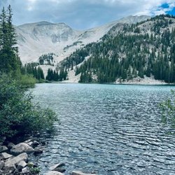


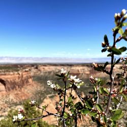
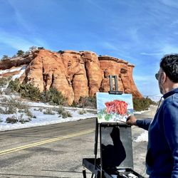
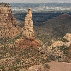


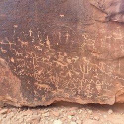

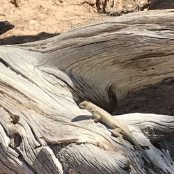


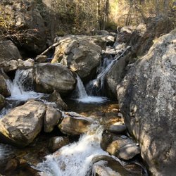


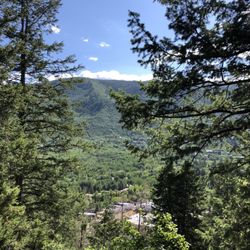





Crag Crest National Recreation Trail - hiking - Updated October 2026
Best of Cedaredge
People found Crag Crest National Recreation Trail by searching for…
Scenic Overlook in Cedaredge, CO
Hiking Trails in Cedaredge, CO
Walking Trails in Cedaredge, CO
Running Trails in Cedaredge, CO
Dog Friendly Trails in Cedaredge, CO
Camping Sites in Cedaredge, CO
Off Road Trails in Cedaredge, CO
Off Leash Dog Hikes in Cedaredge, CO
Places to Swim in Cedaredge, CO
Public Shower in Cedaredge, CO
National Parks in Cedaredge, CO
Lakes & Ponds in Cedaredge, CO
Scenic Restaurants in Cedaredge, CO
Trending Searches in Cedaredge, CO
Apple Orchards near Crag Crest National Recreation Trail
Apple Picking near Crag Crest National Recreation Trail
Hair Stylists near Crag Crest National Recreation Trail
Hiking Trails near Crag Crest National Recreation Trail
Leather Goods near Crag Crest National Recreation Trail
Off Road Trails near Crag Crest National Recreation Trail
Pharmacy near Crag Crest National Recreation Trail
Photo Booth Rentals near Crag Crest National Recreation Trail
Photo Spots near Crag Crest National Recreation Trail
Pick Your Own Farms near Crag Crest National Recreation Trail
Places To Take Pictures near Crag Crest National Recreation Trail
Pumpkin Patches near Crag Crest National Recreation Trail
Scenic Overlook near Crag Crest National Recreation Trail
Venues & Event Spaces near Crag Crest National Recreation Trail
Browse Articles
Browse Nearby
BEST of Cedaredge, Colorado Horseback Riding near Crag Crest National Recreation Trail
BEST of Cedaredge, Colorado Restaurants near Crag Crest National Recreation Trail
BEST of Cedaredge, Colorado Fishing near Crag Crest National Recreation Trail
BEST of Cedaredge, Colorado Rafting/Kayaking near Crag Crest National Recreation Trail
BEST of Cedaredge, Colorado Campgrounds near Crag Crest National Recreation Trail
Browse Brands
Related Searches in Cedaredge, CO
Affordable Kayak Rental Services in Cedaredge, Colorado
Best Dog Hiking Trails Around Cedaredge, Colorado
Best Fishing Locations and Guides in Cedaredge, Colorado
Best Fun Things to Do in Cedaredge, Colorado
Best Places for Horseback Riding in Cedaredge, Colorado
Check Out Off Road Trails in Cedaredge, Colorado
Discover Dog Friendly Trails to Explore in Cedaredge, Colorado
Discover a Hiking Trail in Cedaredge, Colorado
Discover the Best Night Hike Trails in Cedaredge, Colorado
Dog-Friendly Hikes With Dogs in Cedaredge, Colorado
Enjoy Camping Adventures Around Cedaredge, Colorado
Enjoy Off Leash Dog Hikes in Cedaredge, Colorado
Enjoy Tent Camping Spots Around Cedaredge, Colorado
Enjoy the Best Tubing Experiences in Cedaredge, Colorado
Enjoy the Best Walking Trails in Cedaredge, Colorado
Experience Thrilling White Water Rafting in Cedaredge, Colorado
Explore Beautiful Parks and Green Spaces in Cedaredge, Colorado
Explore Bike Rentals Throughout Cedaredge, Colorado
Explore Easy Hikes Perfect for All in Cedaredge, Colorado
Explore Fun Activities to Do in Cedaredge, Colorado
Explore Popular Campgrounds Near Cedaredge, Colorado
Explore Popular RV Parks Around Cedaredge, Colorado
Explore Popular Scenic Overlook Points in Cedaredge, Colorado
Explore Popular Scenic Views Near Cedaredge, Colorado
Explore Scenic Lakes to Visit in Cedaredge, Colorado
Explore Top Dog Parks in Cedaredge, Colorado Near You
Explore the Best Swimming Holes Around Cedaredge, Colorado
Family Friendly Hiking With Kids in Cedaredge, Colorado
Find Popular Ziplining Spots Around Cedaredge, Colorado
Find Top-Rated Waterfalls in Cedaredge, Colorado Now
Find the Best Playgrounds to Visit in Cedaredge, Colorado
Hiking Trails With Waterfalls in Cedaredge, Colorado
Off Leash Dog Hiking Trails in Cedaredge, Colorado
Plan a Scenic Drive Route Near Cedaredge, Colorado
Popular Kids Activities in Cedaredge, Colorado
Safe River Swimming Areas in Cedaredge, Colorado
Safe and Fun Parks for Kids in Cedaredge, Colorado
Top Hiking Trails to Explore in Cedaredge, Colorado
Top Paddleboarding Activities in Cedaredge, Colorado
Top Playgrounds for Kids to Enjoy in Cedaredge, Colorado
Top RV Campgrounds to Visit in Cedaredge, Colorado
Top Running Trails to Explore in Cedaredge, Colorado
Top Swimming Spots and Pools in Cedaredge, Colorado
Top Things to Do With Kids in Cedaredge, Colorado


