Coronado National Forest Photos


More like Coronado National Forest
Recommended Reviews - Coronado National Forest
Start your review...

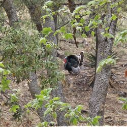
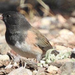
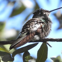
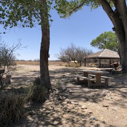
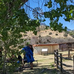
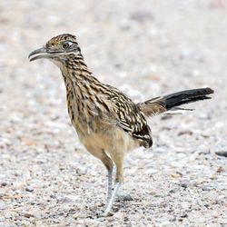
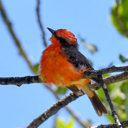
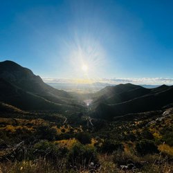
The CNF is my backyard. I first was introduced to this area in 1986 when I was a young Specialist in the US Army. I fell in love with the area and decided then I would retire to these moutains. Retired people like to golf, play Bingo!, RV travel and roadtrip. I like the outdoors, hiking, and exploring. I'm living my dream with the CNF. The forest is divided into many smaller tracts. I'm just east of the Huachuca mountains. There are trails to Miller and Carr Peaks and foothills trails right here. Just look at the website for many options. Drive 50 miles north, west or east and there are many more options in nearby towns. We have our share of wildlife, so be cautious if hiking alone. I've come across black bears, mountain lions, javelina, coatamundi, rattle snakes, and illegal border crossers sneaking across at night. Be situation aware! My dogs keep me protected. I don't have one favorite trail, as I like diversity, but Carr Peak is an easy peak to bag if you are in shape. The Perimeter trail in the eastern slopes of the Huachucas are great for full moon hikes. The Santa Ritas are charming and have hidden springs. If you hike with dogs, the CNF will deliver My hiking club, the Huachuca Hiking Club, does volunteer maintenance work on trails for the CNF. We are a tough bunch of older hikers. The local meetup, the Sky Island Hikers, does more local and easier hikes. I sometimes lead full moon hikes with them. read more


3 years ago
5 years ago


More info about Coronado National Forest
Hereford, AZ 85615
Directions
Hours
Outdoor Amenities


Coronado National Forest - hiking - Updated May 2026
Best of Hereford
People found Coronado National Forest by searching for…
Browse Nearby
BEST of Hereford, Arizona Things to Do near Coronado National Forest
BEST of Hereford, Arizona Restaurants near Coronado National Forest
BEST of Hereford, Arizona Parks near Coronado National Forest
BEST of Hereford, Arizona Coffee near Coronado National Forest
BEST of Hereford, Arizona Lakes near Coronado National Forest
BEST of Hereford, Arizona Campgrounds near Coronado National Forest
BEST of Hereford, Arizona Taxis near Coronado National Forest
BEST of Hereford, Arizona Breakfast near Coronado National Forest
BEST of Hereford, Arizona Hotels near Coronado National Forest
Browse Brands
Browse Articles
People who viewed Coronado National Forest also viewed
Carr Canyon
4 reviews
Ramsey Canyon Preserve
20 reviews
San Pedro Riparian National Conservation Area
18 reviews
Brown Canyon Ranch
7 reviews
Veterans Memorial Park
6 reviews
Double Adobe Campground and Shotgun Sports
6 reviews
Ramsey Canyon Cabins
6 reviews
$
B Active Bisbee
12 reviews
Sierra Vista Shooting Range
10 reviews
Fun Place
1 review