Cancel

Open app

Search

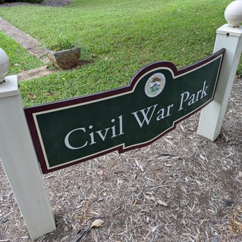
Civil War Park

3.0 (1 review)

Civil War Park Photos

Recommended Reviews - Civil War Park

Your trust is our priority, so businesses can't pay to alter or remove their reviews. Learn more about reviews.
Yelp app icon
Browse more easily on the app
Review Feed Illustration
Photo of Bruce K.
2442
26492
79148

18 days ago

Helpful 5
Thanks 0
Love this 2
Oh no 0

Verify this business for free

People searched for Parks 174 times last month within 15 miles of this business.

Verify this business

Sycamore Community Park - Hispanic Festival at Sycamore Community Park

Sycamore Community Park

5.0(2 reviews)
41.7 mi

Undoubtedly the best park in town! Unfortunately, there's often no one else there. Hopefully,…read morethat will change and this will help the word get out. Here, you get it all--shade sail covering the adult area with many picnic tables, a separate patio area for adults with chairs, a giant playpen-like structure with a bouncy ball in it and lined with garage tiles for safe falls for younger toddlers. There is a play set for younger kids and for older. I would say about age 3 to about 8 or 10. There is a car on a spring that rocks; a big, spiral slide, straight slights, a fake climbing mountain with seats on top, and tons and tons of options to climb and swing, including a jungle gym and even spiral-style monkey bars (they go in circle, rather than just in a straight line. There's a balance beam, different types of swings, and really everything you could possibly want. All that's missing is the kids, really. Absolutely amazing place. The greatest likelihood to catch other kids to play with is before lunchtime. The only downside is that there is zero shade on the actual playground itself. Very important note: This place is public and at the back of a church parking lot. Turn in right beside the blue library sign, and drive alllll the way back. You cannot see the playground from the street at all, not even upon turning into the lot.

My girls loved this playground and they are older too. We happened upon a Fall event there when we…read morevisited this time. Everyone was super sweet, the forgot was going, lights were hung, bathrooms were very clean. Great all around.

Photos
Sycamore Community Park - Hispanic Festival at Sycamore Community Park

Hispanic Festival at Sycamore Community Park

Sycamore Community Park - Hispanic Festival at Sycamore Community Park

Hispanic Festival at Sycamore Community Park

Sycamore Community Park

See all

Bear Creek Lake State Park

Bear Creek Lake State Park

4.3(33 reviews)
22.6 mi

Nestled in the heart of the Cumberland State Forest in central Virginia, activities in this park…read more(which is managed by Virginia State Parks) are centered around the 40-acre lake. We camped in this park for three nights in late April 2022; our stay included two weekday and one Friday night. There are three campgrounds in the park ... the Acorn Loop, which is lakeside and intended more for tent camping and Black Oak and Chestnut Loops, which are for larger RVs. Both of the latter campgrounds were closed for construction activities. Being lakeside, sites on the Acorn Loop, were very peaceful and relaxing though they are quite close to each other. Each site had a picnic table, fire ring, and a pole for a lantern. Only two sites were occupied during our Wednesday and Thursday night stay; there was about 70% occupancy on the Friday night but it was still relatively quiet. The bathhouse/showers were well-maintained. There is access to park trails directly from the campground. There are also a lodge and cabins available to rent. The park offers a boat launch, fishing pier, boat rentals, beach area/(unguarded) swimming, a snack bar, picnic shelter, playground, and an archery range. Some of these activities are seasonal. For instance, the snack bar and boat rentals were closed in late April. The park is also a great place to do some hikes. The Trail Guide is available at the Contact Station or online. There are a number of hiking trails in the park that are rated easy or moderate. We did the Lakeside Trail (easy, 1.52 miles), the Channel Cat Loop (moderate 1.78 miles), and some shorter connector trails. There are two short trails, Otter (0.16 mi) and Coyote (0.07 mi), which are handicap accessible. The park is also adjacent to state forest, which offers the 14-mile Cumberland Multi-use Trail, which is shared by hikers, bikers, and equestrians. Finally, there is some wi-fi availability in the park, primarily in the beach and campground areas.

We have come to the state park before and enjoyed it. We are in cabin 11. when we got here we were…read morepleasantly surprised with the upgrades and a new fireplace. Lots of walking trails. The staff are friendly.

Photos
Bear Creek Lake State Park - Front window

Front window

Bear Creek Lake State Park - Lakeside Trail.

Lakeside Trail.

Bear Creek Lake State Park

See all

Totier Creek Reservoir Park - The reservoir

Totier Creek Reservoir Park

4.5(2 reviews)
14.4 mi

Really awesome park to take a picnic lunch to and explore! My kids especially enjoyed scrambling…read morealong all the large, flat rocks along the large stream. Great outdoor option especially during the pandemic.

There was only one other car in the parking lot when we arrived on a Wednesday in June around 1:30…read more The first impression is that it is very neat and tidy. The parking lot is nicely paved. There is a kiosk with a picture of the trails, and a couple of picnic tables. There is also a place to put non-motorized boats into the reservoir. The bathrooms are "real" and clean but there is only one toilet. The hardest part was finding the beginning of the trails. There is a sign pointing to the right of the bathrooms but it's hard to see the actual post where the trail starts when the trees are in full bloom. It's there up by the tree line so be persistent! We did the outer loop which is a little over 2 miles. It took about and hour and 30 minutes but we stopped a lot. It's not the most exciting hike but it is an easy loop with some views of the reservoir. Mostly, it's a nice traipse through the woods. There are plenty of signs along the trails so no worries about getting lost. Oddly, there were a ton of downed trees. As far as bugs, the flies were the worst but they would come and go. We had on bug spray, so if there were mosquitoes they left us alone. One thing to keep in mind is that there is no cell service. Recommend for some quite time with nature.

Photos
Totier Creek Reservoir Park - There were a couple of short bridges

There were a couple of short bridges

Totier Creek Reservoir Park - Part of the trail

Part of the trail

Totier Creek Reservoir Park - Glimpse of the reservoir

See all

Glimpse of the reservoir

Appalachian Trail - Rockfish Gap Trailhead - There are several waterfalls near the A.T. - this is off the Jones Run (Blue Blaze) trail.

Appalachian Trail - Rockfish Gap Trailhead

4.2(5 reviews)
34.5 mi

There are few places in the world that can elicit a feeling of pure joy, nervousness and excitement…read moreas much as the Appalachian Trail. A few years back I read "A Walk in the Woods: Rediscovering America on the Appalachian Trail" by Bill Bryson (Fantastic BTW) and that's when A.T. fever hit me. I've done some hiking before... nothing like I experienced here though. Nothing at all. There are so many different feelings that coursed through me during my 2 week hike... days when I had the energy and drive to do 15+ miles, days when I'd leisurely hike about 8 miles and stopping at every vista, meadow or creek I could find to relax, nap or take some pictures. And then there were days where just putting on the hiking pack was a challenge, days that I just wanted to stay in my tent or in the shelter (3 days of straight rain will do that to ya). On to the good stuff though, you're looking at this to plan your own adventure not hear mine. Here's some good need to know stuff for you. Gear - I'll mention it, but you won't listen to the advice (I didn't either). Pack LIGHT! There was nothing worse than the extra weight of stuff I could've lived without. Examples: Cans of soup - good treat, but super heavy. Extra Clothes - you only need one extra T-Shirt and pair of pants. Underwear is more important, especially socks... bring extra socks. Warm dry feet are happy feet. Large Roll of Duct Tape - it's a lifesaver for sure, but it's heavy. I only used about 10-12 feet of it (tent, poncho and hiking pack repair), bring a small roll instead. Extra Rain Jacket - WHY? one poncho was all I needed. Oh, and if you were in the military like me.. DON'T use your issued Rucksack as a hiking pack... Yes, it's got nice compartments and comfy padding, but they're WAY too heavy and you can use that extra weight for more food/water. A lot of folks I bumped into were using Osprey Packs, just a suggestion. Drop-off / Parking - If you're only planning on doing a day hike or an over nighter, there is a small parking lot near the trailhead. Park, cross the bridge and walk about a quarter mile, the trailhead will be on your right side and marked by the standard White Blaze of the A.T. Blazes - The main color to follow is White, Blue blazes that spur off the A.T. go to Springs and/or Shelters. Blue blazes can be a fun side trip, check your map for the following: Jones Run & Doyle's Run - beautiful Waterfalls Ivy Creek - nice place to camp Water - When you see a spring or stream replenish your water supply. I know that it's heavy especially a few days into the hike, but take it from me... you don't want to run out. Another pointer - you should either boil or filter your water. I didn't do either on a few occasions and was just fine though... up to you. Waysides - First one you'll run across is Loft Mountain. Get a hot meal, some pop (soda) and recharge any electrical devices there. There is a Camp Store to resupply as well but it's not in the same building. Camp Store opens in Mid-May usually. The next one is Big Meadows - They have EVERYTHING there. Fire/Backwoods Camping - No open fires except at the shelters. Backwoods Camping (between shelters) is awesome, just make sure to pitch your tent so that it disturbs as little vegetation as possible and follow the "Leave No Trace" ethics please. Terrain - The terrain throughout the Shenandoah National Park section varies quite a bit, everything from easy paths through the woods to mountain paths that will seriously test your mettle. According to most thru-hikers, the S.N.P. section is the "easiest" as for as terrain... I'd hate to see the hardest. If your feet/ankles need a break from the trail; one good thing is that the A.T. crosses Skyline Drive several times, if you want a break from the trail you can walk on the blacktop for a while. Wild Animals - Keep a lookout for the Shenandoah Salamander - http://www.nps.gov/shen/naturescience/shenandoah_salamander.htm and Red Eft's they're pretty neat. I saw a couple Black Bears on the trail, they pretty much left me alone, just make sure to hang your food at night so they don't get to it. (10 ft up, 20+ yds from camp). There is A LOT of Deer in the park, you'll see plenty if you keep an eye out. Coyotes are what to watch out for, especially if hiking at night. My dog made me WELL aware if they were ever near. Most got skittish and ran after Rella barked, not all. We had one incident with a small male coyote that came at us, Rella ummm 'took care of it' I'll leave it at that. Guess those are all the big pointers I can pass along. I had a really great time on this section of A.T. and would highly recommend any avid hiker or outdoorsy folk to check it out. Even if it's only for a day-hike or weekend camping trip, it's well worth it.
Sorry for the 1-star (you may change my "review" to 5-star when this is fixed). Often referred to…read moreas "Afton Mountain," Rockfish Gap is not in Bedford, VA. This is the intersection of the Appalachian Trail (abt mp 863.5), Blue Ridge Parkway, Skyline Drive, I-64 exit 99 (I think), and US Rt 250. To the west is Waynesboro, Stuarts Draft, and Staunton. To the east is Afton, Crozet, and Charlottesville. How do I know? The gap is about 2 miles out my back window. Not much commerce at rhe gap itself, except the wonderful old-time "King's Gourmet Popcorn" stand which has much more than popcorn. There is a motel and a couple of B&Bs a mile or so West on Rt. 250 near the Western edit of the famous Blue Ridge Tunnel (check it out on YouTube), which then pops you out in the village of Afton on the east side of the Blue Ridge. A longer walk back to the Gap, but adequate parking is at either terminus. Afton is in an area rich with wineries, distilleries, and breweries. Blee BleesRockfishRetreat.com
Photos
Appalachian Trail - Rockfish Gap Trailhead - Me and Rella. April 2013

Me and Rella. April 2013

Appalachian Trail - Rockfish Gap Trailhead - Watching new friends leaving the shelter (Blackrock)

Watching new friends leaving the shelter (Blackrock)

Appalachian Trail - Rockfish Gap Trailhead - More Deer... chillin' and posing for the camera.

See all

More Deer... chillin' and posing for the camera.

Preddy Creek Trails Park - We didn't see any horses, but barely avoided stepping on what they left behind!

Preddy Creek Trails Park

4.8(5 reviews)
22.4 mi

This is a substantial preserve that is free to enter. Some facilities without running water are…read moreavailable at the entrance. The topography varies, and the meadow near the parking lot is markedly distinct from the valley in which the actual creek lies. One suspension bridge crosses the creek and it was in quite good condition, but it could also be crossed on foot, or on hoof as this is a horse area. There were several miles of trails and I was worn out enough that I did only a fraction of them, but they were quite pleasant. Various signage suggested this parking lot was a spot for thieves despite the rural location; I suppose it is a highbrow crowd that would be parking here. It also suggests that anytime your shoe leaves a mark the trail is too wet to walk, which if taken literally is kind of ridiculous. Fortunately, if you lock your car and make your own decisions about mud, you can have a good experiences.

This is a great park we happen to find in the area. After spending the previous day at the winery,…read morewe needed to do a small hike. Unfortunately, it was extremely cold and windy and we didn't have bug spray, so we didn't get didn't get too adventurous. For these reasons, we tried the easiest trail--the Meadow Loop Trail. It was an easy loop around a grassy area, took maybe less than 10 minutes. There was a very detailed map at the entrance of the trails. This included all the available trails, the level of difficulty for each trail, basic etiquette, friendly reminders, etc. There was also a reminder that everyone needs to watch out for each other --hikers, bikers and horse riders. We didn't see any horses, but we did try to dodge the "presents" they left behind. We did see some bikers returning from the trail. There was a large parking lot, which most likely fills up when the weather is nicer. Cameras are watching the parking lot, but it's always best to lock cars and hide valuables :). There were bathrooms available, but not the type with running water....if you get what I mean! Would I return? Can't say for sure since it's pretty far.

Photos
Preddy Creek Trails Park - We chose to do the easy meadow trails for the sake of time .....and because of the insane wind and cold!

We chose to do the easy meadow trails for the sake of time .....and because of the insane wind and cold!

Preddy Creek Trails Park - Bathrooms and map

Bathrooms and map

Preddy Creek Trails Park - Book library/donation

See all

Book library/donation

Civil War Park - parks - Updated October 2026

Loading...
Loading...
Loading...