Cascade Falls Photos


More like Cascade Falls
Recommended Reviews - Cascade Falls
Start your review...


Reviews With Photos


4 mile hike but worth every step VERY Beautiful would do it again.. Not for the beginner unless you take the lower trail.. upper tail is high moderate trail..


The provenance of this site is somewhat unclear, but I think it falls under the federal government and putting up my national parks pass was successful in getting me through a visit without paying any additional parking fee. The main falls are two miles uphill from the parking lot, but the entire journey is a series of eminently worthwhile sights and sounds. Signs warned of challenging currents for anyone taking a dip in the water, which some people did. I would note that when I arrived a rescue operation was underway and emergency services did drive someone by me with what thankfully appeared okay. There are trails on one elevated bank and one closer to the water, as well as some offshoots and extensions. It's a great stretch of forest where you could easily spend more time than the couple of hours I did.

I thought the lower trail was supposed to be easier; it wasn't as steep/steady an incline and had scenic places to stop and enjoy being down by the water, but was much longer (more than a mile more) and involved navigating more stone stepping stones. Glad we took the upper trail on the way down/back.


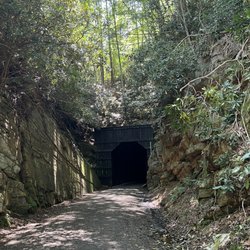
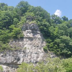
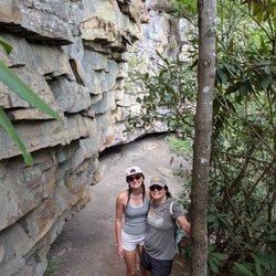
Nestled in the Jefferson National Forest section of the Virginia Appalachian Mountains is a trail reminiscent of scenes from the movie Indiana Jones. The overall hike to the waterfall is approximately 2 miles one way or 4 miles round trip back to the parking lot. The parking area is spacious with room for more than 2 dozen cars . That being said, it's a popular trail and can fill up quickly. ~ TWO TRAILS | ONE DESTINATION There are two routes to the waterfall. An upper and lower trail with a few connectors in between. The monument sign at the trailhead says the lower trail is the more scenic trail while the upper trail gives more of a cardio challenge, but we would beg to differ. The upper trail is far more spacious and mostly seems to be a gravel road gradually and steadily climbing its way to the falls while the lower trail bounces up and down the entire way. [ THE LOWER TRAIL ] While the lower trail is said to be more scenic, there are some impressive points along the upper trail as well. I did not find the lower trail to be all that attractive until after the 3rd bridge. Until then, the creek was mostly filled with blown over trees and rocky surfaces. But the occasional man-made rocky walkways next to the creek and stone stairs reminded me of an Indiana Jones quest for sure. One section truly felt like the scene were if you stepped on the wrong stone, you might trigger a booby trap and get shot with a poisonous dart. There were actually two other impressive waterfalls along the way to the main fall. However, one of them had so many downed trees covering it that it was impossible to photograph. Otherwise it would have been roughly a 15 foot beauty. The other seemed to be coming from a different creek, dropping into the main creek from a cliff about 35 feet up. It would've REALLY been impressive if the water flow had been greater. [ THE FALLS ] 69 foot Cascade Falls comes into view as we walked up a set of stone stairs near a giant boulder that looks like a doorway as the branches of a nearby tree arch towards the boulder. Once through this opening, the falls are visibly about 150 yards away. This is a popular waterfall to stay and play so the pool at the base of the falls will likely be filled with swimmers in the summer months. The area feels much like an open-air stadium as the waterfall is surrounded by two hundred foot cliff walls. [ THE UPPER TRAIL ] IF you hiked the lower trail to the falls, traditionally you would take the upper trail back to the parking area. Near the big falls are a set of steep stairs to the upper trail, but we opted to follow the lower trail a few hundred yards back to a gentle side trail leading to the upper trail. The upper trail is far smoother and more relaxing than the lower trail since you have far fewer hazards to look out for while walking. ~ FINAL THOUGHTS Cascade Falls was voted Blue Ridge Country Magazine Favorite Waterfall (30th anniversary edition) and the falls also won the GOLD AWARD for Best Short Hike as voted by readers of The Roanoker. While most people only come to hike the trail to the big Cascade, few know you can continue another mile to the Upper Cascades and Barney's Wall. Just follow the wooden stairs to the left of the falls observation deck. It can be trick, so google step by step directions. We did not continue because it began to rain heavily and the wives insisted on returning to the car. DANG IT!!! YES DEAR! I'm assuming it was the right decision since a black butterfly greeted us with a kiss upon returning to the parking area. Oh well, next time! Here is a video link showing the Cascades, Upper Cascades and Barney's Wall: https://www.youtube.com/watch?v=_n9kQ1UZZMM&feature=youtu.be&fbclid=IwAR3MV50SMv5FSbXWojA9CO6-hJtWfbvww3U47Mappq_j5wIMCzDNbYCrVsg NOTE: $3 parking fee required 2020 / 36


Of the more than 75 waterfalls that I've explored over the past few years, this hike ranks near the top of my must visit list. I recommend taking the lower trail on the way up to the falls, as it's the more scenic route. After a few days of decent rainfall, this cascade is very photogenic and is among my favorite waterfalls to photograph in this region of Virginia. To avoid the crowd and to experience a different vantage point on your descent, I recommend taking the upper trail. This is easy to do by staying to the right at each fork in the trail, on your way down. On weekends and around major holidays this area can become very busy, so I recommend arriving early to beat the crowd. Humans are very predictable and seldom arrive early, so it's easy to avoid said crowd.


Ok listen. You're gonna see reviews being like "there are more steps on this one" or "I loved the hike". Don't listen to them; listen to me. This is NOT a beginners hike. As someone with a full backside and anxiety, this was a challenging hike. I would rate it as a hard beginners or moderate intermediate. Was it beautiful? Of course. Did every single person that passed me complain about how long it is and ask where the top was? Absolutely. The lower hike has more ups and downs but like.. they do be UP like FLIGHTS of stairs. Bring water. Bring a snack. Bring a strong will to live, because that is going to be eroded by the time you even get to the falls. After that, it's a jaunty 45 minute walk back where your thighs are seizing and you're dreaming of garlic bread.


Wanted to find a nice hike to take the kids on before our tour of VA Tech (wasn't aware the tour was a hike in itself)! Found this little gem! If my son chooses Texh or if I get back up to Blacksburg, I'm definitely doing this hike again! It was so lovely and fun. Reminded me of beloved Washington (minus the heat) Take the time to hike this one.


We drove up from Raleigh for the day. Oftentimes, sightseeing day-trips like this leave us a little disappointed ... the sights really aren't worth seeing. Cascade Falls, though, was worth the trip. We took the scenic lower trail up to the falls. It's a winding, stone covered path along the creek that ended up being a little more than 2 miles one way. That path had plenty to offer in its own right, with beautiful small rapids along the creek and the whole trail covered by the tree canopy. We took our 100-lbs dog. I'll offer this advice: a lot of stone stairs and rock jumping. It had just rained and with my large dog on a leash, it was probably a little more treacherous than I'd prefer. I hear the upper trail is flatter and may be a better option for people with dogs. The two miles on the lower trail required a lot of concentration for novice hikers, so our anticipation was built when we rounded the final turn and saw the nearly 70-ft falls! Just beautiful. The kids got in the ice cold water for a bit and made some great memories. I highly recommend.


Cascade Falls is AMAZING. I visited my friend in Virginia. We went hiking at Jeffereson National Forest. And what a great hike it was. After hiking an one and a half or so, the trails end with a beautiful view of Cascade Falls. It is probably the biggest falls I have ever seen. And to be so close to it and stand underneath the falls is mind blowing. If you have any friend or family member that goes to Virginia Tech, use any excuse to the visit them just so they can take you to Cascade Falls. Yes, it's that amazing!! ^^


One of my favorite hikes ever! You go a while through a residential area to get there but there were many people there. It had rained a lot earlier so the rapids were super high. It was slippery in some spots but it was so well maintained - bridges, stone/mortar paths, and railings. Not too crowded on the trail. As it had rained heavily sometimes the trail was obstructed by two or three sizable streams but passage wasn't impossible. The falls is magnificent and imposing. There is a flat rocky area and a big round pool that receives the waterfall. There was also a path with a railing that went up the hill next to the falls so you could get closer. Swimming is allowed but seems dangerous and the water was cold. You should definitely consider this hike if you're in the area!


Cascade Falls is a highly scenic hike within Jefferson National Forest. Parking is $3 cash, exact change only. My recommendation, if you are looking for a challenge, would be to take the scenic lower trail down to see Cascade Falls and take the upper trail for an easy way back. This is a 4-mile round-trip trail with a beautiful 66-foot waterfall at the end. If it is a nice day, bring your swimsuit and take a dip. Or, spend your time walking up the steps to get different views of the waterfall. Cascade Falls is a must visit if you are in the area.


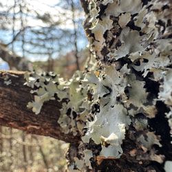
Cascade Falls is one of the most scenic hikes on the East Coast. While it's not, tall canopied trees, ever present moss, lichen and wild mushrooms and very wet / humid environment reminded me of Hoh Rain Forest and western Vancouver Island. This is a moderate hike but have some difficult components like wet and rocky trails. This POPULAR trail is near Roanoke (1.25 hour) and Blacksburg (1/2 hour). HIKING ONLY and dogs on leash. Here's the DL. = Parking is EXACT CASH ONLY $3/day. 1) STOP at the entrance before parking 2) pay in the envelope provided, write your info AND tear the perforated part 3) Deposit the payment 4) Display the perforated paper on your mirror or dash 5) Park in 1 of 83 stalls - You may need to wait for a spot to open + Facilities, water and trash only at the trail head + Moderate elevation (~700') and 4+miles round trip - NO accommodation for people needing assistance + Dog friendly (on leash and pack out any mess) + 66ft Cascade Falls is at 2880 feet and many small falls along the lower trail + VERY Well maintained and marked trails + SCENIC Lower trail is wet/slippery, stone & wooden steps up along Little Stony Creek + Upper trail is wider, gradual elevation, smaller rocks / pebbles and less scenic I arrived at 8:45AM Saturday and there were 6 vehicles. A couple of people were already returning from their hikes and were leaving. My total hike took less than 2 hours. I took the lower trail that is more scenic up. This route is S shaped up crossing a bridge over LSC at the start and back another bridge at the half way point (~1M). This trail was very wet and was dominated by flat stone pavements, stone steps and wooden steps. Parts of it were slippery and caution is necessary. Took about 50 minutes to reach the CF with at least a dozen stops for pictures and to appreciate the nature splendor, at the top, spent 20 minutes walking around and took in the 66ft cascade. Took the upper trail on my return and it went along the LSC too but from higher elevation. The upper trail was wider and gradually descended. But it was sprinkled with pebbles! I twisted my ankle a couple of times (wore ankle supported Gortex boots) and stopped to shake out tiny gravels from my shoes. This route took about 40 minutes and if it weren't for pebbles, you could run/jog down. After reaching the fall, there are additional wooden steps and wooden bridge to a higher lookout area that provides a different perspective. There are wooden benches to rest and appreciate the view along the trail. On my way up I saw only 6 people but on my way back ~ 12 people. When I finished, the parking lot was full and someone was already waiting for my spot. It was before 11am Saturday. Overall, I'll definitely be back to hike this lovely again but will do the lower trail up and back. The upper trail is often written as easier / faster but I found it annoyingly filled with small pebbles. Maybe due to the copious amount of rain / storm we had recently, Little Stony Creek was roaring drowning out all the noise of daily life in my head along the lower trail. Or maybe I just felt at home in an environment similar to PNW ;-)


This is a great waterfall hike. It's one of the bigger waterfalls that I've seen on East Coast and it's great because we're situated. It feeds into a small recreational swimming hole area. Highly suggest changing into a bathing suit and doing the approximate 2 mile hike to the falls. On the way, you'll see a lot of smaller falls and some spots where you can go and splash your feet in the water. I came after a spotty storm and the trail was a little bit wet so it'd be good to bring some grippy shoes. There are a couple of stones and rocks and roots to wander through. It's definitely worth a trip and the three dollar parking fee charge since it's a national car unless you have a national park pass that you can leave on your dash the national Park pass is roughly 60 or $70 per year unless you're military or have a disability and you can get it for free. There are a couple of bathrooms at the start of the trail and nowhere near the Falls to change read more


5 months ago
Tony Vanoy and I went hiking today at Cascade Falls in Pembroke, VA. Started out really great, we thought it was 1.5 or 2 mile loop hike but OMG it turned out to be 5.57 miles roundtrip!! It cost a $3 per car to park and if you have America the Beautiful Card its free!! It was a beautiful day, but it was so long and so many stairs!! Over 1,000 stairs!! read more




2 months ago
4 mile hike but worth every step VERY Beautiful would do it again.. Not for the beginner unless you take the lower trail.. upper tail is high moderate trail.. read more


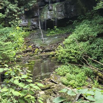


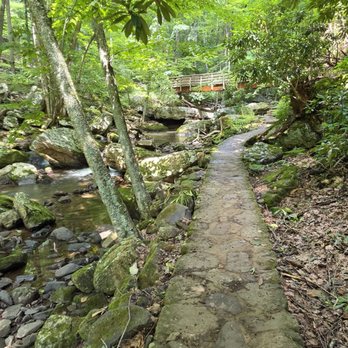
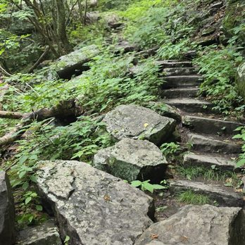
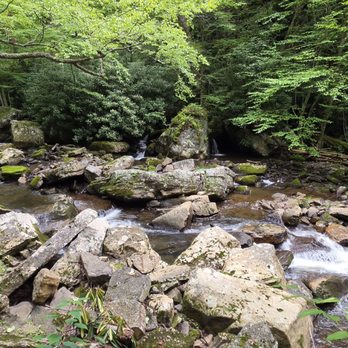

The provenance of this site is somewhat unclear, but I think it falls under the federal government and putting up my national parks pass was successful in getting me through a visit without paying any additional parking fee. The main falls are two miles uphill from the parking lot, but the entire journey is a series of eminently worthwhile sights and sounds. Signs warned of challenging currents for anyone taking a dip in the water, which some people did. I would note that when I arrived a rescue operation was underway and emergency services did drive someone by me with what thankfully appeared okay. There are trails on one elevated bank and one closer to the water, as well as some offshoots and extensions. It's a great stretch of forest where you could easily spend more time than the couple of hours I did. read more


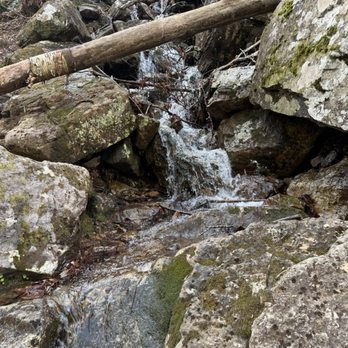


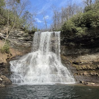

1 year ago

1 year ago
I thought the lower trail was supposed to be easier; it wasn't as steep/steady an incline and had scenic places to stop and enjoy being down by the water, but was much longer (more than a mile more) and involved navigating more stone stepping stones. Glad we took the upper trail on the way down/back. read more


2 years ago

6 years ago
Nestled in the Jefferson National Forest section of the Virginia Appalachian Mountains is a trail reminiscent of scenes from the movie Indiana Jones. The overall hike to the waterfall is approximately 2 miles one way or 4 miles round trip back to the parking lot. The parking area is spacious with room for more than 2 dozen cars . That being said, it's a popular trail and can fill up quickly. ~ TWO TRAILS | ONE DESTINATION There are two routes to the waterfall. An upper and lower trail with a few connectors in between. The monument sign at the trailhead says the lower trail is the more scenic trail while the upper trail gives more of a cardio challenge, but we would beg to differ. The upper trail is far more spacious and mostly seems to be a gravel road gradually and steadily climbing its way to the falls while the lower trail bounces up and down the entire way. [ THE LOWER TRAIL ] While the lower trail is said to be more scenic, there are some impressive points along the upper trail as well. I did not find the lower trail to be all that attractive until after the 3rd bridge. Until then, the creek was mostly filled with blown over trees and rocky surfaces. But the occasional man-made rocky walkways next to the creek and stone stairs reminded me of an Indiana Jones quest for sure. One section truly felt like the scene were if you stepped on the wrong stone, you might trigger a booby trap and get shot with a poisonous dart. There were actually two other impressive waterfalls along the way to the main fall. However, one of them had so many downed trees covering it that it was impossible to photograph. Otherwise it would have been roughly a 15 foot beauty. The other seemed to be coming from a different creek, dropping into the main creek from a cliff about 35 feet up. It would've REALLY been impressive if the water flow had been greater. [ THE FALLS ] 69 foot Cascade Falls comes into view as we walked up a set of stone stairs near a giant boulder that looks like a doorway as the branches of a nearby tree arch towards the boulder. Once through this opening, the falls are visibly about 150 yards away. This is a popular waterfall to stay and play so the pool at the base of the falls will likely be filled with swimmers in the summer months. The area feels much like an open-air stadium as the waterfall is surrounded by two hundred foot cliff walls. [ THE UPPER TRAIL ] IF you hiked the lower trail to the falls, traditionally you would take the upper trail back to the parking area. Near the big falls are a set of steep stairs to the upper trail, but we opted to follow the lower trail a few hundred yards back to a gentle side trail leading to the upper trail. The upper trail is far smoother and more relaxing than the lower trail since you have far fewer hazards to look out for while walking. ~ FINAL THOUGHTS Cascade Falls was voted Blue Ridge Country Magazine Favorite Waterfall (30th anniversary edition) and the falls also won the GOLD AWARD for Best Short Hike as voted by readers of The Roanoker. While most people only come to hike the trail to the big Cascade, few know you can continue another mile to the Upper Cascades and Barney's Wall. Just follow the wooden stairs to the left of the falls observation deck. It can be trick, so google step by step directions. We did not continue because it began to rain heavily and the wives insisted on returning to the car. DANG IT!!! YES DEAR! I'm assuming it was the right decision since a black butterfly greeted us with a kiss upon returning to the parking area. Oh well, next time! Here is a video link showing the Cascades, Upper Cascades and Barney's Wall: https://www.youtube.com/watch?v=_n9kQ1UZZMM&feature=youtu.be&fbclid=IwAR3MV50SMv5FSbXWojA9CO6-hJtWfbvww3U47Mappq_j5wIMCzDNbYCrVsg NOTE: $3 parking fee required 2020 / 36 read more


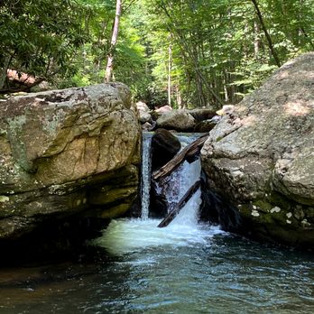


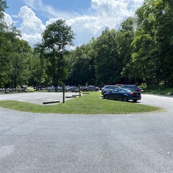


Of the more than 75 waterfalls that I've explored over the past few years, this hike ranks near the top of my must visit list. I recommend taking the lower trail on the way up to the falls, as it's the more scenic route. After a few days of decent rainfall, this cascade is very photogenic and is among my favorite waterfalls to photograph in this region of Virginia. To avoid the crowd and to experience a different vantage point on your descent, I recommend taking the upper trail. This is easy to do by staying to the right at each fork in the trail, on your way down. On weekends and around major holidays this area can become very busy, so I recommend arriving early to beat the crowd. Humans are very predictable and seldom arrive early, so it's easy to avoid said crowd. read more


6 years ago
Ok listen. You're gonna see reviews being like "there are more steps on this one" or "I loved the hike". Don't listen to them; listen to me. This is NOT a beginners hike. As someone with a full backside and anxiety, this was a challenging hike. I would rate it as a hard beginners or moderate intermediate. Was it beautiful? Of course. Did every single person that passed me complain about how long it is and ask where the top was? Absolutely. The lower hike has more ups and downs but like.. they do be UP like FLIGHTS of stairs. Bring water. Bring a snack. Bring a strong will to live, because that is going to be eroded by the time you even get to the falls. After that, it's a jaunty 45 minute walk back where your thighs are seizing and you're dreaming of garlic bread. read more


Wanted to find a nice hike to take the kids on before our tour of VA Tech (wasn't aware the tour was a hike in itself)! Found this little gem! If my son chooses Texh or if I get back up to Blacksburg, I'm definitely doing this hike again! It was so lovely and fun. Reminded me of beloved Washington (minus the heat) Take the time to hike this one. read more




7 years ago
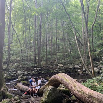
We drove up from Raleigh for the day. Oftentimes, sightseeing day-trips like this leave us a little disappointed ... the sights really aren't worth seeing. Cascade Falls, though, was worth the trip. We took the scenic lower trail up to the falls. It's a winding, stone covered path along the creek that ended up being a little more than 2 miles one way. That path had plenty to offer in its own right, with beautiful small rapids along the creek and the whole trail covered by the tree canopy. We took our 100-lbs dog. I'll offer this advice: a lot of stone stairs and rock jumping. It had just rained and with my large dog on a leash, it was probably a little more treacherous than I'd prefer. I hear the upper trail is flatter and may be a better option for people with dogs. The two miles on the lower trail required a lot of concentration for novice hikers, so our anticipation was built when we rounded the final turn and saw the nearly 70-ft falls! Just beautiful. The kids got in the ice cold water for a bit and made some great memories. I highly recommend. read more


14 years ago
Cascade Falls is AMAZING. I visited my friend in Virginia. We went hiking at Jeffereson National Forest. And what a great hike it was. After hiking an one and a half or so, the trails end with a beautiful view of Cascade Falls. It is probably the biggest falls I have ever seen. And to be so close to it and stand underneath the falls is mind blowing. If you have any friend or family member that goes to Virginia Tech, use any excuse to the visit them just so they can take you to Cascade Falls. Yes, it's that amazing!! ^^ read more


6 years ago
One of my favorite hikes ever! You go a while through a residential area to get there but there were many people there. It had rained a lot earlier so the rapids were super high. It was slippery in some spots but it was so well maintained - bridges, stone/mortar paths, and railings. Not too crowded on the trail. As it had rained heavily sometimes the trail was obstructed by two or three sizable streams but passage wasn't impossible. The falls is magnificent and imposing. There is a flat rocky area and a big round pool that receives the waterfall. There was also a path with a railing that went up the hill next to the falls so you could get closer. Swimming is allowed but seems dangerous and the water was cold. You should definitely consider this hike if you're in the area! read more


9 years ago
Cascade Falls is a highly scenic hike within Jefferson National Forest. Parking is $3 cash, exact change only. My recommendation, if you are looking for a challenge, would be to take the scenic lower trail down to see Cascade Falls and take the upper trail for an easy way back. This is a 4-mile round-trip trail with a beautiful 66-foot waterfall at the end. If it is a nice day, bring your swimsuit and take a dip. Or, spend your time walking up the steps to get different views of the waterfall. Cascade Falls is a must visit if you are in the area. read more


9 years ago
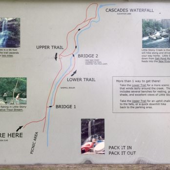
Cascade Falls is one of the most scenic hikes on the East Coast. While it's not, tall canopied trees, ever present moss, lichen and wild mushrooms and very wet / humid environment reminded me of Hoh Rain Forest and western Vancouver Island. This is a moderate hike but have some difficult components like wet and rocky trails. This POPULAR trail is near Roanoke (1.25 hour) and Blacksburg (1/2 hour). HIKING ONLY and dogs on leash. Here's the DL. = Parking is EXACT CASH ONLY $3/day. 1) STOP at the entrance before parking 2) pay in the envelope provided, write your info AND tear the perforated part 3) Deposit the payment 4) Display the perforated paper on your mirror or dash 5) Park in 1 of 83 stalls - You may need to wait for a spot to open + Facilities, water and trash only at the trail head + Moderate elevation (~700') and 4+miles round trip - NO accommodation for people needing assistance + Dog friendly (on leash and pack out any mess) + 66ft Cascade Falls is at 2880 feet and many small falls along the lower trail + VERY Well maintained and marked trails + SCENIC Lower trail is wet/slippery, stone & wooden steps up along Little Stony Creek + Upper trail is wider, gradual elevation, smaller rocks / pebbles and less scenic I arrived at 8:45AM Saturday and there were 6 vehicles. A couple of people were already returning from their hikes and were leaving. My total hike took less than 2 hours. I took the lower trail that is more scenic up. This route is S shaped up crossing a bridge over LSC at the start and back another bridge at the half way point (~1M). This trail was very wet and was dominated by flat stone pavements, stone steps and wooden steps. Parts of it were slippery and caution is necessary. Took about 50 minutes to reach the CF with at least a dozen stops for pictures and to appreciate the nature splendor, at the top, spent 20 minutes walking around and took in the 66ft cascade. Took the upper trail on my return and it went along the LSC too but from higher elevation. The upper trail was wider and gradually descended. But it was sprinkled with pebbles! I twisted my ankle a couple of times (wore ankle supported Gortex boots) and stopped to shake out tiny gravels from my shoes. This route took about 40 minutes and if it weren't for pebbles, you could run/jog down. After reaching the fall, there are additional wooden steps and wooden bridge to a higher lookout area that provides a different perspective. There are wooden benches to rest and appreciate the view along the trail. On my way up I saw only 6 people but on my way back ~ 12 people. When I finished, the parking lot was full and someone was already waiting for my spot. It was before 11am Saturday. Overall, I'll definitely be back to hike this lovely again but will do the lower trail up and back. The upper trail is often written as easier / faster but I found it annoyingly filled with small pebbles. Maybe due to the copious amount of rain / storm we had recently, Little Stony Creek was roaring drowning out all the noise of daily life in my head along the lower trail. Or maybe I just felt at home in an environment similar to PNW ;-) read more




3 years ago

This trail was so scenic. We took the lower more strenuous trail up to the big falls and the wider one on the return. Beautiful views of rocks, moss covered rocks and cascading water all the way up the path. Wildflowers were very pretty too. Took us 4 hours but took lots of pictures. Don't forget a water bottle. Highly recommend. read more


14 years ago

7 years ago

10 years ago


14 years ago

11 years ago
Great little hike that took us about 2 1/2 hours with stopping for awhile at the falls. We did it with our 13 and almost 10 year old and they did great. I was wearing my Fit Bit and it clocked the hike at closer to 4.4 miles round trip so plan for that. Definitely worth the drive! read more

9 years ago
7 years ago
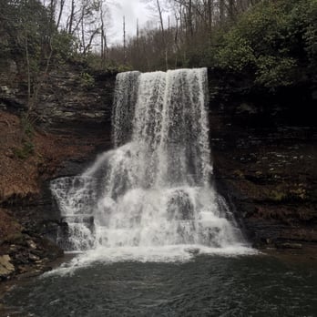
I was looking for an easy to moderate hike while in Roanoke for a wedding this weekend and this fit the bill! Although it's just about an hour away from downtown Roanoke it was totally worth the trip! The trails were not crowded and it felt like the two of us were the only two around until we reached the end of the trail at the base of the waterfall. We used first time advice we found online which was to take the second route (over the first bridge) on the way out and take the upper trail on the way back. The route out had a bit of ups and downs, lots of stairs that followed the river, and not nearly as steep as the alternative. Although pictures don't do it justice, here is a glimpse into the views you will have during most of the hike if you take this route. read more


9 years ago

13 years ago

10 years ago

10 years ago

10 years ago
12 years ago
10 years ago
13 years ago

10 years ago
More info about Cascade Falls
2068 Cascade Dr
Pembroke, VA 24136
Directions
(540) 552-4641
Call Now
Hours
Outdoor Amenities