Cape Royal Road Photos


You might also consider
More like Cape Royal Road
Recommended Reviews - Cape Royal Road
Start your review...

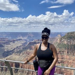
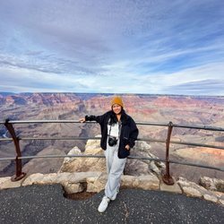
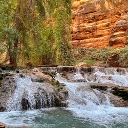
The Cape Royal Trail is simply breathtaking! The North Rim of the Grand Canyon isn't as large or as popular as the South Rim. However, the vista points are just as grand and way more enjoyable in my honest opinion. For one thing, you're in one of the most remote rims in the Grand Canyon that is only accessible during certain parts of the year. And for this reason alone, the journey here already feels special. Cape Royal Road is an excellent place to explore while visiting Grand Canyon's remote North Rim. The Cape Royal Trail isn't any kind of strenuous hike by any means. In fact, it's an easy leisurely stroll that measures a quick 1 mile or so in total. The reason for your visit should simply be for the views. And let me tell you; those views will NEVER disappoint. the depths of the canyons are so astounding. These are views that just keep getting grander the further in that you go. Not to bad mouth the South Rim, but these views don't "look at the same" on this rim trail. There's so much variation in the scenery. It's so uncanny. One really neat viewpoint from the trail is Angel's Window. It's a large gaping hole in a section of the canyon that can be easily seen from the trail. It actually looks pretty scary, like that part of the canyon could collapse at any time. And of course, there's a section where YOU can walk right on top of it! Yes, for those of you who like the adrenaline rush; Do it! It's actually not as scary as it looks from far away. There's a gated pathway that will take you to the edge, and you can imagine how amazing the views are from this point. I witnessed it firsthand, and it's pretty extraordinary. And then of course, you can peek deep down into the canyon and spot the Bright Angel and North Kaibib trails as well as parts of the Colorado River. It's just so fascinating. Since the Cape Royal Trail is flat and paved, it's easily accessible to those with small children and people with disabilities. It makes for an excellent family adventure or even just a fun stop along the drive through the North Rim. This was definitely one of my favorite stops during my visit to Grand Canyon North Rim. When on the North Rim, make some time to stop here. The majestic views will make it worth while. read more


More info about Cape Royal Road


Cape Royal Road - parks - Updated May 2026
Best of North Rim
People found Cape Royal Road by searching for…
River Swimming in North Rim, AZ
Picnic Tables in North Rim, AZ
Picnic Areas BBQ Pits in North Rim, AZ
Hiking Trails in North Rim, AZ
Parks for Picnics in North Rim, AZ
Scenic Overlook in North Rim, AZ
Walking Trails in North Rim, AZ
Places to Swim in North Rim, AZ
Park & Forests in North Rim, AZ
Browse Nearby
BEST of North Rim, Arizona Restaurants near Cape Royal Road
BEST of North Rim, Arizona Coffee near Cape Royal Road
BEST of North Rim, Arizona Breakfast near Cape Royal Road
BEST of North Rim, Arizona Hiking near Cape Royal Road
BEST of North Rim, Arizona Horseback Riding near Cape Royal Road
BEST of North Rim, Arizona Campgrounds near Cape Royal Road
Browse Brands
Browse Articles
People who viewed Cape Royal Road also viewed
Bright Angel Trail
123 reviews
Grand Canyon View
64 reviews
South Kaibab Trail
90 reviews
Grand Canyon National Park Lodges-South Rim
28 reviews
Grand Canyon Recreation Center
3 reviews
Tusayan Greenway Trailhead - Arizona Trail
1 review
Grand Canyon
22 reviews
Way Far Out Adventures, LLC.
3 reviews
Grand Canyon Bikes
18 reviews
Bright Angel Point Trail
8 reviews