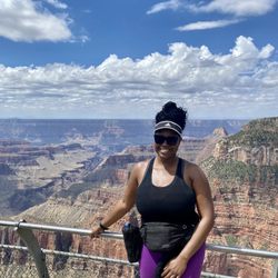
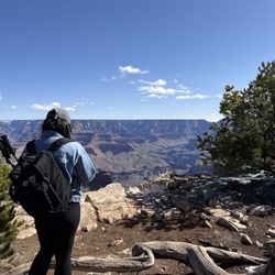
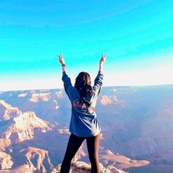
Desert View Drive Photos


You might also consider
More like Desert View Drive
Recommended Reviews - Desert View Drive
Start your review...

11 years ago
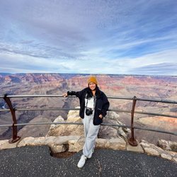
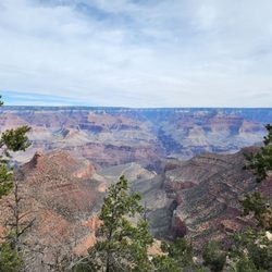
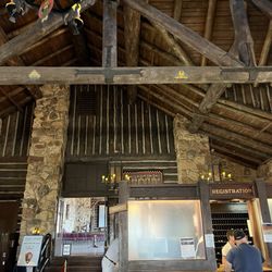
One of our favorite spots to view the Grand Canyon. The best viewpoint along Desert View Drive is at the Watchtower where the Desert View Visitor Center is located. If you are headed up to Page, AZ...then Desert Drive would be the best route to take. The road leads all the way east to Cameron, AZ. From there you can take Hwy 89 North to Page or South to Flagstaff. Anyways, there are other view points to stop at Desert View Drive. All the viewpoints give terrific photo opportunities of the Grand Canyon. There is also the Tusayan Museum along this route as well. Most tourists only go to the main Grand Canyon Visitor Center. If you have the time, then check out the sites along Desert View Drive! You won't be disappointed. read more


First view spot from the south rim entrance from Page, Arizona. We got there around 5 pm.. all the stores n visitor center are closed but doesn't stop us going there..nice cold breeze so dress warm. Its place n trail very clean n nice. Its easy n short trail. Nice view of the canyon while watching sunset. read more


13 years ago
More info about Desert View Drive
Grand Canyon, AZ 86023
Directions
Hours
Outdoor Amenities
Desert View Drive Reviews in Other Languages
You might also consider


Desert View Drive - parks - Updated May 2026
Best of Grand Canyon
People found Desert View Drive by searching for…
Things to Do in Grand Canyon, AZ
Playgrounds in Grand Canyon, AZ
Picnic Areas in Grand Canyon, AZ
Visitor Centers in Grand Canyon, AZ
Parks for Kids in Grand Canyon, AZ
Sunset View in Grand Canyon, AZ
Hiking Trails in Grand Canyon, AZ
Playgrounds for Kids in Grand Canyon, AZ
Things to Do at Night in Grand Canyon, AZ
Picnic Spots in Grand Canyon, AZ
Scenic Drive in Grand Canyon, AZ
Picnic Tables in Grand Canyon, AZ
Sunrise View in Grand Canyon, AZ
Waterfalls in Grand Canyon, AZ
View Points in Grand Canyon, AZ
Tourist Attractions in Grand Canyon, AZ
Picnic Areas BBQ Pits in Grand Canyon, AZ
Hiking With Kids in Grand Canyon, AZ
Running Trails in Grand Canyon, AZ
Browse Nearby
BEST of Grand Canyon, Arizona Coffee near Desert View Drive
BEST of Grand Canyon, Arizona Hiking near Desert View Drive
BEST of Grand Canyon, Arizona Restaurants near Desert View Drive
BEST of Grand Canyon, Arizona Things to Do near Desert View Drive
BEST of Grand Canyon, Arizona Playgrounds near Desert View Drive
BEST of Grand Canyon, Arizona Breakfast near Desert View Drive
BEST of Grand Canyon, Arizona Campgrounds near Desert View Drive
BEST of Grand Canyon, Arizona Motel near Desert View Drive
BEST of Grand Canyon, Arizona Lodging near Desert View Drive
Browse Brands
Browse Articles
People who viewed Desert View Drive also viewed
South Kaibab Trail
90 reviews
Desert View Entrance Station
23 reviews
Grand Canyon National Park
11 reviews
The Watchtower
19 reviews
Grand Canyon View
64 reviews
Mooney Falls
25 reviews
Grand Canyon - North Rim
92 reviews
South Entrance Station
19 reviews
Grand Canyon National Park Lodges-South Rim
28 reviews
Way Far Out Adventures, LLC.
3 reviews