Cape Byron Walk Photos


Recommended Reviews - Cape Byron Walk
Start your review...

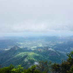
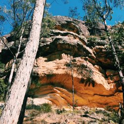
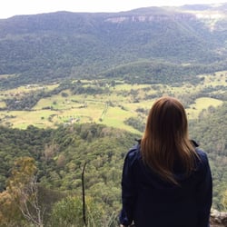
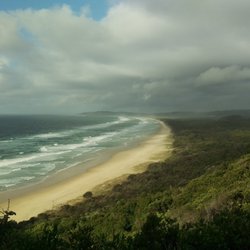
Beautiful area! We took the longer trail up to the lighthouse from a parking lot near Brooke drive. Had brunch at the pass cafe. As you start on the trail look up in the trees and you might spot a koala. They are pretty high up, but visible. Head through the rain forest terrains up a very nice steep trail that is well maintained. You will come to many picturesque spots with spectacular views of the sea it's splendid! The light house itself is beautiful. Sitting high upon a lookout its white gleaming features remind me of Greece. There are also trails down to the rocky beach area where there are crashing waves and tide pools. Very cool hike/ walk. read more
One of my favourite things about Byron Bay is this walk. Yes, the social life is fun, the beaches are gorgeous and the weather is warm, but I think the walk really wins as my favourite Byron Bay activity. The walk can be configured in different ways, but basically it weaves its way down to Wategos Beach, then up to the eastern-most point of Australia, and then around to the Cape Byron lighthouse, then down through some gorgeous bushland, in a sort of loop. Or you can do it the other way around. It's definitely run-able, although some sections are steep and full of steps, so often everyone but the most fit athletes are reduced to walking... One of the things I love about this walk (apart from how gorgeous the vistas are...) is the steep up and down nature of it all. Steep climbs and descents, varied terrain, from open and in the sun, to hidden in the trees. How long it takes is entirely up to you. I started the walk as a jog - on the other side of town, and then did a sort of run-walk, circling back. That took about 75 minutes. Unfortunately most of the walk is not wheelchair accessible, and it can be pretty rough if you have bad knees. read more


There are few things I'll wake up to start my day in the dark and Cape Byron walk to the lighthouse is one reason. The sunrise walk lives up to its hype and I highly encourage it. It's beautiful seeing the day begin here. read more

9 years ago
12 years ago
We went for a day to the beautiful Byron Bay! Which reminded me of Venice beach, California. Lots of young, chill, hip people enjoying themselves. Gorgeous scenic beaches and nice shops with surrounding restaurants. Paradise looking forests filled with kangaroos and koalas. I tried to catch one crossing our road but no luck. Wild Koalas are fast, unlike the ones in kept in a zoo! Finally we made our way to the light house which has an amazing lookout point. I definitely recommend checking this spot out, if you're lucky enough to get to this part of the world! ;)) read more


11 years ago
More info about Cape Byron Walk
Lighthouse Road
Byron Bay New South Wales 2481
Australia
Directions
Hours
Outdoor Amenities