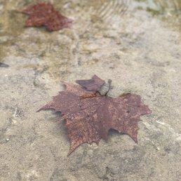
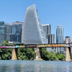
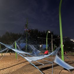
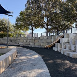
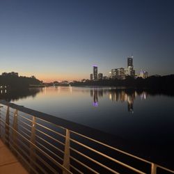
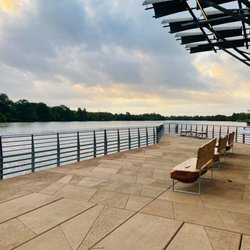
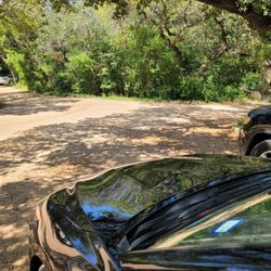
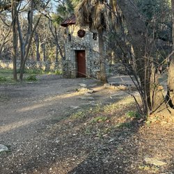
Bull Creek District Park Photos


You might also consider
More like Bull Creek District Park
Recommended Reviews - Bull Creek District Park
Start your review...

Reviews With Photos


GROSS!!! This place is hella polluted, the water looks pretty filthy, there is trash everywhere and no one here seems to care much about nature. I would not recommend coming here. First thing I saw coming in was a warning advisory notifying the public of high bacterial levels detected and may cause illness. Contact with water is NOT recommended!

I love Bull Creek park. I love walking along the water, but almost never want to brave the crowds you get down by Town Lake and Barton Springs. This park feels like a little piece of nature tucked just outside of Austin, and without driving too far away. When the weather is dry, you can hike the stream bed easily and enjoy the rock formations created by years of moving water. In wetter weather, the falls gets moving a little more quickly and the trails can get pretty slick and muddy. However: it would be wonderful if there would either be some leash law enforcement or a change in the rules here. About half (or more) of the dogs we see are off leash, despite several explicit signs about this being a leashed park. I would love to let my dog romp around off leash in the water, but the point of leash laws is to ensure dog owners know what to expect and can manage safe dog introductions. Owners, just because you think your dog is friendly, doesn't mean letting your off-leash pup rush my on-leash pup is a good idea. If you bring your dog here, please be respectful of the leash laws for the safety of all dogs and people.

I've been coming here since i was little, it's one of the safest, family friendly areas that i can comfortably hang out at.... until yesterday when my car and another family's car got broken into, belongings stolen, $1000's of dollars withdrawn from cards, broken windows etc. Apparently this has been happening a lot lately, so i wouldn't recommend it.


I am only reviewing the trails at the park and from the perspective of a trail-runner. This is a great place to introduce others to running trail. It's at a park many Austinites already know, yet most likely have no idea there are miles of trails just above where everyone normally gathers. The trails are a mixture of very runnable flat bits with lots of small to medium-sized rolling hills. There are also several more-challenging, short climbs that range from 80-100 feet. My typical loop there is a little under 5 miles with about 700ft of elevation gain. There are approximately 10 optional "out & backs" along my route to get almost exactly 1000ft of vert. What you'll want to do is cross the shallow part of the creek near the parking area where the volleyball nets and restrooms are. To the left, you should see the trailhead. About 50 feet from the trailhead, you will want to go in the general left direction and away from the creek and towards the hills. In 1/4 mile, hang a right at the trail marker and start heading up the steep hill along the barbed wire fence. This hill is called Treacherous and goes straight up 100ft in just a few hundred feet. Hang a left at the boulder at the top to start on the high trails. In just a few minutes the trail will veer to the right and go alongside and above 360 for a bit. Take note of the trail heading down on the left just before the veer, we'll be going down that as you wrap up the loop. Continue for 1/4 mile to the fork. You are now at the end of the stick on this lollipop trail. My loop now continues counter-clockwise and will take you back to this same spot later to double up on the lollipop stem and wrap things up. Take a right at the next fork in just a bit then an almost immediate left. If you want to check out the abandoned VW bus, take a right there first then come back to continue (it's just up 50ft or so.) Continue on the main trail for about 1 mile to another main fork where you will take a left. A right here is one of the many "out & backs" if you want extra gain, this is one of the more significant ones and will end on Valburn Dr. Chances are, any little side trail you see can be explored and for extra vert. Just come back down and continue on with the loop after each. After about another 3/4 mile (guessing) you will come to a split where I normally take the right for extra gain then a left a minute later after climbing the hill. Start heading down the steep portion and hang a quick right in just about 50ft. This is the entrance to the upcoming set of 24 downhill switchbacks (aka Slinky) which are super fun to bomb. Keep on for approximately 1/3 mile and I'll try my best to describe the next intersection. You will see a trail to the right, keep going just a bit and veer to the left. In just a very short bit you will hang a left (take note of trail on the right as you will come back to this spot and start this section again later.) In a minute or so you will start Slinky. Between the 5th and 6th switchback you will want to take the side trail taking you away from the switchbacks and off to another lite set of switchbacks within these. In 1/2 mile the trail will come to a T where you will hang a left, go downhill to a really great overlook above Inga's Trail and 360. I usually have a snack here and give my pup some treats and water. Backtrack up the hill and continue on, passing the trail entrances to the right, one of which you exited just earlier. At the top of this hill you should be back to the intersection that is the beginning of Slinky. This time bomb it all the way to the bottom, almost 1 mile. You should exit the wooded area and cross the retention pond/dam. Head up the little climb and in just a second you will be at the end of the lollipop stick I mentioned earlier. If you want to do another loop take a left. Otherwise, head to the right to wrap this up. Head all the way to the steep downhill side trail we noted much earlier in the directions (this is where I mentioned to veer right and run above 360.) Head down (be careful here, lots of loose rocks, roots and steep) and in just a minute you will be at the waterfall area where I usually have a quick dip. You will have to scramble down a bit here exiting the trail. You will need to come back to this spot if you decide to get in the water and hang a left to go in the general direction of where we initially crossed the creek to start this whole thing. 1/4 mile along the creek and you should be at ground zero. I'm thinking about continuing on with detailed route descriptions for all of the many trails I run. If this was helpful, please let me know and check out my other reviews.

Nice park. Our first time here. We came when it was cold so we couldn't get in the water. But it's was a beautiful walk along the water. Looks like dogs really like this place. So it was cool to see that. We'll be back when the Texas weather heats up. Location is easy and convenient to get to. Parking is ample.

A very nice little park that's simple and just what nature intended. You can stay near the parking area and just enjoy the little waterfall and the cool clear water or you can go on an excursion and explore the area like Lewis and Clark. Worth stopping and just relaxing to the sounds of the water and birds for a little while. You can have fun wet or dry here, but if you want to really explore you will get a little wet.

Are we in doggy heaven? I think so. The sun is shining, the birds are chirping, dogs are playing and the water gurgles peacefully in the creek... Ahhh... Serenity Now. Dogs galore frequent this park running from one end to another and bounding through the creek. This place gets CROWDED when the weather is nice. I typically judge places by the crowd. For instance, if you're I'm in a new place and I don't know where to eat I search for the place with the longest line. I'm a true believer that the longer the line the better the food (typically). While Bull Creek doesn't have lines, except if you count parking, a ridiculous amount of canines and their human counterparts swarm this park - especially on the weekends. Therefore, if you, and/or dog, don't care for a busy park with lots of dogs and people, this might not be the place for you. Also, if you have an aggressive dog I would NOT recommend this place, or any off-leash crowded dog park, for you.

Great place to bring the dogs and the family. Trails around a running creek that has swimming holes tucked throughout it. Mossy rocks can be slippery and there are spots with not much water or water that I wouldn't let my dog swim in. But, for the most part, enough clean deep holes to swim in to have fun. We walk along the creek to ensure the dogs keep cool and all in all - always have fun spending the day here.

This is a fairly easy hike as in distance, however the terrain makes it a little challenging. The surface has rock, dirt, gravel, stumps and water. So insure the soles of your shoes are in good shape to prevent falls. I've walked here a couple of times now. Today it was a little chilly but nothing too bad. The last time it was warmer and the vegetation was much greener. The trail is about 1.5 miles long but back and forth you can get around 3 miles. So if you are looking for different scenery, then be sure to stop by here! read more


1 year ago
Exercise is a fundamental part of our lives! My husband and I sometimes walk through the neighborhood in an effort to have together time and get some exercise...a twofer! We were so carried away with our conversation this morning, we ended up at Bull Creek District Park. We walked around Bull Creek for a while and then headed home. You can see mountain bikers often at Bull Creek and sometimes runners or avid walkers especially on the weekends. On the weekend it can be quite busy. It's ideal for enjoying nature or catching up. read more


Our visit was wonderful here - we started out at St. Edwards which I am now just checking out the reviews on St. Ed's parking. I am quite blessed to say that our vehicle was untouched. Bull Creek wasn't crowded. The water was clear and the time on this trail was ABSOLUTELY BEAUTIFUL. My partner and I sat by a small body of clear, crystal blue water. We talked for over an hour and enjoyed not only each others company, but the scenery and weather. Ugh, MY HEART. read more


1 year ago
2 years ago
If you love nature and wanna be alone chilling this the place to think about life , you see tadpoles fishes swimmings in the river plus sunny day just excellent good place to bring your family and dogs also good for hiking read more


GROSS!!! This place is hella polluted, the water looks pretty filthy, there is trash everywhere and no one here seems to care much about nature. I would not recommend coming here. First thing I saw coming in was a warning advisory notifying the public of high bacterial levels detected and may cause illness. Contact with water is NOT recommended! read more

I love Bull Creek park. I love walking along the water, but almost never want to brave the crowds you get down by Town Lake and Barton Springs. This park feels like a little piece of nature tucked just outside of Austin, and without driving too far away. When the weather is dry, you can hike the stream bed easily and enjoy the rock formations created by years of moving water. In wetter weather, the falls gets moving a little more quickly and the trails can get pretty slick and muddy. However: it would be wonderful if there would either be some leash law enforcement or a change in the rules here. About half (or more) of the dogs we see are off leash, despite several explicit signs about this being a leashed park. I would love to let my dog romp around off leash in the water, but the point of leash laws is to ensure dog owners know what to expect and can manage safe dog introductions. Owners, just because you think your dog is friendly, doesn't mean letting your off-leash pup rush my on-leash pup is a good idea. If you bring your dog here, please be respectful of the leash laws for the safety of all dogs and people. read more

4 years ago
I've been coming here since i was little, it's one of the safest, family friendly areas that i can comfortably hang out at.... until yesterday when my car and another family's car got broken into, belongings stolen, $1000's of dollars withdrawn from cards, broken windows etc. Apparently this has been happening a lot lately, so i wouldn't recommend it. read more


Not to impressed with this park. It is in a beautiful area and it's very sad that it hasn't been maintained as it has so much potential. There is two sides to the park. They do have an area to access some shallow water for swimming and a few tables to enjoy a shaded picnic. read more


7 years ago
I am only reviewing the trails at the park and from the perspective of a trail-runner. This is a great place to introduce others to running trail. It's at a park many Austinites already know, yet most likely have no idea there are miles of trails just above where everyone normally gathers. The trails are a mixture of very runnable flat bits with lots of small to medium-sized rolling hills. There are also several more-challenging, short climbs that range from 80-100 feet. My typical loop there is a little under 5 miles with about 700ft of elevation gain. There are approximately 10 optional "out & backs" along my route to get almost exactly 1000ft of vert. What you'll want to do is cross the shallow part of the creek near the parking area where the volleyball nets and restrooms are. To the left, you should see the trailhead. About 50 feet from the trailhead, you will want to go in the general left direction and away from the creek and towards the hills. In 1/4 mile, hang a right at the trail marker and start heading up the steep hill along the barbed wire fence. This hill is called Treacherous and goes straight up 100ft in just a few hundred feet. Hang a left at the boulder at the top to start on the high trails. In just a few minutes the trail will veer to the right and go alongside and above 360 for a bit. Take note of the trail heading down on the left just before the veer, we'll be going down that as you wrap up the loop. Continue for 1/4 mile to the fork. You are now at the end of the stick on this lollipop trail. My loop now continues counter-clockwise and will take you back to this same spot later to double up on the lollipop stem and wrap things up. Take a right at the next fork in just a bit then an almost immediate left. If you want to check out the abandoned VW bus, take a right there first then come back to continue (it's just up 50ft or so.) Continue on the main trail for about 1 mile to another main fork where you will take a left. A right here is one of the many "out & backs" if you want extra gain, this is one of the more significant ones and will end on Valburn Dr. Chances are, any little side trail you see can be explored and for extra vert. Just come back down and continue on with the loop after each. After about another 3/4 mile (guessing) you will come to a split where I normally take the right for extra gain then a left a minute later after climbing the hill. Start heading down the steep portion and hang a quick right in just about 50ft. This is the entrance to the upcoming set of 24 downhill switchbacks (aka Slinky) which are super fun to bomb. Keep on for approximately 1/3 mile and I'll try my best to describe the next intersection. You will see a trail to the right, keep going just a bit and veer to the left. In just a very short bit you will hang a left (take note of trail on the right as you will come back to this spot and start this section again later.) In a minute or so you will start Slinky. Between the 5th and 6th switchback you will want to take the side trail taking you away from the switchbacks and off to another lite set of switchbacks within these. In 1/2 mile the trail will come to a T where you will hang a left, go downhill to a really great overlook above Inga's Trail and 360. I usually have a snack here and give my pup some treats and water. Backtrack up the hill and continue on, passing the trail entrances to the right, one of which you exited just earlier. At the top of this hill you should be back to the intersection that is the beginning of Slinky. This time bomb it all the way to the bottom, almost 1 mile. You should exit the wooded area and cross the retention pond/dam. Head up the little climb and in just a second you will be at the end of the lollipop stick I mentioned earlier. If you want to do another loop take a left. Otherwise, head to the right to wrap this up. Head all the way to the steep downhill side trail we noted much earlier in the directions (this is where I mentioned to veer right and run above 360.) Head down (be careful here, lots of loose rocks, roots and steep) and in just a minute you will be at the waterfall area where I usually have a quick dip. You will have to scramble down a bit here exiting the trail. You will need to come back to this spot if you decide to get in the water and hang a left to go in the general direction of where we initially crossed the creek to start this whole thing. 1/4 mile along the creek and you should be at ground zero. I'm thinking about continuing on with detailed route descriptions for all of the many trails I run. If this was helpful, please let me know and check out my other reviews. read more

Nice park. Our first time here. We came when it was cold so we couldn't get in the water. But it's was a beautiful walk along the water. Looks like dogs really like this place. So it was cool to see that. We'll be back when the Texas weather heats up. Location is easy and convenient to get to. Parking is ample. read more

A very nice little park that's simple and just what nature intended. You can stay near the parking area and just enjoy the little waterfall and the cool clear water or you can go on an excursion and explore the area like Lewis and Clark. Worth stopping and just relaxing to the sounds of the water and birds for a little while. You can have fun wet or dry here, but if you want to really explore you will get a little wet. read more

Are we in doggy heaven? I think so. The sun is shining, the birds are chirping, dogs are playing and the water gurgles peacefully in the creek... Ahhh... Serenity Now. Dogs galore frequent this park running from one end to another and bounding through the creek. This place gets CROWDED when the weather is nice. I typically judge places by the crowd. For instance, if you're I'm in a new place and I don't know where to eat I search for the place with the longest line. I'm a true believer that the longer the line the better the food (typically). While Bull Creek doesn't have lines, except if you count parking, a ridiculous amount of canines and their human counterparts swarm this park - especially on the weekends. Therefore, if you, and/or dog, don't care for a busy park with lots of dogs and people, this might not be the place for you. Also, if you have an aggressive dog I would NOT recommend this place, or any off-leash crowded dog park, for you. read more


8 years ago
Pretty good spot to bring your pup, although it wasn't very clearly marked as to where the trails were - we parked up in the nearby neighborhood to get to the creek area where our pup could play in the water off leash. Water was cool & clean - would recommend! read more


9 years ago
9 years ago
Great place to bring the dogs and the family. Trails around a running creek that has swimming holes tucked throughout it. Mossy rocks can be slippery and there are spots with not much water or water that I wouldn't let my dog swim in. But, for the most part, enough clean deep holes to swim in to have fun. We walk along the creek to ensure the dogs keep cool and all in all - always have fun spending the day here. read more


8 years ago
I loved the view here! So green and pretty! You definitely will need water shoes if you want to go in the water. The water is not super deep. It's a great place to bring the kids/dogs and have a nice bbq! read more


13 years ago
9 years ago
We are new to Austin and had literally the best time ever here. Parking was easy to find and free, there wasn't really any directions so we just got out and walked along the creek, found a bunch of waterfalls, crossed along the creek a couple of times. Wear shoes that can get wet and you can hike in, bring water, there's bathrooms in one of the parking lots. read more


17 years ago
15 years ago
"Plenty of dogs, pretty scenery, and some good old fashioned exercise." Yes, you heard correctly that Bull Creek used to be a great off leash park for dogs. It still is (yet the leash law is in place here now). Although, I can say next to no one follows the leash law here. I'm totally okay with it as long as your dog listens and behaves itself on the trail. I always make sure another trail goer has a friendly dog prior to letting my dog just jump in and play (although she usually knows how to pick the friendly playmates). This is a great park with a ton of doggy swimming areas to throw the stick. There are plenty of secluded areas and scenic views. There are a couple of great parking spaces. One of 360 and Winding Ridge Road which takes you right to the water falls (that's if we are lucky enough to get some rain, so there's not always a waterfall). Then there's parking lots off of 360 and Lakewood Drive. This is where the main field for dogs is and some of the deeper swimming holes and streams. This area also has some great trail markers with mini hikes...don't stray off or you might into walking way the heck up the hill to someone's house. Not saying I've done this or anything... Anyways, this is a great place when the weather is just right and you want a bit of fresh air. The plus side is wearing my dog out so she goes home and sleeps. Bull Creek is one of the many things that goes on the list of why Austin is really cool. I'm not talking cool weather...we all know it gets pretty dang hot here. read more

12 years ago
15 years ago
Stumbled upon this place by accident. We had some extra time before having to drop the husband off at the airport, and the pups were getting cranky in the backseat, as all children do. We did a quick google search of off-leash dog parks in Austin, and Bull Creek came up. So we headed over, only to find that there is actually no off-leash area. Silly google, we probably should have yelped it. But we were not disappointed! The creek was full and moving rapidly, thanks to the storm last night. My arctic dogs loved it! Then we found a secret staircase and climbed some rocks, got deliciously muddy and pretended we were much further away from the city than we actually were. All in all, the park was relatively clean and quiet. Next time the old ball and chain flies out of Austin, we'll plan to spend some more time there because honestly, there's nothing like driving back to San Antonio with the smell of two wet dogs. At least they were sleeping. read more

19 years ago
18 years ago
Page 1 of 2
More info about Bull Creek District Park
6701 Lakewood Dr
Austin, TX 78731
Directions
Hours
Indoor Amenities
Outdoor Amenities
Bull Creek District Park Reviews in Other Languages
Ask the Community - Bull Creek District Park
Review Highlights - Bull Creek District Park
You might also consider


Why does Yelp recommend reviews?
Bull Creek District Park - parks - Updated May 2026
Best of Austin
People found Bull Creek District Park by searching for…
Trending Searches in Austin, TX
Baseball Fields near Bull Creek District Park
Boat Rental near Bull Creek District Park
Botanical Gardens near Bull Creek District Park
Bounce House Rentals near Bull Creek District Park
Campgrounds near Bull Creek District Park
Cherry Picking near Bull Creek District Park
Cliff Jumping near Bull Creek District Park
Dog Friendly Things To Do near Bull Creek District Park
Fishing Lake near Bull Creek District Park
Flower Shop near Bull Creek District Park
Garage Sales near Bull Creek District Park
Hair near Bull Creek District Park
Nurseries & Gardening near Bull Creek District Park
Off Leash Dog Parks near Bull Creek District Park
Outdoor Activities near Bull Creek District Park
Outdoor Basketball Courts near Bull Creek District Park
Outdoor Furniture Stores near Bull Creek District Park
Party Equipment Rentals near Bull Creek District Park
Pedicure near Bull Creek District Park
Pick Your Own Farms near Bull Creek District Park
Picnic Spots near Bull Creek District Park
Places To Take Pictures near Bull Creek District Park
Plant Nursery near Bull Creek District Park
Public Beaches near Bull Creek District Park
Rock Quarry near Bull Creek District Park
Scenic Drive near Bull Creek District Park
Splash Pad near Bull Creek District Park
Strawberry Picking near Bull Creek District Park
Browse Articles
Browse Nearby
BEST of Austin, Texas Coffee near Bull Creek District Park
BEST of Austin, Texas Things to Do near Bull Creek District Park
BEST of Austin, Texas Restaurants near Bull Creek District Park
BEST of Austin, Texas Playgrounds near Bull Creek District Park
BEST of Austin, Texas Breakfast near Bull Creek District Park
Browse Brands
Related Searches in Austin, TX
Best Nature Trails for Hiking in Austin, Texas
Best Off Leash Dog Parks in Austin, Texas
Best Parks for Parties and Events in Austin, Texas
Best Water Parks for Kids in Austin, Texas
Check Out Great Playgrounds in Austin, Texas
Discover Baseball Fields Around Austin, Texas
Discover Fun Toddler Parks in Austin, Texas for Your Little One
Discover Lakes & Ponds to Explore in Austin, Texas
Discover Popular Photo Spots in Austin, Texas
Discover Public Beaches to Visit in Austin, Texas
Discover Soccer Fields in Austin, Texas Near You
Discover Top Nature Parks to Visit in Austin, Texas
Discover Top Scenic Spots to Visit in Austin, Texas
Discover Top State Parks to Visit in Austin, Texas
Discover the Best Beaches in Austin, Texas
Discover the Best Kids Park Spots in Austin, Texas
Enjoy the Best Picnic Spots and Ideas in Austin, Texas
Enjoy the Best Walking Trails in Austin, Texas
Explore Family-Friendly Zoos and Wildlife in Austin, Texas
Explore Free Picnic Areas Around Austin, Texas
Explore Fun Activities to Do in Austin, Texas
Explore Parks With Pull Up Bars in Austin, Texas
Explore Popular Campgrounds Near Austin, Texas
Explore Popular Picnic Areas Around Austin, Texas
Explore Popular RV Parks Around Austin, Texas
Explore Popular Recreation Centers Around Austin, Texas
Explore Popular Scenic Views Near Austin, Texas
Explore Scenic Lakes to Visit in Austin, Texas
Explore Top Dog Parks in Austin, Texas Near You
Explore Top Water Parks in Austin, Texas Today
Explore the Best Trail Options in Austin, Texas
Find Parks and Recreation Activities in Austin, Texas
Find Top Dog Friendly Parks to Visit in Austin, Texas
Find Top Skate Parks in Austin, Texas for All Skill Levels
Find a Park With BBQ Pits in Austin, Texas
Find the Best Parks BBQ Grills in Austin, Texas
Find the Best Parks for Picnics in Austin, Texas
Have Fun at a Splash Pad in Austin, Texas
Locate Tennis Courts Around Austin, Texas
Parks With Basketball Courts for Games in Austin, Texas
Picnic Areas With BBQ Pits Available in Austin, Texas
Play at a Splash Pad Park in Austin, Texas
Popular Children Playgrounds to Visit in Austin, Texas
Popular Fishing Spots to Explore in Austin, Texas
Popular Outdoor Activities to Try in Austin, Texas
Top Hiking Trails to Explore in Austin, Texas
Top Running Trails to Explore in Austin, Texas
Top Swimming Lakes to Enjoy in Austin, Texas
People who viewed Bull Creek District Park also viewed
Walnut Creek Metropolitan Park
221 reviews
Allen Park
8 reviews
Far West/Northwest Hills
Inga's Trail
7 reviews
Emma Long Park Turkey Creek Trail
52 reviews
Stillhouse Hollow Nature Preserve
7 reviews
Jessica Hollis Park
19 reviews
Gracywoods Park
10 reviews
Creekside Park
4 reviews
Wild Basin Creative Research Center
69 reviews
Walnut Creek Greenbelt
12 reviews