Brule Fish Hatchery Photos


More like Brule Fish Hatchery
Recommended Reviews - Brule Fish Hatchery
Start your review...

11 years ago
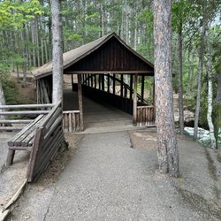
Free, family friendly, educational. We experienced cold rainy weather while vacationing near Brule so decided to look for a morning outing. Nice little spot to kill 30-45 minutes, maybe more if you call ahead and ask if there is a tour available. We happened to jump in with a large group that must have arranged a tour beforehand. We got to see and touch many large varieties of trout and walk the grounds where the holding ponds are. Very nice, well educated, and accommodating staff that are excited about what they do. Our one year old loved getting to pet the fish! read more


More info about Brule Fish Hatchery
13847 E Hatchery Rd
Brule, WI 54820
Directions
(715) 372-4820
Call Now
Hours
Outdoor Amenities
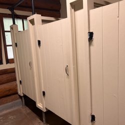
Other Amenities


Brule Fish Hatchery - tours - Updated July 2026
Best of Brule
People found Brule Fish Hatchery by searching for…
Things to Do in Brule, Wisconsin
Fun Things to Do With Kids in Brule, Wisconsin
Attractions in Brule, Wisconsin
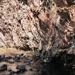
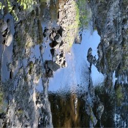
Fishing Spots in Brule, Wisconsin
Waterfalls in Brule, Wisconsin
Tourist Attractions in Brule, Wisconsin
Running Trails in Brule, Wisconsin
Places to Take Pictures in Brule, Wisconsin
Picnic Areas in Brule, Wisconsin
Public Showers in Brule, Wisconsin
Train Ride in Brule, Wisconsin
Hotels & Travel in Brule, Wisconsin
Scenic Drive in Brule, Wisconsin
Walking Trails in Brule, Wisconsin
Boat Rental in Brule, Wisconsin
Boat Tours in Brule, Wisconsin
Scenic Views in Brule, Wisconsin
Lakes & Ponds in Brule, Wisconsin
Breakfast Places in Brule, Wisconsin
Picnic Tables in Brule, Wisconsin
Parks and Recreation in Brule, Wisconsin
Browse Articles
Browse Brands
Related Cost Guides
Related Searches in Brule, WI
Affordable Kayak Rental Services in Brule, Wisconsin
Best Nature Trails for Hiking in Brule, Wisconsin
Best Places for Stunning Views in Brule, Wisconsin
Best Sightseeing Experiences Available in Brule, Wisconsin
Best Spots for Star Gazing in Brule, Wisconsin
Best Water Parks for Kids in Brule, Wisconsin
Best Waterfalls and Swimming Holes in Brule, Wisconsin
Book Engaging Historical Tours in Brule, Wisconsin
Book a Guided Cave Tour in Brule, Wisconsin Today
Check Out Great Playgrounds in Brule, Wisconsin
Check Out Off Road Trails in Brule, Wisconsin
Discover Dog Friendly Beaches Near Brule, Wisconsin
Discover Popular Bike Trails in Brule, Wisconsin
Discover Popular Photo Spots in Brule, Wisconsin
Discover Romantic Activities to Enjoy in Brule, Wisconsin
Discover Top Boat Tours in Brule, Wisconsin for All Ages
Discover Top Nature Parks to Visit in Brule, Wisconsin
Discover the Best Caves to Explore in Brule, Wisconsin
Discover the Best Fishing Lake in Brule, Wisconsin
Discover the Best Kayak Tour Options in Brule, Wisconsin
Dog-Friendly Hikes With Dogs in Brule, Wisconsin
Enjoy Kayaking Adventures in Brule, Wisconsin
Enjoy Scenic Night View Experiences in Brule, Wisconsin
Enjoy Water Activities and Fun in Brule, Wisconsin
Enjoy a Relaxing Paddle Boat Ride in Brule, Wisconsin
Enjoy the Best Night View Spots in Brule, Wisconsin
Enjoy the Best Tubing Experiences in Brule, Wisconsin
Enjoy the Best Walking Trails in Brule, Wisconsin
Experience Stunning Sunset Views in Brule, Wisconsin
Experience Thrilling Snowmobiling in Brule, Wisconsin
Explore Easy Hikes Perfect for All in Brule, Wisconsin
Explore Nature Spots Around Brule, Wisconsin
Explore Popular Campgrounds Near Brule, Wisconsin
Explore Popular Day Trips From Brule, Wisconsin
Explore Popular Picnic Areas Around Brule, Wisconsin
Explore Popular RV Parks Around Brule, Wisconsin
Explore Popular Scenic Views Near Brule, Wisconsin
Explore Popular View Points Around Brule, Wisconsin
Explore Scenic Lakes to Visit in Brule, Wisconsin
Explore Secret Spots Worth Visiting in Brule, Wisconsin
Explore Top Walking Tours in Brule, Wisconsin
Explore the Best Wine Tours in Brule, Wisconsin
Family Friendly Hiking With Kids in Brule, Wisconsin
Find Beautiful Views in Brule, Wisconsin
Find Fun Kids Activities Outdoor in Brule, Wisconsin
Find Picnic Tables for Outdoor Fun in Brule, Wisconsin
Find Top-Rated Waterfalls in Brule, Wisconsin Now
Find the Best Parks for Picnics in Brule, Wisconsin
People who viewed Brule Fish Hatchery also viewed
Brule River Canoe Rental
10 reviews
Lake Nebagamon Village of
1 review
Copper Range Campground
2 reviews
Flagship Rentals
2 reviews
Bois Brule State Forest Campground
1 review
Old Stockade Site Historical Marker
1 review
Brule River Classics
1 review
Norwood Golf Course
2 reviews
Tahkodah Hills Golf Course
1 review
World Of Wheels Skate Center
7 reviews