1. Bridgeport Covered Bridge

0

Penn Valley, CA

Cancel

Open app

Search

Bridgeport Covered Bridge

5.0 (8 reviews)

Bridgeport Covered Bridge Photos

More like Bridgeport Covered Bridge

Recommended Reviews - Bridgeport Covered Bridge

Your trust is our priority, so businesses can't pay to alter or remove their reviews. Learn more about reviews.
Yelp app icon
Browse more easily on the app
Review Feed Illustration

Reviews With Photos

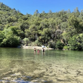
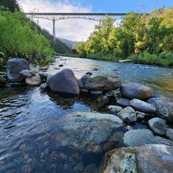
View from the bridge.

Fun for everyone. You can spend the day or just spend an hour walking around. Perfect for kids and all ages. Watch for snakes we saw a big rattlesnake.

See all

11 months ago

Helpful 0
Thanks 1
Love this 0
Oh no 0
Photo of Heidi W.
1103
1194
2337

4 years ago

Helpful 6
Thanks 0
Love this 4
Oh no 0

1 year ago

Very cute and a great place to take the family, only thing is beware of rattlesnakes.

Helpful 0
Thanks 0
Love this 0
Oh no 0

2 years ago

Helpful 0
Thanks 0
Love this 0
Oh no 0

4 years ago

Helpful 1
Thanks 0
Love this 0
Oh no 1

3 years ago

This is a classic bridge. Don't let the structure fool you. It is safe. Come during the late afternoon hours. It is cooler.

Helpful 0
Thanks 0
Love this 0
Oh no 0

2 years ago

Awesome bridge, nice trails be careful not to get washed down stream. I was just going to check water levels.

Helpful 0
Thanks 0
Love this 0
Oh no 0

3 years ago

Helpful 0
Thanks 0
Love this 0
Oh no 0

Ask the Community - Bridgeport Covered Bridge

Verify this business for free

Get access to customer & competitor insights.

Verify this business

China Wall - 10.06.24 the China Wall is a testament of the passion of the hardworking Chinese workers

China Wall

4.8(10 reviews)
46.8 mi

Summer and school breaks are our favorite times for family adventures. Once school starts, life…read moregets hectic! This year we have a foreign exchange student with us, so we've added to that hectic-ness by a lot. Haha! One up side is the "extra credit" work in US History. The history teacher assigned a trip to China Wall with specific graffiti look-fors to find and take a picture with. We decided to pack up the family and had an AMAZING adventure!!! Our party was 7 people ages 2-35, and everyone had a great time! The 2 year old made it there climbing and hiking (he LOVES to climb), but he was donzo on the way back. We parked around 5:30 and started our way back to the car around 7:30. We visited three tunnels, but didn't get to the end of the one to the left. Lots of places to take a detour. So fun! Take 80 and exit Donner Lake Road toward Donner Lake. Continue west past the lake and gaining in elevation. Park on the left just before Donner Summit Bridge (we were able to turn around when we saw the bridge - whoops!). Either go down then up toward the wall from the parking area or walk west along the road until you see the much flatter rocks and take those toward the wall. HAVE FUN!

Great hike, the tunnels were so cool. I think the part people "miss" is they are walking over what…read moreis considered China Wall. If you are walking the tunnels you can't see this engineering feat from the trail. You need a side quest or to start from a lower vantage point to see the actual wall.

Photos
China Wall - The rocks that fill in the gap below the wall was hand fitted by the Chinese rail workers, no mortar just perfectly positioned.

The rocks that fill in the gap below the wall was hand fitted by the Chinese rail workers, no mortar just perfectly positioned.

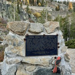
China Wall - 10.06.24 China Wall of the Sierra plaque

10.06.24 China Wall of the Sierra plaque

China Wall - 10.06.24 view of tunnel opening from the base

See all

10.06.24 view of tunnel opening from the base

Wakamatsu Farm

Wakamatsu Farm

4.8(4 reviews)
39.9 mi

Me being of Japanese decent, I felt the need to visit Wakamatsu Tea and Silkworm Colony Farm in…read morePlacerville, and to pay my respect to all the courageous men and women whom traveled thousands of miles to a foreign land (America) for a dream of a better life. There are no words that can express my heartfelt gratitude for the sacrifices and hardship the " Isei " (First Generation ) must have gone through ! They paved the way for people like both of my grandfathers whom came to the United States in 1906. On May 20th, 1869 a group of 22 samurais and one women arrived in San Francisco on board the SS China with 50,000 (Mulberry Trees) (Silk worm cocoons) (tea plants and seeds) ( cooking utensils) and (swords). Thus the Wakamatsu Tea and Silk Colony Farm was established on 160 acres in Gold Hill Placerville on June 8th, 1869. The life of the colony was short lived (1869 -1871) due to inadequate funding and a severe drought in 1871. Wakamatsu Tea and Silk Colony was considered to be the first Japanese Settlement in North America. In 1969 Ronald Reagan (governor at the time) proclaimed the colony to be a California Historic Landmark No. 815. The land is currently owned and operated by the American River Conservancy. The farm is on private property, so visitations can only be made by arranging a private tours, attending certain festivals on the property or schdueled events. Next year (2019) marks its 150th anniversary celebration !!! See web site for more details. Thanks for reading !

Have been to a couple of American River Conservancy events at Wakamatsu Farm. Such an historic &…read moreinteresting place. The volunteers & teachers are impressive. It is always an interesting & enjoyable experience in a beautiful setting.

Photos
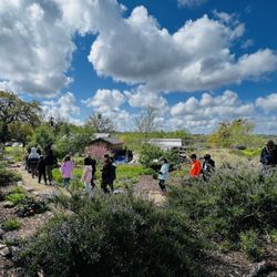
Wakamatsu Farm - Lake View

Lake View

Wakamatsu Farm - The Giving Garden

The Giving Garden

Wakamatsu Farm

See all

Donner Pass Railroad Tunnel Hike - Nice example

Donner Pass Railroad Tunnel Hike

4.9(53 reviews)
46.8 mi

The Donner Pass Railroad Tunnel Hike was one of the reasons for our trip to the area. My boyfriend…read morehad always wanted to check out the Donner Petroglyphs, and I stumbled across the rail tunnels when looking for things to do while in the area. We parked at the Donner Ski Summit - if you are looking to check out this hike, that is the best place to park and access the start of the tunnels. I truly enjoyed this hike, but was ill prepared. I was fully committed once we were in the tunnels & I should have went back to the car and swapped my "barefoot" style shoes for my hiking boots. The large chunk gravel path killed my feet with the thin soles of the shoes I wore. We hiked through about 5-6 tunnels before heading back. We did a total of 6 miles in and back. There were alot of beautiful street art within the tunnels, we found 19 cave ghosts along the trail as well as some other reoccurring variations of different items over the course of the trail. I would like to eventually take the trail past the last tunnel and to the next set of tunnels some day. This is a trail we would do again next time we are in the area. Though the weather was nice, we both wore hooded sweatshirts as the are in the tunnels got quite chilly. If you plan on checking these trails out, take well charged flashlights or head lights with extra batteries. The tunnels can be PITCH Black when you are in the heart of them. Overall this was a really cool thing to see and I would love to do it again with the correct shoes!

We had out of town family in town last week and we made it back to the Donner (Railroad) Tunnels. I…read morelove the tunnels! It's SO beautiful. And as it was a railroad, it's level and easy, and as it's in the tunnels, you're mostly protected from the weather. Bring good trail walking shoes and a flashlight. (And park across from the Donner Ski Ranch.)

Photos
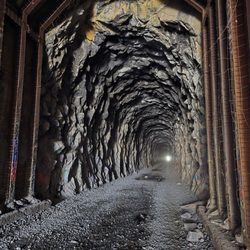
Donner Pass Railroad Tunnel Hike - Donner Tunnels hike

Donner Tunnels hike

Donner Pass Railroad Tunnel Hike - By yours truly

By yours truly

Donner Pass Railroad Tunnel Hike

See all

Foresthill Bridge

Foresthill Bridge

4.7(26 reviews)
26.9 mi

Came here for a hike and an intimate view of this awe inspiring bridge. Found a loop hike that…read morestarts at the bottom of the valley where the North Fork American River winds around. It starts with a hard and steep climb. The Foresthill Bridge is California's highest bridge, which is some 730 feet above the bottom. The Golden Gate is only 220 feet from the water, so use that for reference. This stretch of the hike is difficult cuz you do have to climb that 700+ feet, and it is not gradual with gentle switchbacks. It is almost straight up for over 40 minutes. I found it even harder during the summer months in Auburn, where it can soar easily past the 80 degree mark, also with little shade. I had to break several times to rehydrate and get my breath back. This was harder than most climbs I attempt. The good is the length isn't that long. I've climbed many peaks some even double this length, but those were more gradual. This was fast and furious, done in less than an hour with lots of sweat. But when that initial climb is done, it is all views and a breeze from there on out. Once on top, you'll meet the highway that crosses the bridge. There is a pedestrian path, so you're nice and safe from zooming traffic. Now you can cross and look down if you dare, into the gorge. It is a thrilling look as now you'll feel the breeze and the glimpses only an eagle would experience. There will be a sad reminder though as you're crossing the bridge. Once you hit the middle of the bridge, you'll start to see handwritten cards taped to the bars of the bridge. It appears to be children or young teens, writing hand messages of encouragement, for people having a plan to commit suicide from those heights. It is sad yet inspiring to see those messages, very humanizing. Once you've crossed the bridge, it is all down hill back to the river. Again no shade but so much easier and faster than the way up. Like with most incline hikes I choose, I always choose to climb first and descend last. It's a solid work/reward progression. This is a gleaming example. Once back down to the river, I'd advise to explore a little down by the water. It was so hot the day I went, that I took off my shoes and waded in that ice cold water. It's a little tricky stepping onto the river stones so I didn't go too far out. Literally just enough to cool off, splashing that refreshing water onto my head and shoulders. It was so hot, that I dried up in no time, without a towel. Awesome end to a hard hike, with breathtaking views. No regrets here.

If you are ever in the area, be sure to check out one of the tallest bridges in the US. Sweeping…read moreviews and amazing architecture. You can drive walk or bike across. Super close to the Clementine Dam lookout if you want another "instagram " photo op.

Photos
Foresthill Bridge
Foresthill Bridge - Tallest bridge in California

Tallest bridge in California

Foresthill Bridge

See all

Bridgeport Covered Bridge - landmarks - Updated October 2026

Loading...
Loading...
Loading...