Box Canyon Photos


More like Box Canyon
Recommended Reviews - Box Canyon
Start your review...

9 months ago


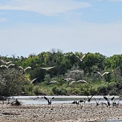
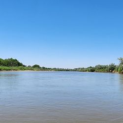
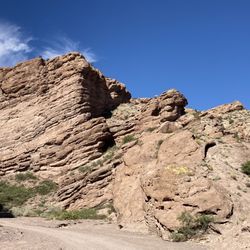
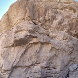
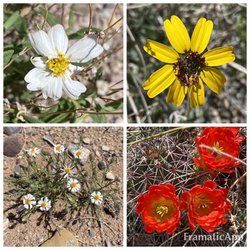
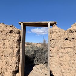
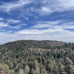
Good hiking spot just outside of Socorro New Mexico. Blink and you'll miss the sign for "the box". Nice parking lot and clearly marked paths. Beware of flash floods, you can see where the water runs off and the climb to safe ground can be steep. Good shots of the New Mexican dessert scape. If you happen to run into a group of Castle grazing even better. read more


6 years ago
More info about Box Canyon
Highway 60
Socorro, NM 87801
Directions
(575) 835-0412
Call Now
Hours
Outdoor Amenities


Box Canyon - hiking - Updated July 2026
Best of Socorro
People found Box Canyon by searching for…
Things to Do in Socorro, New Mexico
Hiking Trails in Socorro, New Mexico
Off Road Trails in Socorro, New Mexico
Waterfalls in Socorro, New Mexico
Running Trails in Socorro, New Mexico
Places to Take Pictures in Socorro, New Mexico
Hiking With Kids in Socorro, New Mexico
Climbing Gym in Socorro, New Mexico
Things to Do at Night in Socorro, New Mexico
Walking Trails in Socorro, New Mexico
Places to Go in Socorro, New Mexico
Trending Searches in Socorro, NM
Browse Articles
Browse Nearby
BEST of Socorro, New Mexico Things to Do near Box Canyon
BEST of Socorro, New Mexico Restaurants near Box Canyon
BEST of Socorro, New Mexico Parks near Box Canyon
BEST of Socorro, New Mexico Coffee near Box Canyon
BEST of Socorro, New Mexico Lakes near Box Canyon
BEST of Socorro, New Mexico Hot Springs near Box Canyon
BEST of Socorro, New Mexico Breakfast near Box Canyon
Browse Brands
Related Searches in Socorro, NM
Affordable Bike Repair Services in Socorro, New Mexico
Affordable Bike Tune Up Services in Socorro, New Mexico
Best Nature Trails for Hiking in Socorro, New Mexico
Best Parks for Parties and Events in Socorro, New Mexico
Best Places for Horseback Riding in Socorro, New Mexico
Best Places for Stunning Views in Socorro, New Mexico
Best Water Parks for Kids in Socorro, New Mexico
Check Out Off Road Trails in Socorro, New Mexico
Discover Popular Bike Trails in Socorro, New Mexico
Discover Popular Photo Spots in Socorro, New Mexico
Discover Scenic Creeks to Explore in Socorro, New Mexico
Discover Stunning Skyline View Spots in Socorro, New Mexico
Discover Top Nature Parks to Visit in Socorro, New Mexico
Discover a Hiking Trail in Socorro, New Mexico
Discover the Best Running Track in Socorro, New Mexico
Dog-Friendly Hikes With Dogs in Socorro, New Mexico
Enjoy Camping Adventures Around Socorro, New Mexico
Enjoy Exciting Mountain Biking Adventures in Socorro, New Mexico
Enjoy Hiking Adventures in Socorro, New Mexico
Enjoy Tent Camping Spots Around Socorro, New Mexico
Enjoy the Best Night View Spots in Socorro, New Mexico
Explore Beautiful Parks and Green Spaces in Socorro, New Mexico
Explore Bike Rentals Throughout Socorro, New Mexico
Explore Electric Bikes Available in Socorro, New Mexico
Explore Free Things to Do Around Socorro, New Mexico
Explore Nature Spots Around Socorro, New Mexico
Explore Popular Campgrounds Near Socorro, New Mexico
Explore Popular RV Parks Around Socorro, New Mexico
Explore Popular Scenic Overlook Points in Socorro, New Mexico
Explore Scenic Lakes to Visit in Socorro, New Mexico
Explore Top Dog Parks in Socorro, New Mexico Near You
Explore the Best Trail Options in Socorro, New Mexico
Family Friendly Hiking With Kids in Socorro, New Mexico
Find Specialized Bikes and Accessories in Socorro, New Mexico
Find Top Dog Friendly Parks to Visit in Socorro, New Mexico
Find Top-Rated Waterfalls in Socorro, New Mexico Now
Find the Best Bikes Available in Socorro, New Mexico
Find the Best Parks for Picnics in Socorro, New Mexico
Find the Best Scenic View Locations in Socorro, New Mexico
Locate a Public Shower Facility in Socorro, New Mexico
Must-See Tourist Attractions Around Socorro, New Mexico
Perfect Spots to Watch Sunset in Socorro, New Mexico
Picnic Areas With BBQ Pits Available in Socorro, New Mexico
Plan Nature Center Visits in Socorro, New Mexico
Plan a Scenic Drive Route Near Socorro, New Mexico
Popular Fishing Spots to Explore in Socorro, New Mexico
Popular Picnic Spots to Visit in Socorro, New Mexico
Popular Places to Take Pictures in Socorro, New Mexico
People who viewed Box Canyon also viewed
Sevilleta National Wildlife Refuge
7 reviews
Bosque Del Apache National Wildlife Refuge
39 reviews
San Lorenzo Canyon
3 reviews
Visit Socorro
3 reviews
Escondida Lake And Campground
1 review
Acacia Riding Adventures
13 reviews
Ladd S Gordon Waterfowl Complex
1 review
Yoga Del Sol Studio
1 review
New Mexico Tech
1 review