Bluff Wilderness Hiking Trail Photos


More like Bluff Wilderness Hiking Trail
Recommended Reviews - Bluff Wilderness Hiking Trail
Start your review...

10 years ago
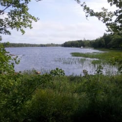
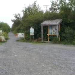
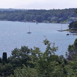
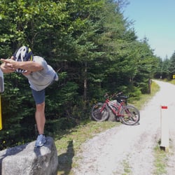
By far the best hike I've ever done. Me and my girlfriend did the first loop out of four I think and it was fantastic. Took us about 4-5 hours and it was roughly 9 kms but we had a blast. Best way to bond with family or loved ones is to go on this trail, beautiful views from all angles and great trails. Highly recommend being somewhat physically fit to do this trail as there are a lot of steep climbs and rough terrain. The first km of the trail is not so bad if you are just trying to get a feel of the trail. Also would be a great place to camp but it frowned upon because of the dangers it can cause to the wildlife and plants. Also there are bear warnings and moose warnings so come prepared. read more


8 years ago
More info about Bluff Wilderness Hiking Trail
2890 Saint Margarets Bay Road
Timberlea, NS B3T 1H4
Canada
Directions
(902) 876-7377
Call Now
Visit Website
http://wrweo.ca
Hours
Outdoor Amenities
Other Amenities
From the Business


Bluff Wilderness Hiking Trail - hiking - Updated June 2026
People found Bluff Wilderness Hiking Trail by searching for…
Things to Do in Timberlea, Nova Scotia
Fishing Spots in Timberlea, Nova Scotia
Make Out Spot in Timberlea, Nova Scotia
Walking Trails in Timberlea, Nova Scotia
Scenic View in Timberlea, Nova Scotia
Places to Take Pictures in Timberlea, Nova Scotia
Boardwalk in Timberlea, Nova Scotia
Things to Do on a Rainy Day in Timberlea, Nova Scotia
Secret Spots in Timberlea, Nova Scotia
Running Trails in Timberlea, Nova Scotia
Off Leash Dog Hiking Trails in Timberlea, Nova Scotia
Scenic Places to Walk in Timberlea, Nova Scotia
Swimming in Timberlea, Nova Scotia
Tent Camping in Timberlea, Nova Scotia
Off Road Trails in Timberlea, Nova Scotia
Photo Spots in Timberlea, Nova Scotia
Caves in Timberlea, Nova Scotia
Tourist Attractions in Timberlea, Nova Scotia
Bonfire in Timberlea, Nova Scotia
Views in Timberlea, Nova Scotia
Hiking Trails in Timberlea, Nova Scotia
Waterfalls in Timberlea, Nova Scotia
Browse Brands
Browse Articles
People who viewed Bluff Wilderness Hiking Trail also viewed
Beechville Lakeside Timberlea Rails to Trails
3 reviews
Hemlock Ravine Park
7 reviews
Bedford
Point Pleasant Park
63 reviews
South End
DeWolf Park
2 reviews
Bedford
Williams Lake
1 review
Birch Cove Park
2 reviews
Dartmouth
Whopper Dropper Trail
1 review
Bayers Lake
Long Lake Provincial Park
12 reviews
Salt Marsh Trail
6 reviews
Uniacke Estate Museum Park
1 review