Cancel

    Open app

    Search

    Blue and Gray Park

    4.0 (1 review)

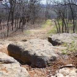
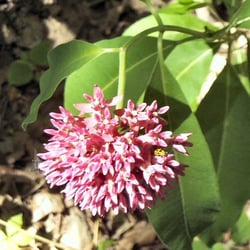
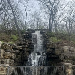
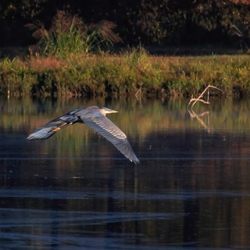
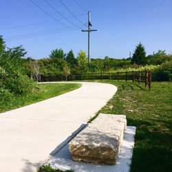
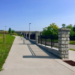
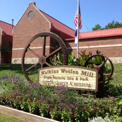
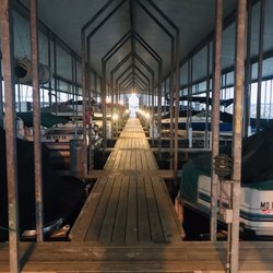
    Blue and Gray Park Photos

    Recommended Reviews - Blue and Gray Park

    Your trust is our priority, so businesses can't pay to alter or remove their reviews. Learn more about reviews.
    Yelp app icon
    Browse more easily on the app
    Review Feed Illustration

    12 years ago

    Helpful 0
    Thanks 0
    Love this 0
    Oh no 0

    Verify this business for free

    People searched for Hiking 235 times last month within 15 miles of this business.

    Verify this business

    Monkey Mountain Nature Preserve

    Monkey Mountain Nature Preserve

    3.9(8 reviews)
    9.3 mi

    This area was called "Monkey Mountains," because early settlers deemed the river bluffs too steep…read morefor even monkeys to climb. This place is as close to being out in the wild as you can get in the KC area. A little bit of a drive but worth it if you want a rugged terrain. It's perfect. Reaching the open meadow at the top is wonderful. Use bug spray and check for ticks.

    Monkey Mountain is an 855 acre nature preserve in Eastern Jackson County, halfway in-between Grain…read moreValley and Oak Grove. The address I listed is the approximate address of the south entrance to the park, there is another entrance a little over a mile north off Old US 40 Hwy next to a softball field. The park is mostly undeveloped, which is what I love about it. You get to experience nature instead of a sanitized version of nature. There are two primary loop trails, one measuring 3.5 miles and one measuring between 2-3 miles depending on the route taken. Numerous smaller trails criss-cross between these main trails and branch out forming various side loops. You can spend hours hiking here and not see everything. The park caters to hikers and equestrians. I usually encounter a few other people at the park but only between long stretches of complete isolation. The elevation ranges from about 780 feet on the banks of Sni-a-Bar Creek to about 950 feet at the summit. There is a wide variety of terrain in the park: marshy lowlands in the north and northwest, thick woods and steep terrain covering most of the western half, limestone outcroppings along the ridge and at the south end of the park, a huge roiling meadow in the center, and farmed land along the eastern edges. Several ponds dot the landscape, and numerous tiny streams feed into Sni-a-Bar Creek along the western edge. There is even a waterfall in the park, but I will not reveal the location since it is both a fragile and a dangerous feature (especially in winter). Finding it can be part of your adventure. In the spring and early summer the park's meadows are filled with a wide variety of wildflowers, and wildlife can be spotted year-round. I've seen deer, foxes, turkeys, tortoises and turtles, all sorts of birds, and even evidence of some sort of wildcat. In the first half of the 20th century, much of what is now Monkey Mountain Park was part of a show farm called Sni-a-Bar Farms, owned by William Rockhill Nelson. The hillside and meadow were used for grazing sheep. Evidence of that can still be seen today in the form of farm remnants such as an old boundary fence running east-west through the middle of the park. If you hike the park, don't do it alone until you are familiar. Even though there are trails they are not always easy to see, and some portions of the trails can be treacherous. If your hike takes you through the northwest portion of the park you can expect to encounter mud pretty much year round so wear appropriate shoes. You will also need to carry your own water, there are no facilities at the park except at the softball field and an outhouse at the south entrance.

    Photos
    Monkey Mountain Nature Preserve
    Monkey Mountain Nature Preserve
    Monkey Mountain Nature Preserve

    See all

    Parkville Nature Sanctuary

    Parkville Nature Sanctuary

    4.8(76 reviews)
    35.5 mi

    My husband and I Roeland Park, this nature sanctuary the day before Mother's Day. We had a heck of…read morea time finding it because the address was listed incorrectly. The nature sanctuary is on 12th St. and the connecting street is East St. Once we figured out where it was, we took our time on one of the trails I believe there are four trail options and the longest is 1.6 mile loop and the second is a 1 mile loop and the other ones are less than that. But it is a beautiful nature sanctuary with lots of greenery, woods, streams, water falls, and benches to enjoy the scenery. No pets are allowed since it is a nature sanctuary. There is a covered area off of one of the hikes that we went to that leads to some picnic tables. There's also several picnic tables by the parking lot. There are also bathrooms near the parking lot. The parking lot is next to the track and field belonging to the college. We really enjoyed our slow, meandering walk/hike and will definitely go back.

    Hidden right by the bustle of downtown parkville, the parkville nature sanctuary has become one of…read moremy favorite places to do an easy hike. The trails are well maintained, and while there are some inclines at certain points, the trail is easy to follow and not strenuous. I love the various view points where you can stop and really appreciate natural beauty, like the waterfall or the butterfly pass. It feels like this is in its own little world despite being so close to the city. Be aware that the parking lot is pretty small so at peak times it may be hard to park.

    Photos
    Parkville Nature Sanctuary
    Parkville Nature Sanctuary - Waterfall

    Waterfall

    Parkville Nature Sanctuary - Marsh  areas

    See all

    Marsh areas

    Rock Island Spur State Park - Heading east between P Hill and Medford

    Rock Island Spur State Park

    4.7(3 reviews)
    8.0 mi

    More people need to know about this place! The Rock Island Spur is a rails-to-trails conversion…read morethat starts in Pleasant Hill and goes 45+ miles to Windsor, connecting to the Katy Trail. Free of cars, largely enshrouded in trees and views of rolling farmland, this is a gem that doesn't get enough pub in the KC area. For starters, it's not necessarily close to things in the metro, but for me on the Plaza, the Pleasant Hill trailhead is about 45 minutes away. Not convenient, but also not a day's trek to get out there either. The best part of this is that you can ride your bike across a crushed limestone (technically could do on a road bike but would opt for a hybrid/cross/mountain for optimal comfort) through nature while not having to worry about cars all around you. Sure you'll have to cross some small roads here and there and be on the lookout, but it's so much more relaxing to ride on this wide trail than on the back highways. This trail is slightly more gravelly than some other limestone trails, likely because it's so new. It'll pack down more in time, but I found my average was 1 mph slower than at some other comparable spots. You'll put in work out here, but it's flat as a pancake so it balances out. Plans are in the works to connect this even closer to the metro, inching towards Lee's Summit (in progress 2018) and then connecting to the Truman Sports Complex, finished by 2020. Hope bike enthusiasts and outdoor lovers take advantage of this trail!

    Love it. I ride the trail 2 or 3 times per week, weather permitting. Great little stop in…read moreChilhowee if you need a bite to eat. Hopefully they get the trail connected to Lee's Summit...I really think ridership would increase. If you use the fairgrounds trailhead in Pleasant Hill, you will have to detour on paved road for a short distance. This is a non issue, as it isn't very far, and the road is fairly lightly traveled by cars. The alternative trail head off Purvis Road involves driving a mile or so down a really dusty gravel road to avoid a half mile of pavement on your bike at the other location. Not worth it. I greatly prefer the downtown P Hill trailhead and just deal with riding on the street for two minutes.

    Photos
    Rock Island Spur State Park - Winter ride near Pleasant Hill

    Winter ride near Pleasant Hill

    Rock Island Spur State Park - New restroom facilities in Leeton.  There is water at the Leeton trailhead, but not at Medford, so plan accordingly.

    New restroom facilities in Leeton. There is water at the Leeton trailhead, but not at Medford, so plan accordingly.

    Rock Island Spur State Park

    See all

    Watkin's Mill - The lake

    Watkin's Mill

    4.0(22 reviews)
    37.4 mi

    Please note, this review is ONLY for the Watkins Mill State Park Lake and the loop bike trail…read morearound the lake. This lake is great for beginner kayakers! 5 Stars! We took an inflatable, tandem kayak, and we felt very comfortable despite our lack of experience. Our tracking fin only caught on the very edges of the lake where we expected the fin to touch the bottom. There didn't seem to be any issues with boat wakes. The boat ramp was easy to use, and you don't need a permit for your kayak if you go. We enjoyed seeing some wildlife, including a small snake, a raccoon, birds, and several types of fish. The bike trail was a good beginner trail. Parts of it were paved, parts of it were gravel, and parts of it were over wooden plank bridges. The trail was wide enough for walkers and bikers to pass each other safely. There were small inclines and declines, but they were very manageable. For reference, I am not someone that exercises often, and I'm also currently in physical therapy for a hurt knee. If I can do it, you can too! The only reason I didn't give this trail 5 stars was because it was poorly marked. It seemed like some of it was being repaired because there were signs to mark the detour route. However, my friend and I did have to guess at one point which way to go, and we thankfully guessed correctly. If you're nervous, make sure to study the trail map, take a picture of it, or ask for help at the Visitor Center. I do not recommend this trail for individuals in wheelchairs, as the inclines and declines may be too tough. Finally, I want to comment on the restrooms. There are several spots around the lake that have restrooms, but they are primitive. It's the kind where you don't flush (just a deep hole), though there is a physical enclosure (not just a port-a-pottie). You may have to "shop around" because the restrooms at the boat ramp were so HORRID, I couldn't even walk in after opening the door. The second restrooms I went to at a different spot around the lake were cleaner, but there were WASPS flying in and around the restroom. Thankfully, there were no issues with lack of toilet paper. If you're like me, plan accordingly and just use the restrooms at the Visitor Center. They're MUCH nicer. If you want to risk the ones near the lake, bring some wasp spray!

    I had friends from out of town camping at Watkins Mill, State Park, and the camping experience is…read morevery nice. All camping sites allow for one vehicle. The swimming beach is very clean and large. The only setback is the awful signage. I recommend if you do stay at Watkins Mill State Park for camping to disregard your map apps, and take 69 highway to 92 to the state park entrance. Otherwise you'll be driving around for 45 minutes without a clue of where you're going.

    Photos
    Watkin's Mill - Love the view!

    Love the view!

    Watkin's Mill - Visitor's Center

    Visitor's Center

    Watkin's Mill

    See all

    Blue and Gray Park - hiking - Updated May 2026

    Loading...
    Loading...
    Loading...