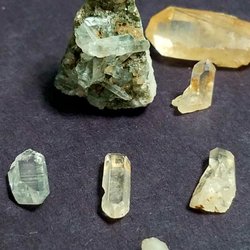
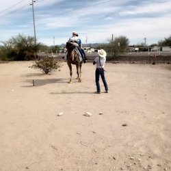
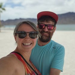
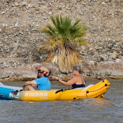
Big Maria Wilderness Photos

You might also consider
More like Big Maria Wilderness
Recommended Reviews - Big Maria Wilderness
Start your review...

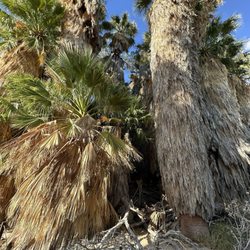
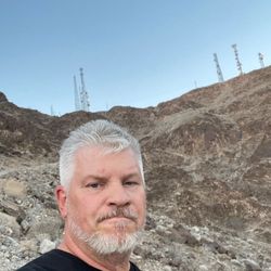
Located in southeastern California and close to the Colorado River, the Big Maria Mountains Wilderness stands ready for a good time with primitive camping, hiking or whatever outdoor passion sparks your fire...with the exception of motorized vehicle use except where designated. It is a wilderness area after all. The Big Maria area features rough, craggy peaks, narrow canyons and bajadas (shallow slopes at the base of rocky hills where materials accumulate) dotted with foxtail and barrel cactus. There is supposed to be a herd of burro deer along the Colorado River side but I have never seen them myself. This area is a good place to stop (as I have) while in the area and take short hikes or check out the Blyth Intaglios which are nearby. read more
More info about Big Maria Wilderness
Big Wash Access
Hwy 95
Blythe, CA 92225
Directions
(951) 697-5200
Call Now
Hours
Outdoor Amenities
You might also consider


Big Maria Wilderness - hiking - Updated August 2026
Best of Blythe
People found Big Maria Wilderness by searching for…
Trending Searches in Blythe, CA
Boating near Big Maria Wilderness
Cinema near Big Maria Wilderness
Jet Ski Rental near Big Maria Wilderness
Kayak Rental near Big Maria Wilderness
Lakes near Big Maria Wilderness
Parks near Big Maria Wilderness
Public Shower near Big Maria Wilderness
River Swimming near Big Maria Wilderness
Browse Articles
Browse Nearby
BEST of Blythe, California Things to Do near Big Maria Wilderness
BEST of Blythe, California Campgrounds near Big Maria Wilderness
BEST of Blythe, California Coffee near Big Maria Wilderness
BEST of Blythe, California Restaurants near Big Maria Wilderness
BEST of Blythe, California Walking Trails near Big Maria Wilderness
BEST of Blythe, California Parks near Big Maria Wilderness
BEST of Blythe, California Breakfast near Big Maria Wilderness
BEST of Blythe, California Day Trips near Big Maria Wilderness
BEST of Blythe, California Lodging near Big Maria Wilderness
Browse Brands
Related Searches in Blythe, CA
Affordable Jet Ski Rental Options in Blythe, California
Affordable Kayak Rental Services in Blythe, California
Best Dog Hiking Trails Around Blythe, California
Best Fishing Locations and Guides in Blythe, California
Best Places for Horseback Riding in Blythe, California
Discover Dog Friendly Trails to Explore in Blythe, California
Discover Top Boat Tours in Blythe, California for All Ages
Discover a Hiking Trail in Blythe, California
Discover the Best Beaches in Blythe, California
Discover the Best Night Hike Trails in Blythe, California
Dog-Friendly Hikes With Dogs in Blythe, California
Enjoy Camping Adventures Around Blythe, California
Enjoy Exciting Mountain Biking Adventures in Blythe, California
Enjoy Off Leash Dog Hikes in Blythe, California
Enjoy Tent Camping Spots Around Blythe, California
Enjoy the Best Tubing Experiences in Blythe, California
Enjoy the Best Walking Trails in Blythe, California
Explore Beautiful Parks and Green Spaces in Blythe, California
Explore Easy Hikes Perfect for All in Blythe, California
Explore Fun Activities to Do in Blythe, California
Explore Popular Campgrounds Near Blythe, California
Explore Popular RV Parks Around Blythe, California
Explore Scenic Lakes to Visit in Blythe, California
Explore Top Dog Parks in Blythe, California Near You
Explore Top Water Parks in Blythe, California Today
Explore the Best Boating Spots in Blythe, California
Explore the Best Swimming Holes Around Blythe, California
Family Friendly Hiking With Kids in Blythe, California
Find Beautiful Views in Blythe, California
Find Cozy Camping Cabins in Blythe, California
Find Parks and Recreation Activities in Blythe, California
Find the Best Playgrounds to Visit in Blythe, California
Great Places to Swim in Blythe, California
Locate a Public Shower Facility in Blythe, California
Plan a Scenic Drive Route Near Blythe, California
Popular Things to Do in Blythe, California
Safe River Swimming Areas in Blythe, California
Safe and Fun Parks for Kids in Blythe, California
Top Hiking Trails to Explore in Blythe, California
Top Paddleboarding Activities in Blythe, California
Top Playgrounds for Kids to Enjoy in Blythe, California
Top RV Campgrounds to Visit in Blythe, California
Top Things to Do With Kids in Blythe, California
Top-Rated Boat Rental Services in Blythe, California


