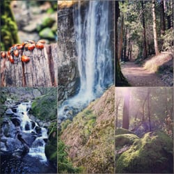
Big Boulder Adventures Photos


You might also consider
More like Big Boulder Adventures
Recommended Reviews - Big Boulder Adventures
Start your review...

6 months ago
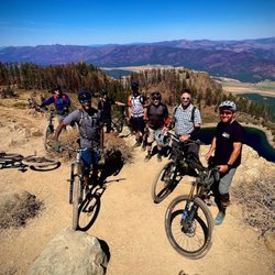
Big Boulder runs the earliest shuttle in Downieville they are great for early birds. You and your crew can have the entire Downieville Classic trail basically to yourselves. It also sets you up for doing two big rides in one day. Like all businesses in Downieville, this one is family run. Please be respectful and be on time. It takes an hour to load-up, get up the mountain, off-load and then an hour to repeat the process if you are late, it throws off the whole day. The Big Boulder family is great and super accommodating. We have had them as our shuttle for years. They truly make the Downieville experience special. Pro-Tip: if you have people in your group that are chronically late (we all have that *one* rider in our group): tell them the shuttle leaves 15 mins before it really does. ;) read more


More info about Big Boulder Adventures
You might also consider


Big Boulder Adventures - mountainbiking - Updated May 2026
Best of Downieville
People found Big Boulder Adventures by searching for…
Browse Brands
Related Searches in Downieville, CA
Affordable Bike Repair Services in Downieville, California
Affordable Bike Tune Up Services in Downieville, California
Affordable Tandem Bike Rental in Downieville, California
Best Dog Hiking Trails Around Downieville, California
Best Electric Bike Rental Services in Downieville, California
Best Fishing Locations and Guides in Downieville, California
Best Nature Trails for Hiking in Downieville, California
Best Places for Horseback Riding in Downieville, California
Best Sledding Spots and Fun in Downieville, California
Best Used Bikes for Sale Near Downieville, California
Best Waterfalls and Swimming Holes in Downieville, California
Discover Dog Friendly Trails to Explore in Downieville, California
Discover Popular Bike Tours in Downieville, California
Discover Popular Bike Trails in Downieville, California
Discover Scenic Mountain Bike Trails Near Downieville, California
Discover Top Nature Parks to Visit in Downieville, California
Discover the Best Night Hike Trails in Downieville, California
Dog-Friendly Hikes With Dogs in Downieville, California
Enjoy Hiking Adventures in Downieville, California
Enjoy Scenic Night View Experiences in Downieville, California
Enjoy the Best Tubing Experiences in Downieville, California
Enjoy the Best Walking Trails in Downieville, California
Explore BMX Bike Shops Near Downieville, California
Explore Beautiful Parks and Green Spaces in Downieville, California
Explore Bike Rentals Throughout Downieville, California
Explore Easy Hikes Perfect for All in Downieville, California
Explore Electric Bikes Available in Downieville, California
Explore Popular Scenic Overlook Points in Downieville, California
Explore Scenic Lakes to Visit in Downieville, California
Explore Secret Spots Worth Visiting in Downieville, California
Explore the Best Swimming Holes Around Downieville, California
Explore the Best Trail Options in Downieville, California
Family Friendly Hiking With Kids in Downieville, California
Find Beautiful Views in Downieville, California
Find Cheap Bike Rentals Around Downieville, California
Find Top Mountain Bike Rental Options in Downieville, California
Find Top-Rated Waterfalls in Downieville, California Now
Find a Fixed Gear Bike Shop in Downieville, California
Find the Best Scenic View Locations in Downieville, California
Hiking Trails With Waterfalls in Downieville, California
Off Leash Dog Hiking Trails in Downieville, California
Plan a Scenic Drive Route Near Downieville, California
Popular Picnic Spots to Visit in Downieville, California
Shop for Mountain Bikes at Local Stores in Downieville, California
Top Hiking Trails to Explore in Downieville, California
Top Running Trails to Explore in Downieville, California
Top-Rated Camping Sites in Downieville, California
Trusted Electric Bike Repair in Downieville, California
Browse Nearby
BEST of Downieville, California Things to Do near Big Boulder Adventures
BEST of Downieville, California Coffee near Big Boulder Adventures
BEST of Downieville, California Hiking Trails near Big Boulder Adventures
BEST of Downieville, California Restaurants near Big Boulder Adventures
BEST of Downieville, California Parks near Big Boulder Adventures
BEST of Downieville, California Breakfast near Big Boulder Adventures
BEST of Downieville, California Campgrounds near Big Boulder Adventures
BEST of Downieville, California Sledding near Big Boulder Adventures
BEST of Downieville, California Hotels near Big Boulder Adventures
Trending Searches in Downieville, CA
Boat Rental near Big Boulder Adventures
Botanical Gardens near Big Boulder Adventures
Bounce House Rentals near Big Boulder Adventures
Campgrounds near Big Boulder Adventures
Cherry Picking near Big Boulder Adventures
Floral Designers near Big Boulder Adventures
Flower Shop near Big Boulder Adventures
Garden Center near Big Boulder Adventures
Graduation Leis near Big Boulder Adventures
Nurseries & Gardening near Big Boulder Adventures
Outdoor Furniture Stores near Big Boulder Adventures
Party Equipment Rentals near Big Boulder Adventures
Pedicure near Big Boulder Adventures
Browse Articles
People who viewed Big Boulder Adventures also viewed
Deer Creek Tribute Trail
14 reviews
Nyack Snow Park
107 reviews
Yuba Pass Sno-Park
1 review
Sierra Buttes
17 reviews
Sierra Nevada Journeys
6 reviews
Donner Party Hike
1 review
Gold Country Triathlon Club
1 review
Gold Lake
3 reviews
Gold Lake Stable & Pack Station
9 reviews
Upper Salmon Lake Trail to Deer Lake and Summit Lake
1 review