Cancel

    Open app

    Search

    Arlington Wetlands

    3.0 (1 review)

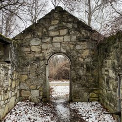
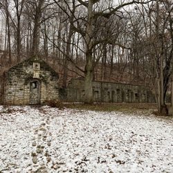
    Arlington Wetlands Photos

    Recommended Reviews - Arlington Wetlands

    Your trust is our priority, so businesses can't pay to alter or remove their reviews. Learn more about reviews.
    Yelp app icon
    Browse more easily on the app
    Review Feed Illustration
    Photo of Tina S.
    200
    1052
    810

    10 years ago

    Helpful 0
    Thanks 0
    Love this 0
    Oh no 0

    Verify this business for free

    People searched for Hiking 837 times last month within 15 miles of this business.

    Verify this business

    Old Chain of Rocks Bridge

    Old Chain of Rocks Bridge

    4.3
    (25 reviews)
    7.7 mi

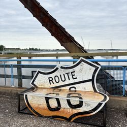
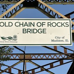
    If you know me, you know I'm fascinated by everyday historic landmarks. I prefer the places people…read moredon't always think about - like the Old Chain of Rocks Bridge. So, fun facts. Old Chain of Rocks Bridge is part of the even more historic Route 66. It also helps to connect Missouri and Illinois (and yes, you can walk it - or wheel it in my case). Built in 1929, the bridge features a 30-degree turn halfway across the mile-long bridge. While today this area is very passable by ships, in 1929 a "chain of rocks" (a 17-mile shoal) made passage difficult. Originally designed to go straight across, riverboat men protested because the bridge itself would have created an additional obstacle. Essentially, it had to "bend" for the sake of safe passage. The bridge cost twice its original estimate ($2.5 million), but it was built as a "destination" from the beginning. The Missouri side had a park; the Illinois side had 400 elm trees. There was even an amusement park. Also, during World War II the red sections were painted green so it would be less visible from air. The bridge closed in terms of official function in 1968 - a new Chain of Rocks Bridge opened in 1967 and includes Interstate 270. Old Chain of Rocks Bridge was nearly destroyed in 1967. For several years, that seemed likely. In 1980 (another fun fact), John Carpenter used the bridge in Escape From New York). Obviously, the bridge has been restored to some fame. It's now part of the Route 66 Bikeway (as of 1999), and in 2006 was added to the National Register of Historic Places. I'm considering a Route 66 Tenderness Tour (or at least part of the 2,000+ mile highway). This bridge may become part of that, so I'm thrilled I got the chance to check it out. The pathway for biking/wheeling is nicely done, easy to maneuver, and stunning in beauty (though it was an admittedly beautiful day when I was on the bridge). The bridge offers connections to the MCT Confluence Trail, Mississippi River Trail (Isn't it weird? I've been out of school 30+ years and I still sing the Mississippi song when I spell it), and the St. Louis Riverfront Trail. There's free parking on the Illinois side at the bridge entrance and also at North Riverfront Park. The Missouri side has a park with a pavilion, native habitats, an event lawn, and a gated parking lot (the event space opened in 2024). The bridge, no longer used by vehicles, is open daily for bikers/pedestrians (and wheelchairs).

    This old bridge is an awesome piece of Americana history. It is about a 1 mile walk to get across…read morethe bridge. There are 2 castle looking buildings in the ole Mississippi that use to be the water source for the city of St Louis. I would recommend parking on the Missouri side as it has be recently redone. Nice parking lot with picnic tables and overhead protection from the sun. No running water but there are 2 porta potties under an awning. The Illinois side is not as pleasant.

    Photos
    Entrance on the Illinois side
    Entrance on the Illinois side
    Bridge sign and Rt 66 signs
    Bridge sign and Rt 66 signs
    Illinois entrance

    See all

    Illinois entrance
    Cahokia Mounds

    Cahokia Mounds

    4.5
    (103 reviews)
    3.5 mi

    We enjoyed a visit to the largest archaeological site in the U.S…read more Quick visit advice: Park at the visitor center or across the street at Monk's Mound (if there are any spots in this smaller lot). Walk to and up Monk's Mound, which is the largest. I recommend reading the signs about the history of the mounds. Background: I visited just after finishing a book called "America Before" by Graham Hancock. He extensively covers the geoglyphs (mounds) across the Americas and describes their site-line survey complexity. They are basically dirt mound versions of Stonehenge, and line up with solar events during the equinoxes. The amount of precision from an ancient hunter-gatherer society is absolutely fascinating. I highly recommend a read before visiting.

    We were in the area so we had to go check this place out, right? The history along should garner…read moreinterest. Pulling up, my kids were not amused. "What's with the big hill dad?" Oh kids... I mean it does look like just a big hill but... As a history buff, I thought it was kind of cool. We climbed the stairs to the top (great work out, a couple folks were doing just that) to get a view of the area. Not much at all is built up around this area, the small town that it is located in is barely a blip before you enter the St. Louis metropolitan area. It is actually pretty remarkable how rural this area is being only miles outside of St. Louis. Anyways, I tried to get my kids to understand that the people that built these mounds did not have Bobcats, dump trucks, or any huge equipment. We are talking woven baskets and such. Still not impressed. At least we stood on the top and say we have been there. I suggest you do the same. Check it off the list and say you once stood on one of the tallest pre-Columbian structures in North America. Can't say that every day!

    Photos
    Mound
    Mound
    Cahokia Mounds
    Cahokia Mounds

    See all

    Jones Confluence Point State Park

    Jones Confluence Point State Park

    4.3
    (3 reviews)
    8.5 mi

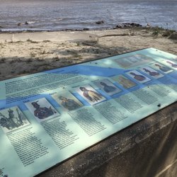
    Be prepared for a 5+ mile drive off Highway 67 to find this state park literally at the end of the…read moreroad. Also, over 4 miles of the road is on gravel. Once at Jones Confluence Point SP you have a 10-minute walk on dirt and concrete paths to the point where the Mississippi and Missouri rivers meet. The feature here is the meeting of the waters: When the Mississippi is clear you can easily see the much muddier Missouri pushing its way far into the Mississippi's current. At the point three placards describe the rivers and the Native Americans who once lived nearby. Signs in the small pavilion (which lacks a table or seating) describe related area history. Outhouses are the only other amenities.

    I visited here a couple of weeks ago and am still thinking about it. We stood on a point of land…read moreand watched the huge Missouri and Mississippi Rivers ripple together a few feet away. If you visit the Lewis & Clark Confluence Tower on the Illinois side of the Mississippi do circle around and visit Jones Confluence Point State Park in St. Charles County, Missouri, too. One of the things I appreciated about the park was that it had been cared for but not overdeveloped. We drove a winding gravel road through flat bottomlands and fields, ending at a small parking area, interpretive kiosk and restrooms. Then we leashed up our dog and hiked about a third of a mile through the woods to the confluence point. The first bit of trail is paved; the rest is well-marked dirt/gravel. At the end of the path is a *very tall* pole marking the high point of the 1993 flood - we couldn't believe there could have been that much water. A low monument explains how the two rivers come together. It was all very low key, and *awesome*. We thought about the history of the area and how many travelers through the centuries had stood there. On the drive back to the highway we saw a bald eagle circling overhead.

    Photos
    A display about Native Americans at the point where the Mississippi and Missouri rivers merge.
    A display about Native Americans at the point where the Mississippi and Missouri rivers merge.
    Pavilion (without a table or seating) and privies at the start of the walking path.

    See all

    Pavilion (without a table or seating) and privies at the start of the walking path.
    Riverlands Migratory Bird Sanctuary

    Riverlands Migratory Bird Sanctuary

    4.9
    (7 reviews)
    13.1 mi

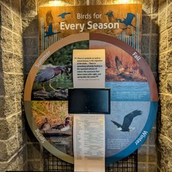
    Whether you are an experienced bird watcher or just beginning,this is definitely a place you want…read moreto visit . This huge nature preserve with visitors center offers bird exhibits as well as educational programs. We spoke to one of the employees who told us where to go to see various birds. You can walk the trails or drive around as there are numerous pull offs for picture taking. Plenty of parking as well as public restrooms and picnic tables. There is no admission fee but a small donation is suggested.

    Do you love bird watching? If not, after a visit to Riverlands Migratory Bird Sanctuary, it may be…read moreyour new interest and hobby. There's 3,700 acres of diverse conversation land and 1,200 of wetlands, making it perfect for all types of birds. 60% of North American migrating bird species use the Mississippi River Flyway and they do it with no TSA or Flight Controllers. On any given day, you'll have a chance to see a variety of waterfowls including; Pelicans, Swans, Geese and Ducks. You'll also get a glimpse of, Herons, Egrets and Ring Necked Gulls. During the colder months, like January and February, you will definitely get to see an American Bald Eagle. In addition of bird watching, you can enjoy one of the many trails for hiking and biking. The staff from Audubon Center and the US Army Corps of Engineers are on site and can ask any questions you may have. I recommend that you get out and not only explore nature, but enjoy it too.

    Photos
    Riverlands Migratory Bird Sanctuary
    Riverlands Migratory Bird Sanctuary
    Riverlands Migratory Bird Sanctuary

    See all

    Arlington Wetlands - hiking - Updated August 2026

    Loading...
    Loading...
    Loading...