Cancel

    Open app

    Search

    Antioch Strait Bridge Photos
    More like Antioch Strait Bridge

    Recommended Reviews - Antioch Strait Bridge

    Your trust is our priority, so businesses can't pay to alter or remove their reviews. Learn more about reviews.
    Yelp app icon
    Browse more easily on the app
    Review Feed Illustration

    3 years ago

    Helpful 35
    Thanks 3
    Love this 24
    Oh no 0
    Photo of Fer R.
    261
    428
    2533

    13 years ago

    Helpful 5
    Thanks 0
    Love this 8
    Oh no 0
    Photo of Ivy S.
    140
    2169
    6181

    16 years ago

    Helpful 15
    Thanks 1
    Love this 17
    Oh no 0

    8 years ago

    Totally keeps my vehicle out of the water the whole way from one side to the other, and try not to drive while it's very windy and raining.

    Helpful 2
    Thanks 0
    Love this 3
    Oh no 0

    17 years ago

    Helpful 5
    Thanks 0
    Love this 7
    Oh no 0

    9 years ago

    Helpful 1
    Thanks 0
    Love this 1
    Oh no 0

    8 years ago

    Helpful 0
    Thanks 0
    Love this 3
    Oh no 0

    8 years ago

    Helpful 0
    Thanks 0
    Love this 0
    Oh no 0
    Photo of Patricia V.
    38
    1423
    345

    15 years ago

    Helpful 1
    Thanks 0
    Love this 0
    Oh no 0
    Photo of Jason G.
    4677
    3625
    8868

    14 years ago

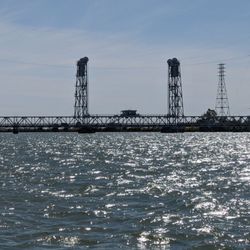
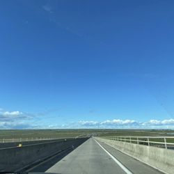
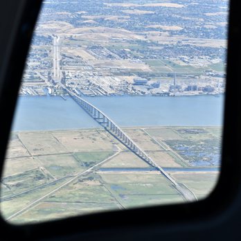
    It's a long straight bridge that goes really high with only one lane each way, yikes.

    Helpful 7
    Thanks 0
    Love this 7
    Oh no 0
    Photo of H D.
    50
    781
    967

    13 years ago

    Helpful 2
    Thanks 0
    Love this 3
    Oh no 0

    Ask the Community - Antioch Strait Bridge

    Review Highlights - Antioch Strait Bridge

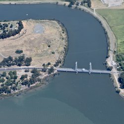
    This beautiful bridge connects Antioch to Sacramento County as you travel the delta (& vice versa).

    Mentioned in 2 reviews

    Read more highlights

    Verify this business for free

    Get access to customer & competitor insights.

    Verify this business

    Black Diamond Mines Regional Preserve - Visitors Center

    Black Diamond Mines Regional Preserve

    4.7(207 reviews)
    7.3 mi

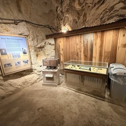
    We walked a couple of trails, explored the old coal mine, and checked out the cemetery...really…read morefascinating to see how far back those tunnels inside the caves go. The visitor center had a ton of great information and history.

    Exploring the California State Parks list online a number of years ago, I liked the description and…read moremap of Black Diamond Mines Regional Preserve. It was neat in that there were historical building(s), a cemetery, and different parts of mines in addition to the natural landscape, plants, and animals to observe. I visited a few different times in 2018 plus or minus a year. One time I brought my friend Jinsol along and another time I brought family (my mom and dad). The park volunteers/workers were friendly when we encountered them. We appreciated the map(s) of the park, it helped with exploring. Some sites were more readily identifiable than others. My mom had difficulty on some of the steeper trails, though my dad faired well. Some parts of the mines had information displayed though were not open on my visits. One of my visits was during a heat wave, while the remainder were during relatively average weather conditions. Shade was sparse, though present, during the heat wave. Even in the shade however, the heat seemed to spread. On a different occasion I slipped and fell on a pathway that had a small section that was temporarily dominantly mud. A place requiring my full attention for traversing the trail system.

    Photos
    Black Diamond Mines Regional Preserve
    Black Diamond Mines Regional Preserve
    Black Diamond Mines Regional Preserve

    See all

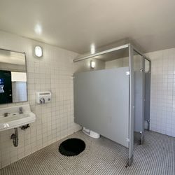
    Mount Diablo State Park - Yes, these are the public bathrooms to keep the SPS on their toes, was clean enough!

    Mount Diablo State Park

    4.3(385 reviews)
    12.5 mi

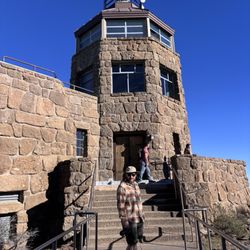
    We absolutely love hiking this magnificent mountain and the surrounding areas as much as we can…read more There are several trails to trek. I'm not going to lie, most if not all are pretty challenging especially the Mitchell Creek to Diablo Summit. That is a 14 mile hike and it will kick your butt for sure. I must be crazy because I love getting my butt kicked by this mountain LOL. We keep coming back for more. The elevation is no joke as there are numerous inclines and declines. Theres hardly any shade so make sure you sublnscreen up and stay hydrated. The views are absolutely stunning. Strenuous hike but the views are worth every ache and pain. Enjoy the views. There is parking but there's a $6 dollar fee (not bad). Parking lot is open at 8am until sunset. There are bathrooms. The ladies room is clean for the most part. As clean as it's gonna get at a park. I absolutely recommend this mountain if you are looking for some challenging trails to hike.

    This by far was one of the hardest trails I've ever hiked. The incline is insane! The entire trail…read morewas uphill, I was breathless. But the views the entire time made me just as choked up. It costs $10 to get into the park, gates open at 8AM. There's a 12 mile hike, loops the site. And an 8 mile hike to the Summit (round trip). At the top there's a museum inside which has an exhibit and gift shop. I got a cute T-shirt for $18, they also had a showing of the history behind the summit and how it came to be. We saw a couple deers, baby coyote, various species of birds, lizards, and butterflies. During this time of year, majority of the trail was dead. I rarely saw any hikers, mostly bikers! Most visitors drove up to the summit for pictures and views. The hardest part was definitely going up to the summit! We cut our time by half on the way back down. It was steep, so we temple ran our way down. Really fun! I highly recommend going early in the morning or later in the afternoon to avoid the heat. Not a beginner friendly hike! Challenging. Trails not shaded. Park rangers are very friendly. Maps are also provided at entrance.

    Photos
    Mount Diablo State Park
    Mount Diablo State Park
    Mount Diablo State Park - G4 storm brought the northern lights to Mitchell Canyon

    See all

    G4 storm brought the northern lights to Mitchell Canyon

    Antioch Strait Bridge - landmarks - Updated August 2026

    Loading...
    Loading...
    Loading...